Hell's Canyon
April 29, 2000
Rod and Cookie Hanna, a GSU faculty member in science education, made a trip to Lewiston, Idaho to Lewis and Clark State College. We were working on a committee to develop an integrated science course for education majors, and LCSC had an attractive model. We got a small grant to go out and consult with them. One of the side benefits was that we got to participate in their Geology Club's annual jet boat trip up Hell's Canyon. I think we went about 40 miles into the Canyon, most of which was inaccessible by road. All these images were scanned from Cookie's negatives, which she graciously loaned. Both Rod's video camera and still camera went out at the beginning of the trip. He considered it providential, since it gave him more opportunity to talk to the people on the trip rather than keeping his eye on the cameras.
We had coordinated with Joanna Schultz who was on the faculty of Biology at Lewis-Clark State College. She was very helpful and invited us to join their group for their weekend retreat which was to focus on the development of the Integrated Science Course. We met Friday afternoon at the Quality Inn in Clarkston and spent the night there. The trip up Hell's Canyon started early the next morning.
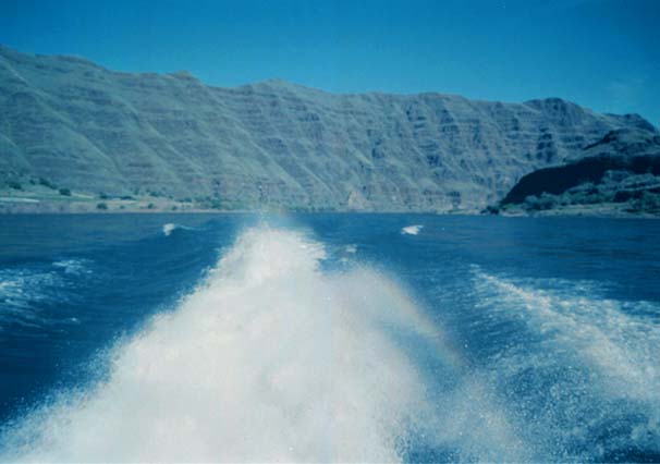
We all boarded the jet boat, with jets driven by three powerful engines to get the combination of high thrust and shallow draft necessary to navigate the rapids on the Snake River. We went roaring down the canyon, throwing up a plume which formed a rainbow on the bright sunny day. Rod had a great time watching things from the rear deck. The full beard he was still wearing from the Easter Pageant gave some practical benefit in the cool wind. | 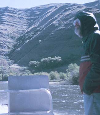 |
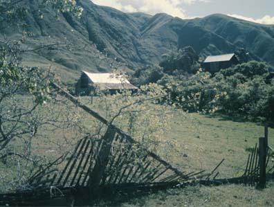 | Our first stop was at a small farm on the east side of the Snake River. |
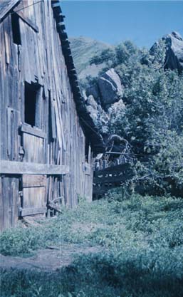 | Cookie liked the old farm buildings. Around the farm were examples of both ancient paintings and carvings in the rock. |
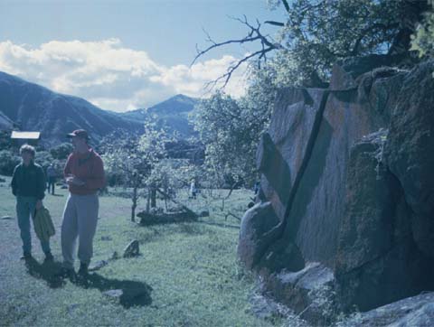 | Joanna Schultz, a plant biologist, and Scott Linneman, a geologist, gave us some background about the area. To the right on the rock is a painting dating back perhaps hundreds of years. |
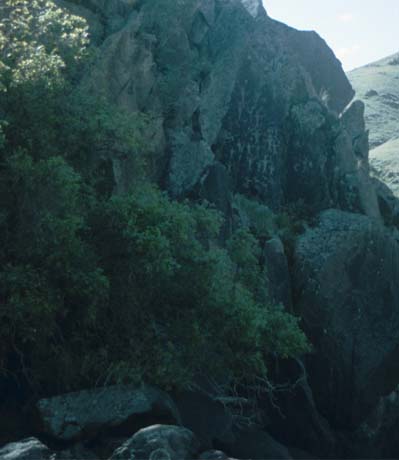 | A few miles into Hell's Canyon was a farm on the east side of the Snake River where there were petroglyphs on the rock. They told us about theories for their origin, as well as some off-the-wall speculations. |
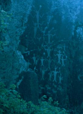 | This closer shot of the petroglyphs show the strange headpieces or head designs on the figures. Some have large ball structures which look like large eyes out on stalks. At the bottom there appear to be carvings of both deer and bighorn sheep. |
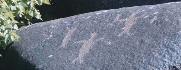
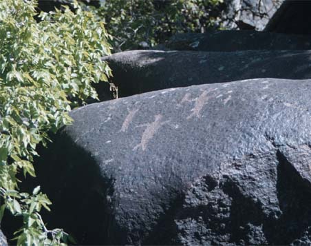 | Besides the prominent petroglyphs up on the vertical rock wall, there were some on large boulders in the ground. |
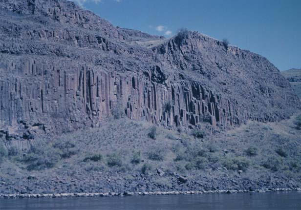

These formations are referred to as "columnar jointing" and were the the most dramatic geologic features in appearance. There was much to be learned about geology in the canyon. It was like a time machine, which took you back in history through several geologic eras.
The geologists on the trip referred to a study of Hell's Canyon by Tracy Vallier, "Islands and Rapids, a Geologic Story of Hell's Canyon." I ordered a copy when I got home. He describes the areas where the columns occur as Permian rhyolite dikes. The columnar jointing is associated with lava flows and dikes of the Columbia River Basalt Group. I'm not familiar with most of the geologic language, so I have to refer to Vallier's glossary often. Rhyolite and basalt are different kinds of rocks. The rhyolite is described as igneous rocks with a high content of silicon dioxide, and a rhyolite dike is a place where this rock cuts across the surrounding rock. I visualized it as a crack where this molten rock upwells and then hardens. The basalt rock apparently forms most of the bedding rock (Columbia River Basalt Group). Basalt has less than half silicon dioxide, to distinguish it from rhyolite, but it is also igneous and its formations are described as being flow processes, like lava flow.
 |  |
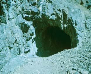
We stopped for lunch at a small beach where the Salmon River enters the Snake. This gives a good perspective of our jet boat and the canyon we were traveling through. At right is a view of the Salmon River and the wall just above it. There was a mine up on this slope in the 1920s.

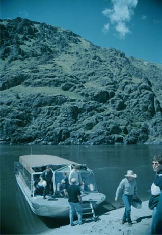
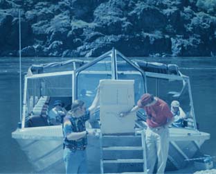 | This shows how the jet boat was pulled up to the sandy area for our lunch stop. After lunch and a bit of exploring, we had a short geology lecture on the origins of the formations we were seeing. This trip was sponsored by the Geology Club, and we had two knowledgable geology faculty members with us. The young man at left is a graduate of GSU's Geology Department. Scott told us a bit about the formation of Hell's Canyon. He made several references to Tracy Vallier's work. |
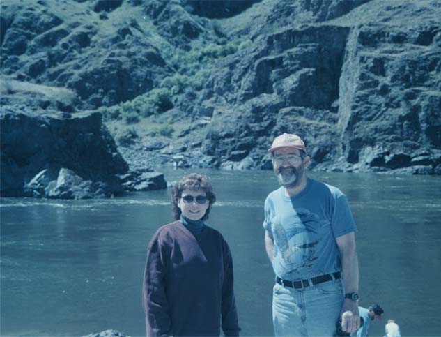
Cookie Hanna and Rod at the lunch site.
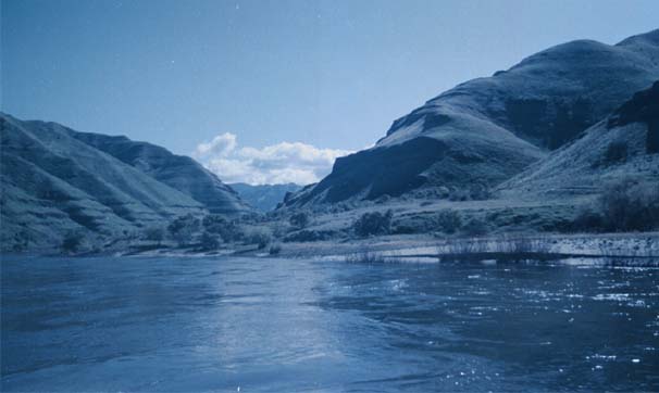

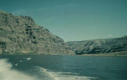
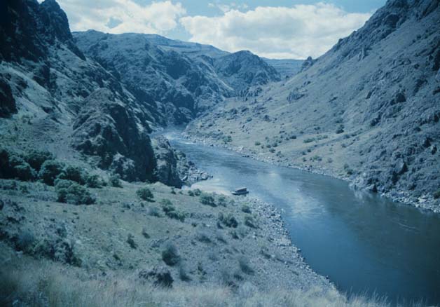
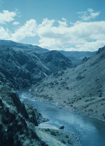
Views of Hell's Canyon and the Snake River. The view just above catches a bit of the rainbow we got in the boat's wake.
 | Rounding one of the bends in the Snake River on the jet boat. |
 | The little house was representative of the cabins at several locations along Hell's Canyon. This one appeared to have road access, but many of them didn't. We were told that many of them were lifted in by helicopter. |
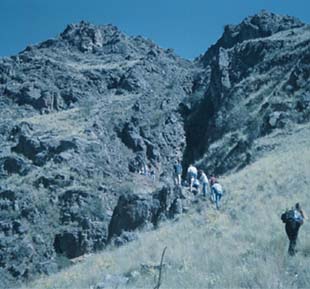
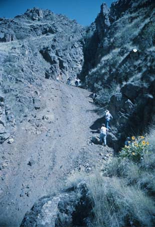
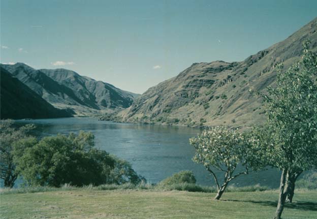
 | This was the view back toward our boat and the Snake River from near the small mine we visited. This enjoyable short hike gave us the tour of the little mine and also our best views of the structure of the canyon. On the right side of the river is Idaho, and on the left, Oregon. |
 |
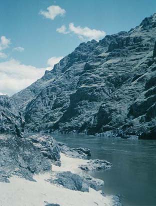
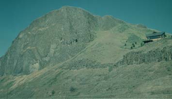
Veiw of the Snake River from the ranger station
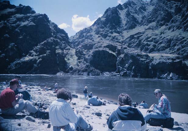
As we began our journey back from the mine visit, we lost one of the three engines. While still powerful, the remaining engines could not get the boat up on the plane necessary for safe passage over the rapids. We were dropped off at the ranger station on the river to look around while they brought out another jet boat to take us back to Clarkston. Since we had no real time schedule, we enjoyed even this part of the trip. The view of the Snake River above is from the little ranger station. We walked a mile or so up the river to see some other petroglyphs on rocks near the river. About the time we returned, the replacement boat arrived and we had an enjoyable ride back. We saw about eight bighorn sheep up on the mountain at one point. It was a memorable day. |
|
Index
2000 |