Mableton First Baptist Food Delivery
September 28, 2009
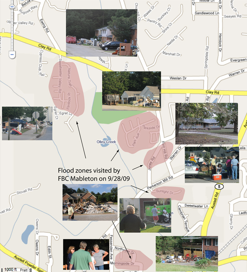
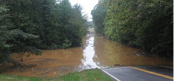 | We gathered at Mableton First Baptist on Monday afternoon and prepared hamburger and hotdog lunches, probably about 400, to take to some of the neighborhoods hardest hit by the flood. About five hard-hit areas had been targeted for our effort, shown roughly on the map below. By this time the waters had receded to show the devastation and whole streets had furnishings piled at the street, reminiscent of what we had seen in Katrina. |
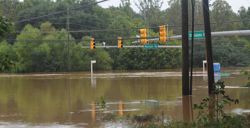
I parked near the lake on Cardell and walked over the hump to see the water at the intersection of Maxham Road and Old Alabama Road. As a reference for depth, you can see the top of the intersection sign just below and to the right of the blue-tarped sign of the old BP Station that was there. The bridge across the Sweetwater Creek is about 50 yards down Old Alabama to the left, so the water had to be 10 feet over the roadway of that bridge.
 | Apparently only the house closest to the creek on Cardell Road took water in the house, although the yard of the second house was full of water. |
Unfortunately for that closest family to the creek, the water came to the top of their lower carport and apparently filled the bottom floor of the house. |  |
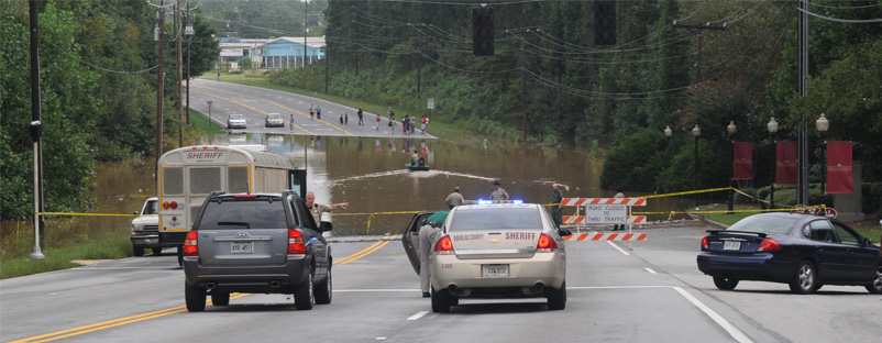
I was interested to see the Maxham/Old Alabama intersection from the Maxham Road side, but when I drove around there I found that the dip in Maxham Road close to Thornton Road was also flooded. The Douglas County Sherrif's office had a bus there and they were ferrying out stranded residents on a small boat.
I headed down Thornton Road to try to get to Bankhead Highway, but Thornton was also closed at a bridge. Blair Bridge toward Sweetwater Park was closed, so I headed back to Factory Shoals and went home.
 | All three area bridges across the Chattahoochie River had been closed on Tuesday as the river crested, but I was able to cross it to go in to Georgia State on Wednesday, Sep 23. The river was just a few feet below the roadway. |
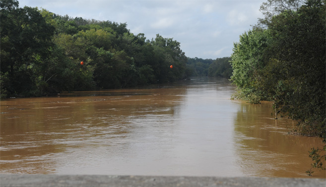
Upon my return from Atlanta, the Chattahoochie River bridge on the expressway I-20 had just been opened to traffic and I got this view of the river from that bridge. It's hard to gauge how far it is above normal, but I have never seen it this high. It is usually tucked well inside the tree line. As I passe the bridge I saw water marks six to eight feet above the current water line, so it had been that much higher. | 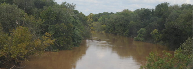 |
| Awana boys to Stone Mountain |
2009