Back to Arches National Park
October 31-November 1, 2016
Very grateful for surviving the tire mishap, we were back in Arches at about 4:40pm.
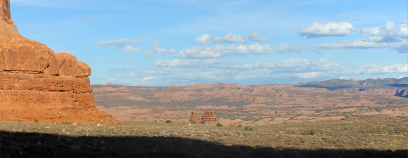
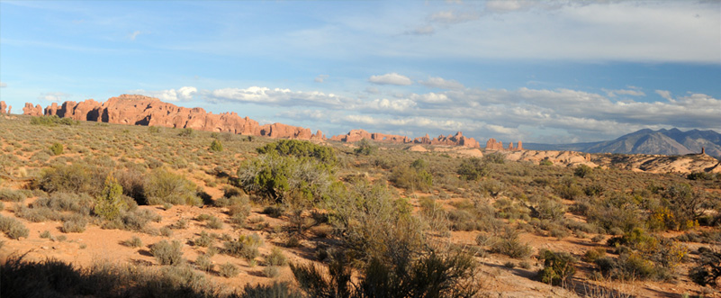
Driving along the entrance road, we were getting wide views of the semi-desert region and enjoying the red formations.
To the southeast we got views of the La Sal Mountains.
It was exhilirating wide open country and we were blessed with a fine day on which to view it. We had decided to make a quick tour of the main roads since it was now almost 7pm, with the plan to come back in the morning. At the very bottom of this view you can see the shadow of one of the rock formations to the west of us, so the shadows were already lengthening.
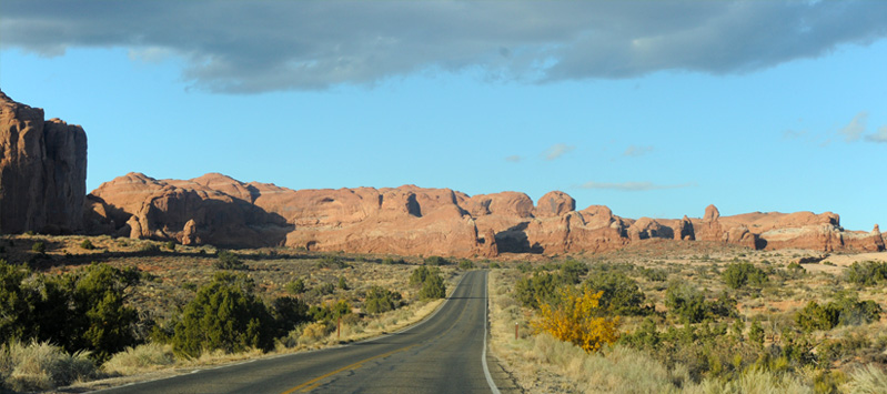
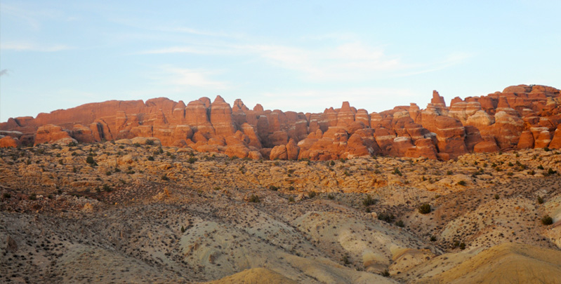
We proceeded along the main entrance road, which was well maintained and well designed to give views of the rock formations.

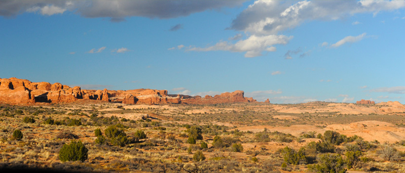
We enjoyed the large variety of red sandstone forms. There was usually a base wall and then various formations on the top part of the walls.

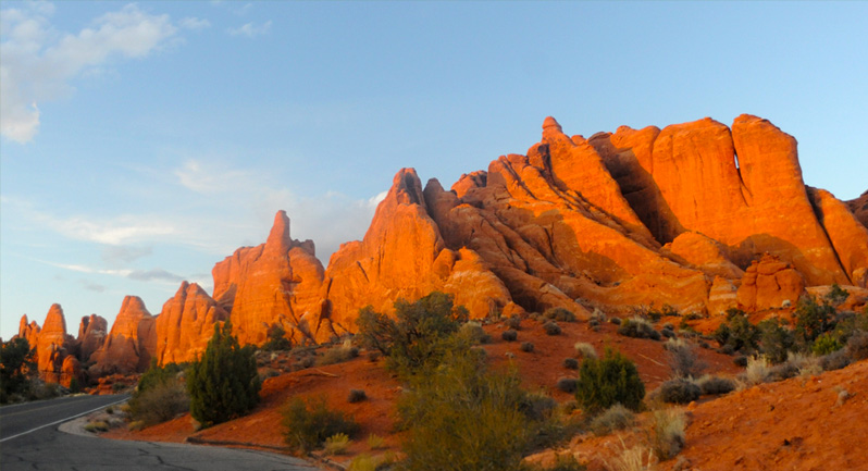
Examples of the wide variety of red sandstone columns. You can note the lengthening shadows now at 7pm.

What a nice road to just drive along and enjoy the beauty of the formations!
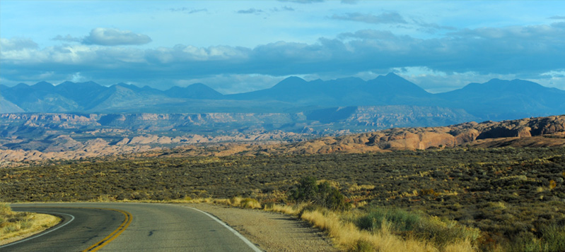
Toward the east and southeast we had longer views of the distant column structures and the La Sal Mountains to the southeast.
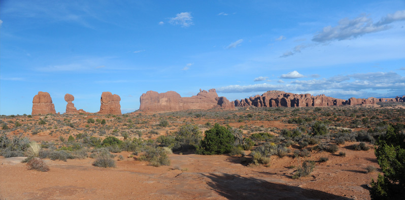
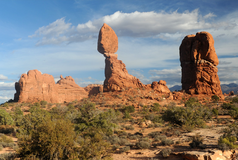
We are now in view of the long column of formations that contains the famous Balanced Rock.

The road leads us around toward Balanced Rock which is one of the most famous points in the park. I really loved seeing it in the wider desert environment.
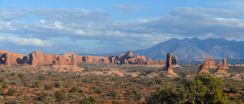
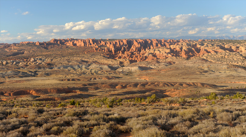
This shows the variety of formations distributed in the area south of the Balance Rock. Note that there are two arches visible out there in the distance. Overall, the presence of the arches was not as pervasive as I expected. Many of them were in places that you had to hike out to see. But there was plenty of dramatic variety, so we certainly were pleased with what we saw. | 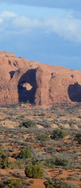 |  |
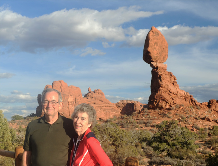 | We parked in the paved lot provided for viewing Balanced Rock and walked the paved trail out to view it. A guy on a motorcycle offered to take our picture. He had a similar camera to mine at home, but was taking pictures with his phone. We talked with him a couple of more times on our exploration of Arches. |
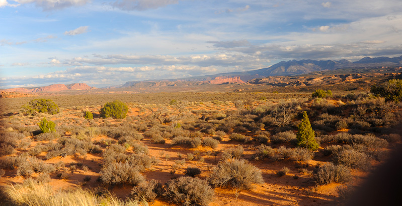
We are back out on the road with wide desert views and lengthening shadows.
This area is known as Salt Valley. The next day we saw it in a wider view from a high ridge. The display describes it thus: "Beneath the valley floor in front of you lies a thick layer of salt. Formed by the evaporation of ancient oceans, the salt became thousands of feet deep. Over the next 290 million years, this salt was buried by sand, silt and other sediments. Under pressure, the less dense salt rose into a dome, partly dissolved, and then collapsed, creating Salt Valley."
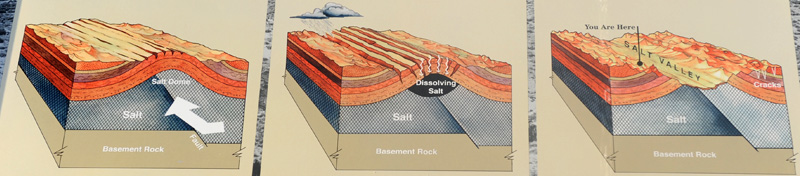
Left: "Windblown and waterborne sediments buried the salt. The weight of the overlying sediment forced the salt to flow, like a glacier, along its rock bed. Where the salt encountered a fault, it bulged upward, forming a salt dome." Middle: "Unable to bend, the overlying rock cracked. The cracks allowed water to seep into the salt, dissolving the upper layers. No longer supported, the overlying rock collapsed, creating Salt Valley. Right: "Rocks along the edge of the valley stretched and cracked in long lines, parallel to the length of the valley. The free-standing fins you see across the valley formed as erosion enlarged the parallel cracks. The process of erosion continues to sculpt a scenic backdrop for Salt Valley."

I liked the red cliffs and the contrasting green of the desert vegetation.
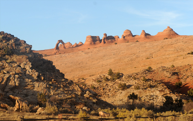
The view of the famous Delicate Arch from the lower viewpoint. We had driven past the main parking area were people take the 3 mile hike to get close to the arch. We went on some distance to this viewpoint where you get a more distant view of it and its surroundings.
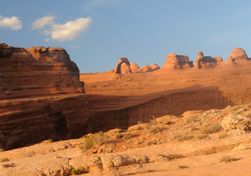
I decided to take the trail to the upper viewpoint in this area. It was about a half mile and steep, but did give a clearer view of the arch. You can see the canyon that prevents you from going all the way to the arch from this approach. You can also see the tiny figures of those who hiked up the other trail for a close view.
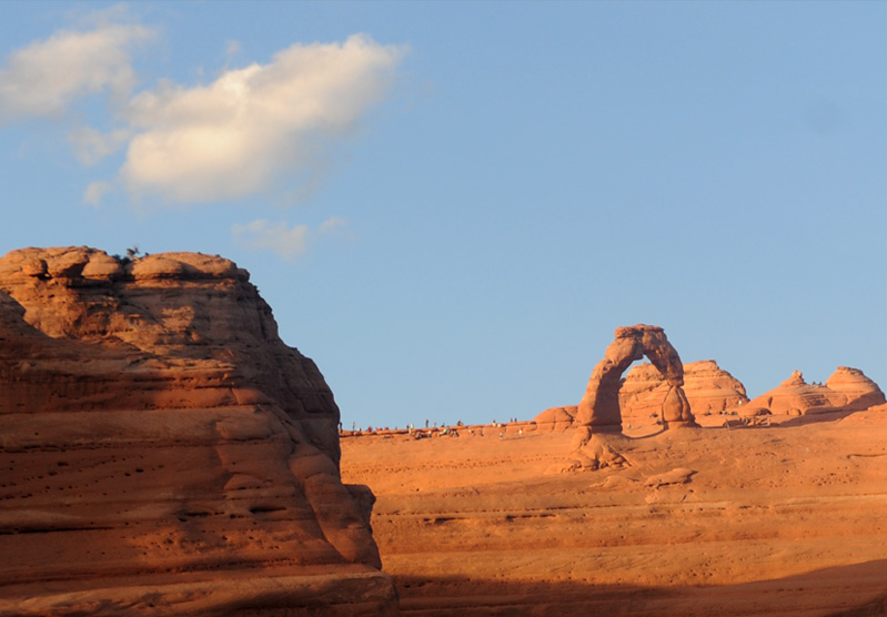
Zooming in a little, you can see those hikers who took the route to the base of the arch.
Interesting columns with layers of light colored stone in the red sandstone.
These red formations were well positioned to catch the last rays of daylight.
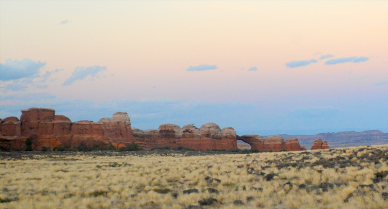
We saw one last arch in the distance as the sky darkened toward sunset at about 8:20pm. It was interesting to see this much color in the eastern sky, almost a reflection of the color that was happening behind us in the western sky.
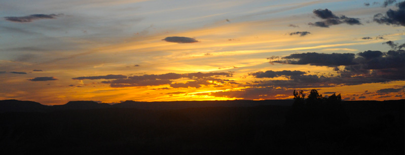
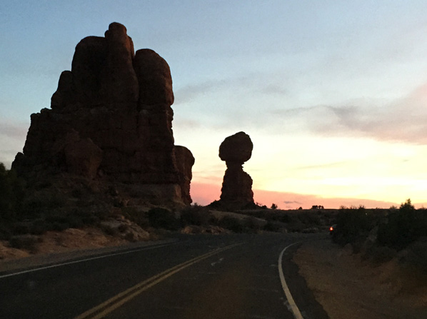 | On the way out of the park, we passed Balanced Rock again, and it was now like an old friend. The sunset gathered color over the red cliffs to our west, so at about 8:30 we headed back toward the entrance, celebrating the beautiful views we had seen. There was certainly a sense of gratitude that we had been able to continue the exploration this afternoon. |
| Back to Arches in the morning |
2016