Canyonlands National Park
November 1, 2016

We started the day with a second trip to Arches National Park and then drove further north from Moab to the entrance road to Canyonlands National Park. We arrived at the park at about 3:40pm. One of the nicest views that we found in the park was just across from the Visitor Center where you got a wide view of multiple canyons. Brenda is at that viewpoint across from the Visitor Center.
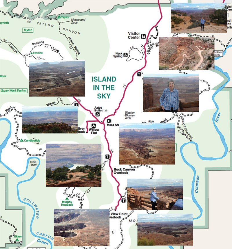
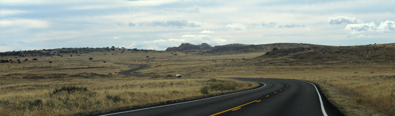
We decided to target the Grand View Point Overlook at the end of the entrance road before dallying anywhere else. From our dramatic beginning with canyons right across from the Visitor Center, we went back into the wide open grassland that we had been following on the approach road. This northern section of Canyonlands Nationanl Park is called the "Island in the Sky" section. We finally got the picture that this high and relatively flat grassland is "in the sky" compared to all the deep canyons all around us.
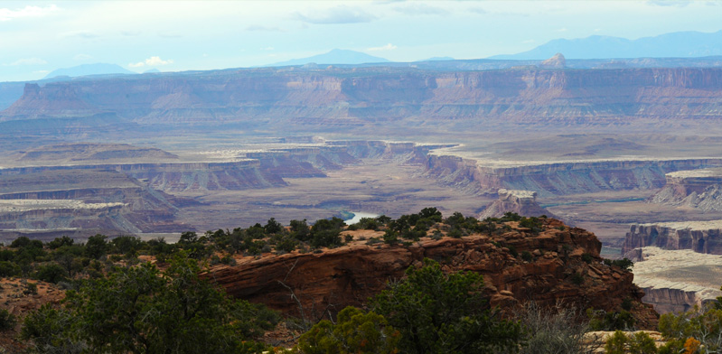
We started getting wide views of the canyons to the west of the road, with tantalizing glimpses of the Green River at the bottom of the canyons.
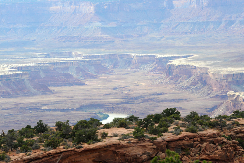
I supposed that the multiple levels of cliffs and canyons were from eons of wandering by the Colorado and Green Rivers. The current rivers are deep within the multiple tiers of cliffs.
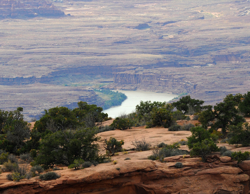
This telephoto shot from beside the road was the most detailed view we got of the Green River.
We were back in the high grassland "island", moving toward Grand View Point.
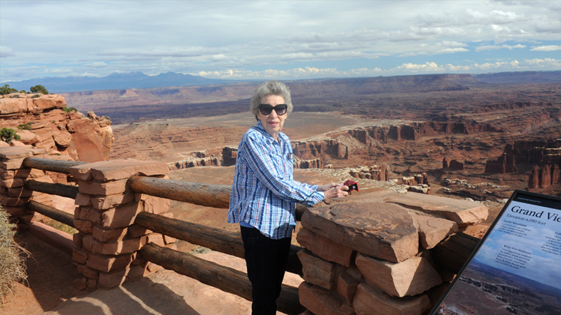
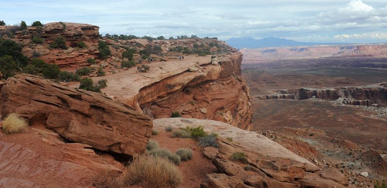
Brenda at Grand View Point Overlook. There were canyons in all directions, so this view takes in a small fraction of the panorama that lay out before us. This was the southern-most point on the park road. The Overlook is at 6080 ft.
Brenda's wide angle view from Grandview Point.
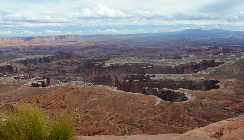
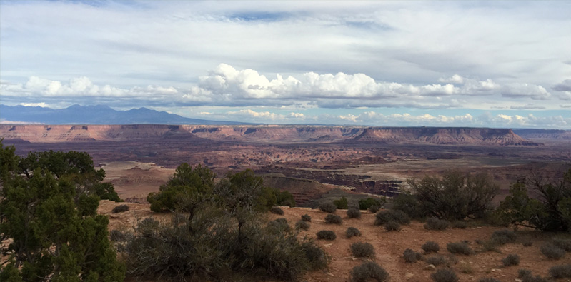
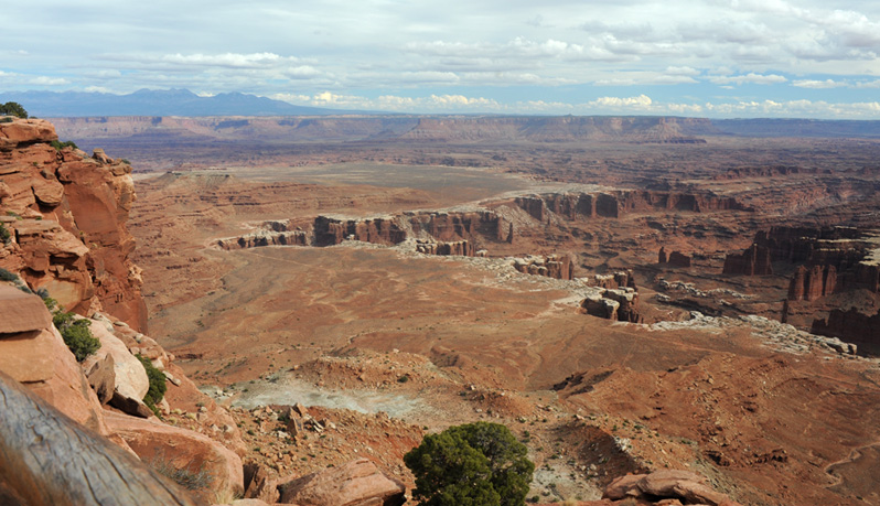
The view was too wide for me to capture in one photo, but this view a little later when I was out a short distance on the rim trail was my best effort to capture the things that caught your eye when you walked up to the edge of the canyon complex. The cliff we were on dropped off to a secondary plateau which was nearly flat. Then there was another set of canyons which looked like the footprint of a huge three-toed animal. Running along the "toes" of that canyon complex was a well-defined dirt road. The mountains at the right horizon are the Abajo Mountains and they are 35 miles away. The highest is Abajo Peak at 11,360 ft.
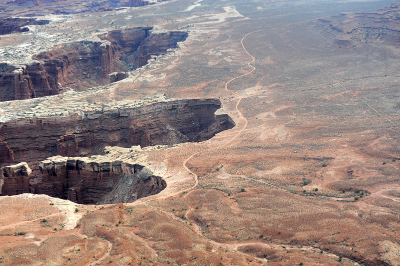
I was fascinated by the dirt roads we saw down in the canyon. One curved around the canyons, but the other went straight across the area. The straight road is a scar left by uranium trucks and bulldozers before the Canyonlands park was established in 1964. The comment in the description of them was "The desert is surprisingly fragile; impacts like these may take decades to heal." The other road is called the "White Rim Road" and it is for park visitors with four-wheel-drive vehicles and mountain bikes. It is 100 miles long and they recommend two days to drive it.
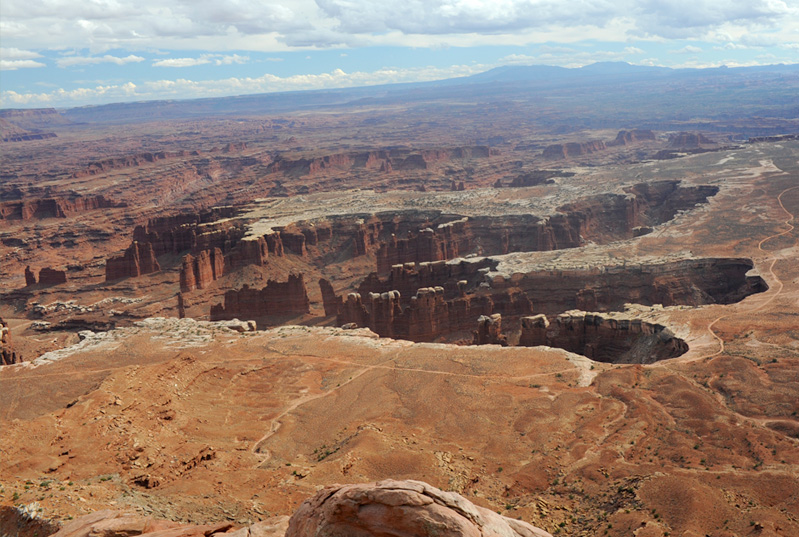
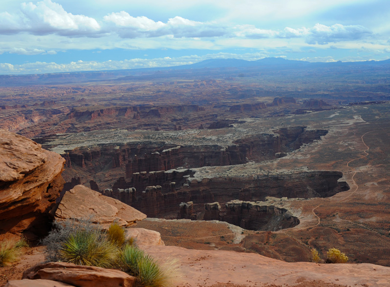
Swinging a bit eastward from the view of the two roads, this view centers on Monument Basin. "Vertical fractures in the sandstone have caused the rocks to erode into steep-sided walls, columns, and pinnacles."
Continuing to swing eastward brings into view the white-topped cliffs that are called White Rim Sandstone. It is a particularly hard layer of white sandstone that forms a sharply defined rim above the lower level canyons. It is attributed to ancient coastal sand dunes and is about 1300 feet below where I was standing. One isolated sandstone tower in the view is called the Totem Pole and stands 305 feet above the lower canyon floor, the tallest feature in the Basin. You can just see the tip of it close to the middle of the picture, mostly hidden by the near canyon wall. Note the White Rim Road, which is pretty straight and flat in this area. The Colorado River runs through this view, but it is so deep in the canyon that it is not visible from this vantage point.
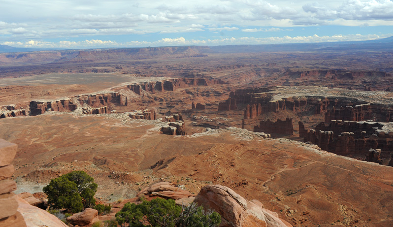
Swinging eastward one more time, we catch the edge of the cliff on which we are standing. At the left horizon are the La Sal Mountains, which we saw from Arches yesterday and this morning.
I walked out maybe half a mile westward on the rim trail from the Grand View Point and got a slightly different view of what I had come to think of as the three toes of the canyon below.
This was my view back along the rim trail toward Grand View Point. There were others on the trail who were taking advantage of these views. Note the La Sal Mountains in the background.
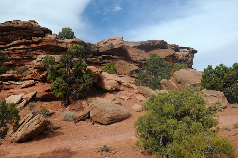
I thought just the evergreen foliage among the red rocks was very beautiful. You can see the rim trail through the middle of the scene above. I did get to see a little more of the length of the isolated column called the Totem Pole from the rim trail. |  |
| Return from Grand View Point |
2016