Mt. Ranier
September 4, 2016
After our return from the Inside Passage and getting a rental car we were exhausted and went to bed early. That got us up and on the road to Ranier a little after 5am. Even the local McDonalds' wasn't open for breakfast, so we headed about 20 miles down I5 and found a McDonald's there.
Getting to Ranier was an adventure in navigation since three of the roads around the west side of the Ranier area don't have numbers,and the ones that do have numbers are not well labeled. Following advice from a tourist brochure, I took exit 135 off I5 to Hwy 164 and found it immediately closed for construction. Getting back on I5 for another few miles we took Hwy 512 toward the park, but got royally balled up in Puyallup trying to get to 167 for connection to 410. After that, Brenda was able to navigate with the GPS on her phone to find South Prairie Road, then Orville Road, and then the Alder Cutoff Road. That got us to the 7, the National Park highway and then 706 into the park.
My plan was to follow the closest roads to Mt. Ranier down the west side with the thought that we would see forest and mountain scenery. It was pleasant, but different from what I expected. We took South Prairie Road into the little town of South Prairie and stopped at a little service station/food store for supplies and talked with a pleasant lady there. We proceeded to Orville Road and stopped again for some gum for Brenda. There I had a pleasant conversation with a couple who had just moved to Washington state from California. They were, like me, trying to learn Spanish and had had a lot of interaction with Spanish speakers in California.
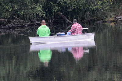 |  |
I thought Orville Road would begin taking us up on the mountainside, but instead it was along a valley with two lakes and low farmland. The first lake was like a swamp, this probably being the low water time of year. As we started along the second we saw this couple fishing peacefully out on the lake. Then further along there was a full-fledged lake resort with cabins and boats all along the shore on both sides.
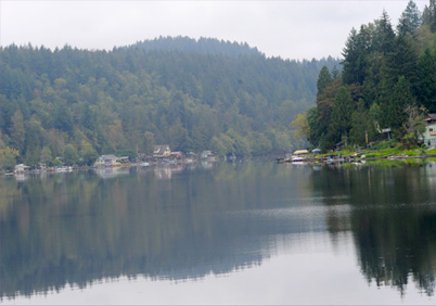 |  |
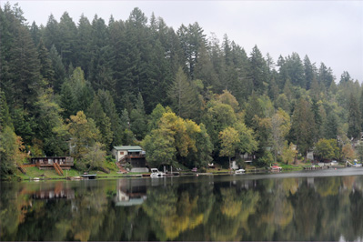
As we proceeded, the lake resort area got more elaborate, so this is obviously a major resort area. When we passed the end of the lake, we entered farmland in this low valley. I enjoyed all this, but I was looking for the mountains, and it turns out that the road along the east side of Ranier is much more mountainous and dramatic. We got to enjoy it at the end of the day because we drove up the east side on our return trip to Seattle.
 | 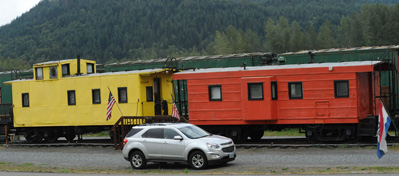 |
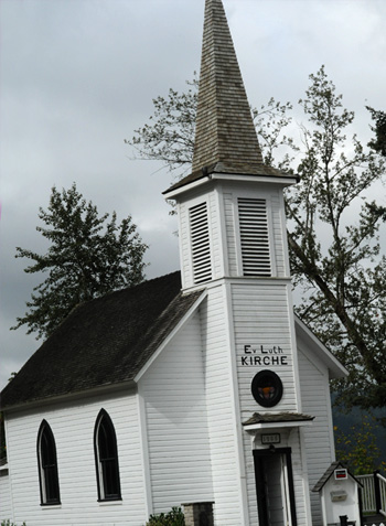 | We reached Elbe, which is a tiny town with official population of 29 as of the 2010 census according to Wiki. It is almost due south of Ranier peak, but it has a lot of spirit. It apparently revels in its railroad history and had made a motel out of cabooses and dining cars. Our last stop before entering the National Park was at this tiny historic church in Elbe. The church is so small that they can't get the full name of the church on the front of the building. That full name is Elbe Evangelisch Lutherische Kirche.The church was built by the German immigrants who established the community, and was listed on the National Register of Historic Places on October 8, 1976. The Mount Rainier Scenic Railroad begins its excursion trains in Elbe, with seasonal tours to Mineral Lake, just 3 miles south. Elbe was known as Brown's Junction after the Tacoma & Eastern Railway was built in the region. When a post office was requested a shorter name was demanded. A meeting of settlers decided to honor the pioneer settler Henry C. Lutkens who had come from the valley of the Elbe in Germany. We visited Elbe in 1993, approaching it up Hwy 7 from the south. |
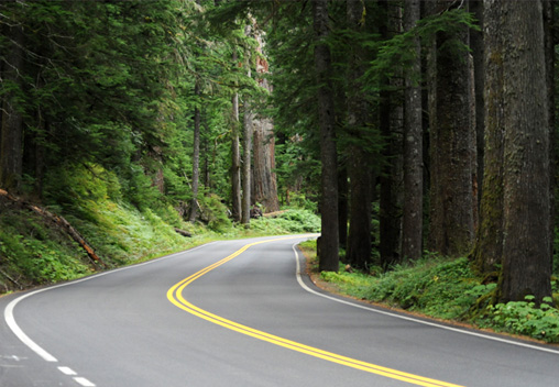 | Finally we were into the great forest that I had been longing to see. The atmosphere of the great trees was enhanced by the lush undergrowth. Brenda always loves the ferns. 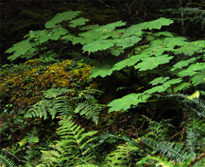 |
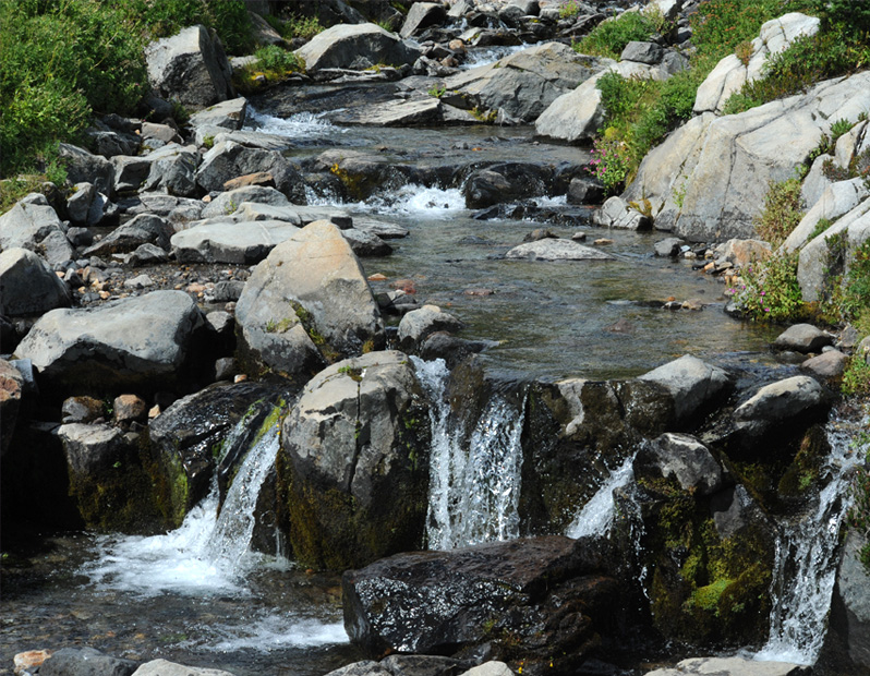
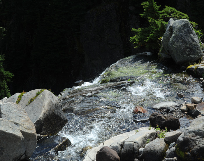
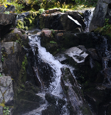
About an hour from Elbe but before we reached the park gate, we stopped to look at this beautiful rushing stream. I love streams where the water cascades over rocks in the stream bed. Generally, when you see an arched stone bridge like this, it is good to look for a turnout to see what is under the bridge. | 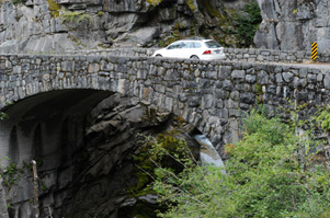 |
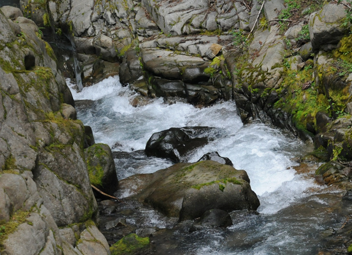 | The wildness and unspoiled nature of this stream was exhilirating. |
 | 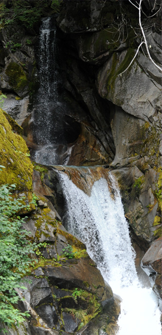 |
The view on the upstream side was just as exciting with a three-cascade waterfall. The image at left is of the first and the bottom of the second and the image on the right has the top two cascades plus the top of the bottom cascade.
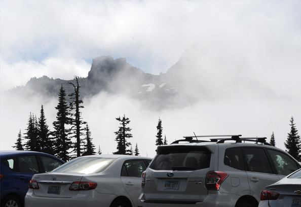 | This is the sight that greeted us when we drove to Paradise Point at 5400 ft. The peak is cloudy most of the time, so we came prepared for that. Still, the place was covered up, it being Sunday of Labor Day weekend. We barely got a parking place and walked to the Visitor Center. |
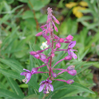 | 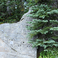 | 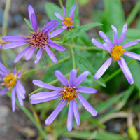 | 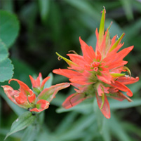 |
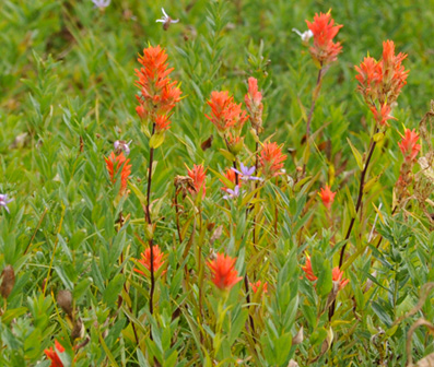
As we walked up the path to the visitor center, we encountered some old friends. On left is fireweed, which shows no signs of "cottoning out" in contrast to some of those we saw out of Skagway. Second is just a nice combination of rock and evergreen that I liked. Third is an aster and fourth is indian paintbrush. We have seen all of these when we have come out west for many years. Not so common is the lupine, which usually blooms in early spring as I understand it. But I have seen lupine at this altitude before at this time, so maybe it thinks it is always spring here til the snow falls. | 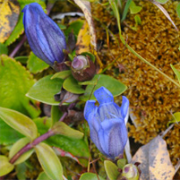 |
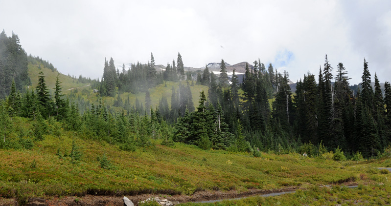
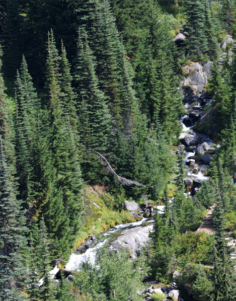
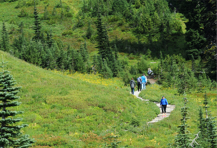
 | We could see far enough up the mountainside to see some snow patches. I found the evergreens dotted on the green slopes to be very beautiful. Below you can see a couple of the trails that lead up the mountainside from the Visitor Center. |
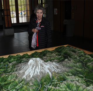 Brenda with the model of Mt. Ranier in the Visitor Center and then out on the trail. Unfortunately she couldn't hike much because of the combination of the altitude and all the things that have been going on with her over the past few days. She got very dizzy when she walked. | 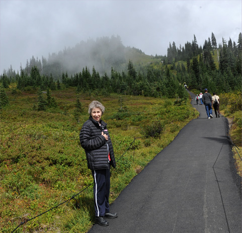 |
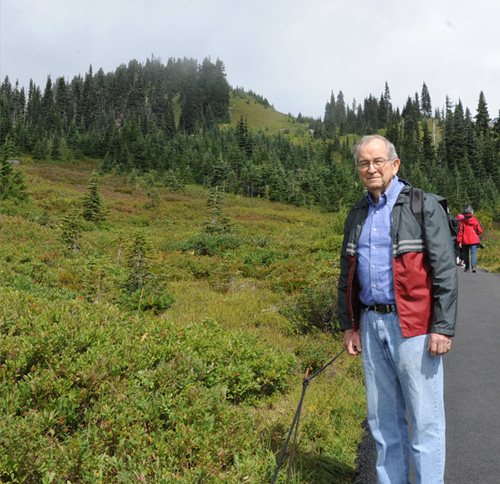 | Rod explored the lower trails for about an hour along with a bunch of young folks and a lot of families with their kids. I liked seeing the families on the trail. 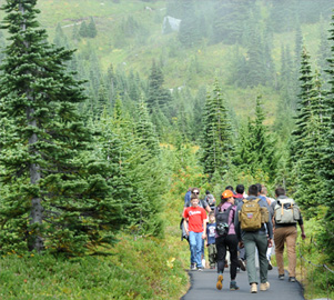 |
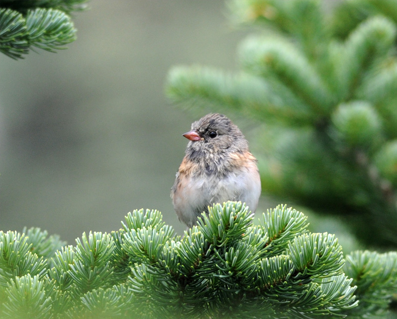
This is one of the things that Rod found, some Oregon juncos! I saw these birds flitting around in the small evergreens and thought they looked like juncos, but their color is very different from the ones we get in Atlanta. Fortunately, there was a Ranger standing at a trail branch just a few feet away, so I asked him about them. He said they had been called Oregon juncos, but that the official name had changed recently. Oregon juncos suits me just fine. | 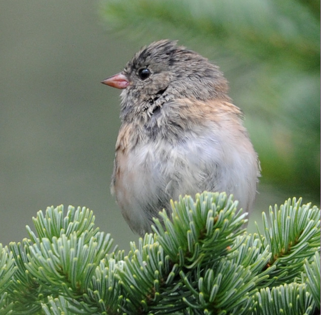 |
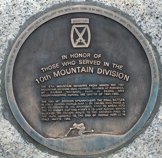 | Another thing the Ranger talked to me about was this plaque in honor of the Mountain Infantry who had trained here for their duty in the Italian Alps during World War II. The Germans and Italians had fortified some high mountains in the snowy Apennines, and it took this snow-trained group to break through and defeat them, bringing to a close World War II in Italy. The Ranger was reasonably close to my age, so I shared with him that Edgar had gone ashore in the Normandy Invasion 6 days after D-Day. He had an uncle who was in the Army Air Corps and was shot down and killed. It was nice to have a conversation on the side of Mt. Ranier about birds and about history. |
I couldn't get enough of just the beauty of the mountainside. |  |
 |  |
 | From up on the trails I discovered a rugged mountain stream across the entrance road that I had missed on the way in. 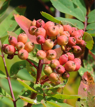 Adding to the color of the mountainside were these bushes of red berries. The berries are shaped sort of like crabapples. |
Though not spectacularly beautiful, I thought this picture of the two snowmelt streams coming from the remaining patches of snow was interesting. At left, you can see the beginnings of the soil-making process as the action of the snow and ice movement has broken up the rocks into gravel. | 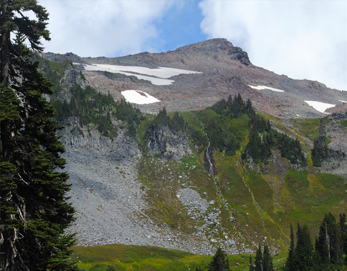 |
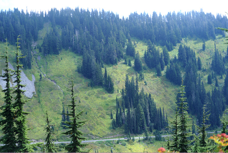
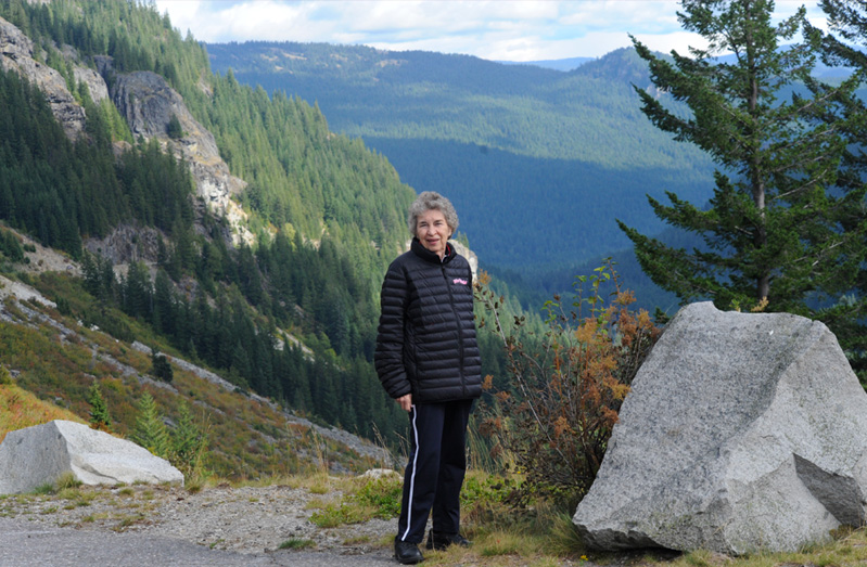
The car on the approach road to Paradise Park gives a sense of scale to this green mountainside.
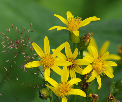
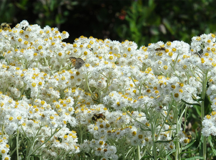 | The bees and butterflies were quite active on this luxuriant collection of white blooms.  |
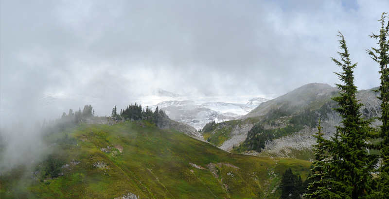
We kept glancing upward and got tantalizing glimpses of the permanent snowpack up on Mt. Ranier, but it never cleared enough for us to see the peak. Mt.Ranier is one of the tallest peaks in the continental US, at 14,410ft being only 84ft shorter than the highest peak, Mt. Whitney in the California Sierras at 14,494ft.
 | Above is the view from a wooden bridge of a fine stream coming down off Mt. Ranier. At left is the view in the downstream direction of this stream. It drops off the edge to form a waterfall. This view certainly made me want to go to see the falls. |
| I had to go down a steep set of steps to a viewpoint to see the falls, but it was certainly worth it! This is the most beautiful waterfall we saw in the park.
The other beautiful thing there was two young families who had brought their children to see the falls. I talked with one of the families quite a bit. They were from Seattle and helped me to find the best route back to Seattle. They legitimately made the point that the main route out to the west and Tacoma would be very congested. They recommended driving up the east side of Mt. Ranier and told us which routes to take. I had avoided 167 on the way down because extensive construction was indicated, but they said they had come down it this morning and that there was little delay. | 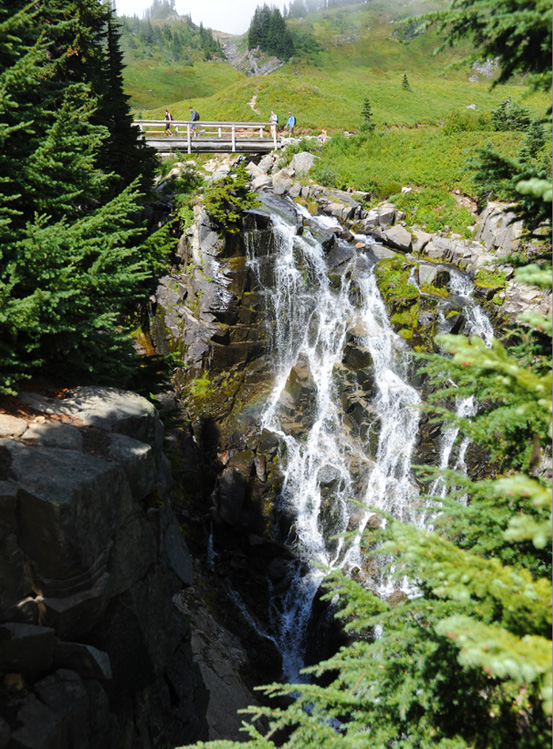 |
 | The trail across the wooden bridge at the top of the waterfall went on up the mountainside. At this time it was very bright along the trail at this level. |
Up above, the conditions were very different. With clouds sweeping in at those elevations and the snow patches, it looked like a different world. | 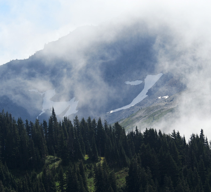 |
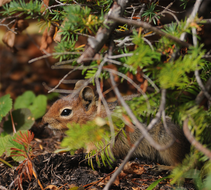 | On the way back from the falls I got this shot of a ground squirrel, the only animal I saw in the park. When we were here before there were marmots, grouse, and lots of squirrels. But that was near sunrise, so with this crowd, I guess all the animals hid. |
We left the Paradise Park area about 3pm and, following the advice of the family from Seattle, turned left to take the route up the east side of Ranier. In a short distance we came to the Mirror Lakes. We had gotten a good picture of Ranier from there before, but now it was totally cloud covered. |  |
 | 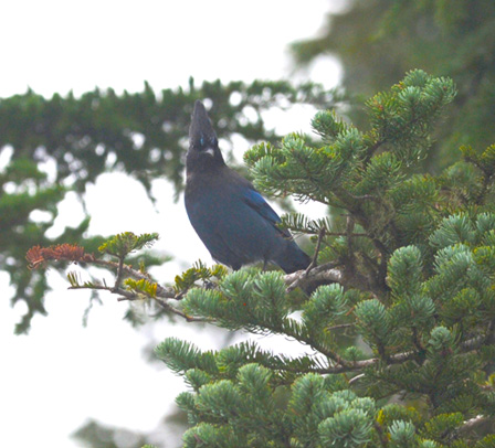 |
I heard a Stellar's jay there and chased him for a while, but the only views I got of him were so strongly backlit that they were only silhouettes. You can see a bit of his color in the right hand photo above, but that was only with a lot of Photoshop fiddling.
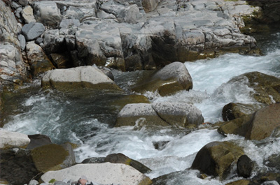
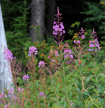  | There was lots of fireweed in this area and this interesting stream with cascades on one side of the road and a stretch of the stream visible from the other. It was interesting to me that all the rocks in the stream were angular with little visible rounding. Geologically speaking that means this is a recent stream. Some big avalanche or landslide or something must have produced this waterway. 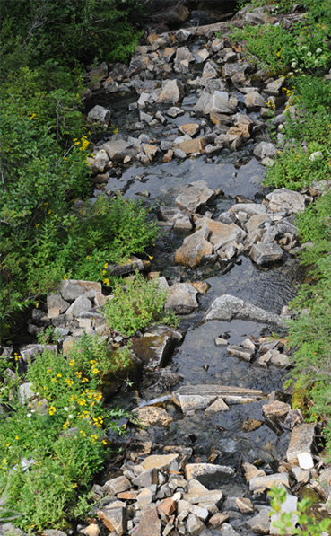 |
 | 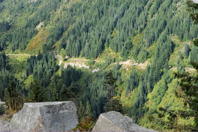 |
Soon we came to this set of curves that was like a vastly expanded switchback. At left above you can see the road coming down the mountain and making a sharp bend to go further down. Then at right above you can see the road far below us that comes out of the next sharp bend down the mountain. In the view of the low road below, you can catch a bit more of the vastness of the setting. There are cars on the road which you can barely see. And on this wide mountainside, the road has obviously been taken out by slides or avalanches several times.

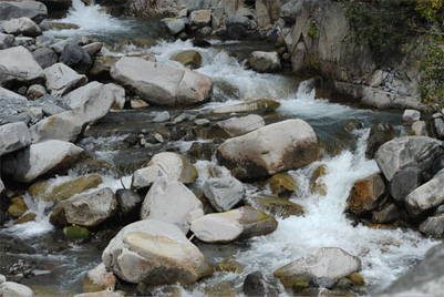 |  |
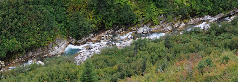
This violent creek was littered by a large number of shattered tree trunks and limbs, which I left out of the photos. Yet all the rocks are well rounded, suggesting that they have been there for ages. So it appears that the violence of the spring runoff brings down all kinds of debris, but the channel of the stream itself is very old. We saw a couple of more debris-laden streams like this, so it is apparently just part of the yearly cycle.
 | We stopped at an overlook to see a vast forested valley and mountainside and discovered this nice waterfall. |
This vast forested valley was very inspiring. We had come down in altitude some and Brenda was feeling well enough to walk around and enjoy it.
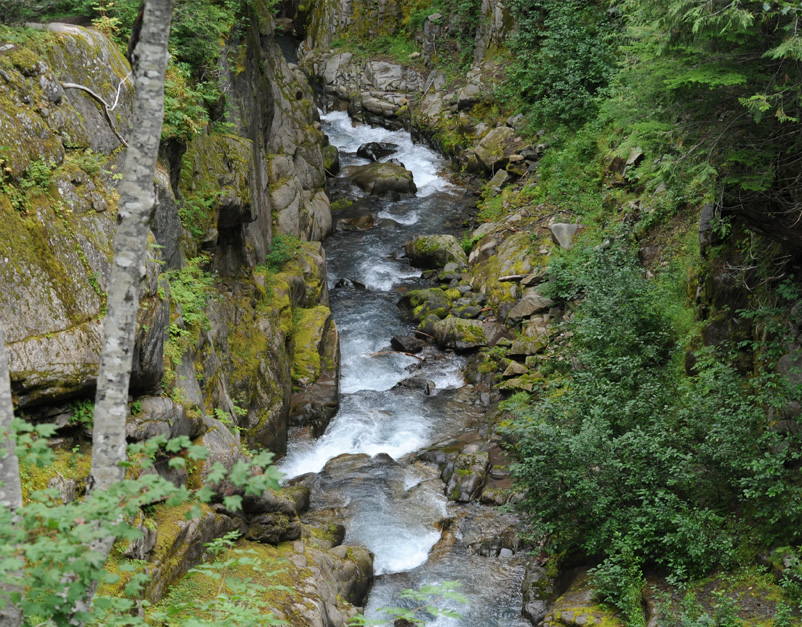
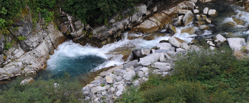
 | Our next stop was at this extraordinary deep gorge with a rushing stream through the bottom of it. It is called the Box Canyon of the Cowlitz. It reminds me of the Maligne Gorge in Alberta, Canada. |
We had come out of this tunnel and over one of the arched stone bridges, which we have found to be a good indicator that there is something interesting under the bridge. 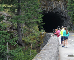 |  |
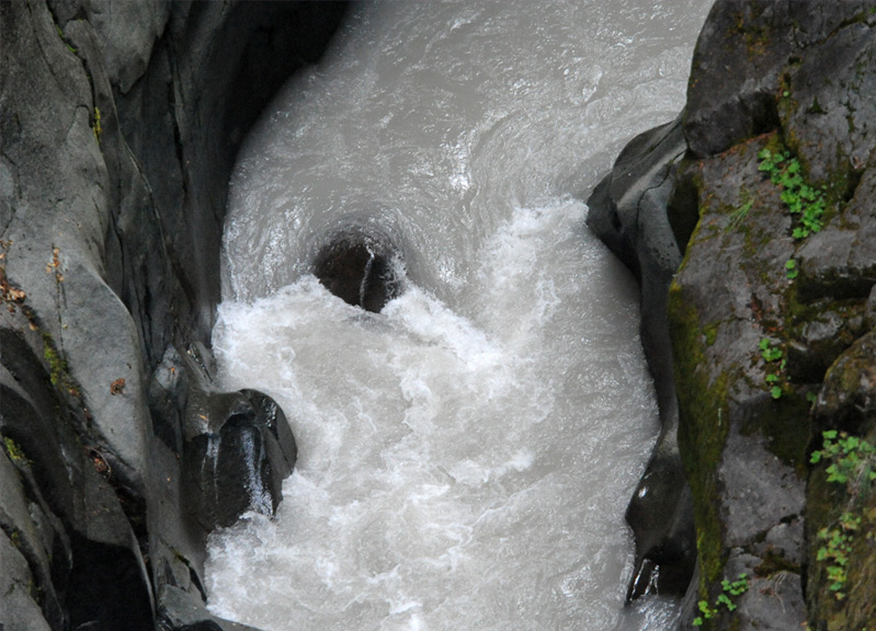
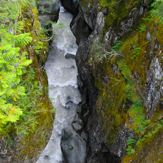
Now that is a scary whirlpool! We were standing on the bridge where there was a sign that said it was 180 ft down to the water surface. | 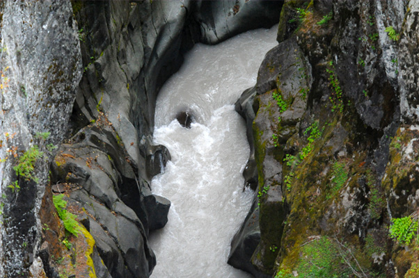 |

This is a view of the wonderful mountainous forest from the Box Canyon of the Cowlitz. This view is characteristic of the forest and mountain views we got as we traveled on around to the east side of Ranier and joined Hwy 410 to loop around the north side and head back to Seattle. The fog and rain settled in so I didn't take any more pictures on that route, but the east side of Ranier is definitely the more beautiful approach to the National Park and Paradise Point. We followed 410 to 164 and then 167 as the Seattle folks had recommended and that worked very well to get us back to Seattle.
| Seattle City Tour |
2016