Indian Housing in Reservation Area
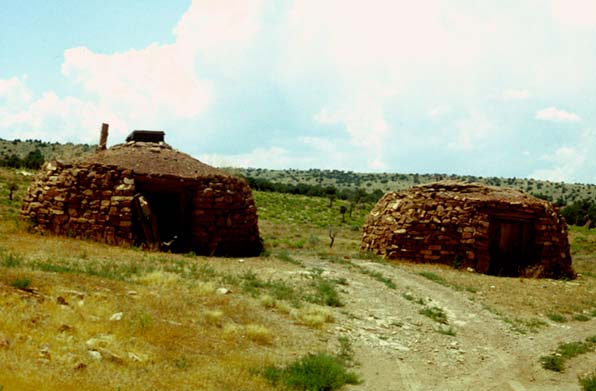
After we left the Grand Canyon and intersected Hwy 89, the landscape was pretty bleak desert. Just north of that intersection there was some presumably Indian housing like this. August 8, 1982.
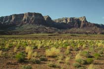
Across Marble Canyon to Vermillion Cliffs
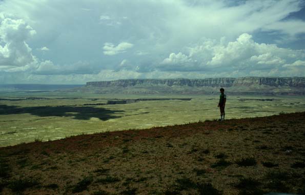
As we turned off the loop road from the South Rim to the North Rim of the Grand Canyon, we decided to divert over to see the Glen Canyon Dam. As we rose out of the plain, we got this remarkable view out across the plain toward the Vermillion Cliffs which must be at least 40 miles away. Cutting across the plain you can see what appears to be a crack - that is the Marble Canyon through which the Colorado River flows to the Grand Canyon. We are headed out for the 200 mile loop around to the North Rim of the Grand Canyon. August 8, 1982.
River Below Glen Canyon Dam
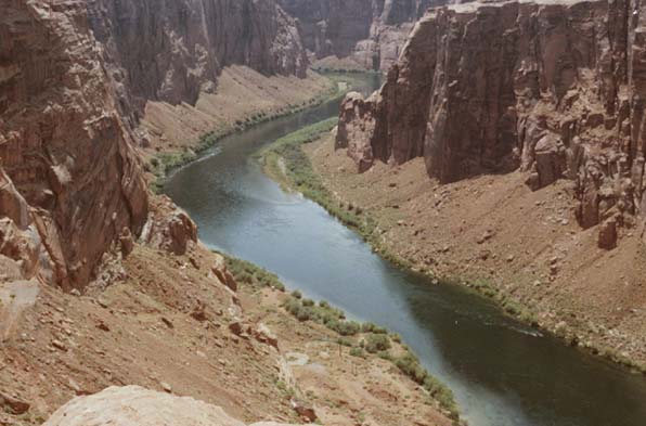
We diverted around to Glen Canyon Dam and Lake Powell on the 200 mile loop around to the North Rim of the Grand Canyon. This is the river below the Glen Canyon Dam. It runs through the Marble Canyon from here and you see the red cliffs characteristic of Marble Canyon beginning even here. August 8, 1982.
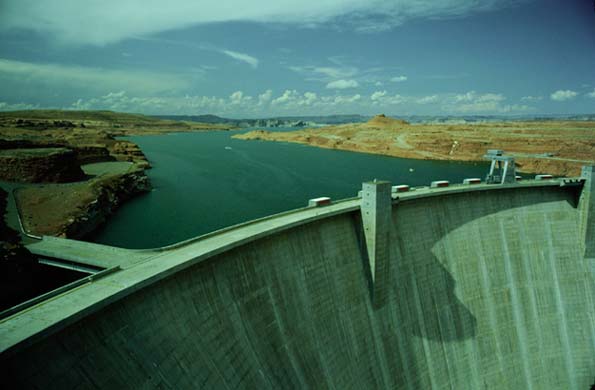
Glen Canyon Dam
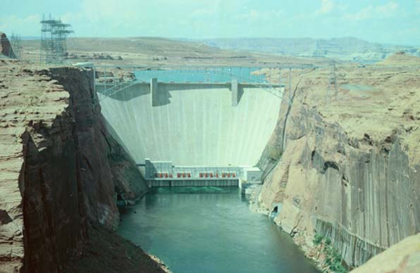
This shows the dam, the suspension bridge which carries highway traffic, and Lake Powell behind the dam. The Colorado River below the dam runs through the Marble Canyon from here. August 8, 1982.
August 8, 1982.
 |
|
 |
 |
|
|
Trip Day 8