Observer Coordinate Systems

|
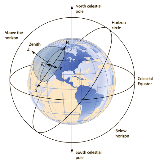
From an observer's position on the Earth, one can define a coordinate system based on the horizon circle and the compass directions. |

|
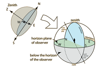
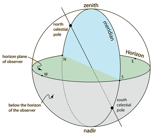
From a horizon plane coordinate system anywhere on the Earth's, we can construct an ordinary observer's reference frame with a zenith overhead and compass directions in the horizontal plane. From the surface observer's point of view, the zenith and Polaris (defining the celestial north pole) are convenient reference points. |
The plane through the north celestial pole and the zenith is called the celestial meridian or commonly just the meridian, understood to be this specific meridian. When an object crosses this meridian, it is called its meridian transit and it will be highest in the sky at that point. |  |

|
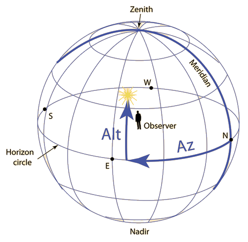
For pointing a telescope, it is convenient to use the Azimuth angle Az from North toward East and the Altitude angle Alt from the horizon plane. Also used is the zenith angle z, which is just 90° - Alt. |
The problem in finding a celestial object is that the Az and Alt are different for different observers and change continually as the object progresses from east to west across the sky. The location of a celestial object with respect to the celestial sphere is expressed in terms of its right ascension α and declination δ. Calculating the Az and Alt from α and δ requires the hour angle H and the latitude of the observer.
Gravity concepts
Orbit concepts
| HyperPhysics***** Mechanics | R Nave |