Villages Nestled in Italian Hills

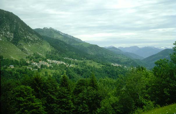
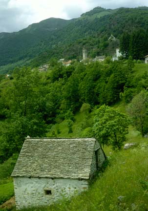
This is a roadside view along the highway to the east of Domodossola, Italy.

We left camp at 7:45 and drove to Brig and started over the Simplon Pass. We had a rather steep climb with windings for several miles. We traveled beside a deep gorge but didn't get the full impact of it because it was again very cloudy and foggy. We could catch glimpses of towering crags above us, with a patchwork of snow, but the clouds only tantalized us with these views - they never opened up. Near the top we went through a couple of miles of roadwork with one lane traffic, rough roads and moving machinery. To top this off, it was so foggy we had to turn our lights on at times. It was a very interesting, if not scenic crossing. It really is a well-engineered road. The clouds lifted a bit as we were coming down toward the Italian border but we had passed the most spectacular part.

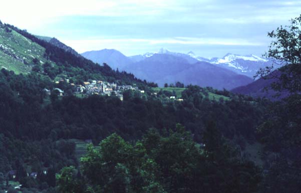
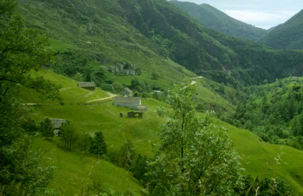
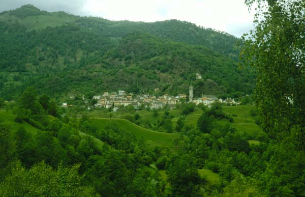
After crossing the Simplon Pass, we had turned east from Domodossola, Italy on the recommendation of an Australian couple at Visp who had just come over the road. We had misgivings at first since it was very narrow, but it was well paved and very interesting. It twisted and turned through narrow gorges and valleys, occasionally passing through a small Italian village perched on the side of the mountain. June 9, 1967

Index

Daily log
  Nave Album****Europe trip chronology Go Back


Italian Village in the Mountains

June 9, 1967

Index

Daily log
  Nave Album****Europe trip chronology Go Back


Our Highway Across Rural Italy

We decided to turn to the south at Malesco because this route would allow us to travel along Lake Maggiore for a short distance. This was a departure from the Australians' route and we had no knowledge about it except a small line on the map. After 2 or 3 miles it turned into a dirt road, about 1 1/2 car widths wide, and I was afraid that we had gotten on the wrong road. We perservered and it turned out to be the right road. It was 25 km of the most fantastic road that I have ever seen - all but about the last 5 km was narrow dirt road.

The road was evidently well engineered. The were many switchbacks, some almost too sharp for the lock of the car. The road twisted and turned its torturous way up and down mountains, through gorges, over streams to the little Italian villages. Often we could see the road in several places across the valley. We would see a tiny village with its church steeple about a mile straight across the valley, and after probably 5 or 6 miles of the winding road we would reach it. June 9, 1967

Index

Daily log
  Nave Album****Europe trip chronology Go Back


Rock-topped House Along Dirt Road

We decided to turn to the south at Malesco because this route would allow us to travel along Lake Maggiore for a short distance. After 2 or 3 miles it turned into a dirt road, about 1 1/2 car widths wide, and I was afraid that we had gotten on the wrong road. The road twisted and turned its torturous way up and down mountains, through gorges, over streams to the little Italian villages. Often we could see the road in several places across the valley. This is a distant view of Finero. June 9, 1967

Index

Daily log
  Nave Album****Europe trip chronology Go Back


Italian Village of Finero

Finero was a fascinating town in the Italian mountains, and serves as a example of the towns we encountered.

Along the winding one-lane dirt road across the mountains of northern Italy we found several compact Italian villages and towns which looked like they had been there forever. They had well-built rock and masonry buildings, always a prominent central church, and a compact structure which would make it practical to walk to any part of the town. June 9, 1967

Finero and Orasso, Italy
Index

Daily log
  Nave Album****Europe trip chronology Go Back