Aerial Photographs of the Newport, Arkansas Area
October 8, 2005

Bobby had spoken to be about possible taking some aerial photographs of the golf course at Village Creek. I'm always ready to take pictures, and this was a great opportunity to get in the air over the area. Brent brought the plane over from the Newport Airport to this grass strip in the middle of a soybean field and Bobby drove me to it, just up the road from his house.
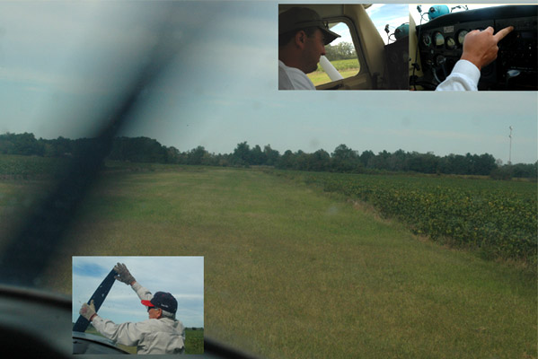
This was a bit different from your normal commercial airplane takeoff. We were about to head down this grassy strip. Brent checks the instruments to get ready for takeoff. The battery was weak, so they had to crank the plane by turning the prop. But soon we were ready for takeoff.
 |
 |
It was neat to lift off over the fields and fencerows, and to see the hay and bean fields from the air.
It was interesting to try to identify long-familiar geographic features from the different perspective of the air. The road just under the plane wing is one we often traveled from right to left in the picture to intersect with old Hwy 67, and then we went over the viaduct shown where the highway crosses the railroad. The place where we took off is the small building just below the plane wing at the extreme right.
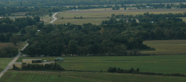
We could look back down to the small grass strip where we took off. Our starting point was at the small metal-roofed hangar building where you can just see another small plane inside. The road leading to the top of the picture leads to our old homeplace. One of my boyhood memories was walking down that road when it was dirt, leading one of our cows down to the Bruce farm along that road for breeding. Our school bus came down that road but turned on the road to the left before getting to the point of the airstrip.
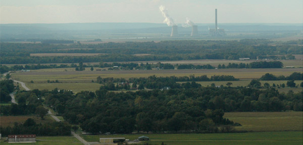
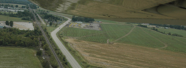
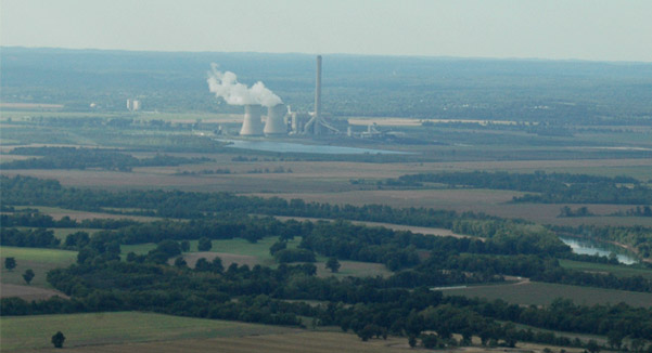
A larger view takes in the power plant at Newark. Our takeoff strip is at the bottom right of the image. We had seen this power plant from Oil Trough on our way into Newport this morning. The power plant was not there when I was a boy.
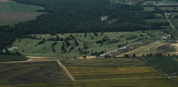
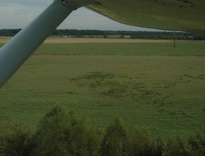
Our commission was to take aerial photographs of this golf course at Village Creek. Brent flew me around it twice and I snapped off a bunch of pictures - I hope they will be helpful.
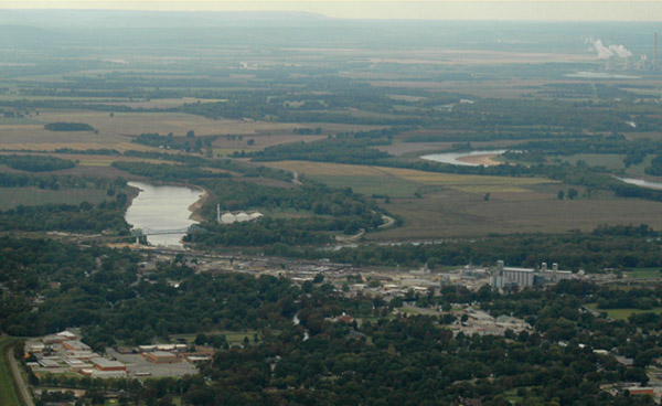
When we left the golf course I was surprised to find us over Newport, which I had never seen from the air. The first thing you recognize is the bridge over the White River. I was interested to see the perspective of the Newark Power Plant in relation to Newport. Newport High School is in the bottom left of the picture.
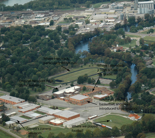
We got a good view of Newport High School and the associated other schools. Having graduated in the original Newport High building in 1957, this area holds lots of memories for me. I think Dorothy, and maybe even Edgar also attended this school, so it covers four generations in our family with Garrett attending currently.
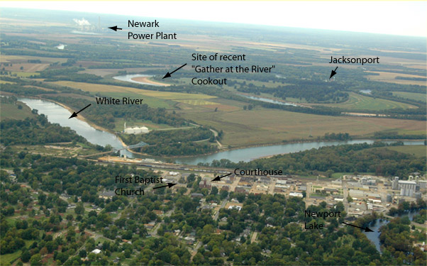
Back to a wide view that starts just above Newport High School, some of the surrounding features are labeled. It was interesting to see the river at Newport and Jacksonport at the same time. It included the Jacksonport Park were we had the "Gather at the River" cookout a week or so ago.

This zooms in for a closer look at downtown Newport with the courthouse and First Baptist Church in central locations.
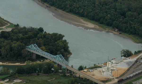
This zooms in closer on Newport's most conspicuous feature, the "Blue Bridge".
A closer view of the Newark power plant.
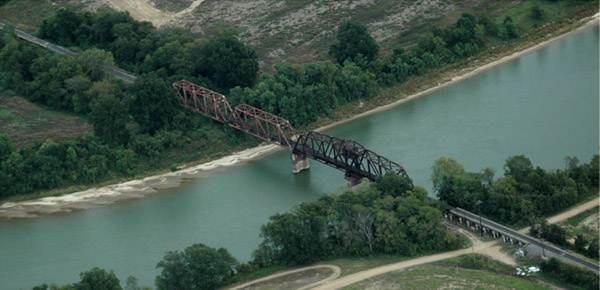
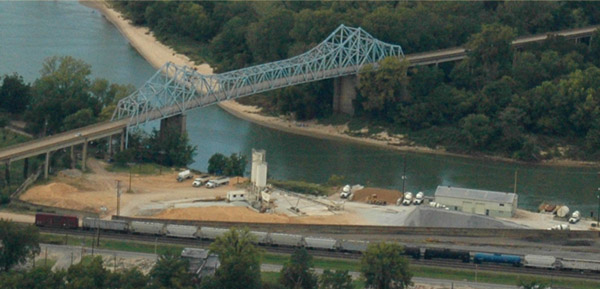
Brent swung us down over the railroad bridge for a close look. I felt like we were on a bombing run, so someone on the bridge might have been nervous. I had never seen this bridge before, and certainly did not have the perspective given at right with the blue bridge in the upper left corner. |
 |
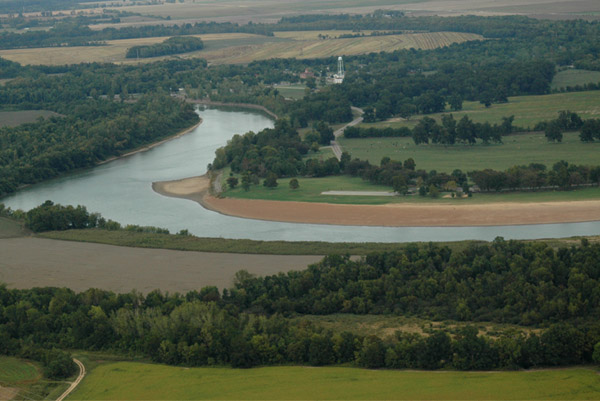
We swung north for a nice view of the river at Jacksonport. You can see the courthouse and water tank at Jacksonport. Jacksonport Park extends to the right along the river, but you can't see quite as far out as the location where we had our cookout.
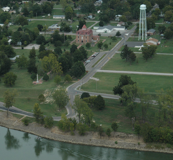
We got close views of the Jacksonport Courthouse as we flew right over it. The road close to the river and leading to the right is the one we traveled to our "Gather at the River" cookout on October 2.
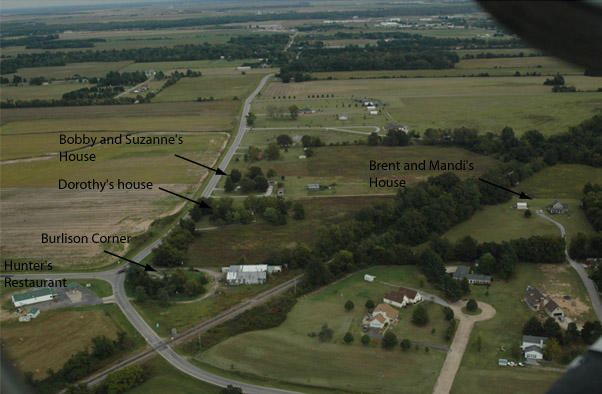
From Jacksonport Brent swung on around to approach the family houses from the west. This shows the area surrounding our old homeplace.
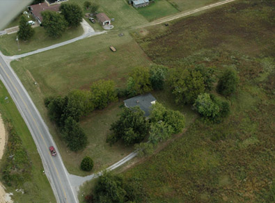 |
An almost overhead view of Dorothy's house on the hill where the family moved in about 1937. The original farm house where we grew up burned in 1961, but this spot has been home to part of the family for almost 70 years. |
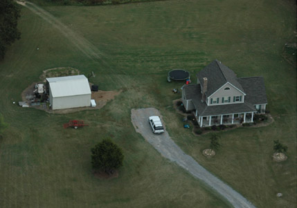
This aerial view of Bobby and Suzanne's house finds Bobby and Garrett out in the back yard. Our little white Toyota is in their back driveway. The van in front belongs to men installing vinyl trim. |
 |
 |
Brent and Mandi's house. I guess I'll always think of their house as sitting in the middle of the watermelon patch. From my earliest childhood, we always grew watermelons on that hill. The sand was so deep that the tractor would bog down, so we gathered watermelons with a wagon drawn by two big belgian horses. |
After a low pass over the houses, we headed toward the airport. We went over the Diaz City Hall where Bobby meets with his city council and carries out his duties as Mayor of Diaz. Soon we were lined up on the runway for landing. |
 |
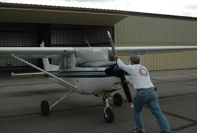
 Many thanks to my expert pilot, Brent Lassiter. He provided a fascinating flight, a smooth landing, and even pushed the plane into the hangar afterwards! |
 |
By the clock on my camera, this flight took just under 30 minutes.
| Visit with Bobby and Suzanne and family |
2005