South on the Icefields Parkway
July 27, 2009
We had a pleasant journey down the Icefields Parkway through lushly forested valleys along the Athabasca River near Jasper. Further south we started seeing glaciers up on the mountains.
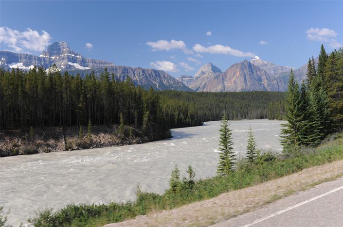
 | Just a few miles south of Jasper we began to travel along the shore of the wide Athabasca River with nice mountain views. |
The Athabasca River was very swift. We had considered canoeing in it, but noticed that no one else was doing it! Everyone was in rafts with survival gear. | 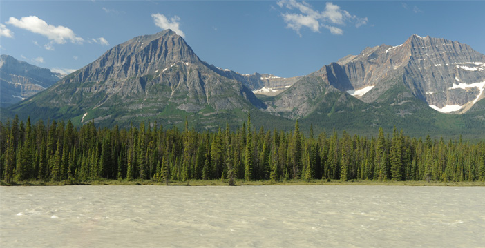 |
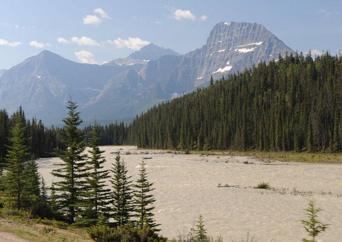
 | The inspiring mountain scenery kept changing and we began to get more snow up on the mountains. |
I loved the lush green forests that climbed up the flanks of the mountains. | 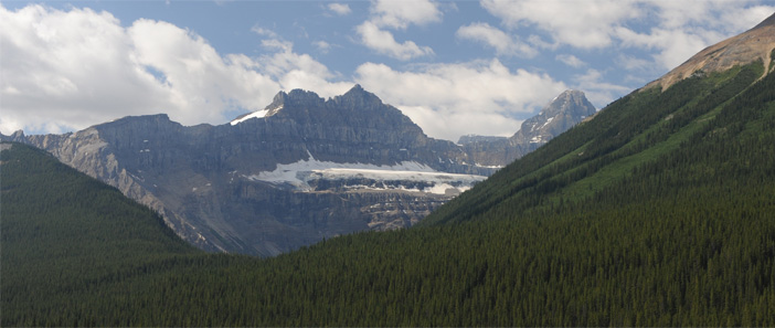 |
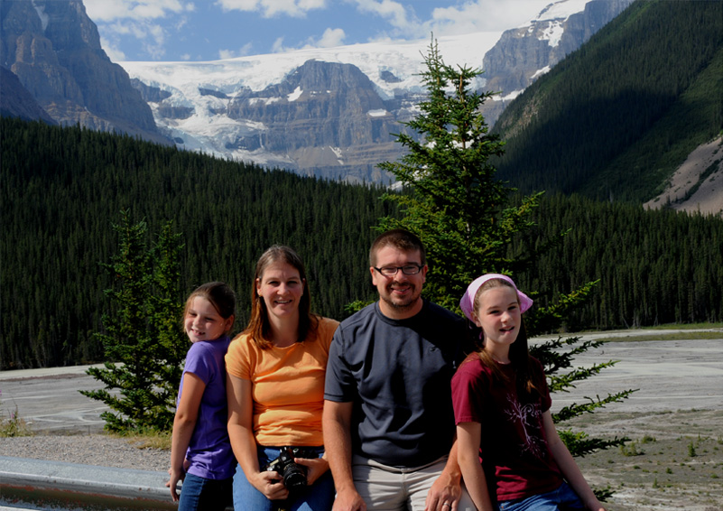
 | This was my favorite viewpoint along this road. Beautiful glaciers, lush forest, the interesting broad glacial river, mountain streams - it had it all. We spent a few minutes there taking pictures and just drinking in the scenery. |
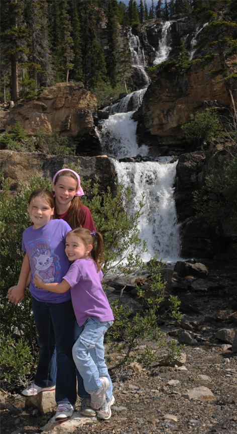
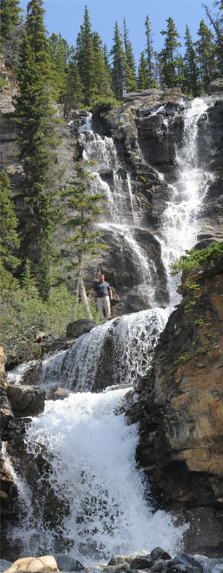
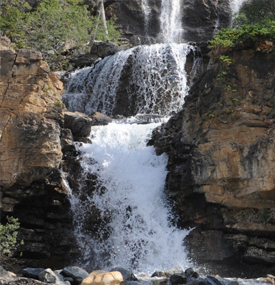
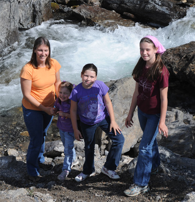
Mark and Jeff climb up for a closer communion with this nice waterfall that fell in several cascades down the mountain. 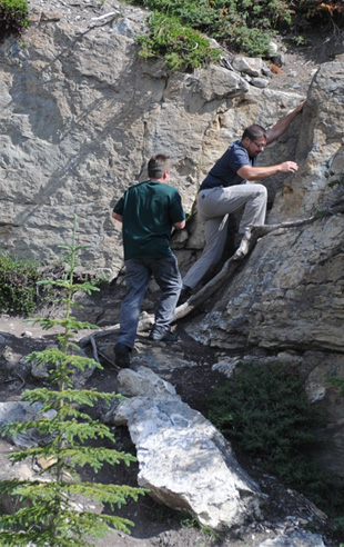
Below, Jordan, Ashleigh and Elyse at the base of these dramatic falls. Jeff climbs up to stand by a higher cascade. | 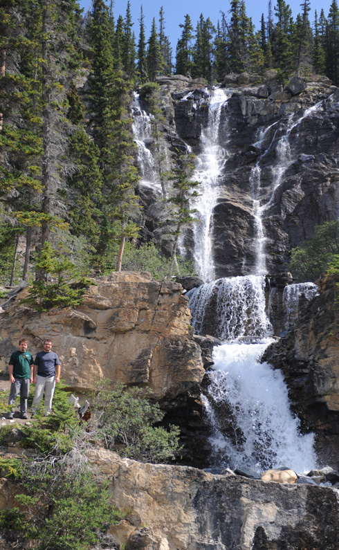 |
 |  |

 |  |
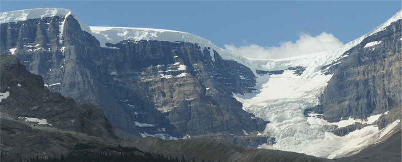
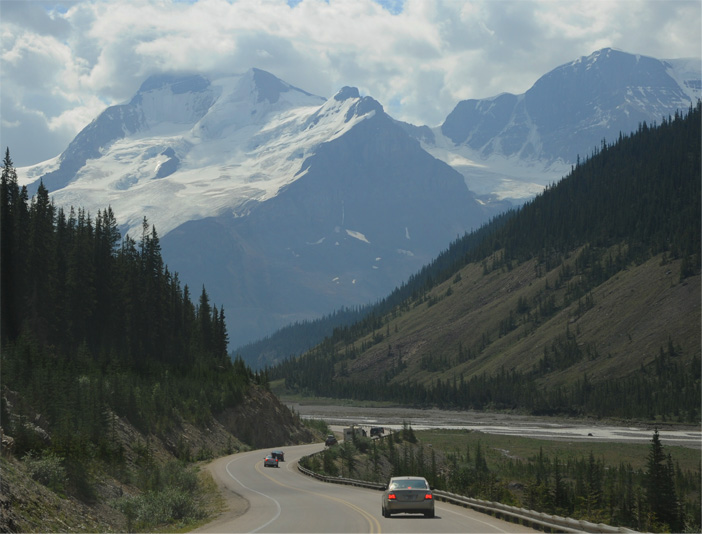 | We are headed down the mountain on our approach to the region of the Columbia Icefield. The large icefield covers the tops of several mountains in the area. |
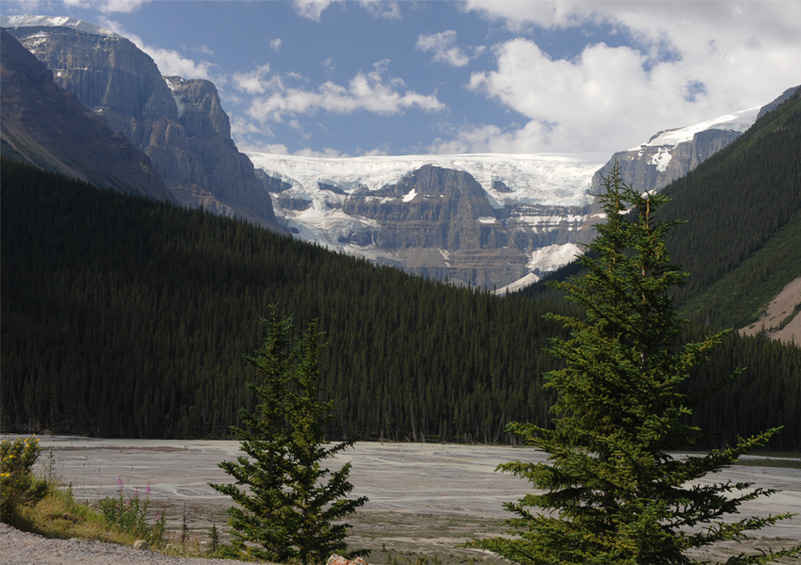
The Sunwapta River originates at the Athabasca Glacier and flows northward. Here it is a wide, braided glacial river with lots of gravel bars in it. | 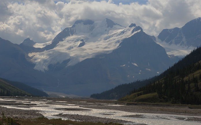 |
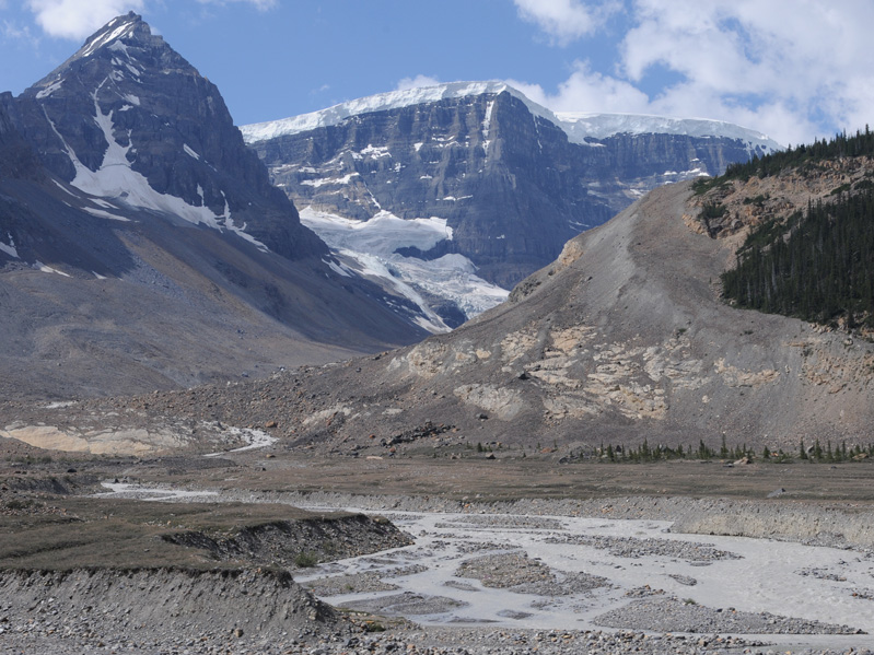
 | These high snow walls on top of the ridges were some of the most fascinating things I saw. The above view puts them in context above the braided Sunwapta River. |
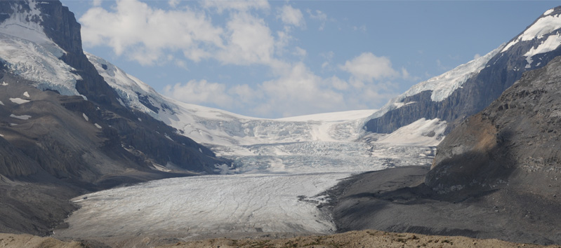
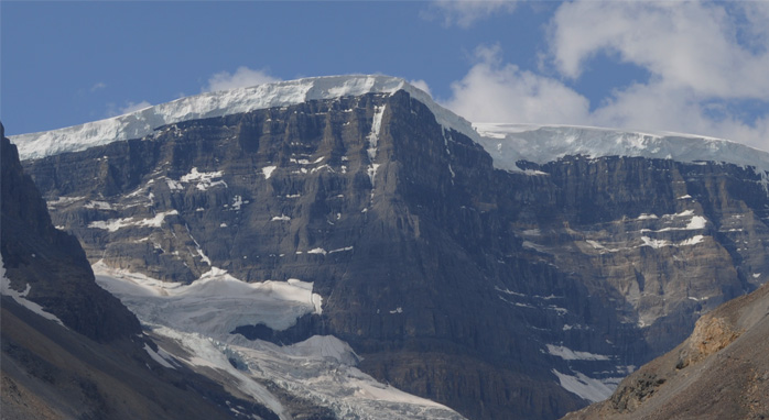
Above is our view of the base of the Athabasca Glacier, the glacier onto which we took the bus tour last year. One of the tour buses can be seen as a tiny speck near the left of the ice. At right is a view of part of the ice field up on one of the mountains, and you can see an ordinary bus taking folks along a gravel road to the station where they board the ice vehicles. A little lower you can see a smaller gravel road which we were to take to the lower parking lot from which we walked up to the glacier's edge. |  |
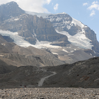  | 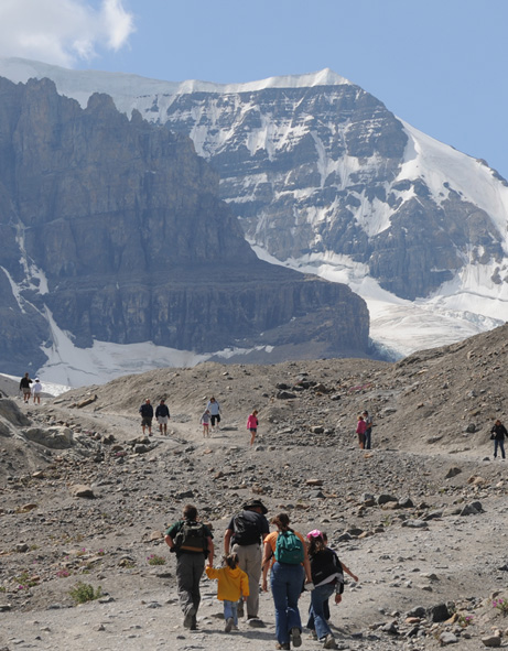 We parked and headed up the footpath to the base of the Athabasca Glacier. The path can be seen above left, with the view up to the glacier on top and the view back down to our parking lot below it. In that view, you can see the big Icefield Center at the extreme right of the picture. |
We reached the base of the glacier and had fully intended to hike out onto it since we had seen the groups like that one in the distance. But we were not allowed onto the ice - the groups we saw were guided tours. They had a posted story of an eight-year old boy who had died when a crevass opened up under him. 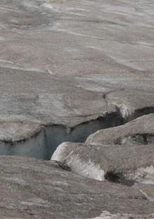 |  |
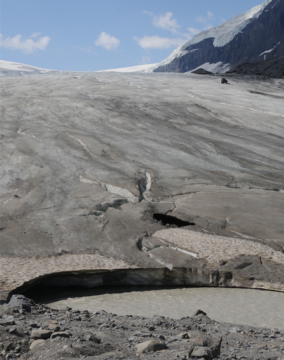 | There is not much beauty about the foot of a glacier, but there were some interesting things to see. At left is the stream that becomes the Sunwapta River flowing out from under the foot of the glacier. So we saw the origin of a river, and the source of some of the instability of the lower part of the glacier - you could break through and fall into the underground stream. Below is a small meltwater stream of clear water flowing over the dirty ice of the glacier base. 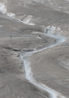 For beauty you had to look up. 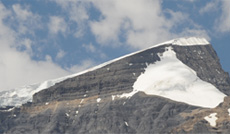 |
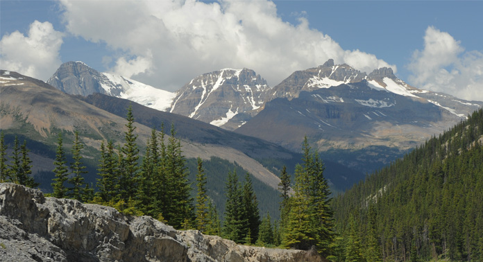 | We headed back northward toward Jasper and again found the beauty breathtaking. You don't tire of this kind of mountain scenery. |

We cruised along this beautifully engineered road. On the right of us here is a continuous rock ridge that ran for miles. It was appropriately named "Endless Chain Ridge".  | 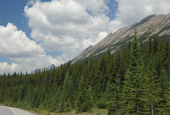 |
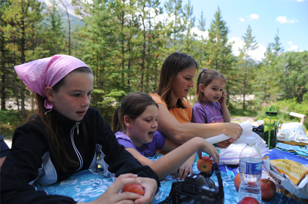 | On the way back north we stopped for lunch at Bubbling Springs, which had a nice picnic area. |
We puzzled over the small bubbling spring, which had a pool about 10ft in diameter, and no other indication of a stream or any other source around it. There were several bubbling sources at the bottom of the crystal clear pool, and when a bubble would rise to the top it would produce a nice circular ripple propagating away from it. | 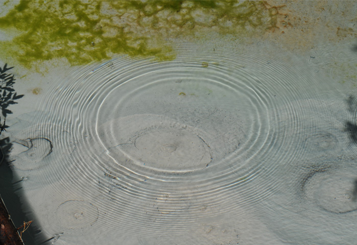 |
You can see about six areas on the bottom of the pool where bubbles would form. From the looks of the bottom, there was probably some mineral content that was being gradually deposited, but the pool looked crystal clear.
After lunch we proceeded a short distance north to Sunwapta Falls.
| Sunwapta Falls |
2009