Columbia Ice Fields and the Athabasca Glacier
July 26 , 2008
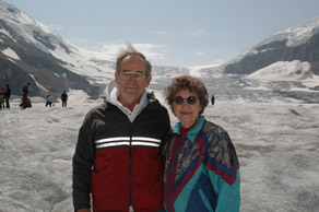
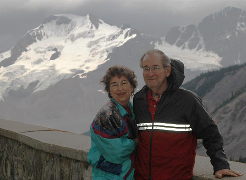 | Continuing the trip from Jasper, Rod and Brenda are at an overlook just a few miles north of the glacier visitor center. The glacier in the background is one of those that surround the great dome of ice that overlooks the Athabasca Glacier to which we were headed. The Sunwapta River here flows north and joins the Athabasca River and flows eventually to the Arctic Ocean. From the great ice dome, some water flows to the south to the Columbia River and to the Pacific, and some flows to the North Saskatchewan River and to the east. |
Though this glacier picture is not of the stunning beauty of many other scenes, it tells a story of what happens in this region. You can see the melt stream coming from the large glacier in the distance. Then in the valley you see what appears to be a huge pile of gravel. Presumably that is the terminal morraine, and tells you that the glacier had advanced to that point at some time in the past. The melt streams converge into the river, which is the Sunwapta River I think. So much silt and gravel moves to the stream that you get the wide gravel bars and multistranded streams in the flat valley floor during the times of low water flow. | 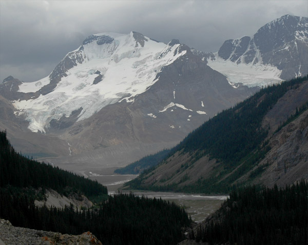 |
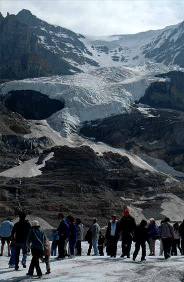
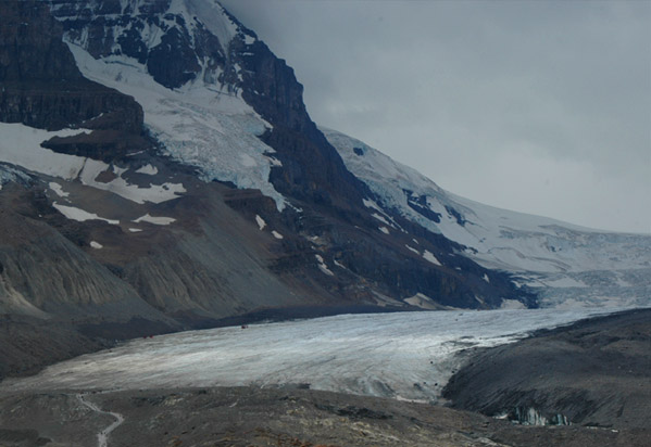 | We reached a point where we can see the Athabasca Glacier that spreads out in a flat sheet on the valley floor. That is what makes possible the tours out onto the glacier. At the bottom you can see the foottrail and the people who are walking to the edge of the glacier. Further back you can see the black specks to the left of the glacier that are the buses that take you out onto the glacier. 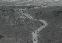 |

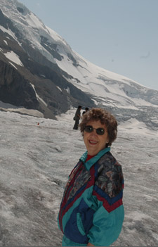
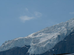
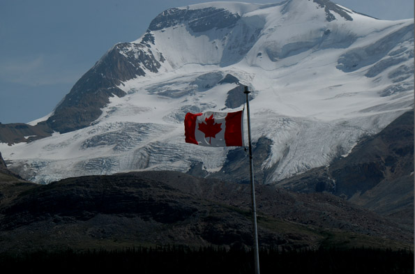
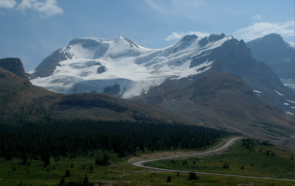
One of the views that captivated us at this point was that of the high walls of ice and snow on the tops of the mountains, shown above. We had never seen anything like this, but enjoyed an even better view later on our Banff trip. Adding to its drama was the fact that a storm was moving over the peaks and it started pouring rain as we ran back to our car from the visitor center. Later our tour guide would say to us "You guys are lucky, an hour ago it was pouring rain out here!" This was a contrast of two worlds - one high and remote and stormy, the other crowded with people speaking a half dozen languages and a parking lot full of cars, rvs and tour buses. We reached the Icefield Center a little before 1 pm and signed up for a 1:45 trip out to the Athabasca Glacier. We had a snack in the car and hurried to catch our tour. | 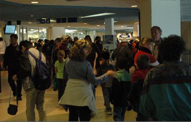 |
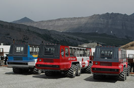
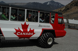
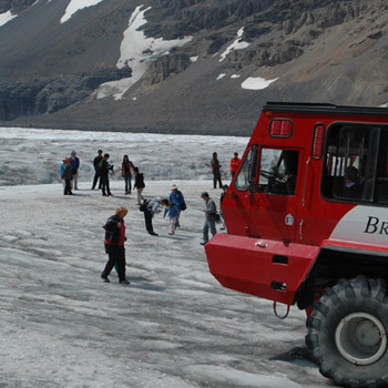
We were taken by a full-sized tour bus, packed out with probably 50 persons, out to the station for the big glacier vehicles. It was only about a mile. We got on the big bus for transport to the glacier. It had tires about five feet tall and the driver said they were inflated to only 15 lb/in2. It too was absolutely packed. At left above are three of the tour vehicles parked at the loading station. In center, one of the vehicles is returning from a tour. At right, our group is packing onto our tour vehicle.
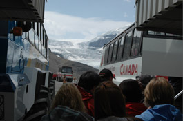
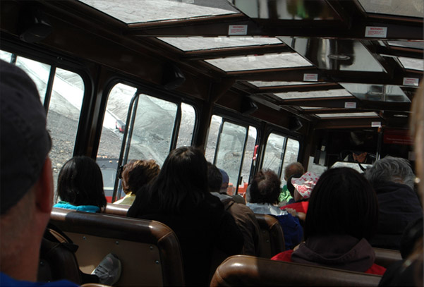 | From inside our tour vehicle, you can see that we are headed for a steep downgrade, and can see one of the other tour vehicles ahead of us at the bottom of the slope. The driver headed the vehicle down a 31% grade to get to the face of the glacier. It had a special locking transmission to keep the tires turning at a constant rate.  |
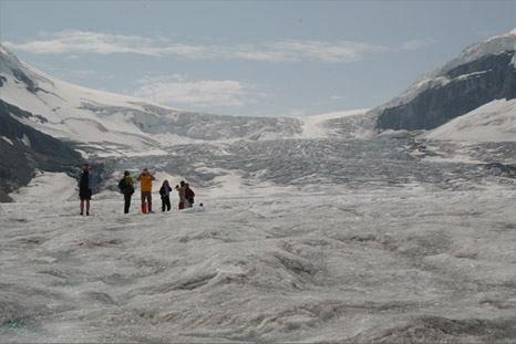
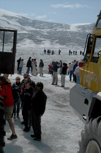
We proceeded a couple of kilometers onto the ice and stopped in a row of three other such vehicles and were able to get out onto the ice for about 20 minutes. We could see the head of the glacier and could see three other glaciers up on the mountains above us. 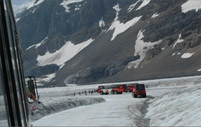 |  |
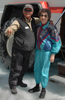
Our driver and tour guide was a friendly and entertaining fellow who told me he had taught at a technical college for 22 years before coming to work for the park service. We were allowed to wander around the glacier, and as usual up here there were people from several countries. Probably more Asians than anyone else.
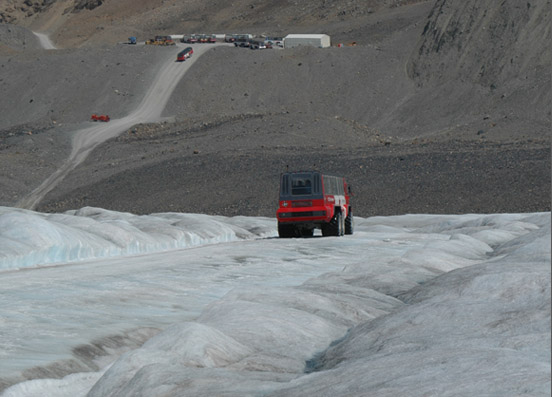
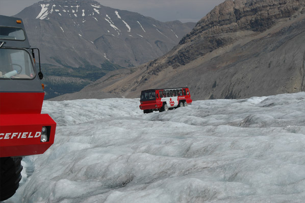 | I liked the view of the bright red glacier vehicles arriving over the glacial ice. 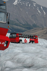 |
 |
I was interested in the two "hanging glaciers" on the left as we approached the Athabasca Glacier. They are associated with the peaks Athabasca (3491m) and Andromeda (3442m). There is a lot of structure to the glaciers, and melt streams that flow from the bottoms of the glaciers. 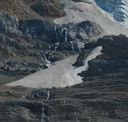 |
 |
We loaded back up on our big-wheeled vehicle for the return trip. Over the glacier we could see the station for these vehicles up the steep slope, and the road that the buses would take us on for the last mile. 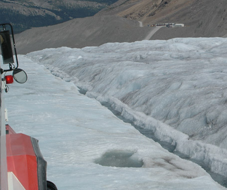 |
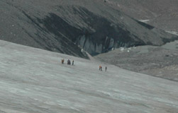
On the way back we could get a good view of the route of the glacier vehicles. We could see the hanging glaciers above, and could see hikers out on the lower end of the glacier surface.

We got a good perspective of the glacier between peaks Athabasca and Andromeda on the way back on the glacier vehicle. | 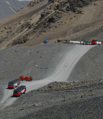 |
The drivers had pointed out the various morraines on the way up. The terminal morraine at the headquarters had been the greatest advance of the glacier and had occurred in 1843. We were shown the annual morrains and the lateral morraines along the sides. We had gone over the lateral morraine onto the steep downward slope of the road onto the glacier. The Athabasca Glacier comes out of the great icefield which forms a kind of bowl between several high peaks. It covers about 200 km2 and is more than 250 m thick in certain areas. Contributing to about seven meters of annual snowfall is snow even during the summer since moist clouds hitting the high peaks rises and forms snow into the bowl all year long.
|  |
 | From back at the visitor center, we got good views of the mountains Snow Dome and Mt. Kitchener, joining from left to right. The glacier is Dome Glacier. This view is to the right of the road we followed in to Athabasca Glacier. This whole area is covered by a major icefield that is the meeting point for three continent-wide watersheds feeding the Columbia River to the south, the North Saskatchewan River to the east and the Athabasca-McKenzie system that empties into the Artic Ocean. |
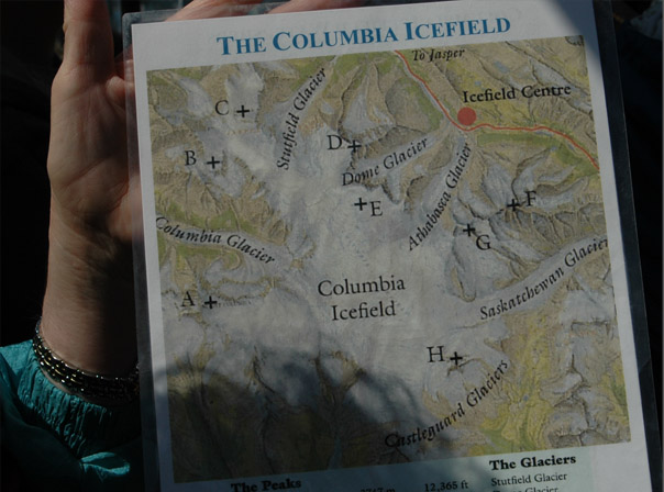
This is the map our tour guide handed around to show us the general layout of the peaks and glaciers of this remarkable region. The Athabasca Glacier was the one we went out on. The peaks labeled F and G are Athabasca and Andromeda peaks. Snow Dome and Mt. Kitchener are E and D and are shown above.
|  |
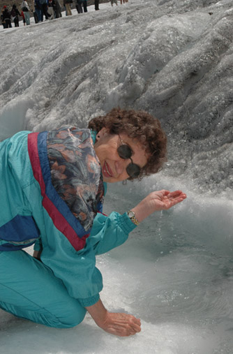
 | The Sunwapta River flows northward out of the Athabasca Glacier, and at its beginning was just a milky looking stream at the toe of the glacier. But streams from other glaciers add to it and it gets larger and larger as we drove northward on Hwy 93 back toward Jasper. Our guide described the milky blue color as coming from "rock flour", the fine dust formed by the grinding of the glacier on the rock below it. It is so fine that it stays suspended in the rapidly flowing streams. In the mountain lakes that are fed by these streams, it has time to settle out, giving them a distinctly different blue color. |
As we drove back northward, we stopped at the Sunwapta Falls where the Sunwapta had already grown from that stream we saw to a roaring river through a narrow gorge. We stopped at a major goat jam where about eight mountain goats were browsing beside the highway. At that point the Sunwapta River was a wide glacial river similar to those we saw in Alaska. Further north we stopped at the Athabasca Falls which were like a miniature Niagara roaring through a rocky gorge. They were just at the turnoff onto Hwy 93A and we followed 93A on northward until it rejoined Hwy 93 to Jasper.
|  |
|
Index
2008 |