Mono Lake
August 7, 2012
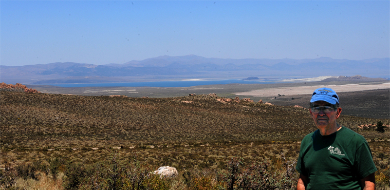
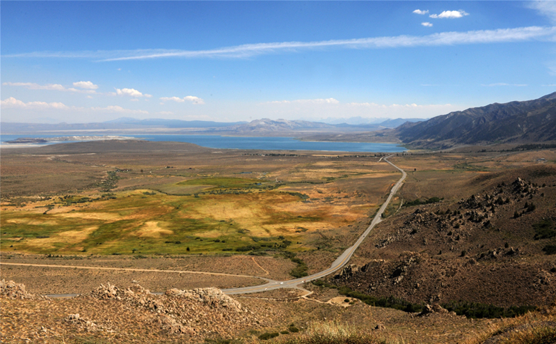
As we drove back northward from the Mammoth Lakes area, we got this view of Mono Lake from up on the mountainside.
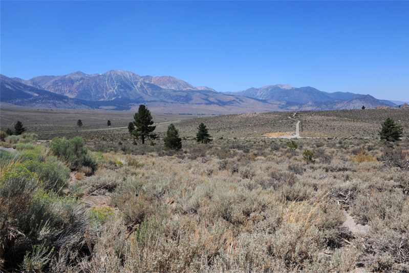
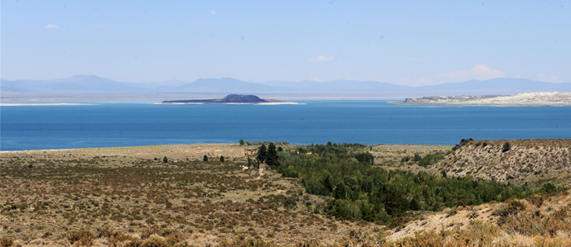
We had been in lots of different types of terrain since breakfast, from the alpine Mammoth Lakes to high mountains in the Minaret area to Devils Postpile in the valley. Now we were in wide open desert country with a view of the high mountains to the west in the area of the Tioga Pass. The view above was on the approach to the Mono Lake viewpoint above it. It was exhilarating to be out in the open country. As I was looking up this hill beside the overlook, enjoying the pleasant clean smell of the desert vegetation in the clear air, it struck me that these boulders were probably glacial erratics like those we saw up at Olmstead Point. | 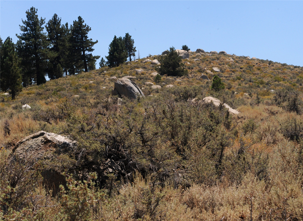 |
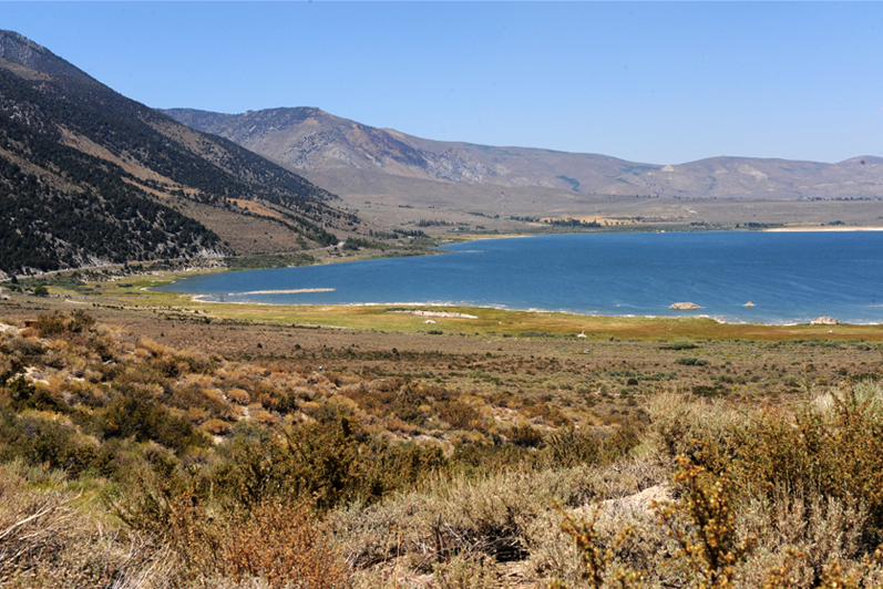
We drove on to the very nice visitor center which overlooks Mono Lake. This is a view of the west end of Mono Lake from that visitor center.
Also from the visitor center we got this nice view of Black Point, the remains of a volcano that erupted underwater in ages past when the lake was much deeper. It is mined for its sharp cinders to put on snowy roads during the winter.
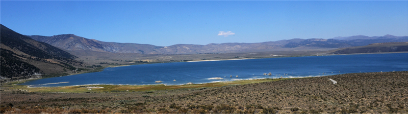
One more nice wide view of Mono Lake's west end from the visitor center. Then we drove on down to the road which passes the west end of the lake.

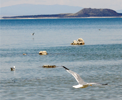
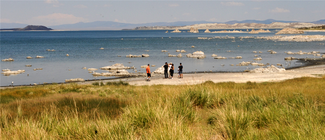 | We drove down to a parking area close to the south shore where the white limestone formations contrasted with the black volcanic island out in the middle. |
The shoreline with its white sculptures was inhabited by large numbers of gulls which feed upon the untold number of flies that also inhabit the shore. Those black specks are not dirt- there are thousands of tiny black flies. | 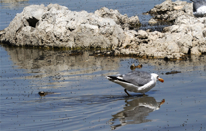 |
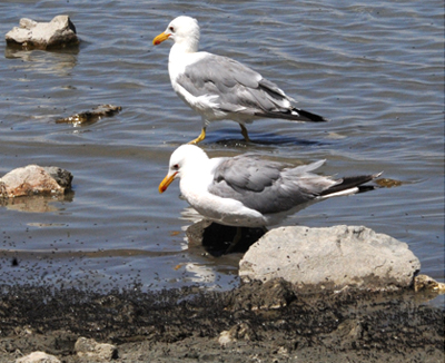 |  |
 | The large population of gulls so far from the ocean is an interesting story of a unique food supply. |
Just a stroll in the shallow water is enough to get supper with the abundant flies and tiny brine shrimp. |  |
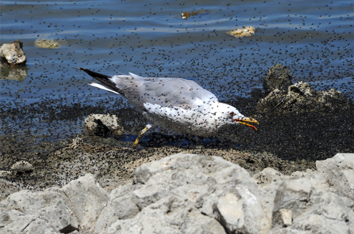 | This gull walks along the waterline, snapping up flies from the incredible abandance of flies along the shore. I'm supposing them to be similar to the brine flies we saw at Great Salt Lake, but even more abundant. |
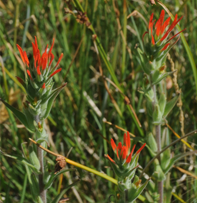 | 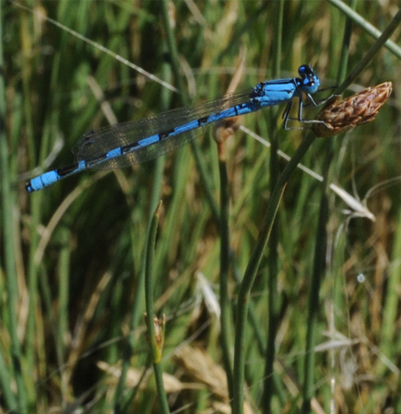 |
The grass and other plants along the shore were quite luxuriant, which surprised me a bit given the high alkalinity of the water of Mono Lake. I liked this delicate red flower, which may be variety of indian paintbrush, but is much finer and more delicate than any I have seen. There were a number of delicate blue dragonflies around in the grassy area.

We drove northward on US 395, skirting the west end of Mono Lake, and got this view from the northwest. You can see Black Point well, and the other large black deposit corresponds to other volcanic activity, I would guess. So the area has had a violent history.
 | Leaving the lake and traveling northward, we started climbing into the mountains and got good views back to Mono Lake. 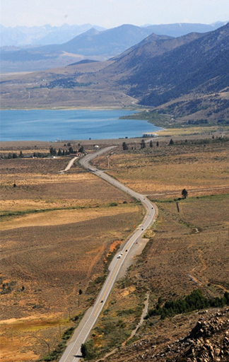 Our afternoon's journey was from Mono Lake to South Lake Tahoe where Brenda had gotten us reservations for the night. |
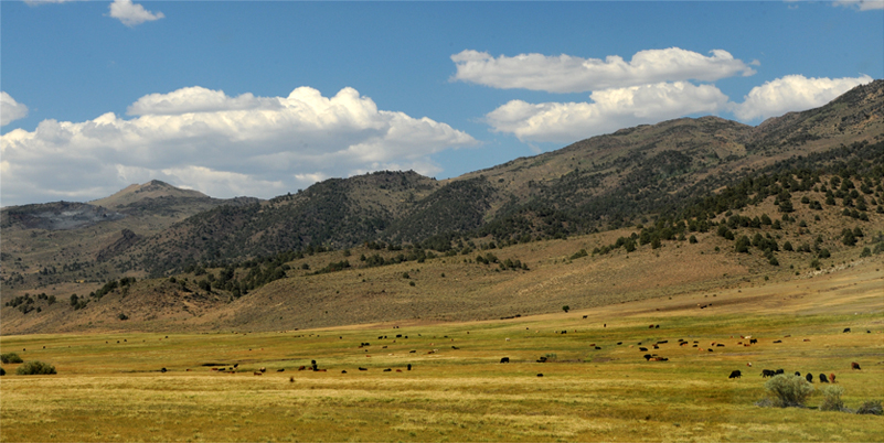
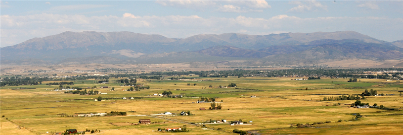
About 45 minutes north of Mono Lake we are in beautiful rangeland at the foot of the mountains. I can never see such western sights without Psalm 50:10 running through my head, reflecting "He owns the cattle on a thousand hills".
 | About 20 minutes further north we were driving through a hilly region and were captivated by this beautiful rocky stream. At extreme left you can just see our car and Brenda standing out on the rocky bank with her coffee. I enjoyed walking up and down the stream. 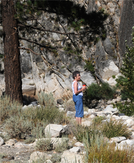 |
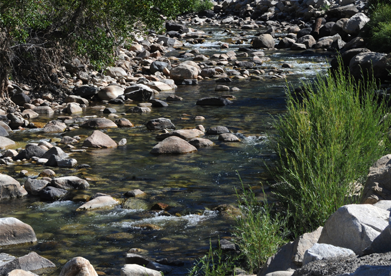
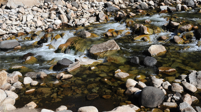 | We loved the stream and compared it to other beautiful streams we have seen, even to my favorite on the road to Mt. Edith Cavell in Alberta. |
Another 20 minutes north and we were back into wide valleys with lots of cows. I really loved this country. The only thing between us and the cows was this barbed-wire fence. Like back home in Arkansas. | 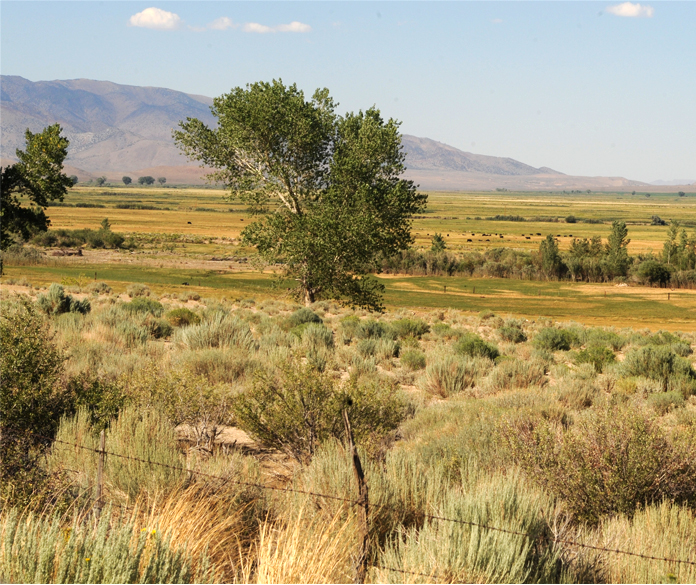 |
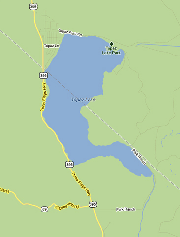 |  |
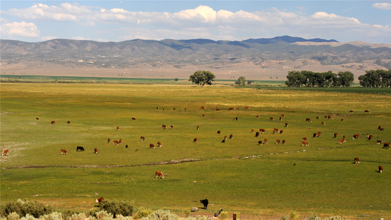
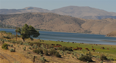
An hour and a half north of Mono Lake we reached the south end of Topaz Lake, which straddles the California-Nevada line. There were cows grazing right up to the water line, keeping company with the shore birds.
 | 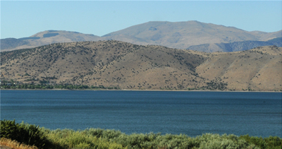 |
Topaz Lake was attractive, when you could get a clear view of it through the clutter along the road. Everything had to go through along a narrow strip of land on the west shore between the lake and the rising hills. That cost us some time there because part of the road had apparently fallen off into the lake, and there was a major construction jam with one lane alternating traffic.
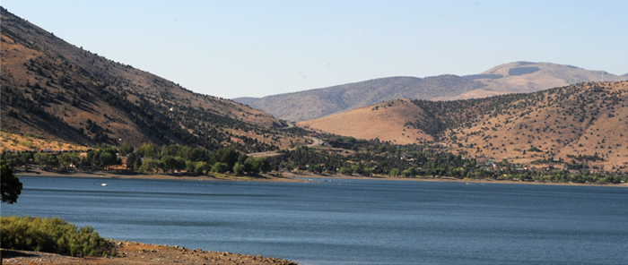 | Once past the construction, we moved quickly past the north end of Topaz Lake where it appears more of the population is. |
We made good time through pleasant farming country, with the number of houses increasing as we entered the Carson valley. | 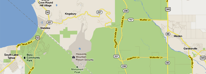 |
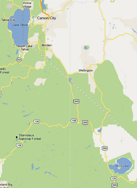
We left highway 395 at the right of the map above and took secondary roads over to meet Hwy 207 which went over the mountain into South Tahoe. The photo above is taken back toward the east as we were climbing the mountain on 207 toward that section of yellow squiggly line which spelled a lot of curves and switchbacks all the way to South Tahoe. We entered that road at about 5:30 pm after having left Mono Lake at 3:15. So in the neighborhood of 6:30 we had found our motel and were ready to settle in for the night. We had seen a lot of different types of terrain on this day!
| Lake Tahoe |
2012