From Moab to Canyonlands National Park
November 1, 2016
Having visited Arches National Park yesterday afternoon, we returned there this morning and finished our visit there with the Windows section. We were now off to visit Canyonlands National Park.

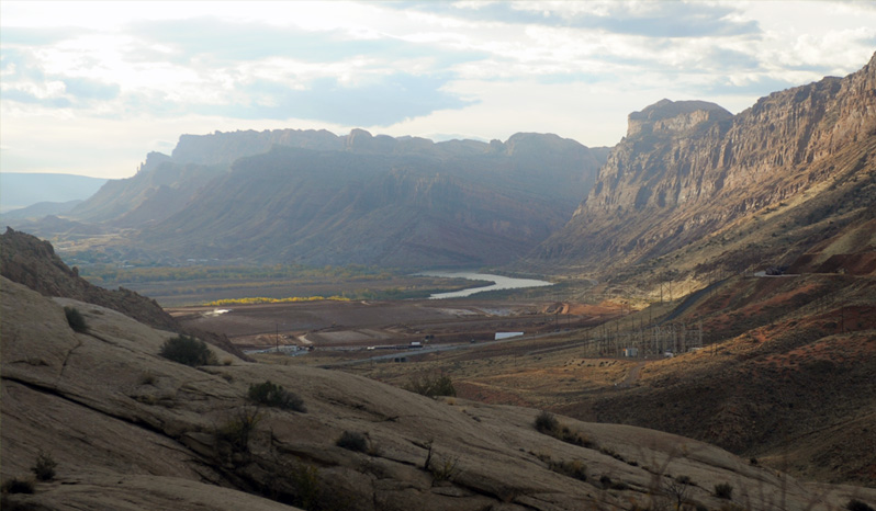
We had breakfast in Moab and were headed north about 8:40am for a return trip to Arches National Park when we saw this long train about to head into a tunnel just north of town.
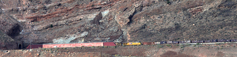
I've always liked trains, so it doesn't get much to make me stop and take a look at one. But this one has some unusual aspects about it. The tunnel it is going into just seems to stay close to the edge of this cliff wall, so it makes you wonder why they didn't just make an outside cut on the canyon wall. The other thing that made me wonder about such a tunnel was that I had heard that Moab was on a fault line. I heard or read about the Moab fault several times. So I would have been a bit nervous going into a long tunnel near the surface of a wall in a fault zone!
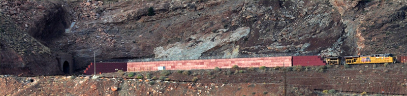
Another puzzling thing to me was that the train went behind this high wall on its approach to the tunnel. With all the loose material up on the wall above the tracks, it would seem that this wall would just hold the debris in case of a landslide and make it more difficult to clear! Oh, well! They weren't going to hire me as a consultant anyway.
There is actually discussion of this tunnel on the web, and some of the participants suggest that the wall is there because of restricted access - the train carries some radioactive mine waste. It was also said that the train only runs once a week and carries mine material. One said it runs on Fridays to Potash, UT for mine loadout. One quote "The tunnel is called Bootlegger Tunnel and is more than 7,000 feet long and includes a curve inside. It was a single-heading tunnel dug from north to south."
Though certainly not a spectacular view, I did find one place on the Arches approach road where you could see the Colorado River. You couldn't see it from any point I found on the way into Moab from the north.
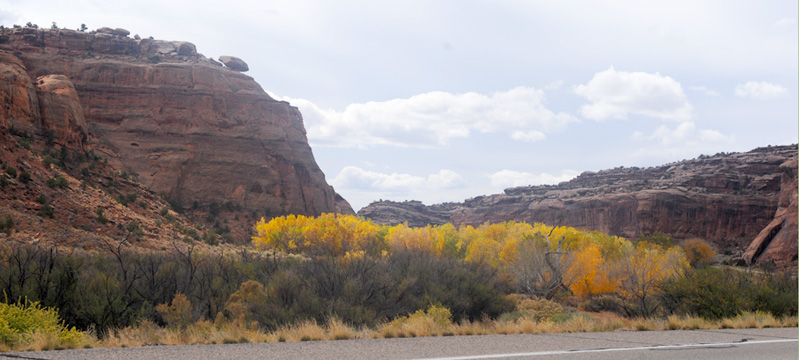
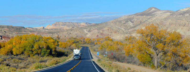
When we exited Arches after our morning visit there, we turned right to go north on Hwy 191 to the road that leads to Canyonlands National Park. About 10 miles north of Moab we took the left turn to go down Hwy 313 to Canyonlands. We were driving through the red sandstone formations and we enjoyed the occasional clumps of colorful trees. Our observation was that in the dry places you just got the evergreen shrubs, but anytime there was a stream, you got the trees that were showing their fall colors now.
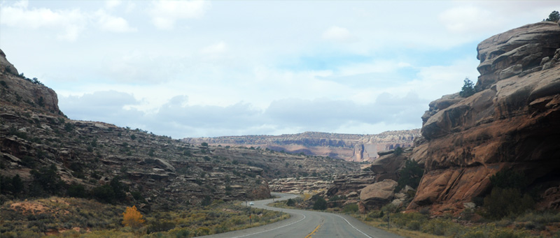
On the first part of the road we spent a lot of time curving around through the red rock formations.
The terrain changed to lighter colored rock humps and grassland.
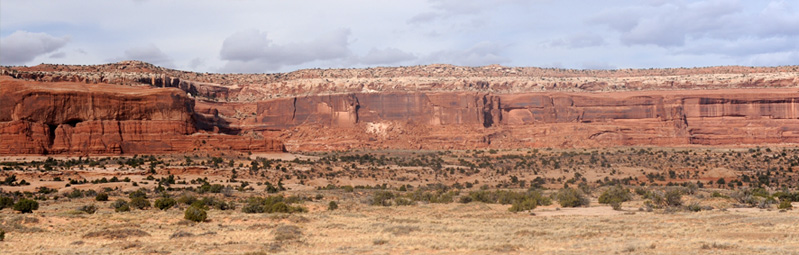
I was a bit surprised to see it transition again to high red rock walls, similar to what we had seen at some parts of Arches.
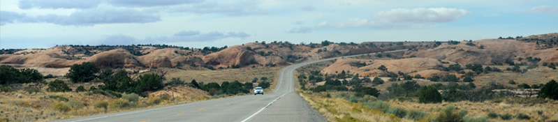
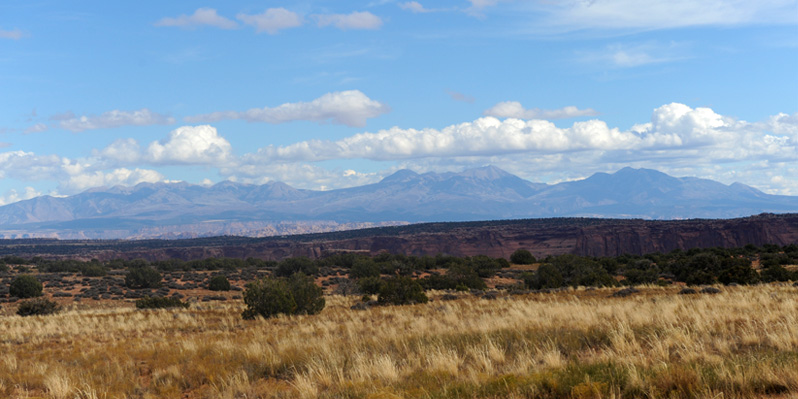
The next transition was to a high grassland, and we saw a lot of this. It is important in the image of the name "Island in the Sky" for the north part of Canyonlands. The "Island" is the grassland, and the canyons drop away from this high plateau.
We are on the "island" of grassland now and we are seeing the canyons drop away from the plateau on our left.
to Arches
 | 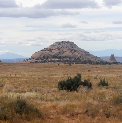 |
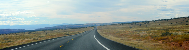
It was a long open road through the grassland with gentle humps. Then there was the occasional rock formation out in the grassland. I think the hump or dome is made of Navajo sandstone, the same stone that makes up the domes in Capitol Reef National Park. At least the information signs around said that the base rock here was Navajo sandstone.
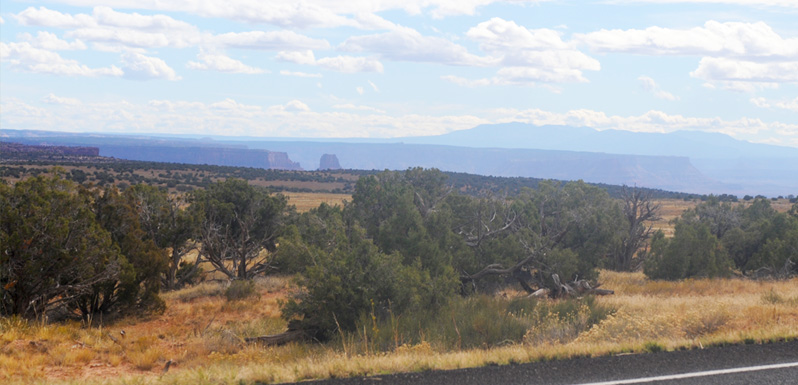
To the east we were getting a good view of the La Sal Mountains, which we had seen from Arches.
We had an enjoyable exploration of Canyonlands, but at about 5pm the light level was dropping and it was cloudy, so we headed back north on Hwy 313. Ok, these rock humps are not all that beautiful, but we certainly don't see anything like this in Georgia. They were sort of similar to the rocks we saw around the Sanddune Arch in Arches.
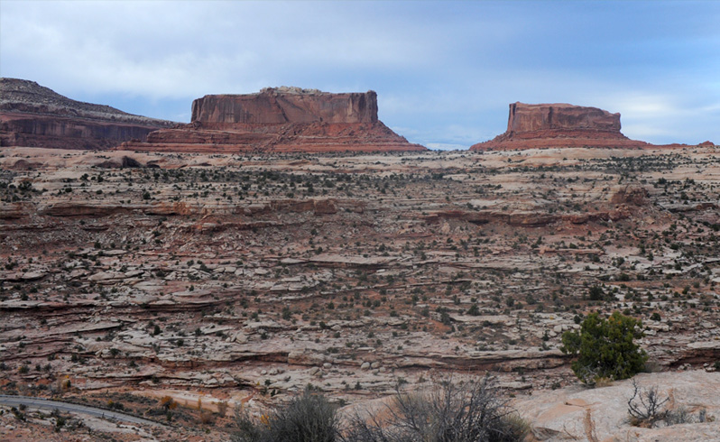
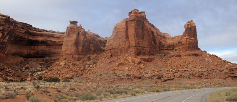
The most remarkable thing we saw on the way back that we hadn't seen on the way down was this pair of red rock formations named "The Monitor and the Merrimac". They are named after the Civil War ironclad ships of the same names. The information booth said that these buttes were composed of Entrada sandstone. They tower 600 ft over their Navajo sandstone base rocks. Note the road below us in the bottom left part of the picture, the road we would follow downward on switchbacks past this point.
This is one of the switchbacks below us that we would travel when we left this high viewpoint.
Exploring Canyonlands

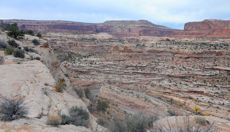
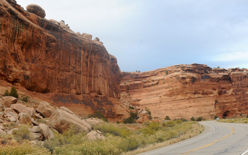
We continued the slalom route down among the huge red walls for a while. The scale of the walls can be judged by the little image of a car in front of us. I was looking at that big ball rock sitting on the edge of the wall, and the things I heard about the Moab fault line - it wouldn't take much vibration to put that big ball down on the road! | 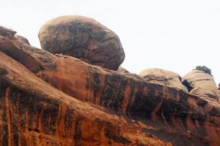 |
These red formations were very much like some we saw in Arches this morning and yesterday. That's not too surprising since we are just a few miles from Arches, and all our travel on this road is essentially between Arches and Canyonlands.
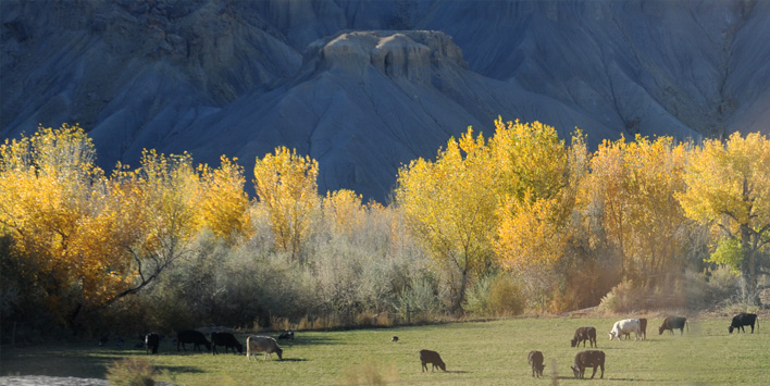
I like cows, but these weren't too sure they liked me. I didn't spook them enough for them to run away. They looked healthy, especially considering that there didn't seem to be much to eat there.
It could be that the leaves on these trees are edible for the cows. At least the trees indicate that there is some water to be had.
We made it back to Hwy 191 about 5:30pm and turned south to Moab for our second night there. Highway 313 had been quite scenic. That was a surprise for me, but it shouldn't have been because it is sitting right between Arches National Park and Canyonlands National Park.
We were up early on Wednesday and left Moab before daylight, making the 30 miles up to I-70 at about dawn. We drove to Green River, arriving about 7:30, and had a nice breakfast there at the West Winds Restaurant. There were several Spanish speakers there, so we asked about the Hispanic population. The lady serving us had lived there a long time and she guessed that slightly over half the population were Spanish speakers. She said she had learned enough Spanish to take orders in Spanish and to direct her kitchen crew, but was not comfortable conversing in Spanish.
By 8:30am we were headed west on I-70 and seeing huge wall structures like this to the north of us. It was very much desert terrain.
We encountered these angled formations at a place where the highway began to wind around through the rocks. It was only about fifteen minutes to the turnoff to Hwy 24 southward.


From Moab to Capitol Reef National Park
November 2, 2016


 | Turning south on Hwy 24 we ran beside these formations and the trees that tell you there is water there. In this case it is the San Rafael River. |
We encountered the kind of open country that I have only seen in the American west. |  |
 | At about 9:30am we were seeing this kind of formations to the west of us. |
A short time later some columns nearer us were added to the mix of formation types. | 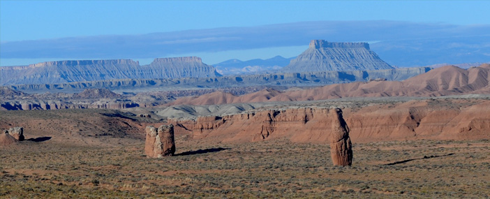 |
 | At the north end of Hanksville we crossed the Dirty Devil River which joins the Colorado downstream. |
At Hanksville we turned westward and were soon in these flat-topped formations. | 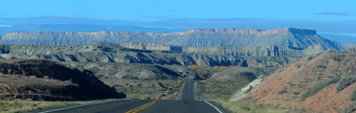 |
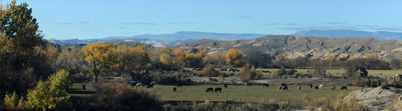
 | At about 10am we encountered evidence of water, cattle and general cultivation. It almost had to come from the Fremont River, so this was a major impact for a tiny river. |

We left the river briefly and went back into desert formations.
We came back into the area of influence of the Fremont River as we approached Capitol Reef National Park.
Exploring Capitol Reef National Park
2016