Glacier Bay
August 31, 2016
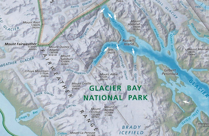
Our ship left Skagway at about 10:30pm and moved back down that inlet and over to Glacier Bay during the night. It sailed into Glacier Bay in the early morning and headed for Margerie Glacier as the first stop. Our route involved an approach through Icy Strait and travel down Glacier Bay to a right turn into Tarr Inlet and the approach to Grand Pacific Glacier and Margerie Glacier. We had a quite leisurely visit to Margerie Glacier and then returned up Tarr Inlet. Turning right into Johns Hopkins Inlet. We moved down that inlet past Lamplugh Glacier and to the bend that turned toward Johns Hopkins Glacier. There we got a good view of the glacier but did not enter the Inlet. We later learned that this was because the seals were calving and needed peace from probing cruise ships.
After this stand-off visit to Johns Hopkins Glacier, the ship turned and spent a considerable time at Lamplugh Glacier and passed what I think is Reid Glacier before heading back down toward the entrance of Glacier Bay.
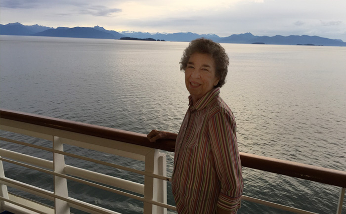 | We entered Glacier Bay early, and the bay was very calm. Brenda could be out on the deck without a coat. We could see snow up on the mountains in the distance in the early light. |

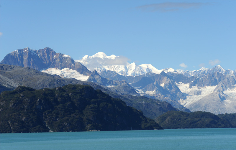
When we got down to breakfast at about 7am, this view of the dramatic snowcapped peaks greeted us through the window of the ship's 15th floor dining area. While I can't pin down the peaks with certainty, Mount Fairweather at 15325ft is by far the highest mountain, so I think one of those peaks must be it. Mount Fairweather (wiki) is one of the world's highest coastal mountains at 4,671 metres (15,325 feet.) It is located (12 mi) east of the Pacific Ocean on the border of Alaska, United States and western British Columbia, Canada. Most of the mountain lies within Glacier Bay National Park. Mount Crillon at 12726ft is closer and would be slightly to the left from our vantage point, so it is probably in that collection of peaks as well. I would guess that this is part of the Brady Icefield in the foreground. It was certainly spectacular and we were appreciative, but we didn't realize how rare this is and how fortunate we were to have such a fine day in Glacier Bay.
 | As we cruise into Glacier Bay, this is a scene (above) on our left at just after 8am. There are glaciers up on most of the peaks. |
| We went up to the bow of the ship on the 7th level. Behind Brenda is the view down the center of Glacier Bay. About 8:12am. | 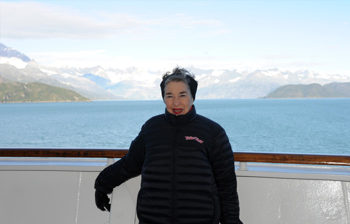 |
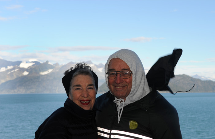
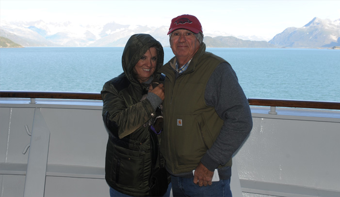 | Suzanne and Bobby joined us on the very windy bow of the ship as it steamed down Glacier Bay. |
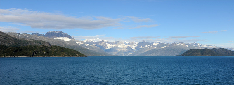
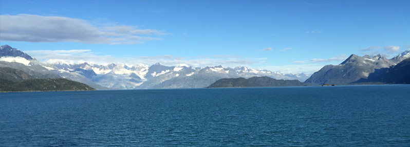
The Bay was smooth as we moved on into it on this extraordinarily beautiful day.
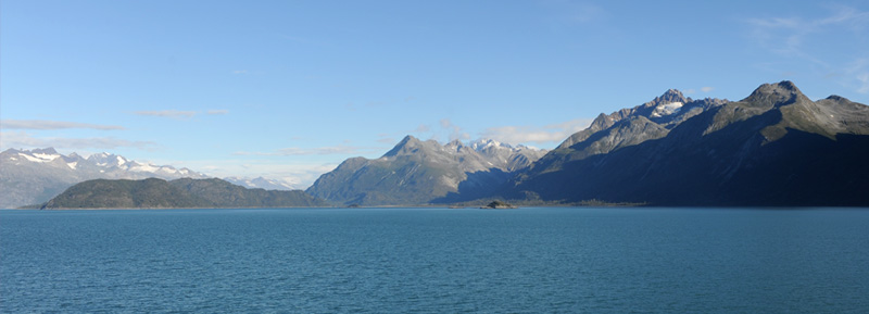
This is a wide view to the right of the bay with several bare rock mountains. One of the small islands can be seen about in the center.
 | The wind picked up even more and, even though it was exhilirating, I was grateful for my sweatshirt and hood. |
| Suzanne and Bob were still braving the elements with us. |  |
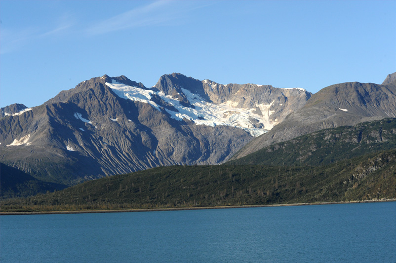
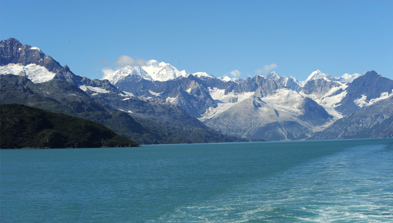
 | The view above was to our left at 8:30am. Rod enjoyed the time out in the open on the deck. Even though you could see lots of ice and glaciers, the temperature was not all that cold, and the clear clean air was exhilirating. 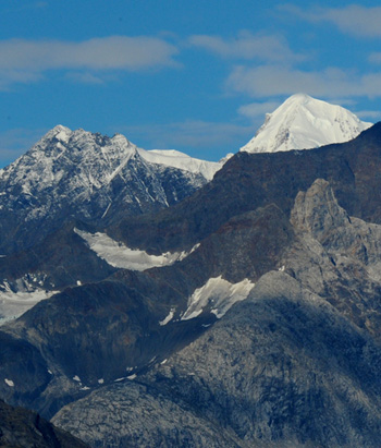 It was remarkable to see this snow white peak up into the blue sky with white puffy clouds hanging around the peak. This might be Mount Fairweather. |

This view of the glaciers on top of the mountains shown in the previous picture certainly paints a cold and barren scene. And this is in the warmest part of the year!
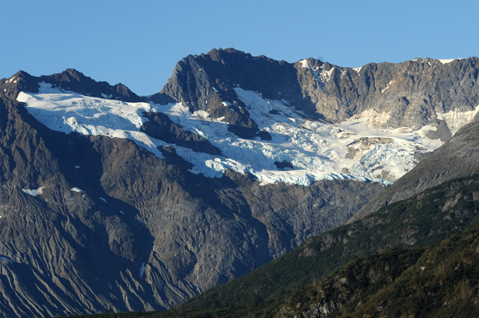
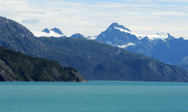
 | The mountains on the right side of the bay were just as rugged and barren. It is easy to believe that they were carved out by glaciers. The closeup shows a hint of the blue glacier color. |
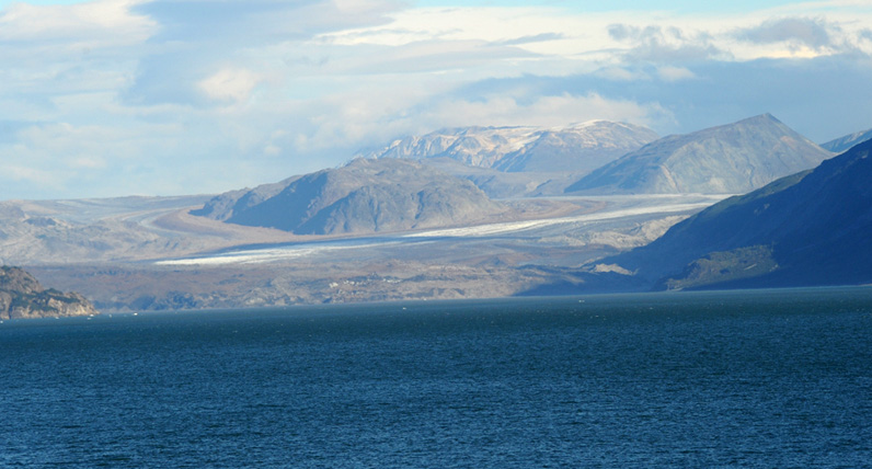
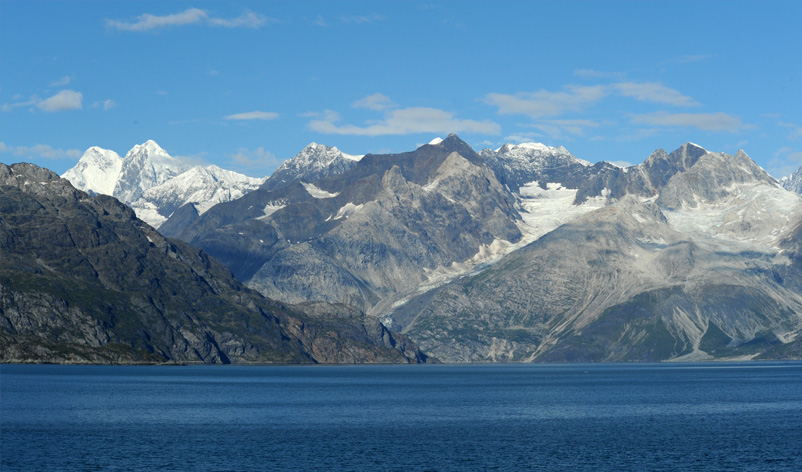
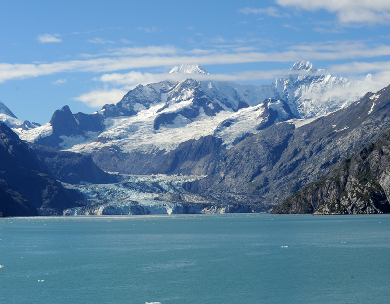
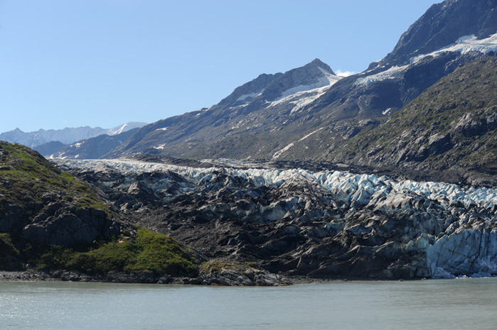
Turning to the right past Russell Island, we were headed down the middle of Tarr Inlet. We could see the Grand Pacific Glacier straight ahead of us, or the remains of it. It has receded a considerable distance.
I continued to be fascinated by the rugged rocky peaks with their new snow and old glaciers on top. This was to the right of Tarr Inlet close to the Grand Pacific Glacier. | 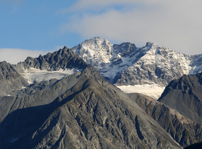 |
 | Finally at just before 9am the high white ice wall of Margerie Glacier comes into view on the left of Grand Pacific Glacier. |
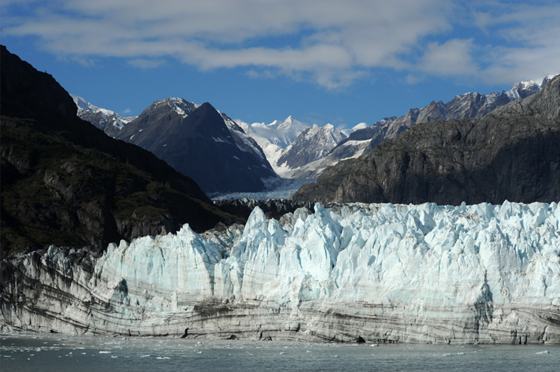
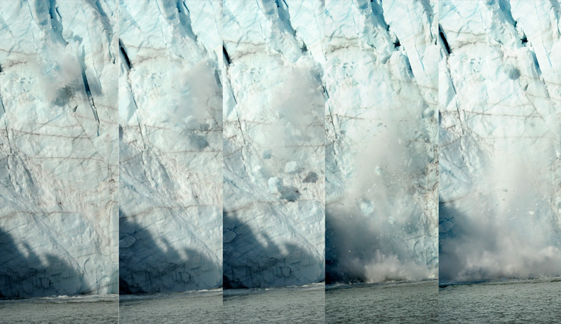
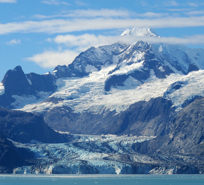
The Margerie Glacier stands as a wall of ice at the water's edge. I understood that it proceeds about 30 miles to the mountain which is its source. From the Park Service's document I learned that the Margerie Glacier is about a mile wide and stands about 250ft above the waterline, and has a base about 100 ft below sea level. Glacier Bay itself is very deep, with much of it being over 1000 ft deep.
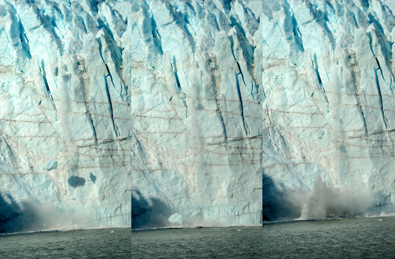
Of course I would like to catch photos of dramatic glacier calving, but this time the best I could do was to catch these small chunks of ice falling. The only reason I got these was that there was an earlier chunk of ice which got my camera focused here. I got a much larger calving event in 2011
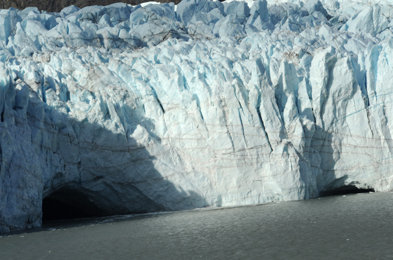
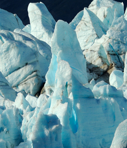 | In the jumble of ice shapes that make up Margerie Glacier there were spots where you could see the characteristic blue light of glacier ice. 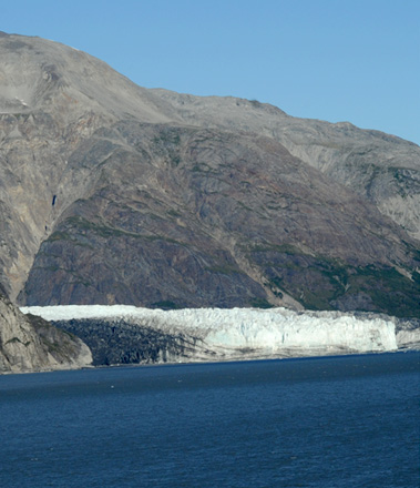 |
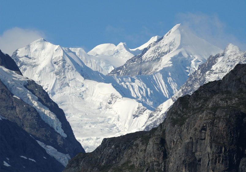
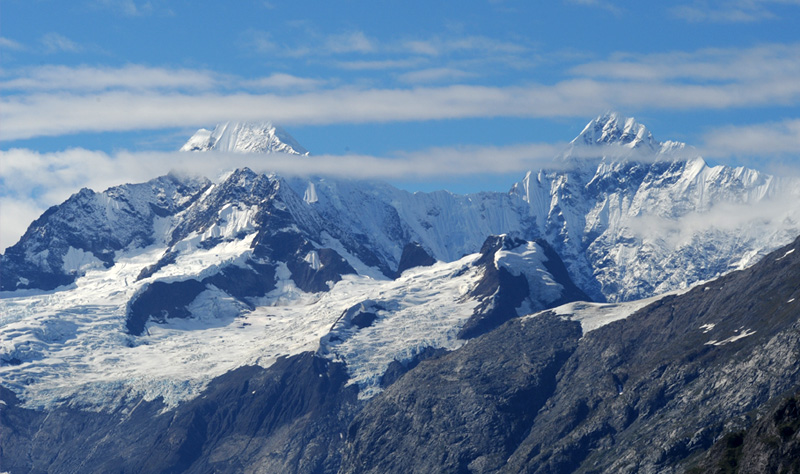
We certainly had beautiful clear conditions for the viewing of these mountains which are the sources of Margerie Glacier. From our view direction as indicated on the map at the top, I am guessing that the left and right peaks in the foreground are Mt. Salisbury(12000ft) and Mount Quincy Adams(13650ft). You can see a higher peak behind, and the only mountain higher is Mount Fairweather at 15300ft.
 |  |
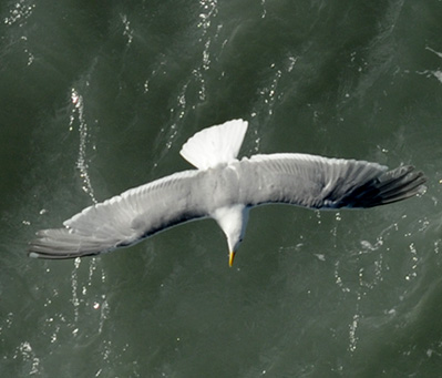 | 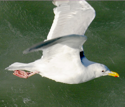 |
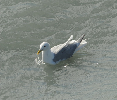
A flock of gulls gathered as our ship slowly approached the glacier for the opportunity of the stirring of the waters. They appeared to be herring gulls. If so, the one on the top right is an immature gull, although its feather pattern is a little different from the young gulls in Wales.
 | From some angles you can see over the white ice wall and see the river of ice that extends through the valley toward the source mountain in the background. We actually got much closer to the glacier in 2011, but the weather was not clear enough to get these beautiful views of the mountains. |
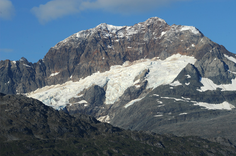
While dramatic, the Margerie Glacier is no thing of great beauty, but the mountain behind it is! Perpetually snow covered, it appears that some of the visible snow is new, even though it is not yet September. |  |
We returned up the Tarr Inlet and turned right (westward) into the Johns Hopkins Inlet. The Ranger onboard told us about the Johns Hopkins Glacier and that we would not be able to approach it because it was the birthing time for the seals there. Then she announced that there were three bears onshore, and that produced a crowd at the rail.
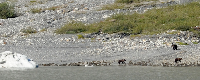 | Three bears on the shore. They were spotted by the Rangers and announced, but I still needed the help of a couple of folks to spot them on the shore. |
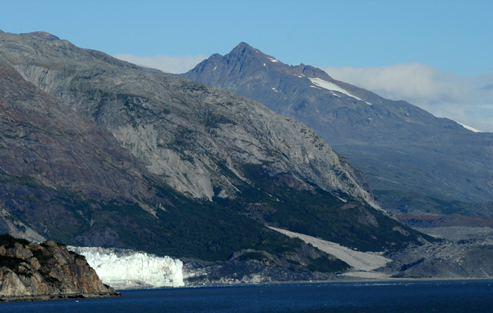
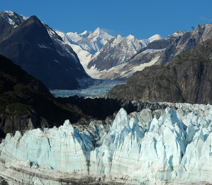
Having moved past the Lamplugh Glacier we approached a blind bend in the waterway and had been told that we would be able to see the Johns Hopkins Glacier when we turned the corner. It was much more spectacular than I expected with the two beautiful snow covered peaks behind it. Even the rough rivers of ice had some beauty to them and you could see the shade of blue. From the view direction on the map, I am guessing that the two peaks are Lituya Mountain (11750ft) and Mount Salisbury (12000ft). We got much closer to the Johns Hopkins Glacier in 2011 because we weren't there at seal pup time, but we certainly didn't have the good weather to get such a dramatic view.
I loved the majestic twin peaks that stood behing Johns Hopkins Glacier. The dramatic snow cover was enhanced by the delicate white clouds near the peaks.
 | The Johns Hopkins Glacier was one of the most dramatic that we have seen, with its thick river of ice snaking down the valley. |
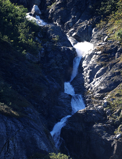 | As we came back out of Johns Hopkins Inlet we passed this nice stream. My impression was that there were fewer and smaller streams than our last trip, but it may just be the time of year. 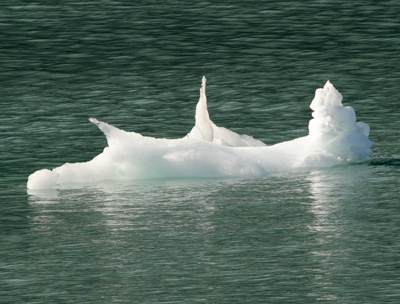 |
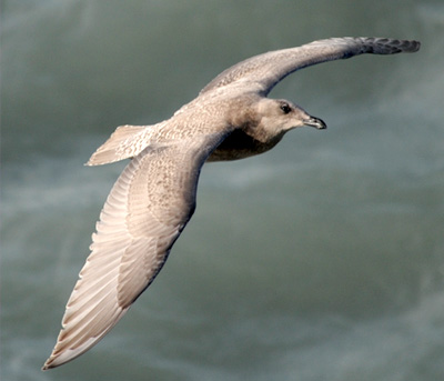
As we came out of the Inlet I saw a black bird soaring toward us, and I thought it was a crow. But I shot at it anyway and it turned out to be a bald eagle! | 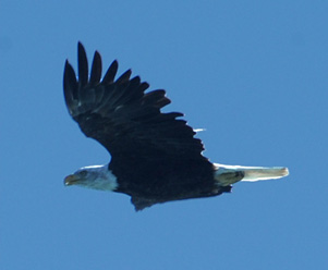 | 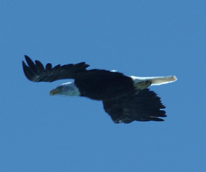 |

As we approached the turn in Johns Hopkins Inlet, I was struck by the beautiful blue color of the water.
I noticed a small melt stream flowing from one of the top glaciers and again thought about the fact that there are not as many streams as on our previous trip. This trip is later in the season, and more of the sources of water have melted. But we have also seen new snow, so the cycle is beginning again. | 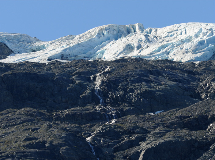 |
 | We again passed the Lamplugh Glacier. I appreciate its status as a tidewater glacier, but I was not struck by its beauty. |
We are now on the return trip, but the blue of the water helps make the mountains more beautiful than when we came in.
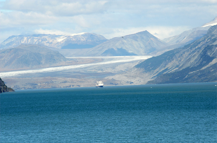 | As we were turning into the Glacier Bay for our return, we saw this other cruise ship coming out from Tarr Inlet with the Grand Pacific Glacier behind it. |
One last major glacier before we head back toward the entrance of Glacier Bay. Perhaps this is Reid Glacier. | 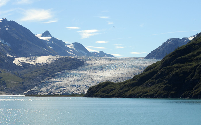 |
It was a reverie to see the rich colors of the bay and sky and the wide expanse of the mountains.
We passed back by the brilliant white mountain that had so impressed us at breakfasttime at 7am this morning. Part of this system of peaks must be Mount Fairweather, an appropriate name since you can see it only in fair weather. We were certainly blessed by fair weather this day!
 | I was impressed with this flock of birds that flew across our bow in formation. They are totally black - have to pin down what they are. Murres (guillemots) all have white on them, even though the size is about right. My best guess is that they are some variation of murre. |
A look behind our ship as we travel outward in Glacier Bay.
 | 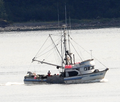 |
As we moved out into Icy Strait we began to encounter fishing boats and whale-watching boats. We did see this whale from a distance.
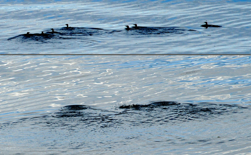 Now you see them, now you don't!
We watched these black birds in the water. They would swim along a bit, and then all dive. It wasn't until the next day that I realized that they were the same kind of black birds we saw flying in formation above.
We left Glacier Bay at about 4pm and the ship headed for Ketchikan during the night. It was not so great a distance to Ketchikan, but the ship had to be traveling at night through the narrow passageways, so I presume it had to travel very slowly.
| Ketchikan |
2016