Glacier Bay, Alaska
August 3, 2011
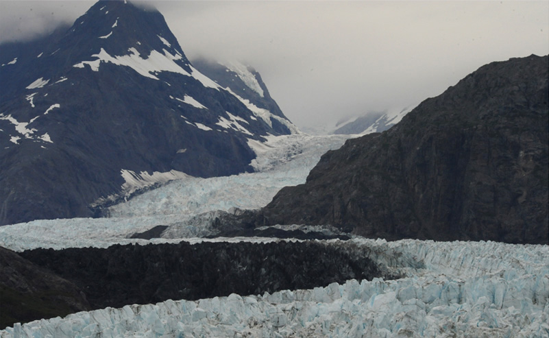
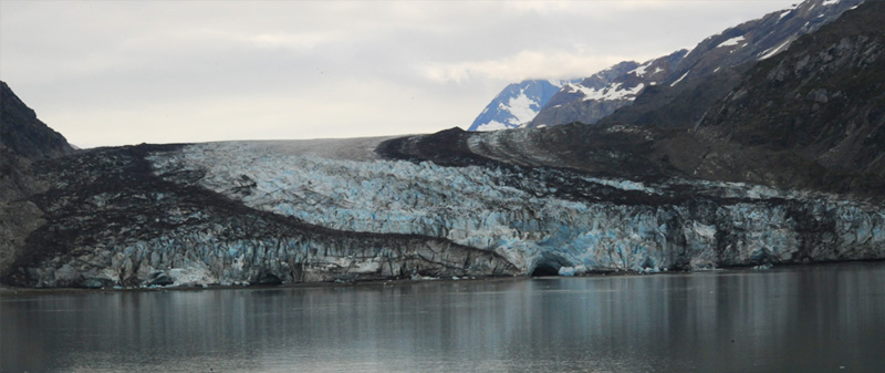
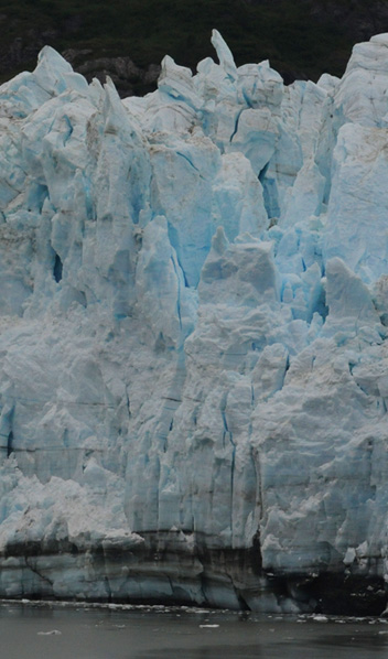
The Margerie Glacier at Glacier Bay National Park
 | The Margerie Glacier above was at the end of our journey into Glacier Bay National Park. It was a river of jumbled ice that extended over a gap between mountains and out of sight. The Zuiderdam traveled from Skagway through the fjords during the night and in the morning we entered Glacier Bay National Park. We traveled down the 65 mile waterway and got our first close view of a major glacier at Lamplugh Glacier. We moved on down Johns Hopkins Inlet and visited Johns Hopkins Glacier. Returning down the Inlet, we turned into Tarr Inlet and visited Grand Pacific Glacier. Our final major glacier visit was near the sea edge of Margerie Glacier, where we spent about an hour. |
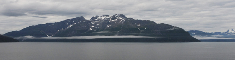
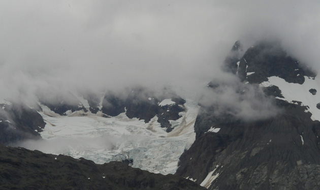
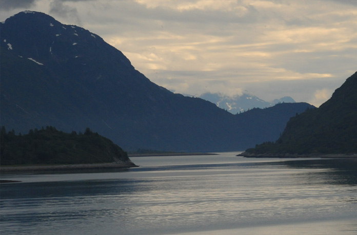
This is a view of the mountains along Glacier Bay at about 7:45am, 30 minutes after we entered the area. The views in Glacier Bay were certainly intriguing with snow-patched mountains and interesting low cloud strata. It certainly looked cold!

This wider view includes some small islands covered with birds.
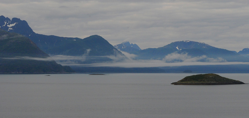
There was not much color because of the cloud cover, but the islands and the low strata of clouds were fascinating.
 | We came upon our first tidal glacier, the Lamplugh Glacier, a dirty river of ice with two or three black bands along it from the material it had scoured up. A thing of beauty it wasn't! But it was certainly interesting, particularly its texture and the subtle blue color. We reached the Lamplugh Glacier about 9:30am, having taken a little over two hours to travel down Glacier Bay. This cave right at the water level was interesting to me because we had seen one very much like it in the glacial pool at Mt. Edith Cavell in 2009. |
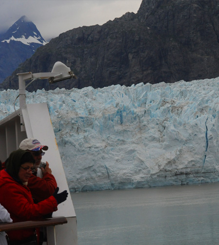
It was good to get a picture at the railing to show that we were there on the ship at Glacier in Glacier Bay National Park. | 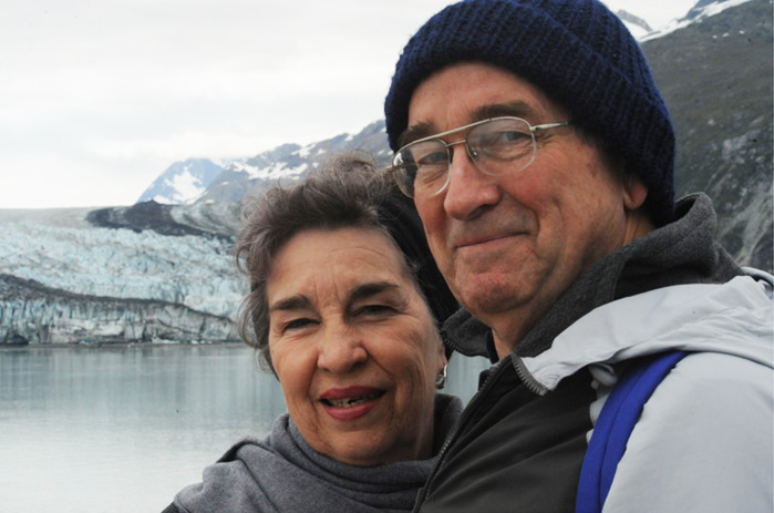 |
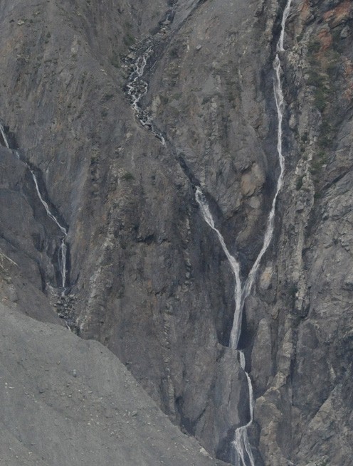
 | There were great views up on the mountains of hanging glaciers and snowmelt streams coming from them. This glacier was up on the mountain almost directly across the Johns Hopkins Inlet from the Lamplugh Glacier. |
I loved seeing the high glaciers and the streams that ran from their bases. This is pretty unusual stuff for a Georgia boy. |  |
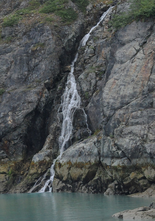
 This stream was back on the Lamplugh Glacier side. We could see it all the way from the high ice field, and it had nice falls at the bottom. | 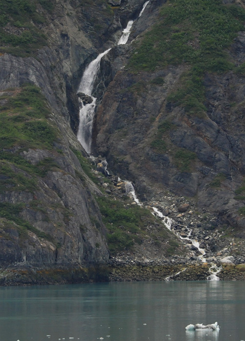 |
 | 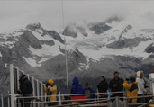 Lots of folks were gathered on the top deck of this floating city to see the mountains and glaciers. The glaciers high in the clouds on the mountains were intriguing. |
The Zuiderdam eased on down Johns Hopkins Inlet until we stood before the Johns Hopkins Glacier, a rough river of ice. | 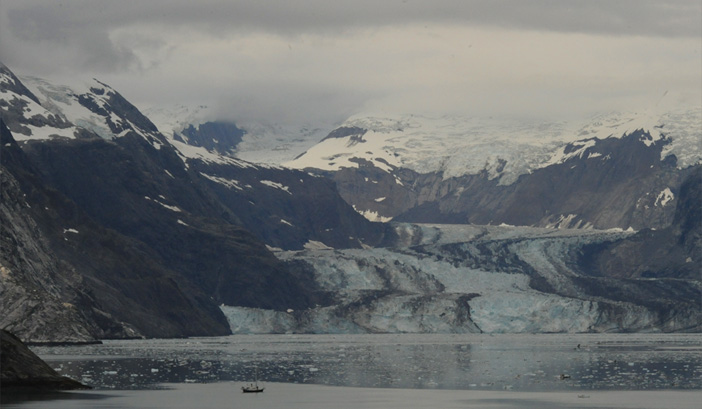 |
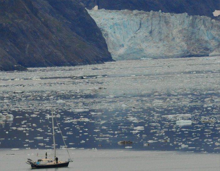 | A small sailboat helped to give us size perspective of the glacier before us. The sailboat was under engine power and moving slowly through the ice floes just as our huge ship was. |
The ship was turned and the group at the stern watched the dramatically rough, dirty river of ice recede. The Johns Hopkins Glacier is 12 miles long and was named after Johns Hopkins University in 1893 by geologist H. F. Reid who discovered it in 1890. | 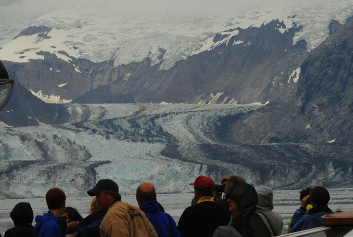 |
 |  From cloud to water to ice, it was all here in abundance. I liked the thin snowmelt streams from high on the mountains. |
 |  |
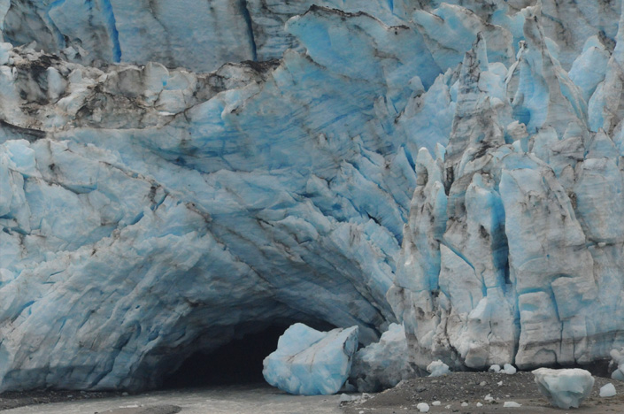 | We cruised back by the Lamplugh Glacier and this telephoto shot shows the blue in the cave under the ice. |
As we were headed out of Johns Hopkins Inlet, this other cruise ship was going in. | 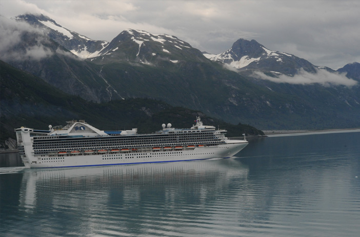 |
 | We came out of the Johns Hopkins Inlet and turned left down the Tarr Inlet toward the Margerie Glacier. |
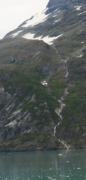
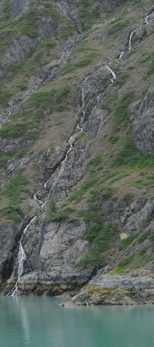
There were lots of rushing streams entering Glacier Bay from the glaciers up on the mountains. I never tired of these streams. | 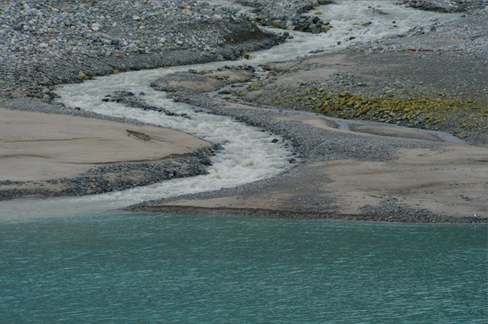 |
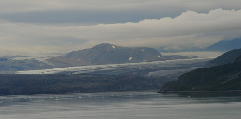
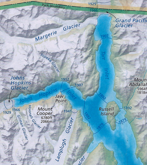
Down at the end of the Tarr Inlet we could see the broad swath of converging rivers of ice that makes up the Grand Pacific Glacier. You can see from the date lines on the map at the top that these glaciers filled the entire Tarr Inlet and Johns Hopkins Inlet areas and enveloped Russell Island in 1879. But since we hear about global warming and glacial melting all the time, it was interesting to note that the Grand Pacific Glacier has been advancing since 1925. This glacier is about two miles wide.
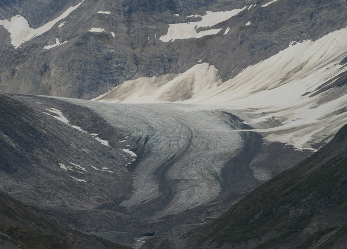 | This was one of the glaciers up on the side of the mountain along the Tarr Inlet. |
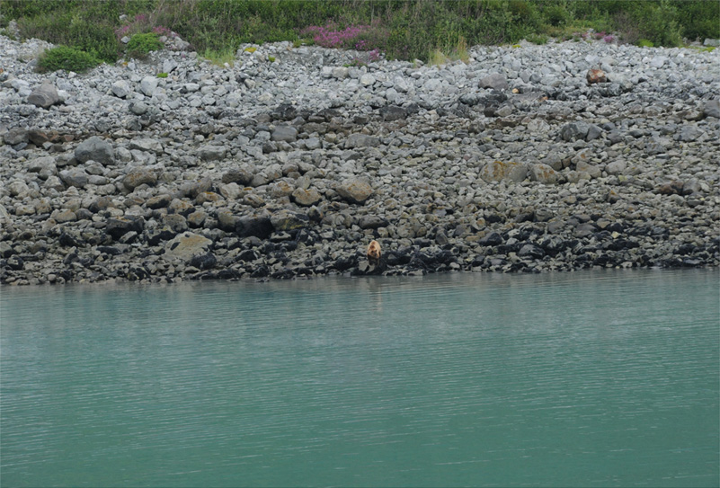
We had three rangers onboard giving information about the Park and scanning for wildlife. This was about the seventh bear they announced on the shoreline, but the first I had seen. He was just a tiny brown speck to my naked eye, so I was pleased to get this much detail with the telephoto lens.
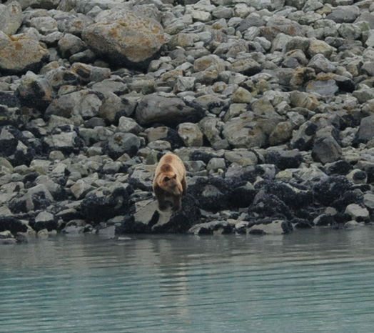 | 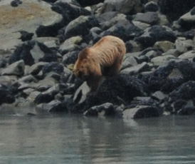 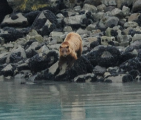 |
It was hard to see what the bear above was finding so interesting at this rocky water's edge. It looked like a jumble of rocks leading down into the water. I wouldn't have expected that to be a good fishing spot for him. But he's pretty fat so he obviously knows what he is doing. This bear at right was poking around in the grass near the water's edge and was even harder to see. I managed to see two of the seven bears that were announced. | 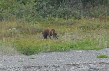 |
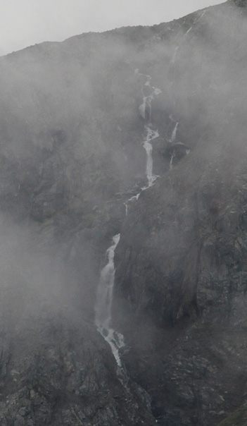 | 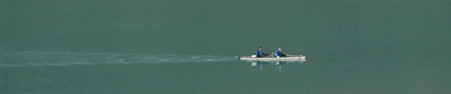 We were watching two guys paddle a kayak across the Tarr Inlet when this flock of ducks flew right over them. 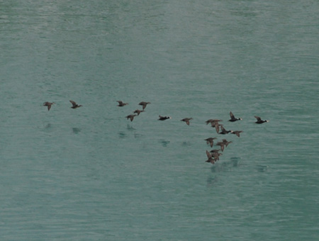 It must have been more dramatic down on the surface where they were to see the flock go by and see the high waterfall shrouded in cloud. But it was pretty dramatic from the deck of the Zuiderdam about ten stories up on this floating city. It must have been more dramatic down on the surface where they were to see the flock go by and see the high waterfall shrouded in cloud. But it was pretty dramatic from the deck of the Zuiderdam about ten stories up on this floating city. |
I was watching this stream as the ship maneuvered into place near the Margerie Glacier. You could follow the stream all the way up into the clouds near the mountain peaks. | 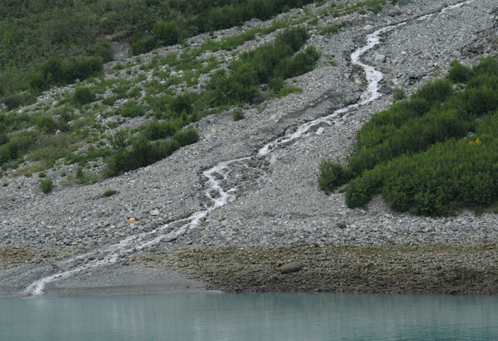 |
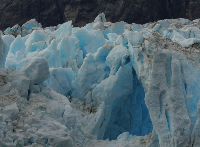
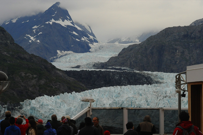 | The ship was brought to rest just off this great rough river of ice called the Margerie Glacier. |
It was neat watching the gulls from the top side as they soared around the ship. | 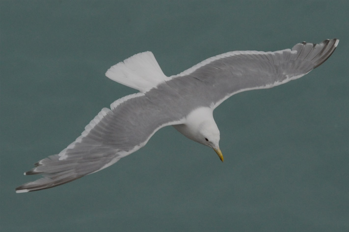 |
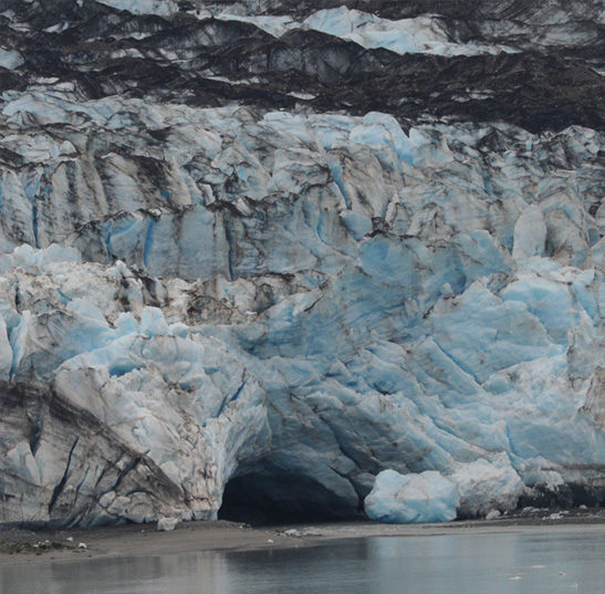
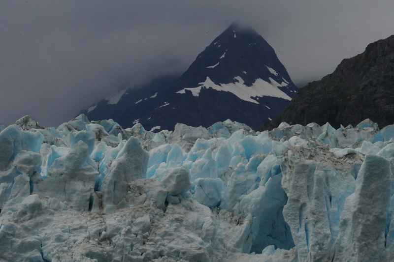
 | 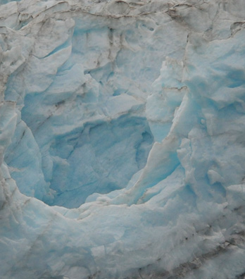 You couldn't say the glacier was a thing of beauty, but it was intriguing to see its size and roughness, and to see the blue glow from the Rayleigh scattering, more pronounced in the cavities of the ice. |
The shapes on top of the rough glacier surface were like abstract sculptures, which wouldn't have impressed me so much except for the blue glow that came from the cavities in the ice. | 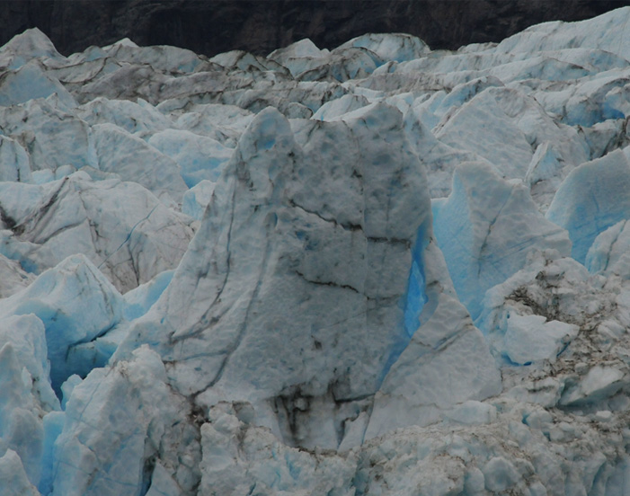 |
 | The presence of a sizable cavity in the ice strengthened the blue glow in the surrounding ice. |
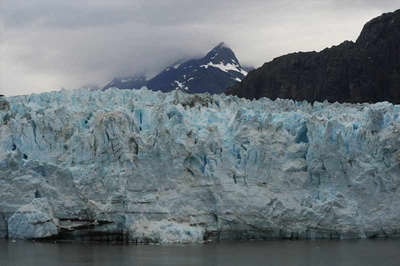
The ship stood close enough that the face of the Margerie Glacier dominated our view, and it was nice to see this perspective with the mountain behind it.
 | 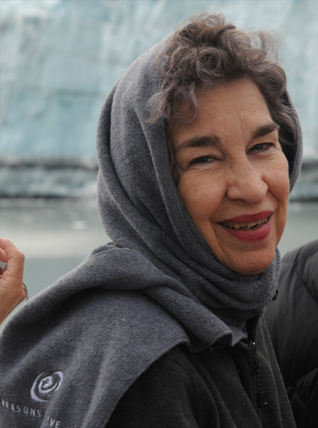 |
 | We enjoyed spending some of the time at Margerie Glacier with Bob and Wendy Andrews, two of our table pals. Wendy and Brenda have the glacier at their backs, but most of the time we were looking at it to watch for "calving" events. |
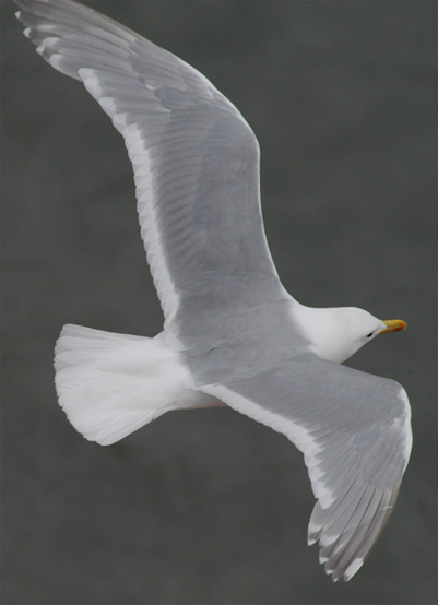 I really enjoyed the elegant flight of the gulls around the ship. We surmised that they were attracted by the fact that the ships propellers stirred up the water and might bring food to the surface, but sometimes it looked like they were just rejoicing in flight and playing in the wind. | 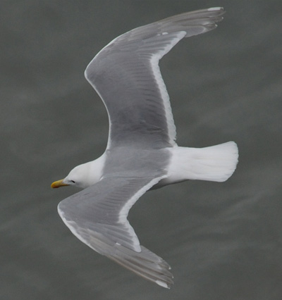 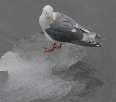 |
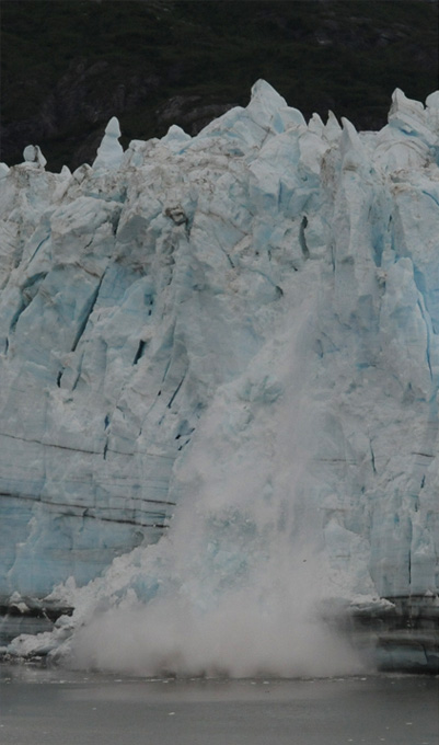 | 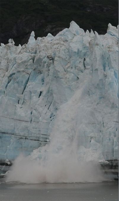 |
This was the biggest calving event we saw, and it came shortly before we left the glacier. In fact, it is possible that it was triggered by the force of the side thrust of the ships propellors.
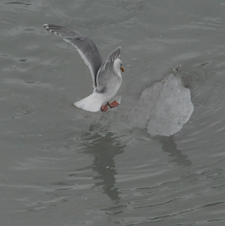 I watched for gull activity immediately after the calving, as I had seen in some videos. But I didn't see much interest from the gulls. They did however take advantage of the small ice floes as landing spots. |  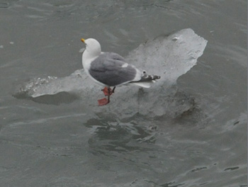 |
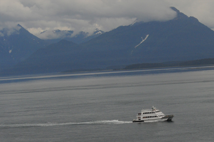 | The Zuiderdam moved away from Margerie Glacier and began the process of extracting us from the extreme end of Tarr Inlet and out of Glacier Bay. We saw this smaller tour boat beside us about three hours away from Margerie Glacier. |
I stayed up on the top deck to see the beautiful forested points and mountains near the entrance to Glacier Bay. We saw some humpback whales as we passed. | 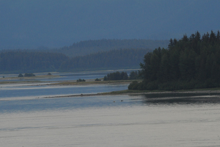 |
 | On the way into Glacier Bay, we had picked up four rangers from the National Park Service who did instructional programs all day. There were three women and one man. Then they told us that they would be picked up by a Park Service boat that would come alongside. |
So I positioned myself on the observation deck, and sure enough, this Park Service boat approached. The boat pulled alongside the huge ship, which continued at cruising speed across Glacier Bay. It began to adjust its speed to that of the Zuiderdam and edge closer to us. |  |
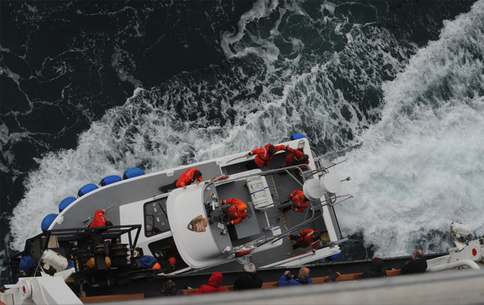 | Having matched speed with the ship, the Park Service boat made contact and tied to the ship. The three rangers, all female, climbed from the ship to the boat. |
The rangers had brought a computer and projector, maps, books and all kinds of gear on board, and had to reload all that to the Park Service boat. Once that operation was complete, they untied from the ship and began to move away. | 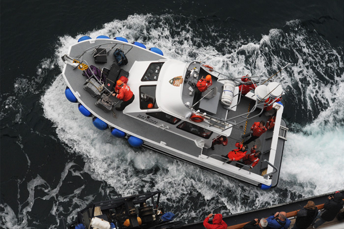 |
 | The transfer of the rangers and equipment complete, the rangers waved to the watching passengers on the ship and began to move away. |
The rangers are still waving as the Park Service Boat moves away and heads for the ranger station near the entrance to Glacier Bay National Park. They'll do it again tomorrow. Just another day at the office! | 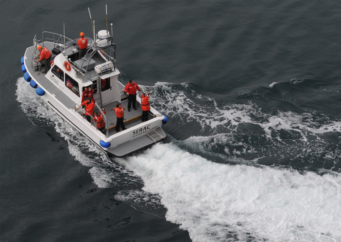 |
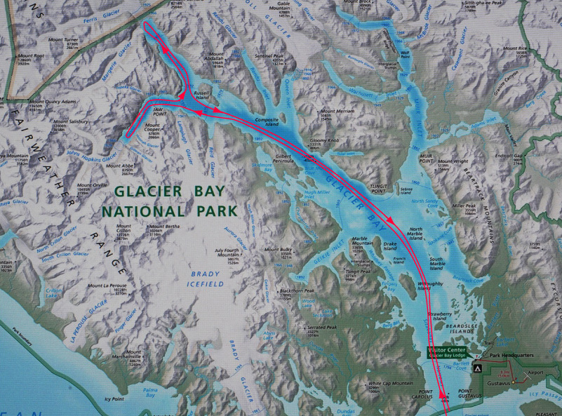
This is the general route we followed on our trip into Glacier Bay. The bay is said to be 65 miles long. We entered the Bay at about 7am and left it at about 3:30pm. The Zuiderdam was then headed southward through the Inside Passage toward our last port of call, Ketchikan.

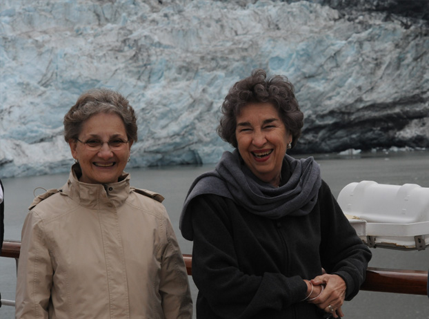
This is our table group for the cruise. We really had a great time together and will remember each other as companions on a great adventure. From left to right are Jeff and Joan Brown from Cypress, California, Wendy and Bob Andrews from Holland, Michigan, Jon and Sharon Loftis from Moore Haven, Florida and Brenda and Rod from Georgia.
| Ketchikan |
2011
Inside Passage