The Road to Ronda
Wednesday, May 31, 2017
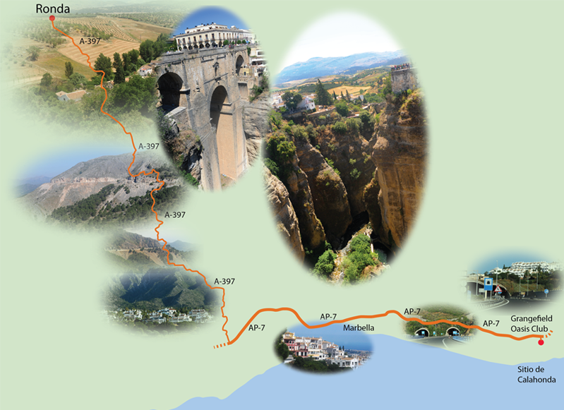
We had breakfast at Grangefield and then headed out to Ronda about 8:30, traveling first on AP-7. It's only about 50 miles, but with the incredibly twisty road on A397 and our photo stops, it took us 2 hours to get there. We went the short distance uphill to the entrance to the AP-7 highway and headed west.
 | Almost immediately we went into one of the fine tunnels on this excellent highway. Above the road was the dense housing that tells you this is a very popular resort area on the south coast of Spain. |
We could just get tantalizing glimpses of the Mediterranean as we traveled along this highway. | 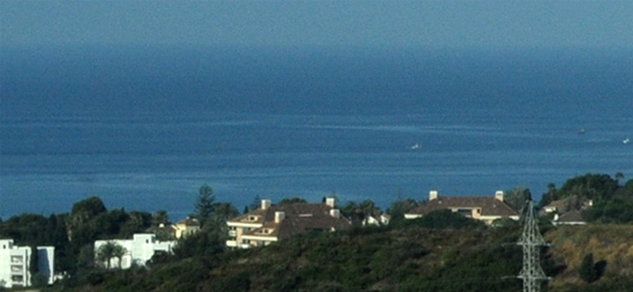 |
 | The AP-7 ran along the seaward slopes of the mountains, in most cases above the dense resort housing of the Costa del Sol. |
Where the mountains came too close to the coast for that strategy to work, they just punched through the mountain with a tunnel. | 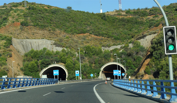 |
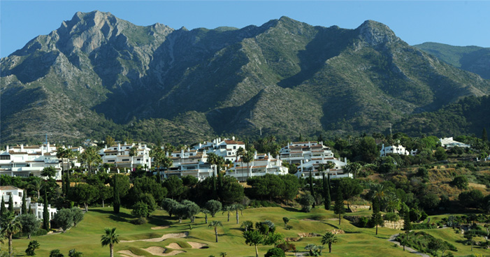 | When the mountains receded from the coast far enough, luxurious resorts were built. This one is close to Marbella. |
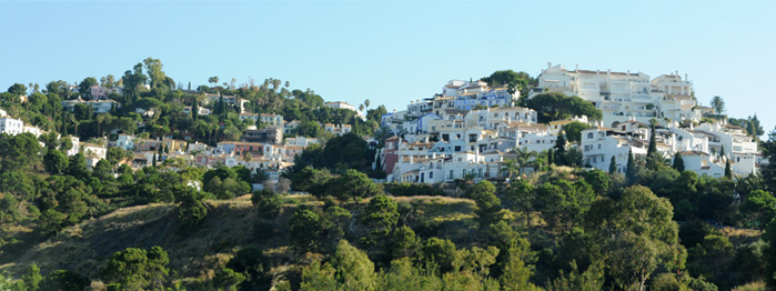
When we reached A-397 and turned north, we went steeply uphill, and the housing went up with us. | 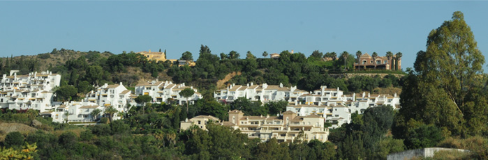 |
 | There were some amazing clumps of houses perched on top of the hills. |
We finally climbed high enough for the housing to thin out, and then we could look over Marbella to the sea. | 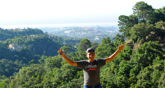 |
 | Even though it was misty on the coast, it was still exhilirating to see the expanse of it. |
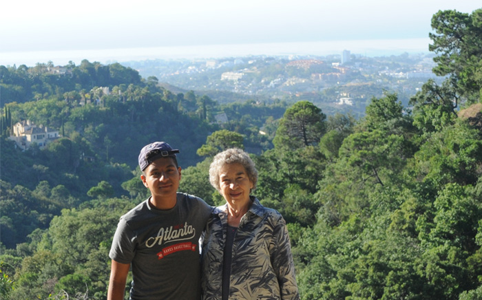
Brenda and Rod on the slopes above the Mediterranean. | 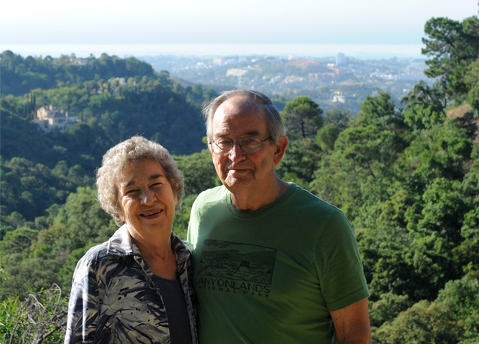 |
 | From higher up we could see several villages including those on the coast and could see the sea through the mist. |
We found an ancient spring-fed fountain on the mountainside. With my tales of giardia in the American Sierras I managed to persuade Chris not to actually drink from it.  | 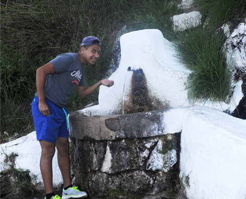 |
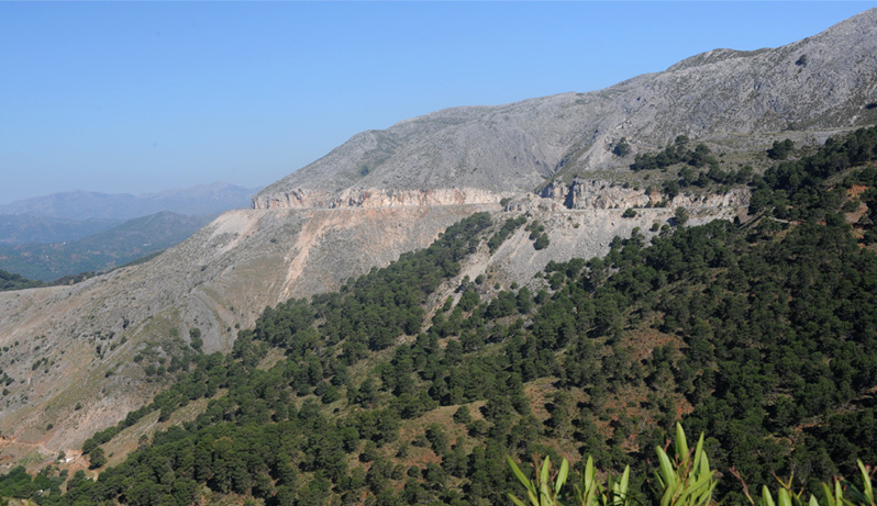
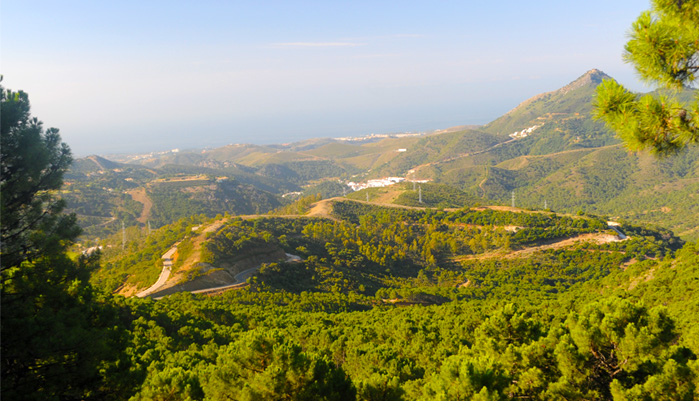
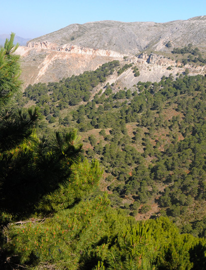
 | The road continued to climb until we were in the high mountains with a road cut just chiseled into the sides of the rocky peaks. At left is the view of the valley below that road cut. The two white patches on the distant mountain are small pueblos blancos. |
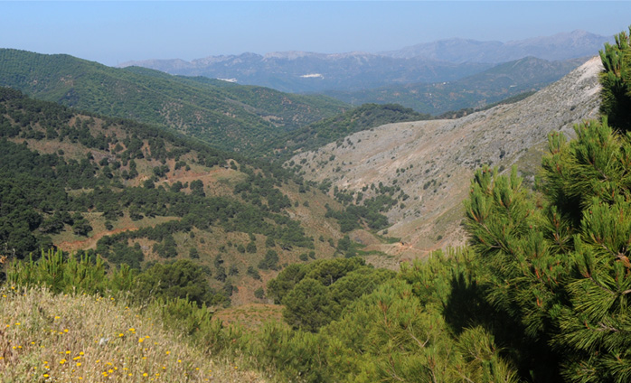
Brenda views the scene from a pleasant overlook along the winding road. It was a pleasant drive - we are quite accustomed to mountain driving, so I was much more comfortable there than in the crowded cities with narrow streets. After the crowded conditions on the coast, it was surprising to come to an area with almost no population. | 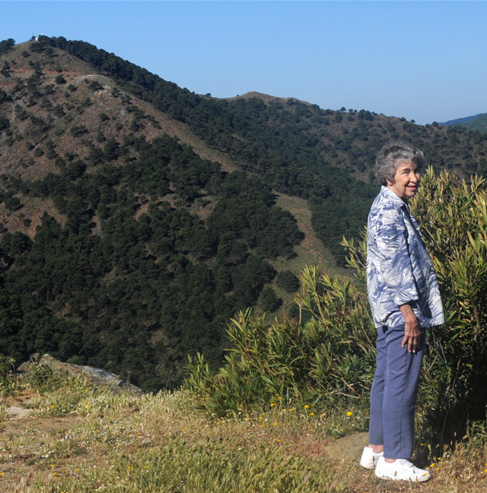 |
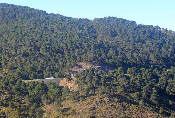 | Across the valley we could see the road on which we had come. We watched several tour buses and some heavy trucks pass this point. It was surprising to see such traffic on a mountain road, but reasoned that if you wanted to get to or from the coast to Ronda, this was about the only road. |
 |  |

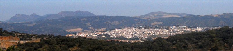
After miles of just the occasional farm building, this white array of a mountain city came into view.
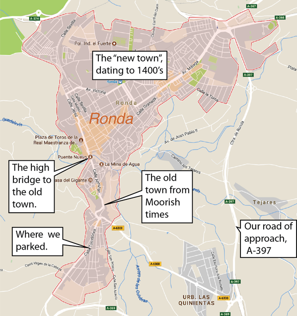 | Sure enough, the city we were looking at was Ronda, perched in the mountains at 2425 feet. This was an exploration trip, and I drove into town on A-397 with total ignorance of the layout and how to get to the high bridge and the old town. I was looking for a tourist office to get information, so I kept following the signs to tourist information. That took me all the way through the "new town" and brought us to the high bridge to the old town. The high bridge is called "Puente Nuevo" or "new bridge", since it was constructed in the late 1800's. When we realized that we had actually stumbled onto the bridge we were looking for, I paused long enough to see that cars were actually driving across it and then just drove across. The idea was to see if we could find a parking place and then explore the old town on foot. |
Our search for a parking place was kind of amusing, particularly in retrospect. Ignorant American tourists driving around in a 1500-year-old European city, looking for a parking place! All the parking places were taken by people who lived there! We went a block down a car-width cobblestone lane because it looked like there were several parking places. But all those openings were garage doors or house entrances - so I wound up backing out the total length of the lane because there was no place to turn around. But the place was very interesting and all the people we encountered were very pleasant. So I continued driving, searching for a parking place, until we were out in an area of newer houses and I found a parking place on the street. We then started our walk back into the old town near the bridge to explore. Our parking place was very close to the bottom of the aerial view of Ronda at right. This sounds kind of bumbling, but it only took us fifteen minutes from entering town to being parked and on our way walking! |
 |
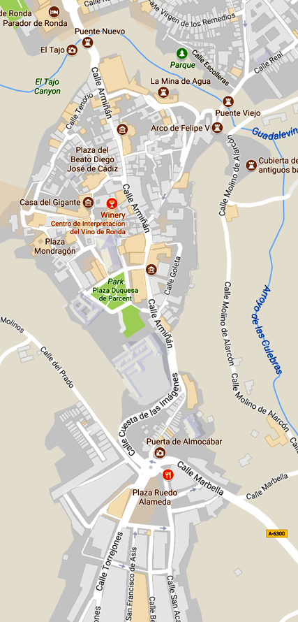 | We started walking from our parking place, traveling down the Calle Torrejones and around the fortress on the Calle Cuesta de las Imagenes. We then followed the Calle Arminan through the center of the old town to the bridge. By scaling on the map, our walk to the bridge was very close to a mile. 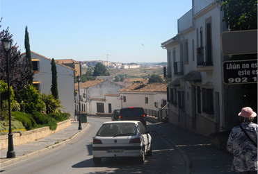 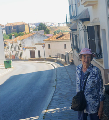 |
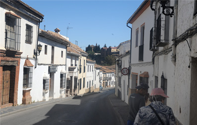
 We are walking on Calle Torrejones.  | 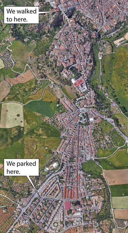 |
 |  |
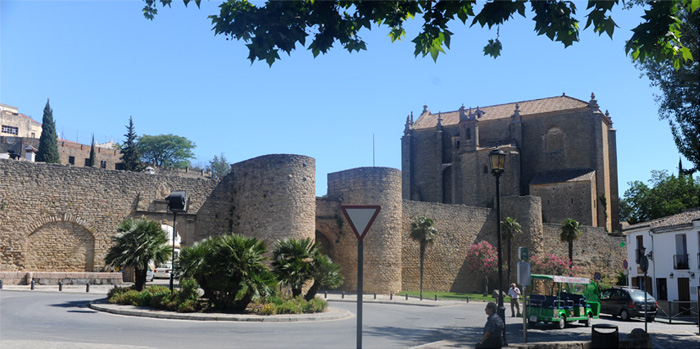 | At the roundabout we could see a section of the city wall and the back of the Iglesia de Espirito Santo. |
 | It was amusing to see an ordinary delivery van go through the thick city walls. A troop of armored knights on horseback, carrying spears, might have seemed more fitting. | 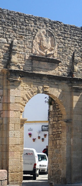 |
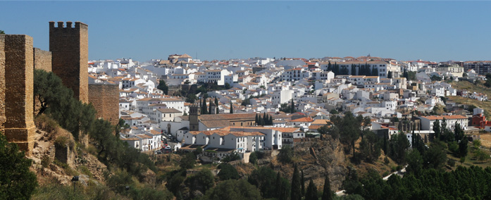
It was impressive to see how well preserved the city walls were when they were built in Moorish times. | 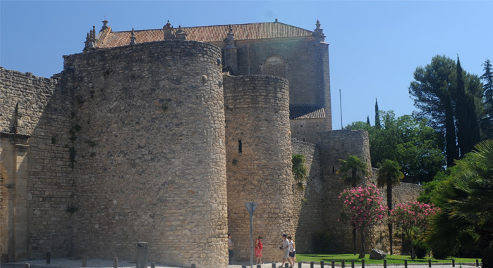 |
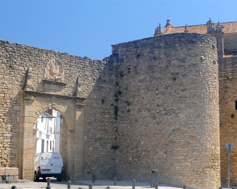
The city walls are mostly of Moorish construction, spanning the period from 712 to 1485. There are two gates in these photos. The one the van went through is the Charles V gate. The gate between the two rounded towers is the Puerta de Almocabar. rondatoday
 | We walked around the curve and by the ruins of the Alcazaba. The Alcazaba fortress was already in existence in the 11th century, and together with the city walls made Ronda almost impregnable. |
One comment was that with its double walls it was impervious from attack until the age of cannon. It was damaged during the siege of Ronda in 1485 and further damaged by French troops in the Peninsular War of 1812.
"Its positioning gives it the greatest strategic importance in the whole of the city of Ronda, as it takes advantage of a rocky spur situated on the south, adapted with at least two lines of walls, of which the outer one can be seen. Inside, the castle itself was protected by a strong towered wall, the keep being situated in the easterly side facing the city.
The entire entrance to the city could be controlled from the Alcazaba and the two quarters, forming, along with the now disappeared Las Imagenes Gate, a practically unconquerable defensive system, vulnerable only to siege."Andalucia Rustica
We walked up the slope past the Alcazaba and got a front view of the Iglesia de Espirito Santo. The construction of this church was begun in 1485, the same year as the conquest of the city, by direction of the Catholic kings. Construction was completed in 1505. | 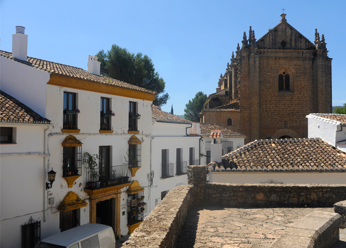 |
The church was built over the ruins of an octagonal tower which was part of the defenses of the Moorish city. It allowed a full 360-degree field of fire for the Moorish archers. wiki, Spanish
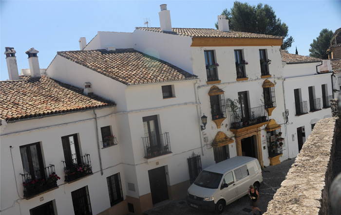 | The house and the stone lane leading to the church were themselves quite impressive. |
We continued up the slope into the old town of Ronda. The white houses in the distance on the right of the picture are part of the new town and are beyond the gorge. You can also see some of the remains of the old Moorish city walls. | 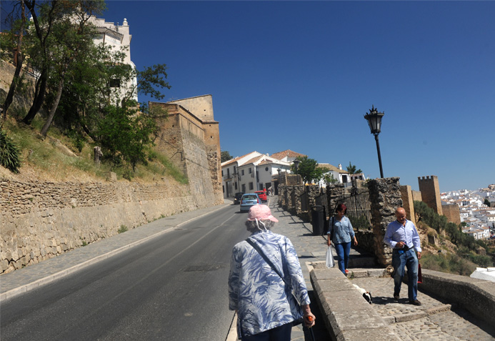 |
 | At points along this slope, we got a good view of houses in the new town across the gorge. The old city walls are also more visible. These walls are called the Murallas de Levante. |
We also got a view of the farmland outside the city. | 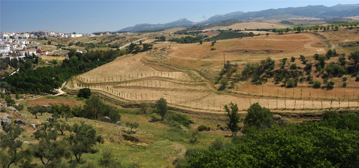 |
 | We had now reached the main part of the old town, which is called "La Ciudad". It has been nicely restored and has lots of nice shops and restaurants. |
We are now approaching the Puente Nuevo and are in the main tourist area of the old town of Ronda. The crowd has increased dramatically. |  |
| Ronda's Puente Nuevo |
2017