Eruption of Mt. Spurr
August 18, 1992
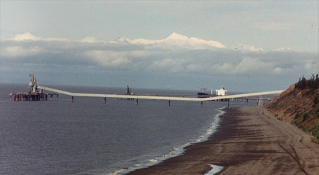 | Early on Tuesday morning I had gone across the road from the Mt. Redoubt Baptist Church where we were working and had taken this photo of Mt. Spurr, about 50 miles slightly west of north from where we were. At this time it was gleaming white and tranquil above the clouds. |
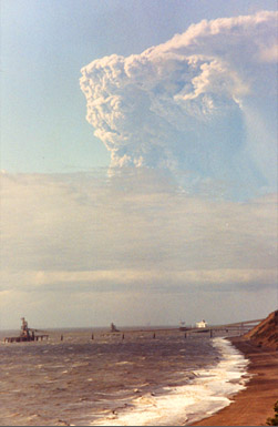
At about 4:30 that afternoon, Spurr erupted! We got excited calls at the church and ran over to the bluff to see what we could see. Although the low cloud covered the peak itself, we could see the boiling cloud of ash from the eruption rising. | 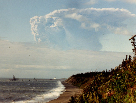 |
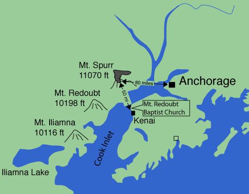
 | This is the illustration we found in the local newspaper. It shows our location, almost right at the bottom of the "K" in the word "Kenai" on the map. It also shows the location of Mount Redoubt directly across the Cook Inlet from us. The location from which the two photos above were shot is directly to the left of the word "Kenai" on the eastern edge of the Cook Inlet. |
As we watched the cloud from the eruption of Mt. Spurr within minutes of its eruption, we could already see that the high altitude ash cloud was blowing toward the east. Although we were closer to the volcano than Anchorage, Anchorage got the ash and we didn't. The satellite photograph and the illustration below show that it didn't miss us by much. Anchorage got 1/4 to 1/2 inch of ash which was stillon the streets when we got there two weeks later. |  |
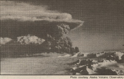 | An aerial view of Mt. Spurr eruption from the north, showing the blowing of the ash toward the east. |
Time Magazine coverage of the eruption. |  |
 | This satellite image with the outline of the Kenai Peninsula outlined on it shows that the southern edge of the ash cloud came very close to where we were. The image was taken at 7:30 pm on Tuesday, the day of the eruption. |
From the Anchorage Daily News, an illustration of the path of the ash cloud over the next few days. We went through the cloud area later. | 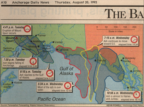 |
 We gathered on the bank across from the Mt. Redoubt Baptist Church probably at about 5:30pm, or about an hour after the eruption. We could see the boiling of the ash cloud of the eruption, so the activity was still going on. We felt no shocks at our location and got no ash that we could detect. The position of the ash cloud is shown at right just a couple of hours later, so the ash obviously just missed us. |  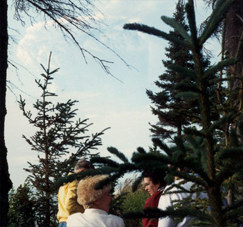 |
We saw the ash later when we were on the train to Whittier, and up on Thompson Pass, and also when we got back to Anchorage.
| Mt. Redoubt construction |
1992