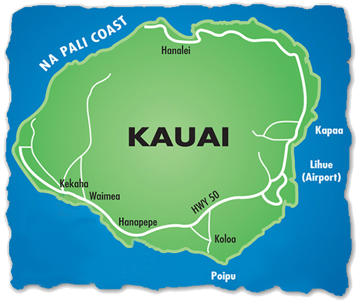
 | Na Pali Coast
June 29, 2018We left our location at the Port of Nawiliwili about 2pm and started our tour of the coast of Kauai, including the famed Na Pali Coast.
|

|
A picture of the water and the ship's railing? Why?? -- Because I thought it was beautiful! The clean water showed colors from light blue to dark blue and into indigo. It was a pleasure to just watch the movement of the water.
We are now rounding one of the tips of the island. I was hoping for views of some of the beautiful beaches like Lumahai Beach, but we were moving too far offshore to see any detail. | 
|
 . . | It was almost 5pm before we began to see the ribbed green mountains that characterize the Na Pali Coast. I had stayed on deck for the two hours previous, reading and watching the variations of the coast. Darla spent most of that time there, doing classwork on her laptop.
|
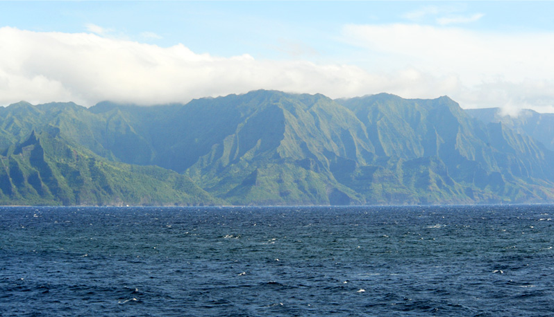 A wider view of the mountains, overlapping the image above on the left.

Just 11 minutes later at 5:09, a different perspective on the same collection of mountains. Three sharp ridges form a sort of fingerprint to locate yourself along the coastline.
|
A very long waterfall cascades down the steep slope. 5:12pm. | 
|

The above image was very helpful because it shows the radar dome that is close to the Kalalau Lookout, and gave us a reference ridge to tell when we were looking at the Kalalau Valley. By the time we got close to the valley, the dome was behind the ridge. | 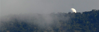 |
 | Quite a number of small boats were exploring the coast. Quite a contrast with our huge cruise ship moving alongside them. Note the small water fall. |

 . . | A catamaran sailboat carrying at least 20 people helps to give some size perspective to the mountains. 5:23pm. |
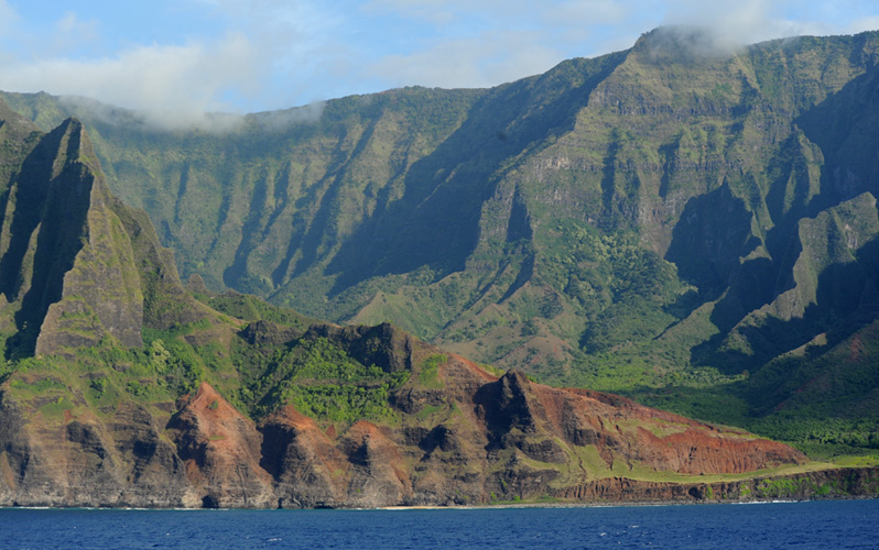
 A good example of the dramatic ribbed mountains that make up the Na Pali Coast.
|
Three small boats exploring. Note the tunnel through one of the shore formations. 5:32pm | 
|
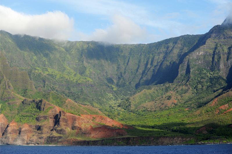
 Since the area is so often cloudy, I felt very fortunate to get such clear lighting on the ribbed mountain structures.
 At this point I could be confident that we are coming upon the Kalalau Valley because of my signature ridge that reaches highest and has the little cloud on it. That ridge is identifiable from the dome picture I got earlier which includes that ridge. The dome is just behind the ridge now and not visible. 5:34pm.
 I was pleased to have had the radar dome as such a clear marker to identify the Kalalau Valley that we had seen from above at the Kalalau Lookout. It was a blessing to see my favorite valley from the bottom.
 As we moved on past the Kalalau Valley, we could see more of the left side of this 2 mile wide valley.
 Moving to the far side of the Kalalau Valley, we could see these dramatic ribbed mountain structures which could not be seen from the top.
 A little further along we saw this catamaran close to a nice beach.


 Moving back from the catamaran to show the grand scale of the Na Pali Coast.
 This final shot is to show that this grand setting is just at the edge of the Kalalau Valley. This is at 5:41pm, so we have spent about 45 minutes cruising by the Na Pali Coast.
 For most of the length of the Na Pali Coast, you didn't see anything that really looked volcanic like the Kona Coast did. But here, with the caves and the lava-looking rock swirls, you can believe the volcanic origin, even if it was 8 million years ago.
 With one last look at the dramatic ribbed structure of the Na Pali Coast mountains, the ship turned away from the coast at 5:46pm. It had been a memorable 45 minutes!
 . . | Heading out to sea, the Pride of America sets its course for Honolulu for an all-night journey to the last stop of our memorable tour. |

We enjoyed our last opportunity to have dinner with Jeff and Darla onboard ship as we headed for Oahu.
|
Index
2018 |


