August Explorations in Wales
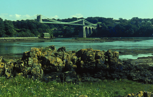
We were always looking for new vantage points for our favorite bridge, the Menai Bridge over the Menai Strait between Anglesey and Bangor. This view is from Church Island. August 13, 1967.
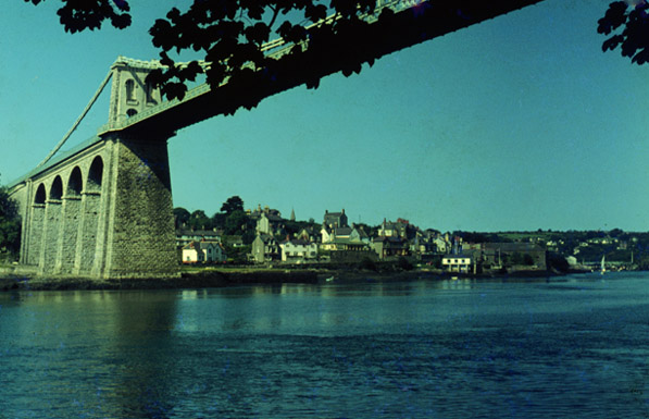
This is a view under the Menai Bridge to the town of Menai Bridge. We drove through the small town and over the Menai Bridge every morning on the way to work in Bangor.

This is the view north along the Menai Strait from the Menai Bridge. Beaumaris, where we lived, is just visible on the horizon to the north.
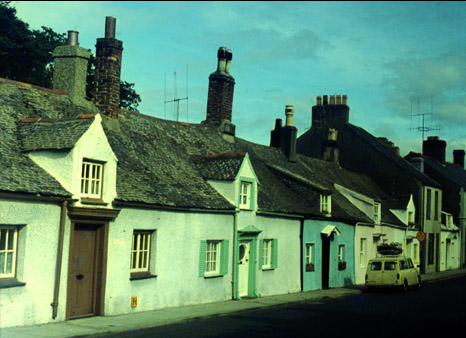 | This is part of the row of houses on the north side of Church Street in Beaumaris, just up the street from where we lived. Note the slate roofs and multiple chimneys. August 15. |
The shops where Brenda did almost daily shopping were along Church Street and the side streets off it. These are the folks from the "tinned goods" store. | 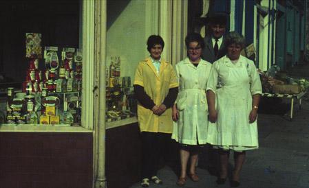 |
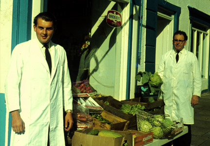 | These are the greengrocers. They were just across the street from us. We became good friends with the greengrocers and the butchers next door. |

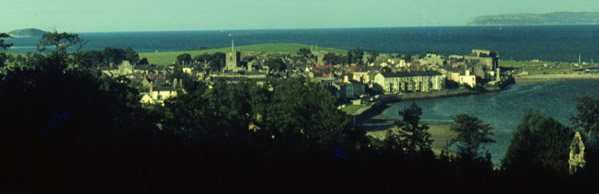
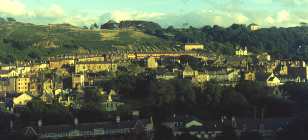
The town of Beaumaris from one of our walks up on the hills behind it. A good view of the Menai Strait and the Great Orme Head across the water in center. We lived on Church Street, about a block to the right of the church steeple you see, so we could always locate where we lived in our distant views.
Zooming in a little on Beaumaris, you can see the neat row of white buildings along the seaside. We often walked down there to feed the gulls and just watch the boats.

Brenda feeding the herring gulls at the pier. 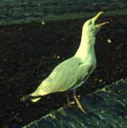 | 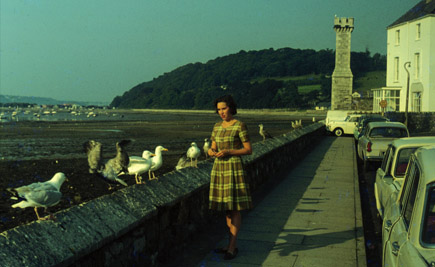 |
Behind Brenda you can see the hill from which the picture of Beaumaris above was taken. From that picture on the right end you can see the white building that is in the picture behind Brenda, and you might just be able to make out the monument on the end of the pier. We very much enjoyed feeding the gulls and learned a bit about them. In the closeup picture of the adult gull above you might be able to see the red dot at the bottom of the beak. Their young would instinctively peck at that red dot, and that would prompt the parent to feed them. When the wind was high, we would go down just to watch the gulls play in the wind. There seemed to be a joyful playfulness among the gulls when the wind was up. I have seen them do stiff-winged barrel-rolls in the wind. Note t hat the tide is out in these pictures. The tidal range is over 8 feet here and it left the yacht basin as a vast mudflat at low tide.

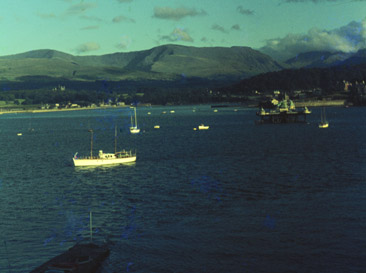
Swinging to the right gives a view of the yachts anchored near the Beaumaris pier at high tide. Across the Menai Strait are the hills of the mainland of North Wales just north of Bangor.
 | This is a view directly westward across the Menai Strait from the village of Menai Bridge. It shows the pier of Bangor directly across and the hills behind Bangor. We spent a lot of time climbing around in those hills. This view is three or four miles south of the images above it. |
This is the town of Bangor from the upper administration building of the University College of North Wales, the building known by the students as "Top Col". The Chemistry Building where Rod worked was just below and to the right of this view. It was in walking distance of all the downtown area. The hospital where Brenda worked was also close, below and to the right.
 | Beach at Morfa Nefyn on the Lleyn Peninsula with the Rivals mountains in the distance. August 16. |
 | We drove to Nant Francon on August 21. Nant means "valley" in Welsh, so this was the valley of the Francon River. A dramatic valley less than an hour from our house, Nant Francon had been one of our favorite destinations during our whole stay, but we had typically visited it in the winter. It was much more lush and green now. |
| A Welsh countryside roadsign, pointing the way to Betws-y-Coed. Llanwrst and Cerrigydruidion were two other villages we drove through. | 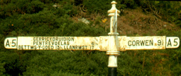 |
| The falls at Betws-y-Coed. They are called Swallow Falls and are the most talked-about waterfalls in the North Wales area. | 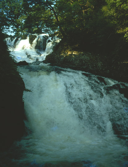 |
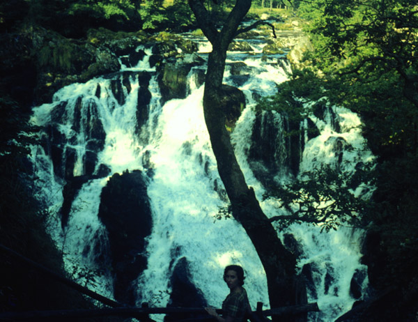
Brenda at the falls at Betws-y-Coed. This was one of our favorite spots in North Wales and we visited it several times. August 21.
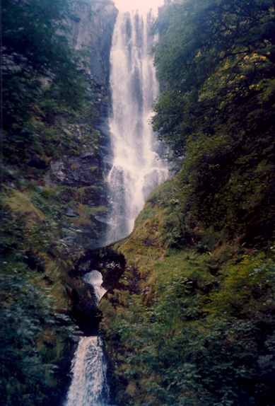 |
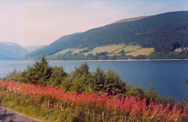
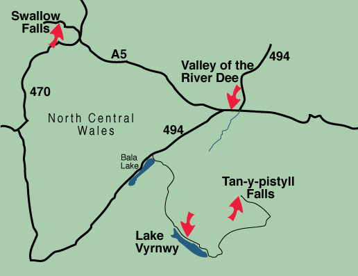
During the summer we branched out further into North Wales into the central area shown in outline on the Wales map. We visited Swallow Falls and explored the area around Bala Lake and Lake Vyrnwy. 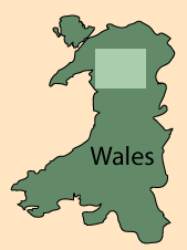 The pink flax growing beside Lake Vyrnwy enhanced the peaceful beauty of the lake. The whole area was a tranquil agricultural area of fields and rivers. The falls with the natural bridge at left are called Tan-y-Pistyl Falls and their location is shown on the map below. |
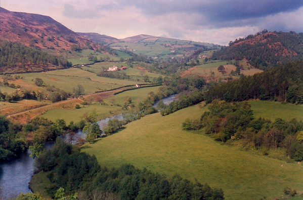
This is the valley of the River Dee as seen from the A5 highway near Corwen. It was one of the nicest, most peaceful valleys we saw.
| Heather on the hills |
1967