Coastal Drive up to Whistler, Canada
July 28, 2011

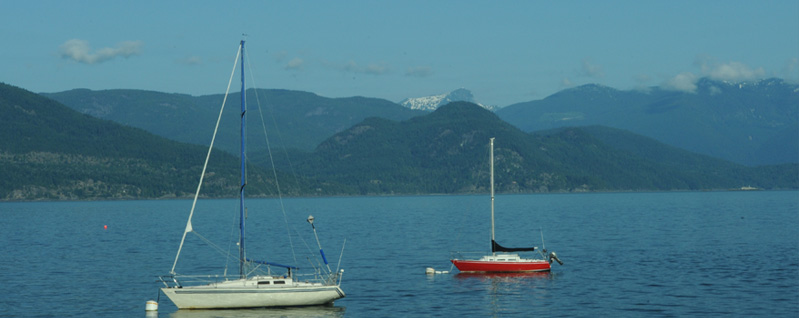
This is a view of the bay west of Vancouver with some of the freight shipping out on English Bay. It is on the way to our days exploration of the area north of Vancouver. We were now a bit rested up from the trip and were ready to explore, so we passed this point at about 7:45 am on this beautiful clear day.
We had a brief tour of the Vancouver area yesterday, and were keen on seeing more of the coastline and mountains above Vancouver on the west. We drove as far north as Whistler, noting that Mark had been there several years ago on a ski trip.
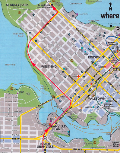 | The red line on the map shows the route we took through Vancouver, guided by the GPS. 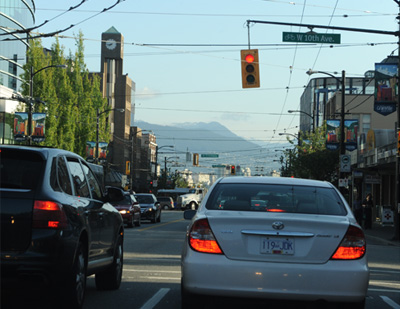 The traffic was a bit of a mess, there being no north-south expressway through the center of the city. Our motel was in Richmond near the airport, so we drove Hwy 99 through the city, which was at least less crowded at 7:30 in the morning than it was at mid-afternoon yesterday. This picture is just south of the map region on Granville St. |
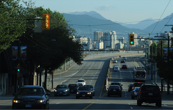 | Here we are headed down the hill on Granville St to cross False Creek on the Granville Bridge. Granville is a suburb of Vancouver, as is Richmond from which we were driving. Note the wires overhead for the electric trolleys which are part of their mass transit system. The overhead rapid transit trains were the really modern part of the city's transportation network. Our route, shown above, took us across the Narrows on the Lions Gate Bridge. |
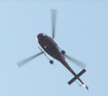
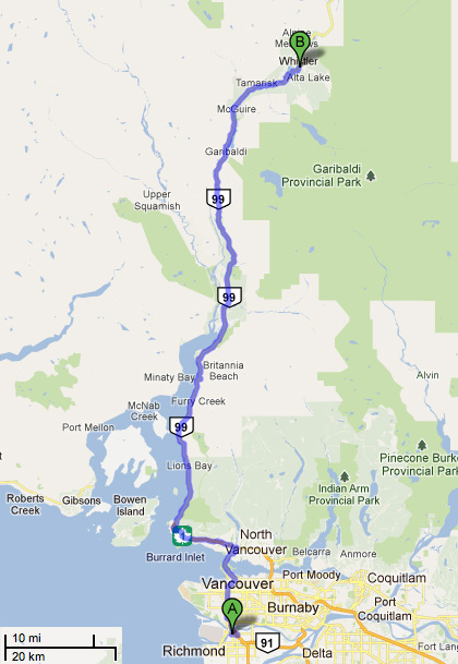 This was our planned route to the Whistler area. Highway 99 runs alongside the bay for a considerable distance. We again crossed the Lions Gate Bridge, and in the morning traffic we again had only one lane with the other two devoted to incoming rush-hour traffic. Fortunately, there weren't nearly so many people on the road as last night, so we got through quickly. |  Brenda snapped this picture of a floatplane going over, but neither of us knew how many dozens of them we would see on this trip. In some parts of Alaska they are as common as cars!  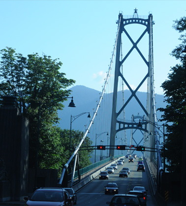 |
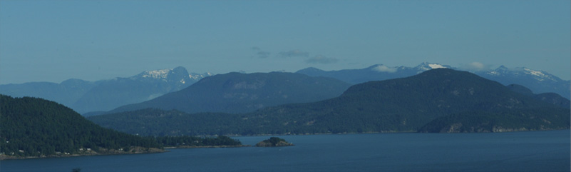
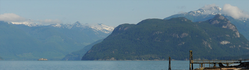
 | This time we bypassed the exit to Horseshoe Bay and headed north on Hwy 99 along the coast. It is called the Sea-to-Sky Highway there. We were quickly rewarded with wonderful views of the bay and the mountains to the west. We were two Georgians enjoying the view of the beautiful Strait of Georgia. |
 | We just took our time up this beautiful highway, and the first time we stopped for any length of time was at Lions Bay where we had hoped to get to the water's edge for a view. 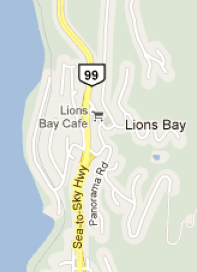 |
 |  |
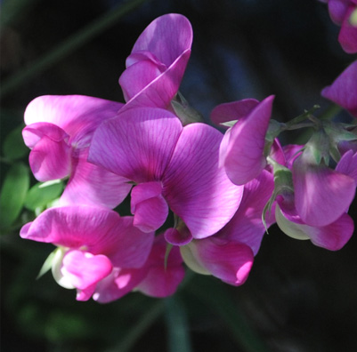 |  |
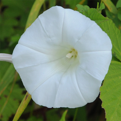
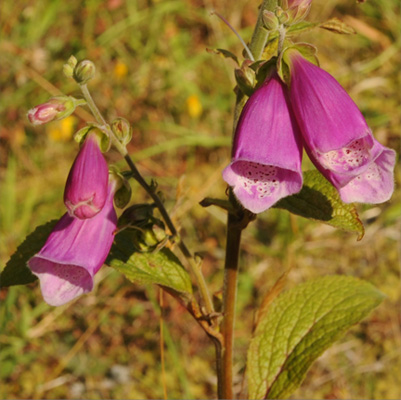
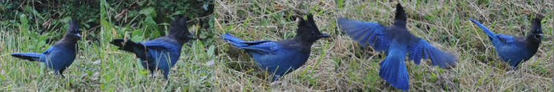
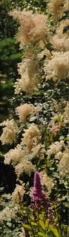
 | Well, we totally failed at finding an access to the water's edge - exclusive and locked-off intensive development completely blocked it. But we did find some beautiful flowers by the roadside, so we enjoyed the effort. We also saw a Stellar's jay.  |
We did find a road to the marina, and although it was covered with signs threatening unauthorized parkers with towing, we could pull in and see the Strait of Georgia from the water level.
 | As we had noticed at Horseshoe Bay, the particular kind of blackbird they have here is quite belligerent. These birds were pecking at each other, almost jousting with their beaks. Maybe they are ravens - several sports teams in the area are named ravens, and maybe this belligerence is the key to that. |
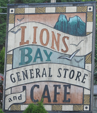 | 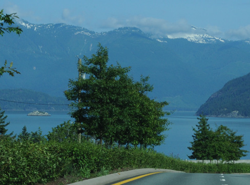 |
We stopped at the Lions Bay Cafe for coffee and a snack and got this nice view of the Strait of Georgia as we left.
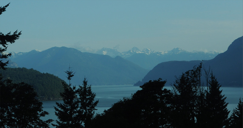
 | We left the Strait of Georgia and got nice mountain views as we traveled further north. |
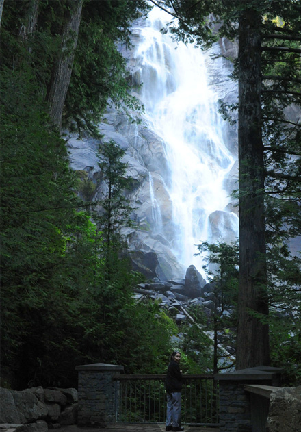
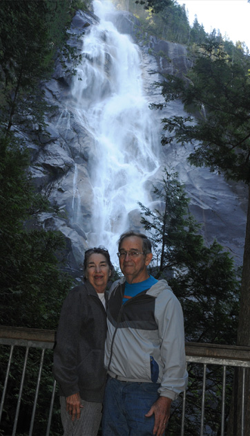
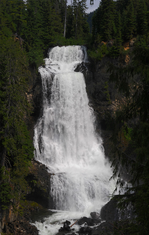
Shannon FallsWe stopped and explored Shannon Falls, an absolutely spectacular waterfall. There is no way a photograph can do it justice. It was the most outstanding sight of the day. It is British Columbia's third highest waterfall at 1105 feet. 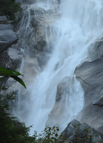 | 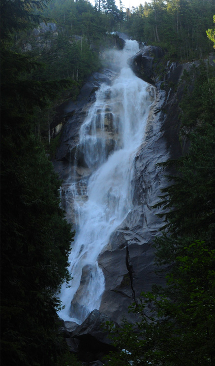 |
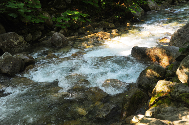
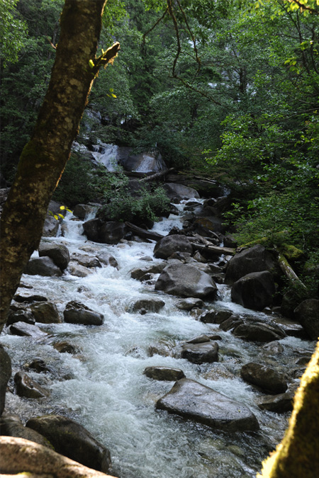 | The stream below the falls was also spectacular. There were about a hundred Japanese tourists there and they were obviously delighted with the setting, with dozens of them taking pictures of this area. I had to wait to get a clear shot, but I certainly didn't mind sharing in their reverie.  |
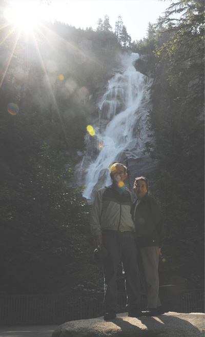 | 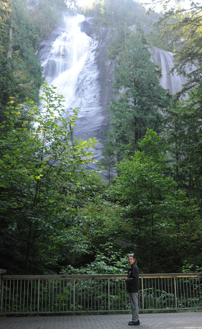 |
This was one of those rare times when we had the luxury of time to hang around in this beautiful place, so we explored for about an hour. The sun was almost directly over the falls, which our eyes adjusted to but the camera had a hard time.
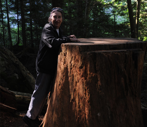
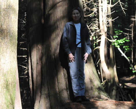
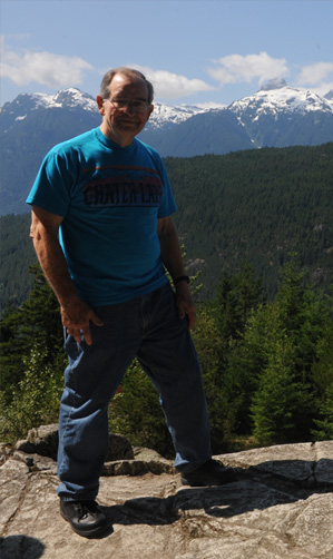
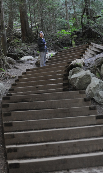 We took another, steeper trail with lots of steps to see a side view of the falls. Brenda shows the size of some of the trees in the area.
|   |
 |  |
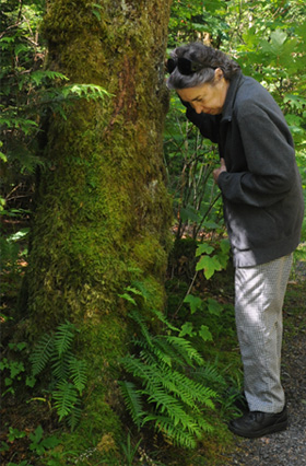 | Brenda loves ferns, and there were extraordinary ones here. The moss was so thick on some trees that the ferns grew up on the tree trunks. She also loves to find a place to lie on her back in the wilderness, which she has done at least since the North Rim of the Grand Canyon in 1982. 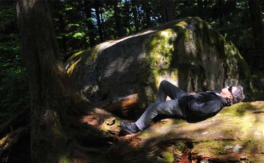 |
We were following the path along a wonderful stream below the Shannon Falls. As we left we passed a line of yellow schoolhouses bringing people to the falls. We certainly understood why. | 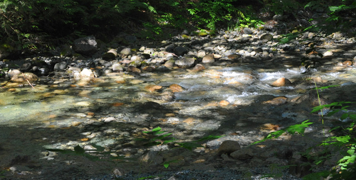 |
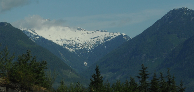
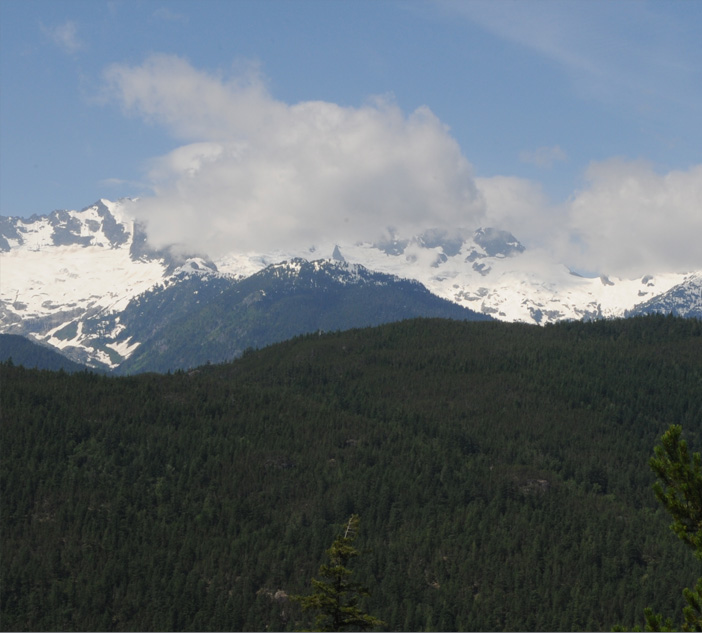
 | About 15 minutes past Shannon Falls we reached the town of Squamish and began to get views of more rugged snow-capped peaks. |
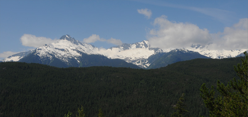
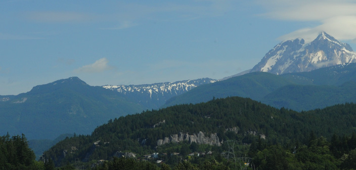
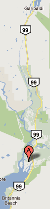
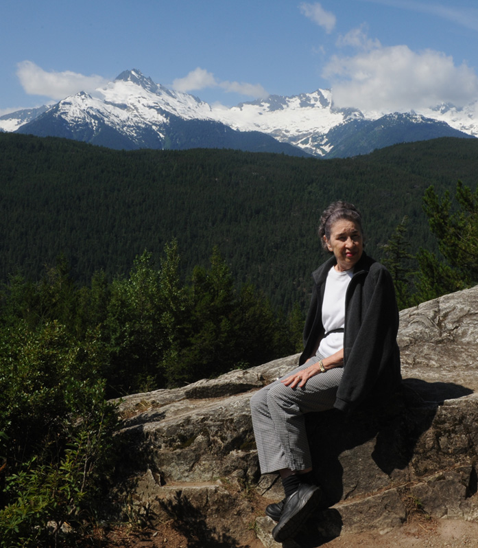
About 20 minutes past Squamish we reached this magnificent viewpoint of snowcapped mountains and unspoiled forests. We think this is part of Garibaldi Provincial Park. It was a reverie. The A on the map strip below marks the location of the town of Squamish. We had continued to drive northward on Hwy 99, so were near the top of this map strip.
  |
 |
 |
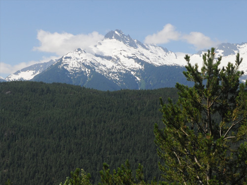 It was hard to leave this place of such great beauty. We were away from the big crowds now, but about three families enjoyed the place with us, and we were all enthralled. One of my favorite things was the drifting of the white puffy clouds across the snowy faces of the mountains. |
 |
 |
 |
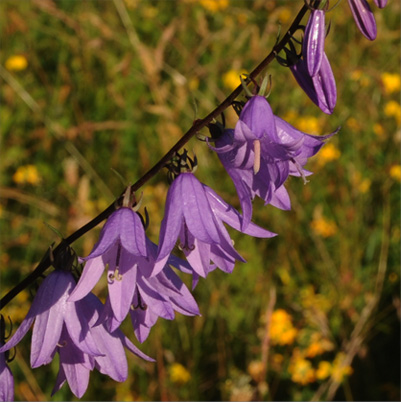
We proceeded north on the Sea To Sky Highway and turned left on the road which led to the Whistler Olympic Park, the location of the 2010 Winter Olympics. It was a very pleasant road and deserted except for two or three other cars and two or three motorcycles. We loved seeing the wild Callaghan Creek and were pleasantly surprised to find Alexander Falls, which we hadn't even heard of. The Callaghan Creek crossing was about 30 minutes from our nice setting in Garibaldi Park. Shortly after crossing Callaghan Creek we came upon a lush green bank with lots of blue lupine - about the nicest stand I've ever seen. We always seem to be at places too early or too late for the lupine. After spending some time admiring Alexander Falls we went on to Whistler Olympic Park, which must have been an impressive thing to see when the 2010 Winter Olympics were in full swing. Callaghan Creek was delightfully wild and unspoiled. Below are views of the uphill side of the creek, south of the road we were traveling. |
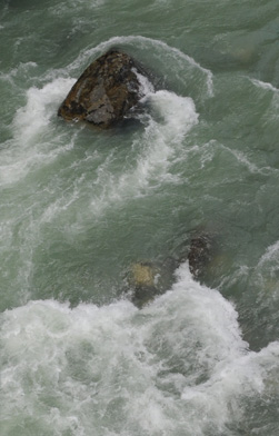 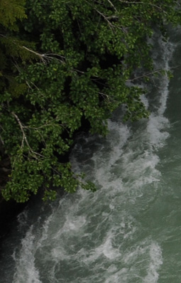 The lush green foliage against the rushing water was also beautiful. |
 |
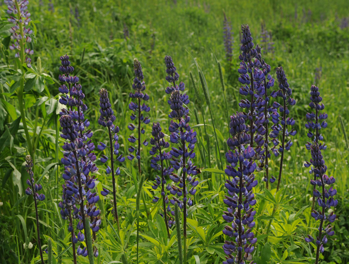 |
Just above the Callaghan Creek crossing we came upon a green bank covered with what I take to be lupine. It was hard to get a broad view, but here is a closeup view of what the bank was covered with. |
|
The discovery of Alexander Falls higher on this road was a complete surprise to us. 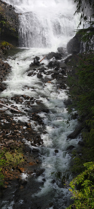 |
 |
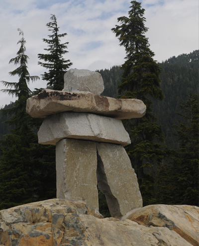
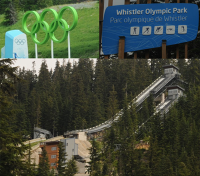 Whistler Olympic Park, site of the 2010 Winter Olympics, was a short distance up from the falls. There were signs and symbols of the olympics, and some structures remained, but it was essentially deserted except for a few mountain bikers. The most dramatic artifact was the huge stone inuksuk. |
 |
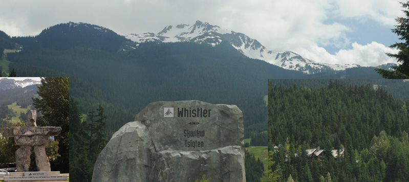
We drove the ten miles or so on up to the town of Whistler and the fancy ski resorts around it, but it is not our type of thing. It had another large stone inuksuk, and we could see the mountains and the ski runs on the mountains. But after a loop around, we headed back south on Hwy 99.
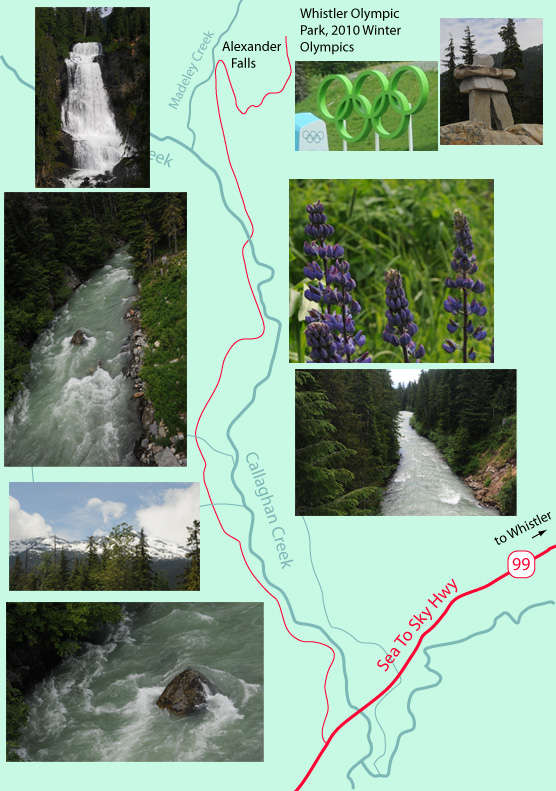
 | 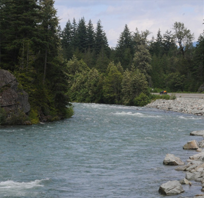 We were retracing our steps down Hwy 99, but going south we had the river on our right and could stop and have a look at it. I'm thinking that this is the Cheakamus River at this point - it is the main river into which Callaghan Creek empties. We always enjoy the fireweed as an old friend because we have seen it in so many places. |
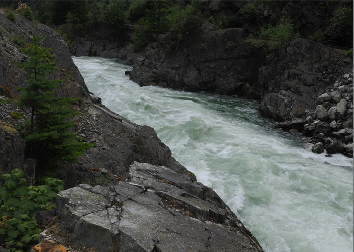 |
This was refreshingly wild country, even though the road was on our left and the railroad track just on the other side of the rapids. Still, we were just a few steps from true wilderness, and this was certainly a wild river at this point. |
We enjoyed our drive on the Sea To Sky Highway very much and were back to Lions Gate Bridge at about 3:45 and went smoothly across it at that time in the afternoon - not like our hour-long ordeal of yesterday. We went to the Barclay Hotel where we had booked a room for two nights to manage the RTB tour tomorrow and getting on the cruise ship on Saturday morning. We dropped our luggage at the hotel, having to park on the street to do so since the hotel has not even a pull-in. I took our luggage to our third-floor room up the stairway in this old hotel with no elevator. Then we drove down to the Budget location on West Georgia St and walked the mile or so back to the hotel.
| Vancouver Tour with RTB |
2011