Vancouver, Canada
July 26-27, 2011
We flew from Atlanta to Vancouver on July 26. On July 27 we picked up a rental car and explored the Vancouver area a bit and planned for a further exploration up to Whistler on July 28.
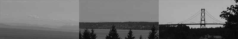
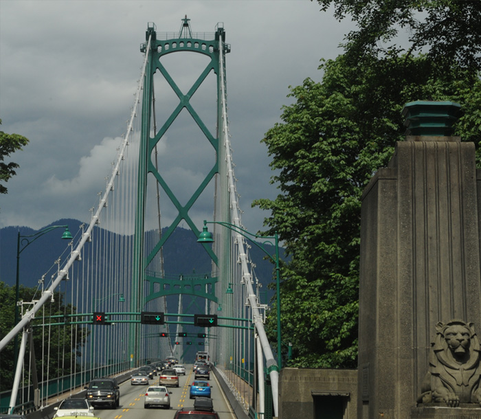 | Here we are headed across the Lions Gate Bridge to explore a bit of the coastline north of "The Narrows". We had crossed the Lions Gate Bridge in 1960, and then it seemed extravagant. Now it is a bit of a bottleneck and they talk about a replacement. |
We left from our lodging at the Days Inn of Richmond, close to the airport, and threaded our way through Vancouver with the aid of the GPS. There are only two bridges across the Narrows, and we took the western one, the Lions Gate Bridge shown above. The western coast looked intriguing to me and we had thought to drive northward up the coast, but the exit to Horseshoe Bay looked inviting so we took it to explore. We had a nice visit and dinner there and decided to postpone further exploration of the coast until tomorrow. We were pleased to now be free to explore a bit after our complicated trip. Our Delta flight from Atlanta was delayed by the FAA because of missing safety decals on the bottom of the plane. So they unloaded over 200 passengers and scheduled a later flight, which wouldn't get us to LA to meet our flight to Vancouver. So we were switched to a later flight through Minneapolis but our luggage didn't make it. We arrived in our room at 4am Atlanta time, so we slept late. We went to the Airport to pick up our rental car and our luggage had arrived so we could be reunited with it. Whew! But now we were on our way. | 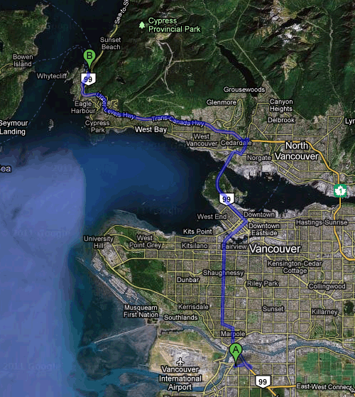 |
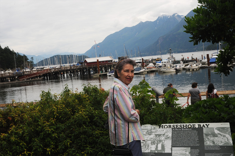
The marina at Horseshoe Bay was very pleasant to explore, and there were lots of families there for picnics and lots of elderly whom we guessed had retired there.
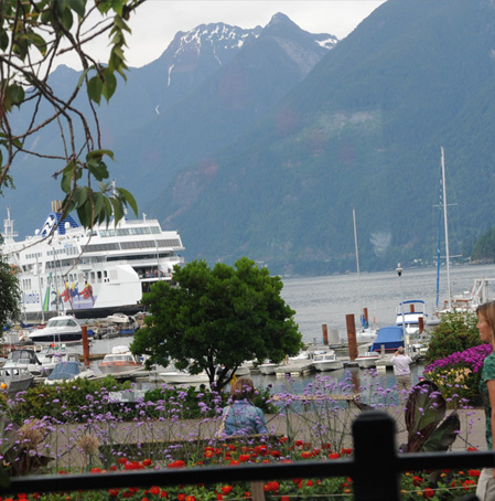 | In making the turnoff to Horseshoe Bay we had stumbled upon one of the major ferry ports for the Marine Highway. The huge car ferries loaded here for the trip to Vancouver Island and other major destinations on the islands. Three major ferry routes initiate here. The bay was very sheltered with mountains on three sides.  From the pleasant Horseshoe Bay Park we watched this ferry arrive. |
There were several families having picnics in the nice green park. They had to watch out for the opportunistic herring gulls and ravens. We liked seeing the herring gulls because of our experience with them in Wales. 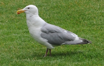 |
 |
 | This was a delightful small park with lush flowers grown in this cool and moist climate. People of all descriptions were enjoying it.  |
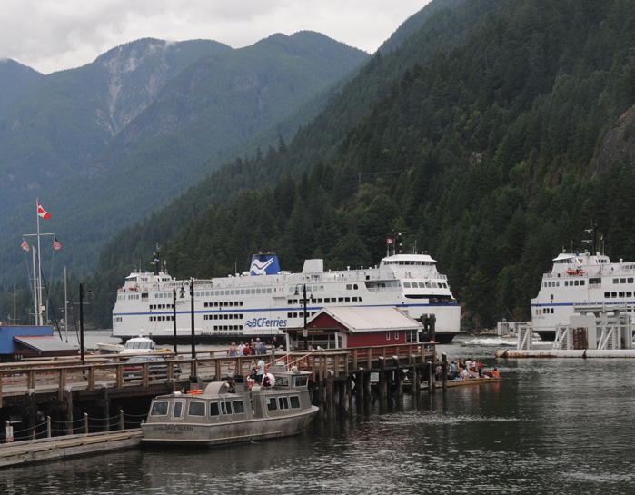 |
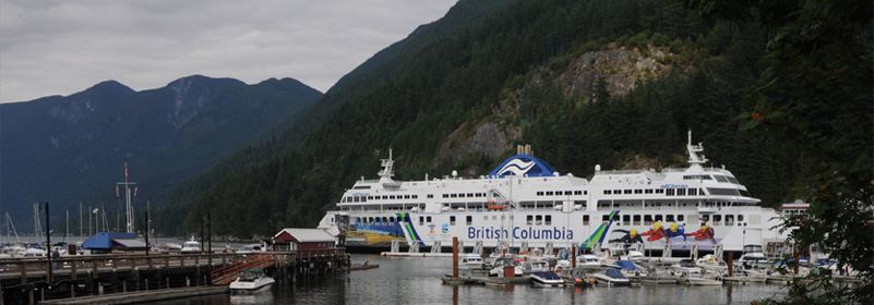
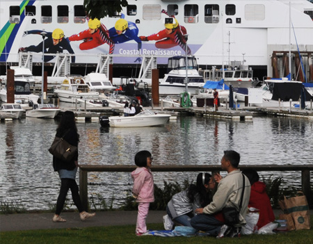
We watched several of these ocean-liner-sized ferries come and go and watched the other activity of this busy marina in the meantime. |
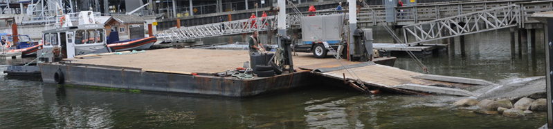
 | I was fascinated with the activities in this small working seaport. We watched for several minutes the process of unloading some heavy movie lighting equipment from this barge. It educated me to the fact that the sea is the working highway in this part of the world with all the waterways and islands where inland travel is blocked for much of the year by snowy mountains. They had a wide concrete ramp, but had to be able to accommodate the different tide levels to handle cargo. They had a big wooden ramp that could be adjusted in height, and two long aluminum ramps with hooks on their ends so that they could adjust them under the wheels of trucks to drive them onto and off the barge. Note the two guys with long sticks with hooks to adjust the aluminum ramps positions. |

Having finished unloading, the guy on the front controls raises the barge's ramp while the guy on the tug backs away from the concrete shore ramp. | 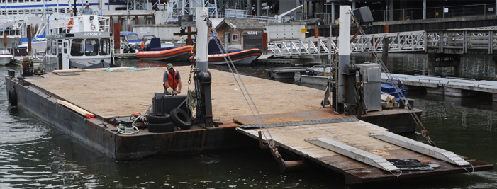 |
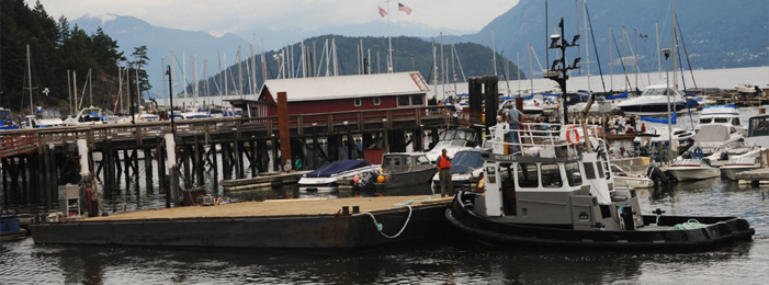 | Then the tug captain had to maneuver the barge out of this crowded marina. All in a day's work for him, I'm sure, but it was certainly a different working world for me. |
Most of the boats in the marina were ordinary fishing boats or pleasure boats, but this powerful zodiac boat looked like it was ready for a wild ride. |  |
 | Besides the huge ocean-liner-sized ferries, we watched several smaller car ferries come and go. It was a very interesting mix of port activities. We had a nice dinner at a restaurant in view of the harbor and headed back toward Vancouver. |

As we drove back toward Vancouver, we could get only tantalizing glimpses of the misty mountains, the settlement south of the Narrows, the shipping on English Bay and the Lions Gate Bridge. That north shore is very wooded and very heavily developed, so there are few viewpoints.
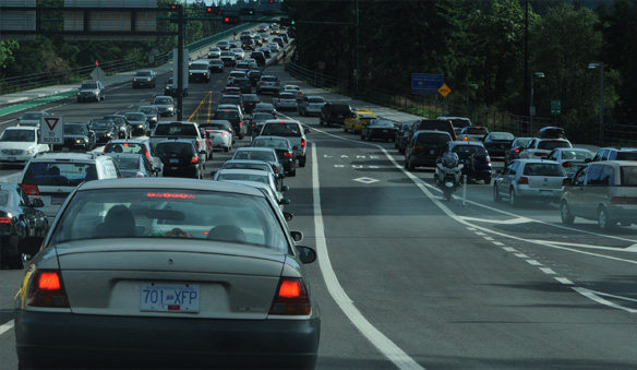 | Four lanes merge to one!!On the way back to Lions Gate Bridge from the west at nearly 5pm I made classic rookie tourist errors which lengthened the time for us. On the way toward the bridge I made a left turn onto a three-lane roadway and didn't know it was critical for me to get into one of the right two to get to the bridge. By the time I realized that, the two right lanes were totally locked and stopped, lined up as far as I could see in the rearview mirror. Couldn't stop in the lane, and no one was budging to let anyone in. So I had to overshoot the turn by about a mile where I could make a loop and come back, having noted which lanes went to the bridge. |
| So then I was locked in a lane with traffic inching toward the bridge. When we got close, it was evident why. Four lanes had to merge into one because the three lane bridge was set for two outbound lanes.I don't recall ever having experienced four-lanes-to-one before! Everyone was scrupulously fair in taking turns, but it took a while. We had approached the bridge at 5:17pm and were moving across it at 6:16 - a full hour to reach the bridge, and it seemed longer. | 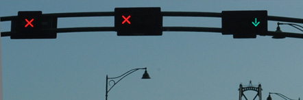 |
We then wound our way back through Vancouver to Richmond and our motel, being thankful for the help of the GPS. It had been a good day, and typical of our adventure vacations. We now knew a lot more about Vancouver and were ready to tackle it again tomorrow.
| Drive to Whistler |
2011