Canyonlands: Return from Grand View Point
November 1, 2016
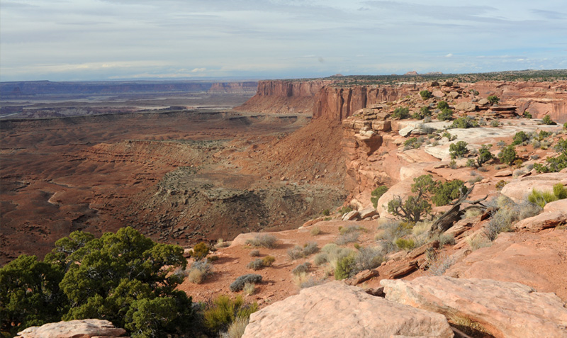
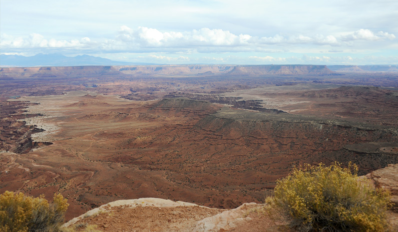
In Canyonlands National Park we first drove down to Grand View Point Lookout, the end of the main park road in the Island in the Sky section. As we headed back northward, our first stop was at Orange Cliffs Overlook which was on the left side of the road.
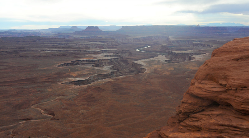
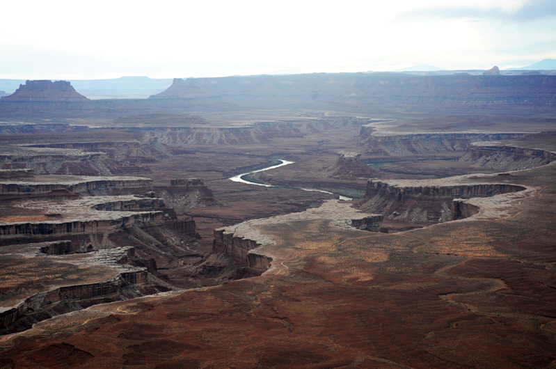
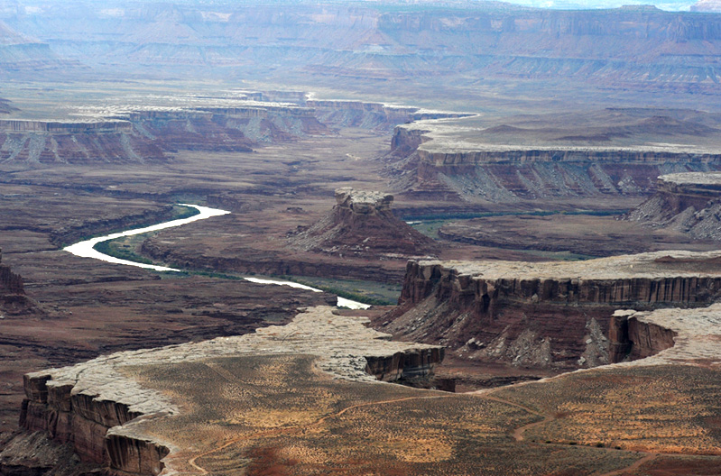
In this wide western view of the canyons from this Overlook, I could see a dirt road snaking up one of the cliffs, and a tantalizing glimpse of the Green River behind the cliff.

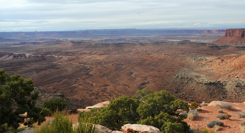
With the long lens I could get a view of quit a length of road through the valley and up the side of this cliff. You can see three vehicles parked up on the little plateau, and could see a bit of the river. Those folks must have had a great view of the river. This road is part of the White Rim Road which we saw from Grand View Point.
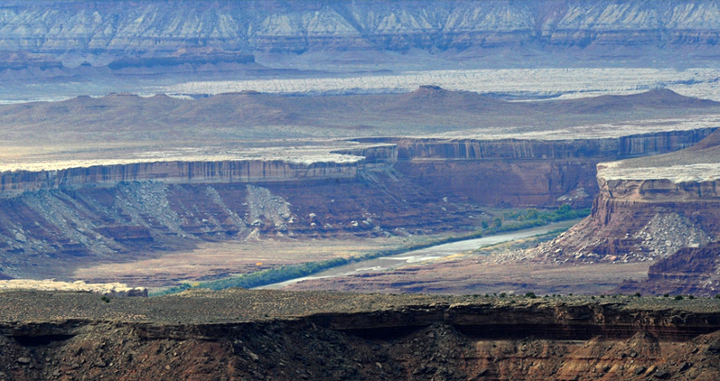
This was the best view I could get of the Green River. It was enough to make you wish you had a 4-wheel-drive vehicle and a few days to explore.
This shows the dirt road across the valley floor of the next level down from us, and then the Green River which is down another level in the floor of the canyon complex. The small flat elevated area where the cars are is labeled a "hogback" and there is a small campground there.
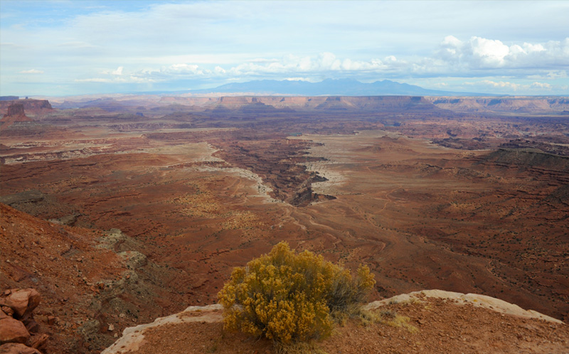
This was a view to the northeast from Buck Canyon Overlook on the east side of the park road. You can see the La Sal Mountains. What you cannot see is the Colorado River, which is such a deep cut that it is not visible from up here.
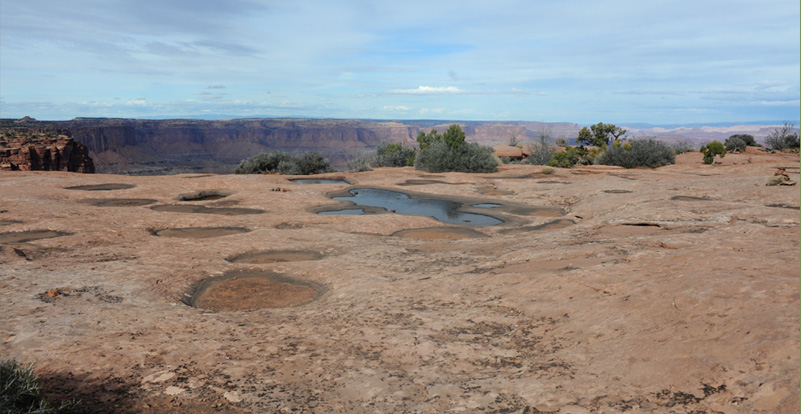
Remarkable to me were these water-filled depressions in the rock on the way to my viewpoint here at Buck Canyon. They were just like the rock depressions on the top of Stone Mountain, Georgia. They may be called spallation ponds - when collected water freezes, it can scale off a bit of rock and gradually develop these depressions in a rock surface. Even though this is sandstone and Stone Mountain is granite, it appears to be the same phenomenon.
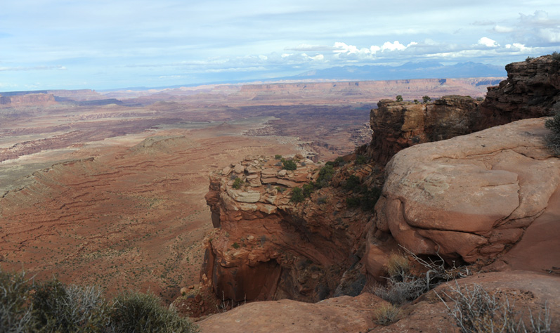
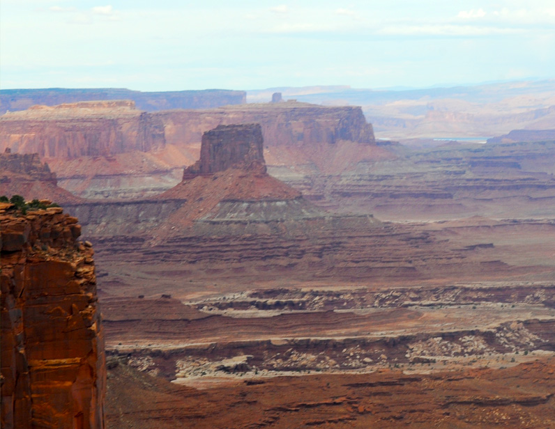
This view is centered on Buck Canyon with the La Sal Mountains standing at the horizon. You can just barely see the dirt road skirting the end of the canyon. I was getting a bit of vertigo standing on that point - the viewpoint is labeled 6240ft, and a previous note we saw suggested that the flat area below us was about 1500ft lower. I believe the broad tower at the extreme left is what is named "Airport Tower".
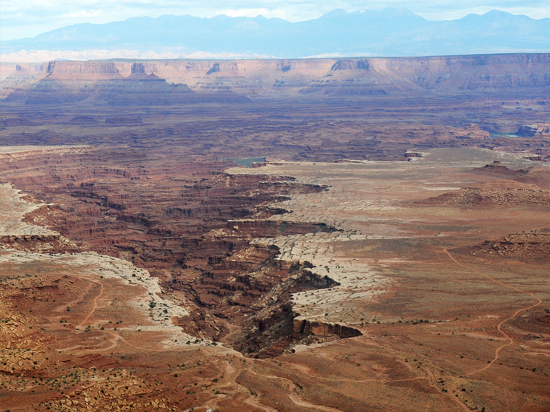
I continued my fascination with this winding dirt road down on that plane of the canyon complex. It skirted the end of Buck Canyon. This is part of the White Rim Road that we saw first from Grand View Point. The other fascinating thing about this view is the view of the Colorado River at points just above the center of the picture and at the extreme right about three quarters of the way up. There are also hints of the river valley winding through the area. This is also a good example of the white rim sandstone around the edges of the Buck Canyon that hardens and defines the edges of the cliffs.
One more shot before I leave my high perch. The Buck Canyon is on the extreme left as I swing toward the southeast. You can see the White Rim Road along the south side of Buck Canyon, and then you can see it reappear on the midline about three quarters of the way over to the right. From there it has to find a way over to the right of this view to get to the south end of the Island in the Sky where we saw it from Grand View Point.
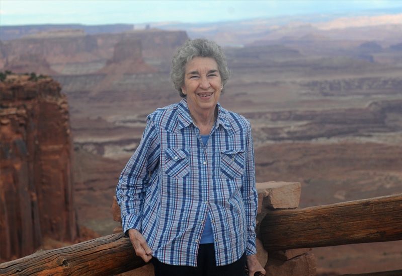
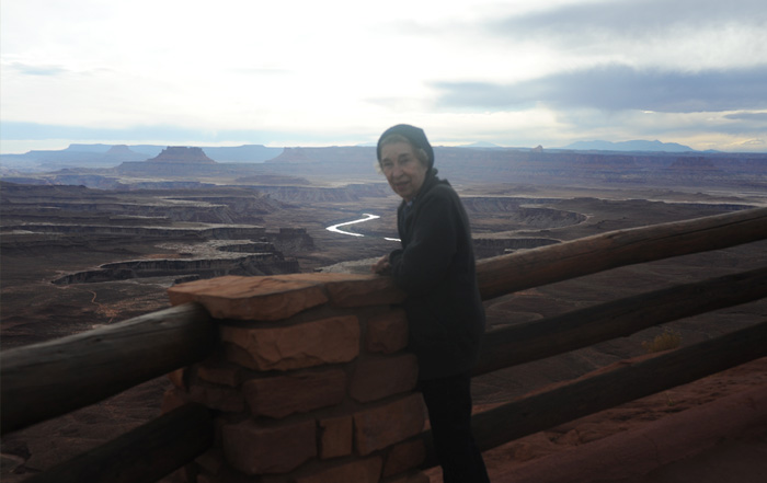
We moved a few minutes north to what I think was the Mesa Arch trailhead. We could still see Buck Canyon and behind Brenda is the formation called Airport Tower.
This shot of Airport Tower has just a glimpse of the Colorado River behind it and to the right. Airport tower has been climbed by rock climbing teams.
Looking back to the southeast, we had a different view of Buck Canyon with the White Rim Road that has so intrigued me. You also get the two views of the Colorado River in the background.
Two telephoto views of the White Rim Road around the end of Buck Canyon. Note that in the lower one the road runs right to the edge of the canyon at the lower right of the photo.
Back on the road in Island in the Sky, we took the branch off the main road that led to the Green River Overlook.
 We parked our little silver car in the parking area among the desert vegetation and headed for the lookout over the Green River basin. | 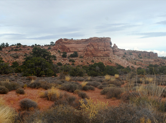 |
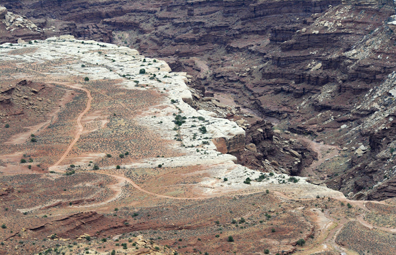
This is what we saw when we walked up to the overlook. Certainly not optimum viewing conditions! It was cloudy, hazy, and we were looking almost straight into the sun at 6:15 in the afternoon! But it was still dramatic. Note the dirt exploration road that skirts the edge of the canyon on the left.
I didn't see the exploration road on the near edge of the canyon when I shot the picture. But we found that it was consistent with Canyonlands National Park; it is designed for exploration, but you may have to have a four-wheeler or a bicycle.

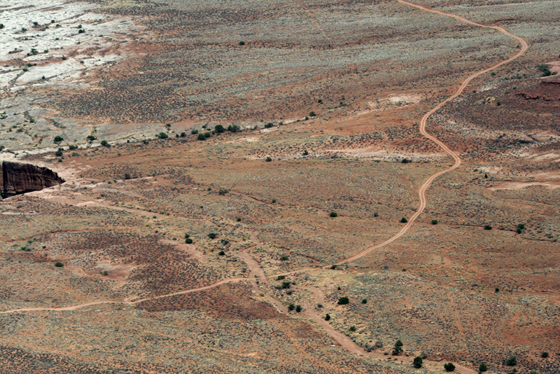
This shows an even longer stretch of the exploration road across the flat level. It has been consistent at this level to have the hard white rim sandstone on the edges of the sharp cliffs.
This gives a little more detail of the road across this particular part of the plateau, and shows a little more detail of this remarkable White Rim Sandstone that contributes strength to the sharp cliff edges.
 | With clouds settling in and the sun getting lower, we had seen about all we were going to see here, so we headed back out toward the main park road. |
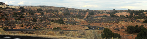
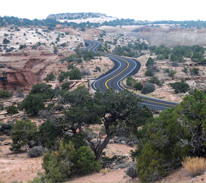
We headed back from the Green River Overlook through the grassland and then hilly red soil. They followed the natural contours with the roads, but sometimes got a bit carried away with the curves. |
 |

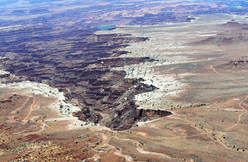
We drove to the Schafer Canyon Overlook and I was amazed to see this dirt road snaking down the canyon wall and the road off into the distance.
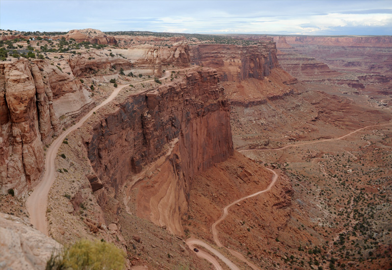
I was even more amazed when I saw a vehicle down below near the bottom of the canyon. These folks are serious about exploring Canyonlands in their vehicles!
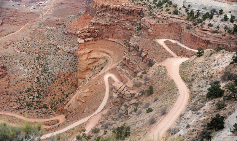
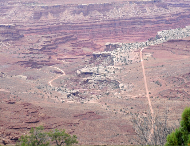
This was as much of the switchback road down into the canyon as I could get from the overlook without falling into the canyon myself. At the top left of the photo above is a branch in the road which is shown in more detail at right. Both of those roads disapppear into the lower canyon structure. Certainly we have learned that Canyonlands National Park caters to those who really want to explore! Note that there is a vehicle on that lower road in the curve. |
 |
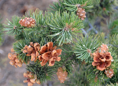 |
At this overlook we saw what appeared to be pine trees with very small cones that were almost balls. 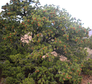 |
 |
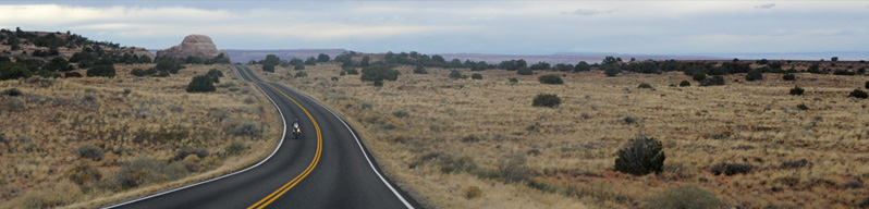
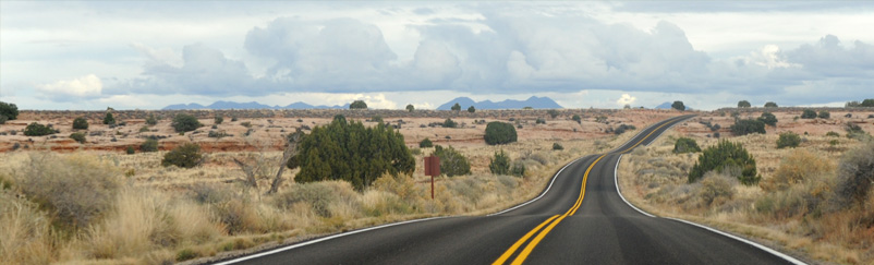
After seeing all this, the curvy road to the park exit didn't seem so severe. We had enjoyed seeing a park where they have worked very hard to make it accessible to adventurers. |
| Return from Canyonlands |
| Capitol Reef National Park |
2016