From the South Rim to the North Rim of Grand Canyon
May 27, 2011
We headed out at about 6am from Williams since we had a long drive today to reach the North Rim of the Grand Canyon and find our housing at the Kaibab Lodge near the North Rim. We had spent three nights in Williams since it was the closest practical housing we could find, and Williams worked well as a staging area to the South Rim. A common and reasonable question is "Why do you have to drive over 200 miles to get from the South Rim to the North Rim if it is less than 20 miles across?". The rather strange graphic at right attempts to explain that. It is a superposition of a road map and an outline of the Grand Canyon Park upon a satellite picture of the canyon complex that we found in the museum on the South Rim. The road shows what it takes to get around the extended arms of this incredible canyon complex.
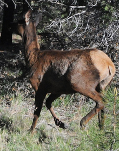
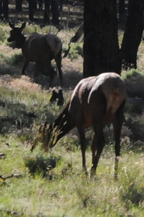
We decided to go back to the Yavapai Lodge for breakfast, and on the way into the National Park we got to watch elk grazing by the roadside. | 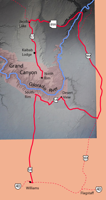 |

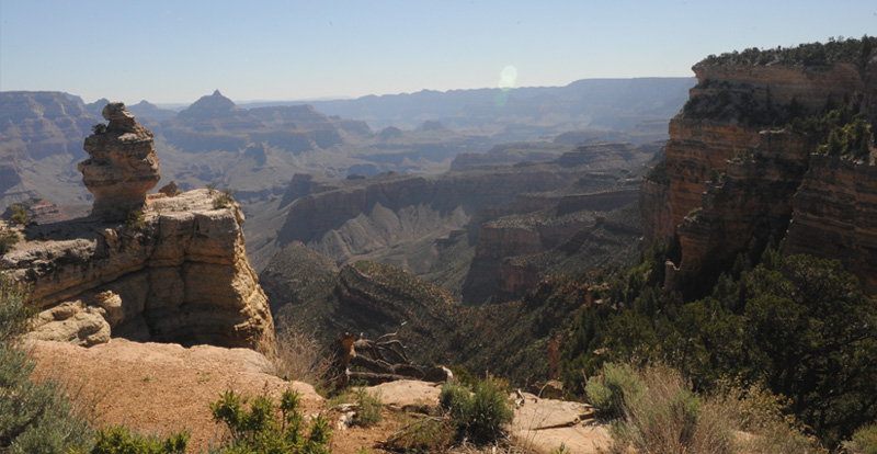
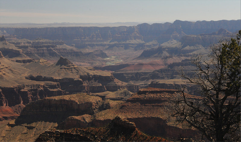
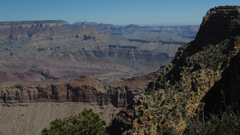
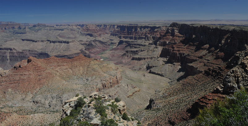
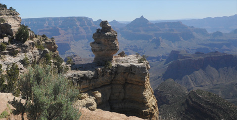 | After breakfast we headed out Desert View road and these views were at our first stop, perhaps near the Pipe Creek Vista at about 9am. The feature with the sharp tip to the right of the big stone knob is called Vishnu Temple. The big plateau to the left of the knob is Walhalla Plateau on the North Rim, 9.5 miles away. You can just barely resolve a flat-topped feature just to the left of the knob that is two miles closer. The view almost directly into the sun with the rippled top is called Palisades of the Desert and is 17.5 miles away, outside the National Park. |
Grandview Point
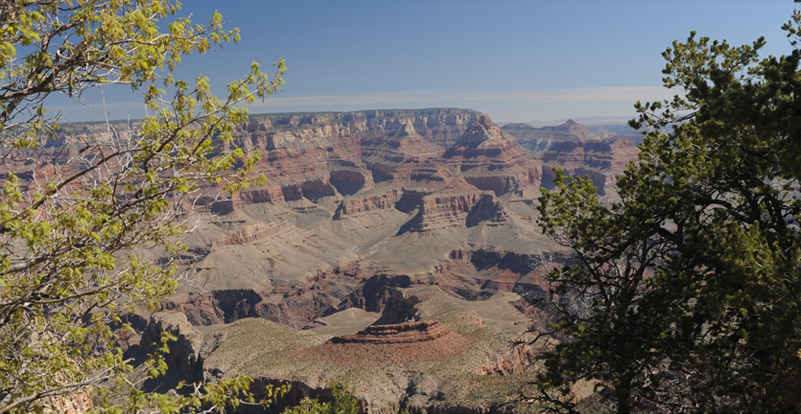
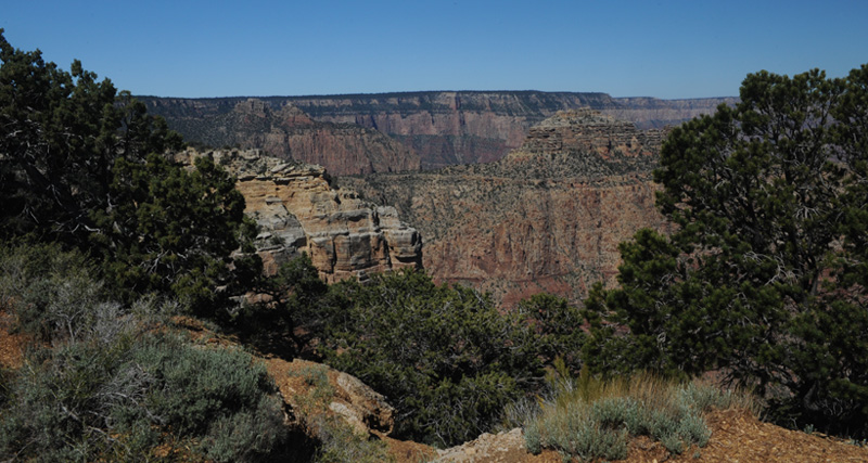
We moved on to Grandview Point where we could get a wide view of the Canyon. I particularly like views of the Canyon framed by the trees on the rim.
Grandview Point offers a very wide view of the Canyon, including views toward the east. This view is the most westward view I could get, with the morning sun illuminating all these surfaces. The line of green trees at the bottom suggests a creek, which from the maps I guess is Hance Creek. But if that interestingly shaped high mesa toward the right is Horseshoe Mesa, then the creek is Grapevine Creek.
This view swings toward the north with the morning sun on the right.
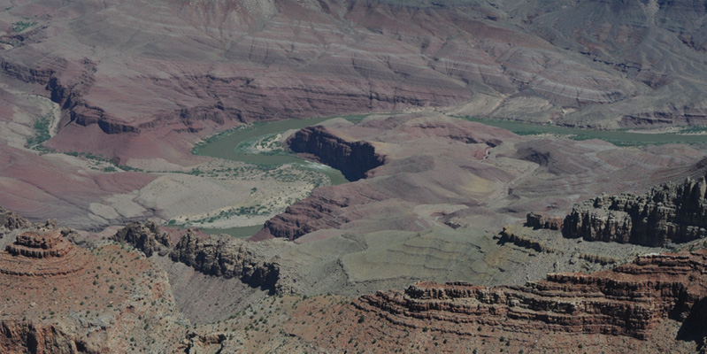
This view swings more toward the east, picking up glare and Mie scattering. In the center of the view is the Colorado River. This was our first view of the Colorado River on our drive east along the Grand Canyon rim. | 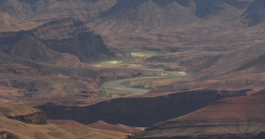 |
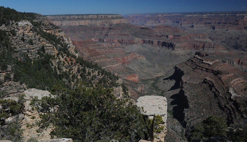
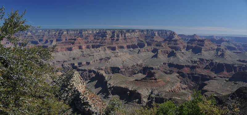
Moran Point
We moved on to Moran Point and again I liked the perspectives of the Canyon along with the trees. Elyse also enjoyed the trees, but for a slightly different reason. 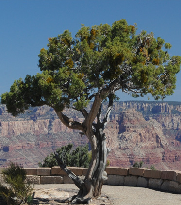 | 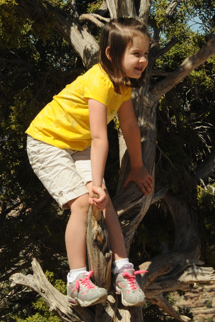 |
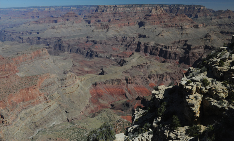
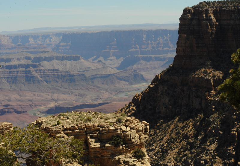
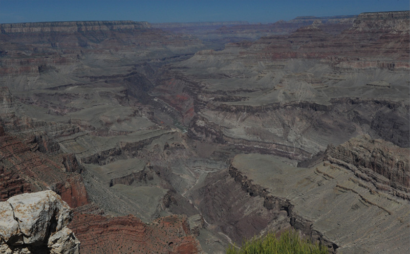
From this complicated canyonland view, a couple of features emerge. You can see the sheer walls of the central canyon through which the Colorado River runs. You can also see the side canyon from the left with the very red walls which appears to contain another stream.
Swinging a bit toward the east we find a small rocky table with evergreens growing on it. To the left of it you can see the river canyon coming in, and at the far right in the distance you can see the Colorado River.
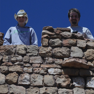
Here Jeff and family are at Moran Point.
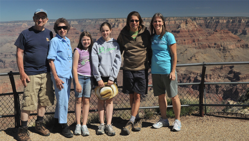
Now Rod and Brenda join with Jordan, Ashleigh, Jeff and Darla. Elyse is over helping Uncle Mark take the picture.
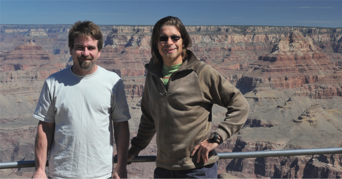 | It was good to get Mark and Jeff together on the rim of the canyon. |
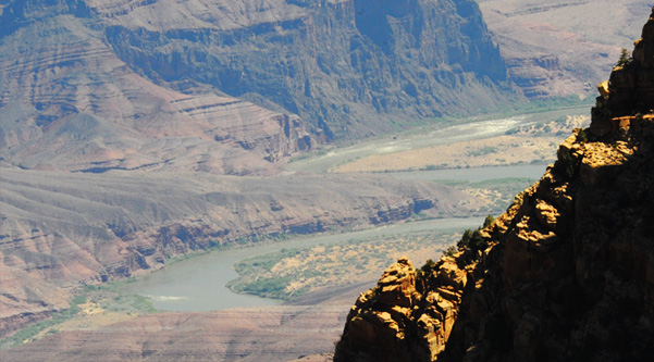 | Swinging a little further east, we got good views of the Colorado River. The Canyon is obviously not nearly so deep now and the river is spreading out. |
Lipan Point
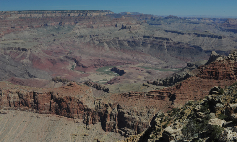
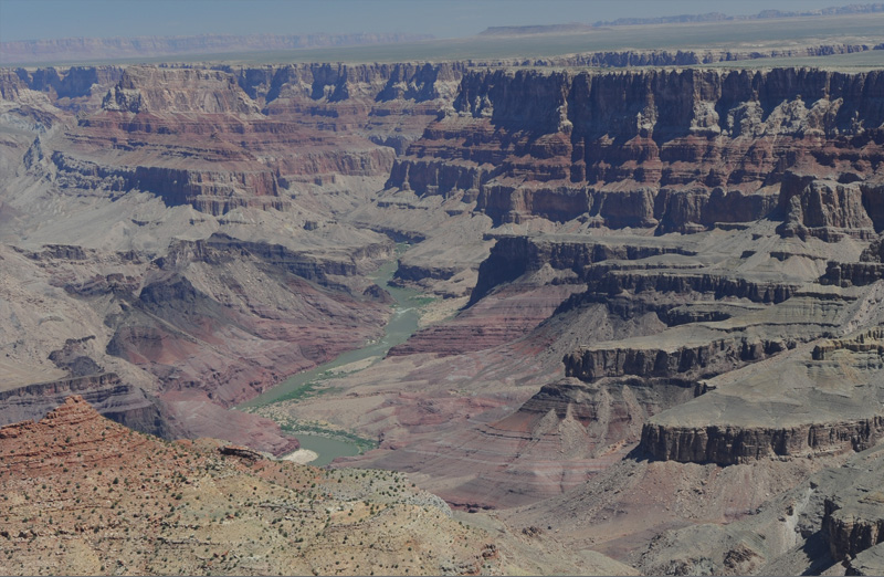
We moved on to Lipon Point where you could see the Colorado River along almost all of your view. In the view above, the river is just over the ridge.
Mark, Jeff, Darla and Jordan look down on the river from Lipon Point. |  |
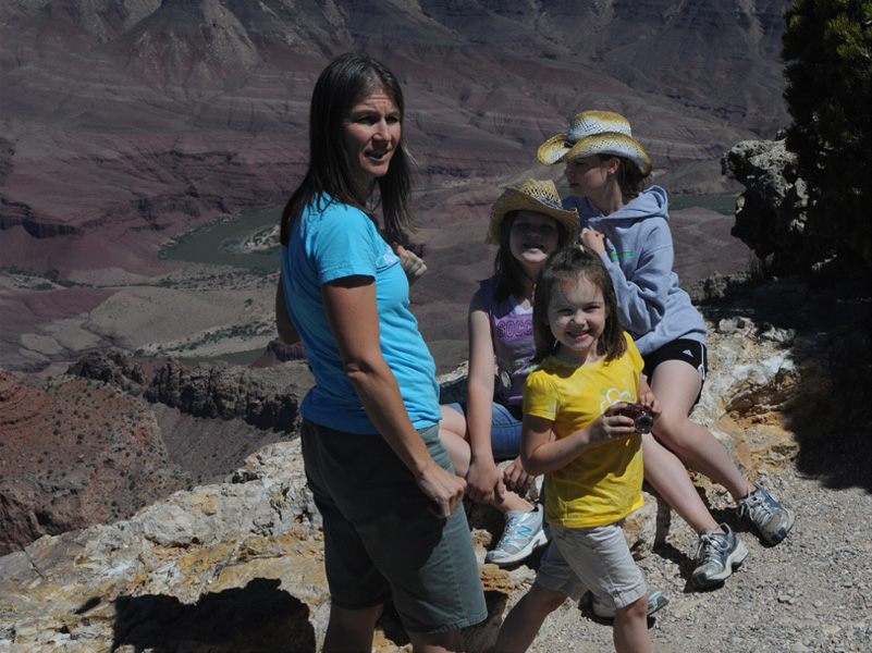
Darla and the girls at a great Lipon Point location where you can get a good view of the Colorado River.
A look back westward up the Canyon is a reminder of the vastness of this place. You can see the Colorado River at the bottom of the Canyon, but it is tiny in perspective.
The view to the northeast gives a pleasing view of the Colorado River as the Canyon becomes more shallow and revealing.
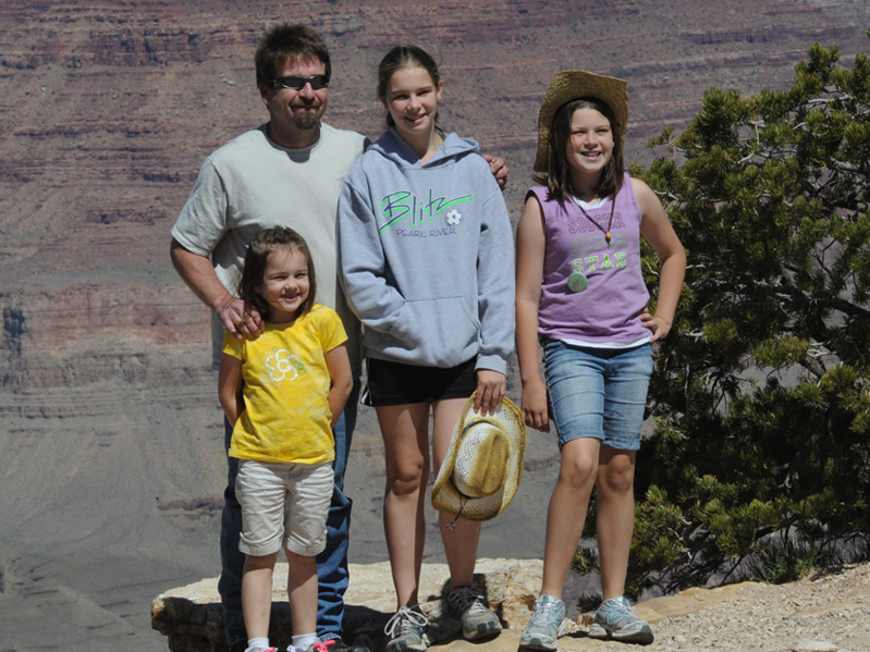
The girls with Uncle Mark on the very edge of the Grand Canyon. Don't step back!

There are very different and pleasant views of the Colorado River from Lipon Point.
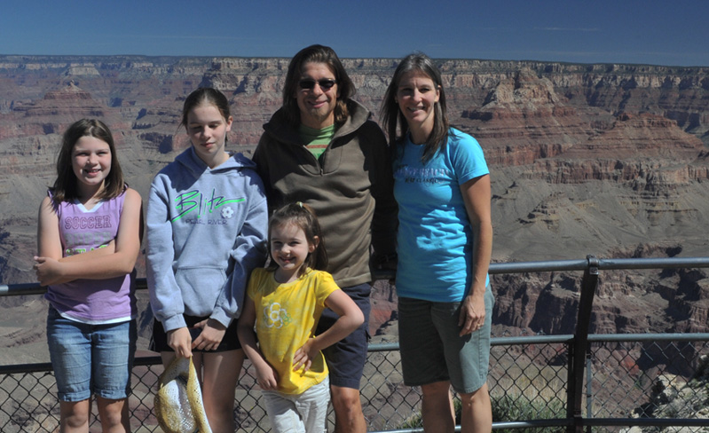
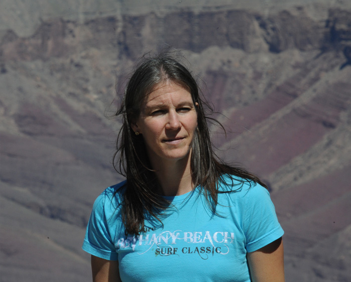 | It's not every day you get to make a portrait with the Grand Canyon as a backdrop.  |
As we pulled out from Lipon Point onto Hwy 64, we got another long view of the San Francisco Peaks, some 40 to 50 miles south of us near Flagstaff. | 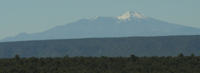 |
Desert View
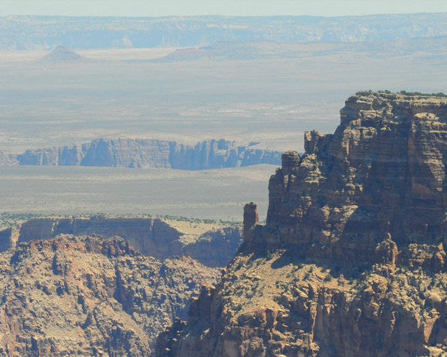
Up to Lipon Point we had been seeing the Canyon walls get lower, but at least at this point near Desert View, the walls are getting higher again. In the closer view at right, I think we are seeing all the way across the desert to the north to the Vermillion Cliffs, which must be 50 miles away at least. |
 |
 |
This was another strange view eastward across apparently a vast distance across the desert. And in that expanse is this huge crack in the earth that is several miles away. |
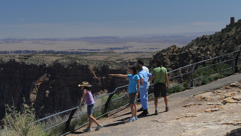
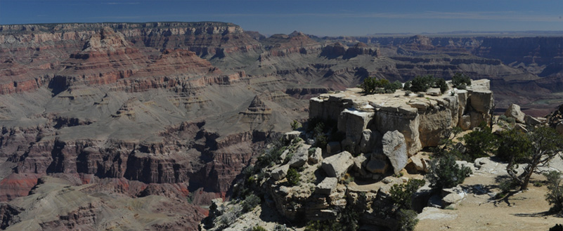
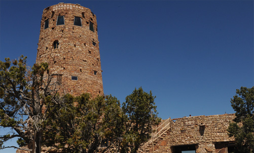
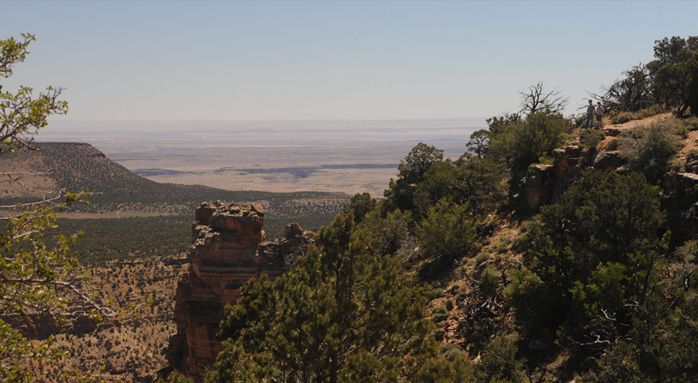
At this slightly higher lookout, we can look down into the Canyon, as shown below, and also out across the desert and see more off this big crack that stretched away from us into the desert. Note the observation tower in the right of the picture - that is where we are headed next.
 |
 |
 |
We reached the Desert View visitor center and explored the watchtower. |
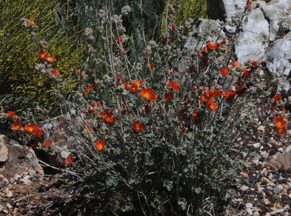 |
There were more of the extraordinary orange flowers here. There was another variety of striped lizard, but he had a very short tail compared to the extremely long tail of the lizard on the Bright Angel Trail. 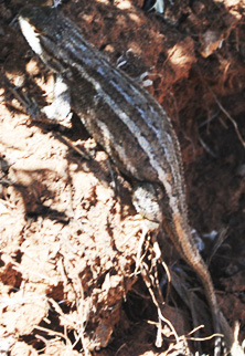 |

Here we take a final view of the Colorado River and the Canyon before heading out into the desert.
 | Here we take a view out northeast into the desert and across two canyons in the distance. One of them is the Colorado River canyon, and the other peels off to the southwest and we will encounter it again just a few miles down the road. |
As you can see by the continuation of the strange flat-topped hump, this is a continuation of the view above. In this one you look eastward across 50+ miles of desert but across only one canyon, the strange branch that peels off the main canyon. |
 |
| Into the Desert and to Marble Canyon |
2011