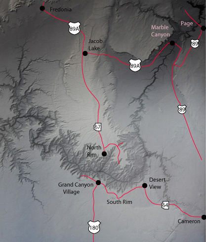
South Rim, Grand Canyon
May 25, 2011
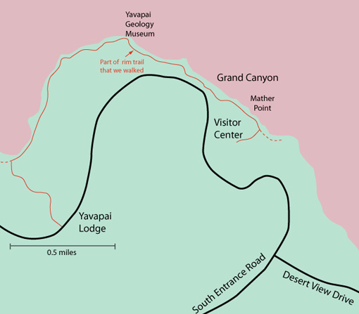 |
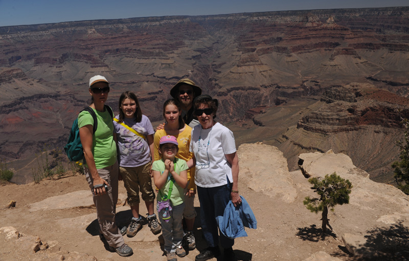
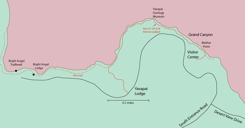
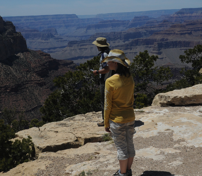
The above photo of the family was taken near Mather Point. There were many places nearby on the rim trail where you could get wide views of Grand Canyon. We had left Williams early to get to the South Rim for sunrise, and then had hiked the Kaibab Trail. Now in the early afternoon we are exploring the rim trail. Having taken the Shuttle back from the Kaibab Trailhead to the Visitor Center, we now walk out on the rim trail from there and walk the indicated section to the Yavapai Lodge where we caught the shuttle back to the Visitor Center. Once we got used to the shuttle, it worked very well for us. We walked a total of about two miles on the rim trail and included a stop at the Yavapai Geology Museum. |
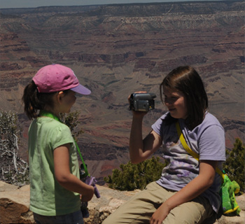 We relaxed for a while on the rim trail in the Mather Point area to recover from the Kaibab hike. Jordan and Elyse tried some videos. |
 |
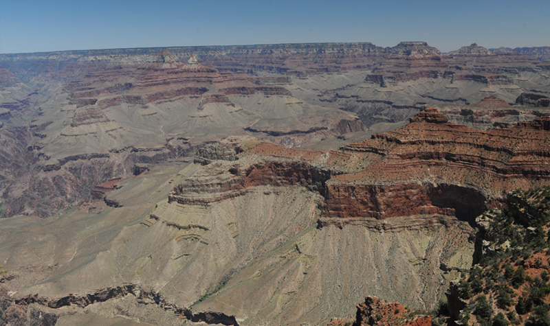
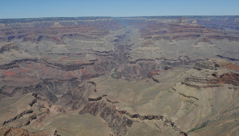
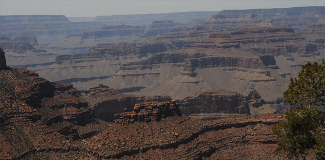
There are many classic views of the Grand Canyon from this area.
 |
In this not-so-classic view I am looking almost straight down into the Canyon. It is about 12:40 so the sun is almost straight down. The view is directly down on one of the high jagged red peaks. |
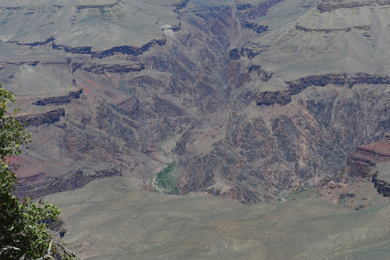
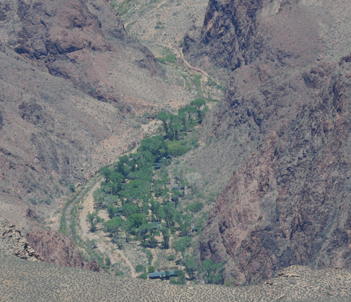
The above wide shot, although not so colorful, shows the course of the Colorado River far below us. It is most clearly seen near the clump of green trees. Zooming in, you can see the buildings of Phantom Ranch. Phantom Ranch actually offers overnight accommodations, but you can only reach it by foot, mule or river boat. We talked to some hikers who had stayed there the previous night and they said it was about 95F with no air conditioning, and that was on a day when it got down to freezing on the rim. |
 |
|
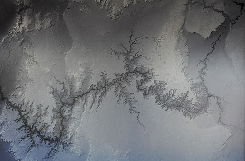
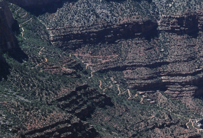
We headed out to walk around the absolutely spectacular rim trail and stopped off at the Yavapai Geology Museum. The thing that impressed me the most was this detailed satellite photo of the Grand Canyon complex. It extends all the way up to the Glen Canyon Dam and Lake Powell. It's a dramatic demonstration of dendritic drainage patterns in the formation of all the branches to the Canyon. At right is an attempt to superimpose the highways we have traveled onto the satellite image. |
 |
In another broad view of the Canyon from the Museum, we could see on the left the Bright Angel Trail going across the flat mesa. It must be a really steep downward trek from there because I believe you can see the Colorado River in the bottom of the V of the canyon below it. This view is from the Museum, so you can see from the perspective given in the map below that the part of the trail we are seeing is a long way from the Bright Angel Trailhead.
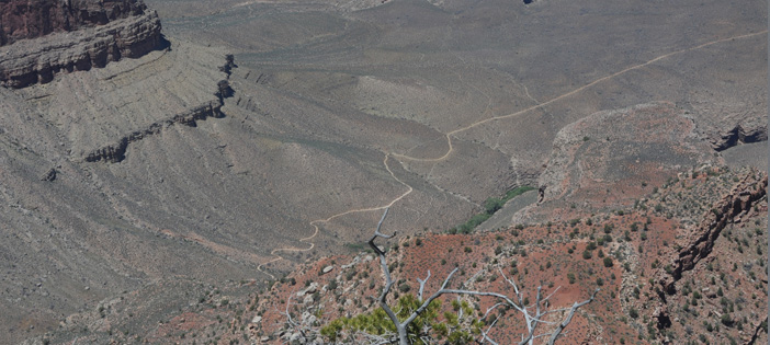 |
Swinging our view further toward the west, we can now see a long stretch of the Bright Angel Trail. |
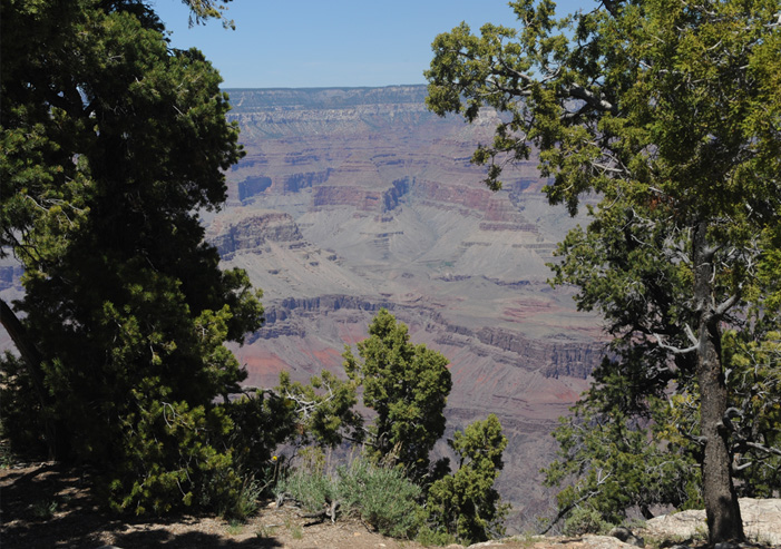
About a 20 minute walk from the Museum we got this view of the Canyon through the trees. The rim trail really gives you a lot of great views of the Canyon. |
 |
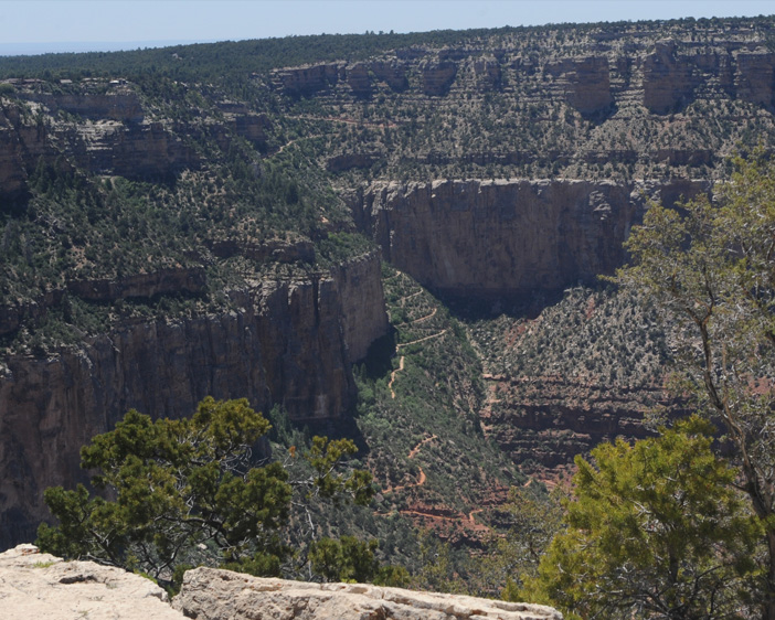 |
Now after just a few minutes more on the trail, we see the switchbacks of the Bright Angel Trail leading down from its Trailhead location on the rim. |
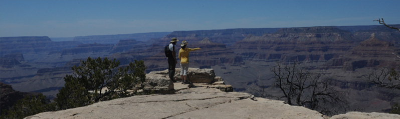
Jeff and Ashleigh explore a large flat rock ledge that gives them unobstructed views of the Canyon all around. 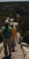 We continued on around the excellent trail right on the Canyon's edge. |
 |
 |
Just before turning back toward the Yavapai Lodge we got this view of the extraordinary switchbacks near the top of the Bright Angel Trail.  |
 |
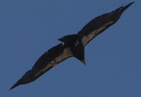 |
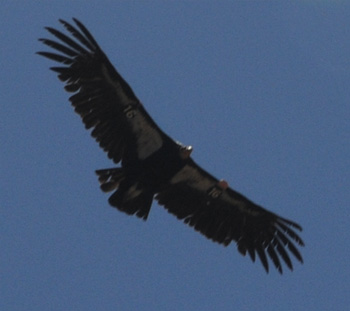
We saw this California condor making circles over the edge of the Canyon. We could even read his number! The following day Brenda attended an information session on the condors and was told that there were 392 in existence after dwindling to a population near 20, on the brink of extinction.
 |
We took one last look at the Grand Canyon for today and turned onto the trail to Yavapai Lodge. There we took the shuttle to the visitor center where the car was parked and headed back south toward Williams. It was about 2pm when we left, but we had been up since 3am, so we had had a full day of exploration. |
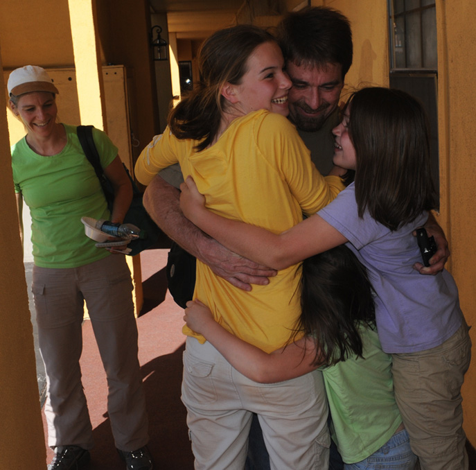
Brenda had surreptitiously been keeping track of Mark on the way back to Williams from the Grand Canyon since he was enroute from Phoenix and we wanted it to be a surprise. She gave him directions on how to find us in Williams, which was not trivial because of weird street naming. But Mark managed to find the motel, and we had a joyful reunion in front of our rooms on the main street of Williams, Arizona. |
 |
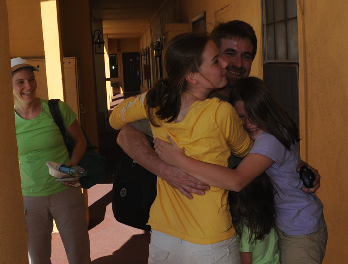 |
Uncle Mark managed to survive the joyous greeting of the girls, and we were all delighted that it had worked out that he could join us. The joy of the surprise was reminiscent of our meeting in Missoula, Montana two years ago for the Canada trip. |
Elyse gets to greet Uncle Mark and we are all talking at once as we celebrate the occasion of once again having the privilege of having the whole family together on a trip. |
 |
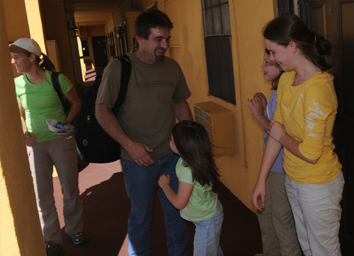 |
Mark had probably worked 40 hours or more during the last three days to finish a welding project on a steel spiral staircase so he could get loose to come. We had kept things from the girls to avoid disappointing them if it didn't work out. But now it was beautiful to see the joy of greeting and we praised the Lord that things had come together. |
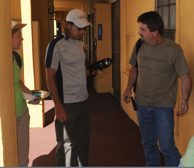
Now that we have gotten together with Mark, we have to feed him and everyone else. Jeff had researched the Red Raven Restaurant in Williams, which was within walking distance. We all walked down the street and had a very fine meal and celebration together. In the past couple of days, we have seen a lot of beautiful things in the great outdoors of Arizona. But nothing as beautiful as what I had just witnessed. |
 |
| Bright Angel Trail |
2011