Kings Canyon, California
September 16-17, 1994
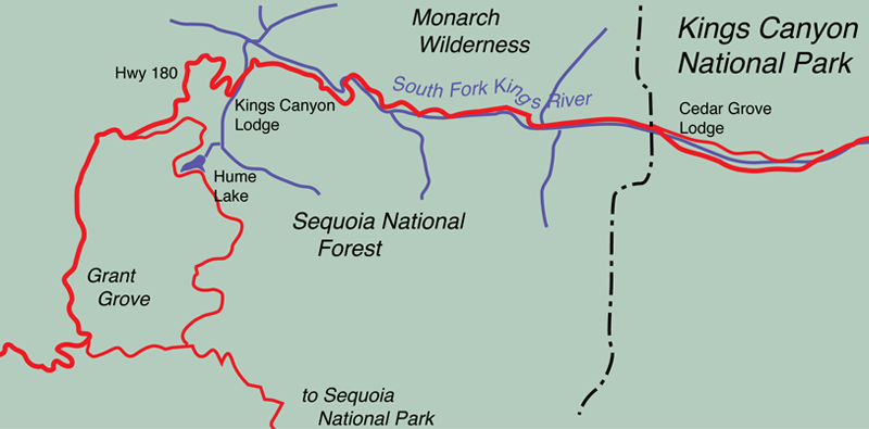
After our exploration of Yosemite Valley, the Mariposa Grove, and Sequoia National Park, we drove down into Kings Canyon and spent the night at the Cedar Grove Hotel.  | 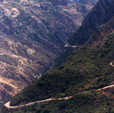 |
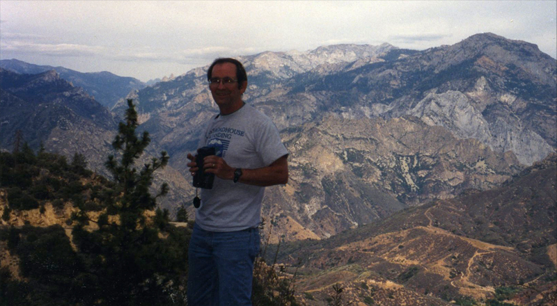
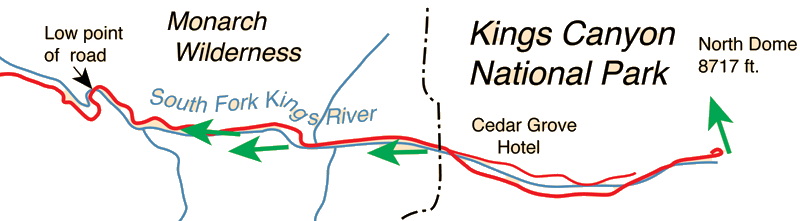
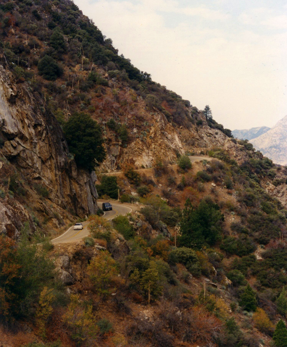
The left arrow indicates the viewpoint for the photo above. 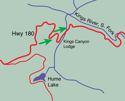 The right arrow indicates the viewpoint for the photo at right. This is a few miles beyond Grant Grove, and we had reached a point where we could see the road descending into the valley in the distance. The valley is fairly dry at this time of year and you can see a lot of bare rock. The most impressive thing about it is the large scale of things. You can see the road snaking around the edge of the mountain in the distance. | 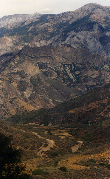 |
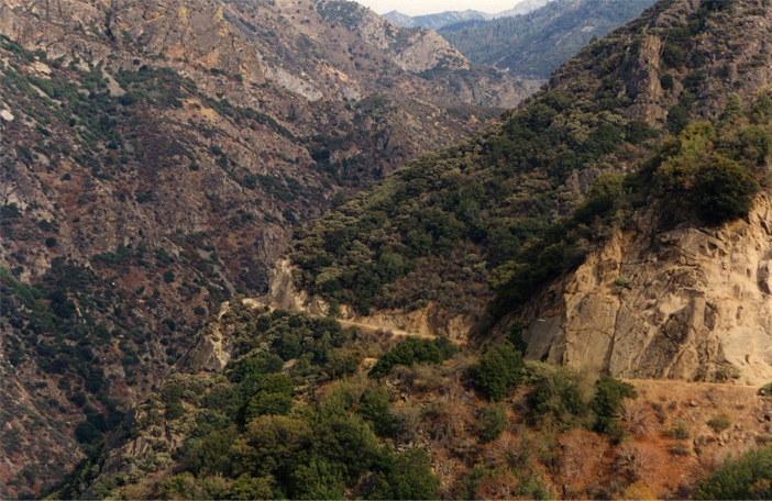
Looking far below us from a viewpoint near those indicated by the green arrows on the map above, we could see the house shown above. Across from it was the Kings Canyon Lodge. We could also see the road cut out of the side of the mountain beyond the house as shown at right. | 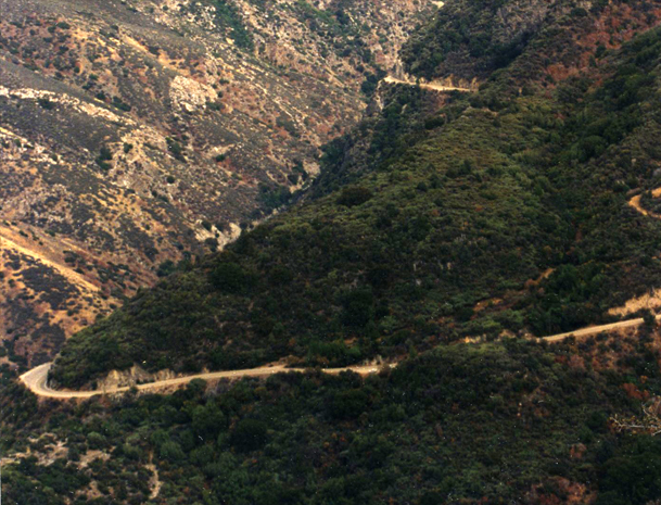 |
 | This is the road as we proceeded along the route shown above. There is a steep drop to the canyon floor below the road. |
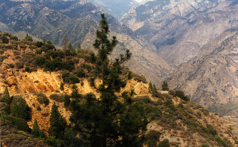
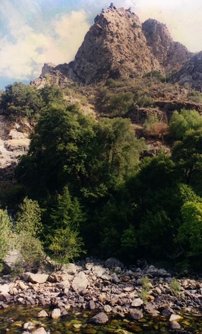
 | In the view below, the tiny distant road cut gives some perspective about the height and ruggedness of these mountains. These mountains rise over 8000 feet. 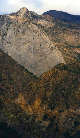 September 17After spending the night at the Cedar Grove Lodge, Rod is out early photographing South Fork Kings River which flows right by it. |
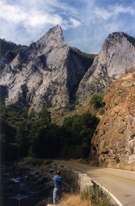
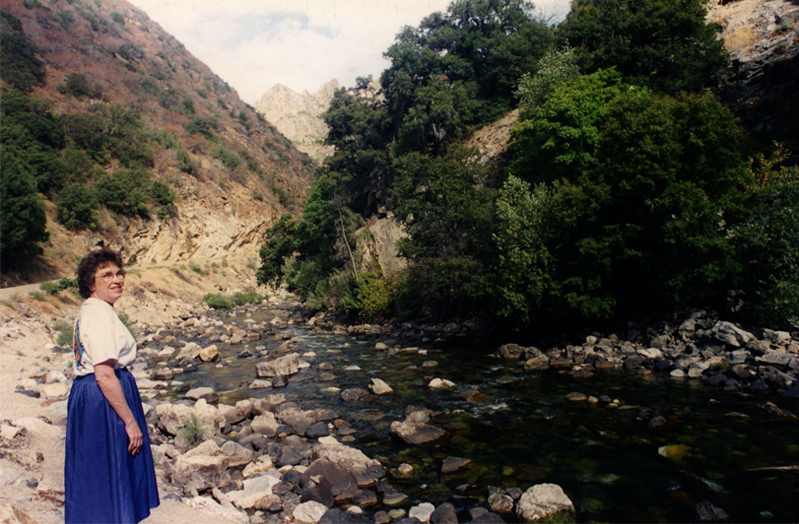
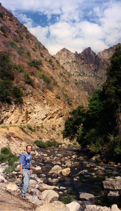
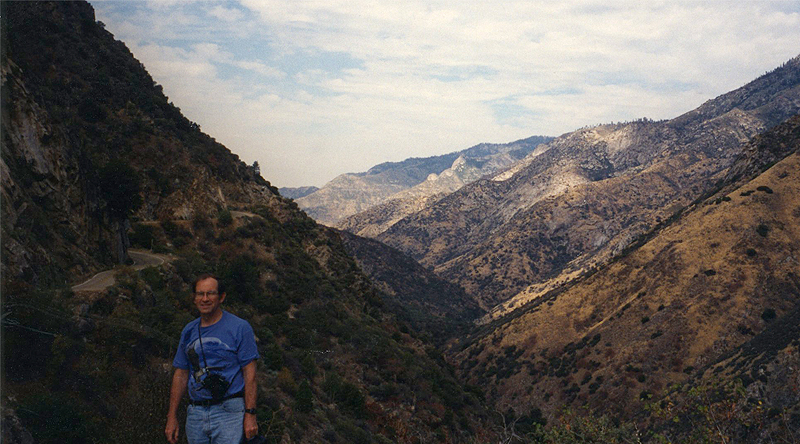
Above, Rod is looking westward along the South Fork Kings River. The river is dropping fairly rapidly at this point and the rocky spires soar thousands of feet above us. The view below is toward North Dome from the end of the road past Cedar Grove. At right is the more gental flow of the river near Cedar Grove. 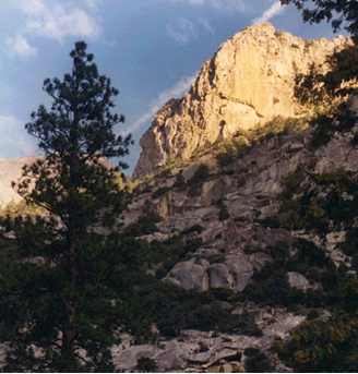 It was interesting to note the range of vegetation in the valley due to the extremes of altitude. It was fairly lush and green near the river, turned to golden grass and chaparral at mid heights, and was desert-like at the tops. | 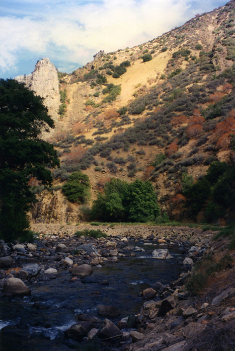 |
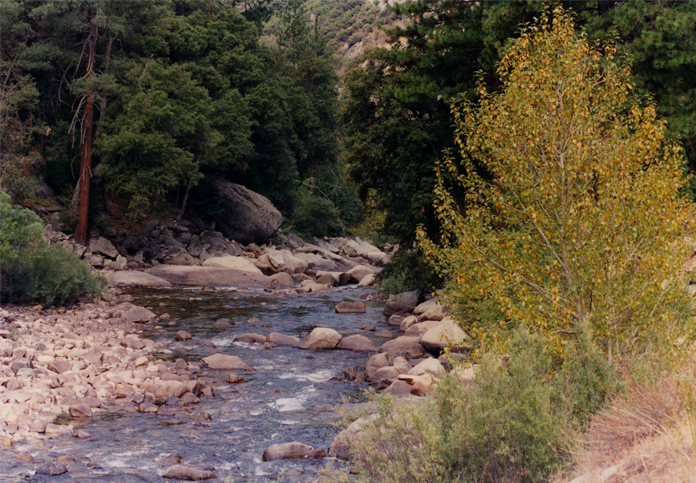 | The South Fork Kings River near the Cedar Grove Hotel |
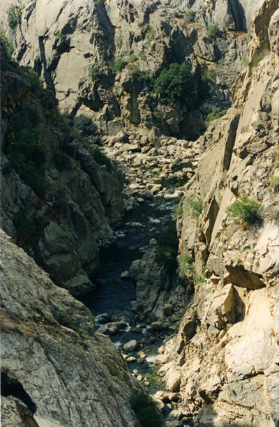
This is the South Fork of the Kings River at the low point of the road where it bridged the river. At this location there was the entrance to Crystal Cave. The river continued to drop while the road started back up. 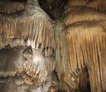 Crystal Cave has remarkable formations, but we didn't have time to visit it on this trip. Below are more views along the South Fork Kings River. The one below right covers an extreme altitude range, much more than it appears. It was taken with a 24mm wide angle lens. The mountain top seemed to rise almost vertically above you when you were standing on the edge of the river. | 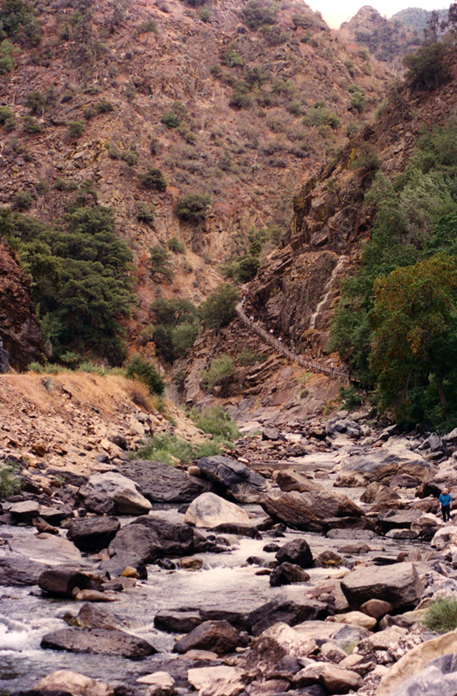 |
 |  |
Brenda is sitting on the edge of a several hundred foot drop to the river below us. The road has climbed sharply from the low point shown in pictures above, while the river has dropped even more sharply.  Brenda is pointing across the canyon to the cut of the road far above us that we will be traveling as we climb further. |  |
From Brenda's perch on the wall, you can see the river far below in the canyon and the road cut far above, cut into the side of the canyon wall. 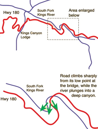 | 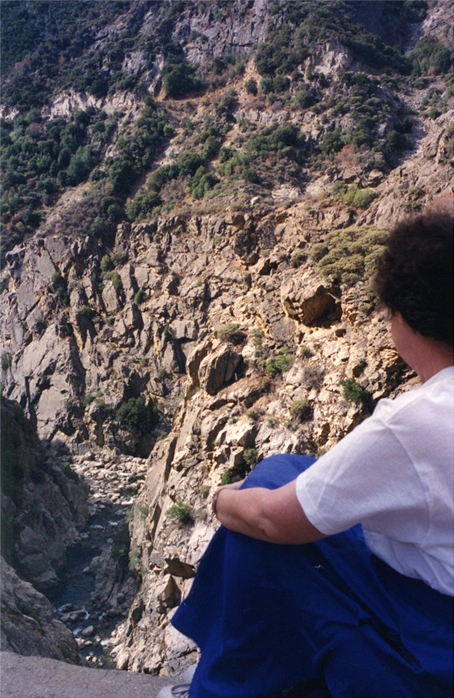 |
 |  |
This was the most dramatic point of the drive in terms of the steepness of the mountains. The above two pictures give something of the feeling of the setting. You could look ahead to the steep winding road going up and the steep rock above, and then just to the right down into the deep gorge where the river now was tumbling. The picture at right above was taken from the rock wall, so we were just in a tiny cut in an almost vertical rock wall.
 | We have now reached the road on the opposite side of the canyon, the road to which Brenda is pointing in the images on the wall above. The road circles round the end of the canyon and keeps climbing. In the view below, Rod is standing on the edge of the road with the canyon to the right of the road picture at left. |
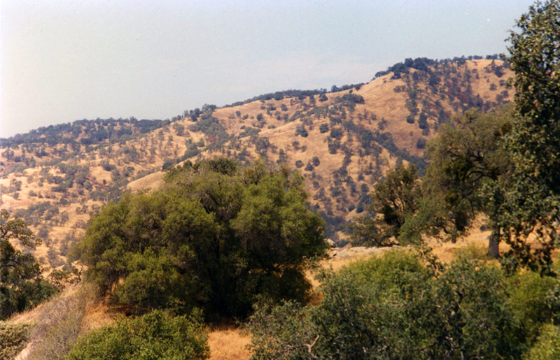
 | Rod takes a final video survey of Kings Canyon as we reach the high part of the road. We then headed out toward Fresno again, passing through the hills covered with golden grass and chaparral. With a great tour of the San Francisco area, Yosemite and Sequoia as well as this drive down into Kings Canyon, we felt very blessed to have seen some of God's great art work. We had visited the Kings Canyon area on the 1982 trip and Mark and Rod had come through Fresno in 1989 on the way to their Summit Adventure camping trip. Now it was time to catch a plane back to Atlanta. |
Leaving Kings Canyon and Sequoia National Park, we drove to Fresno and then northward to stage for a flight out of San Francisco on September 18. We spent the night in Tracy, just east of the San Francisco/Oakland area to get reasonable motel rates and then flew to Atlanta the next day.
| Visiting Mark on Andersonville set |
1994