Whistlers Mountain
July 25 , 2008
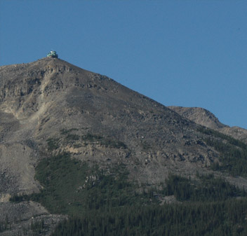 |
This was our first full day in Jasper, and we got up at 5am to a beautiful sunlit morning. It is light until about 10pm and must get light about 4am. If you step out on the main street in Jasper, you can see the lift station at 7470 feet up on Whistlers Mountain, and that is where we were headed this morning. After a nice breakfast at the Whistler Inn, we drove a short distance south to the cable car lift on Whistlers Mountain and took it to the top. 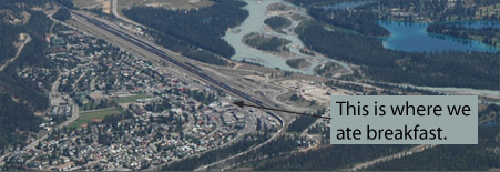 |
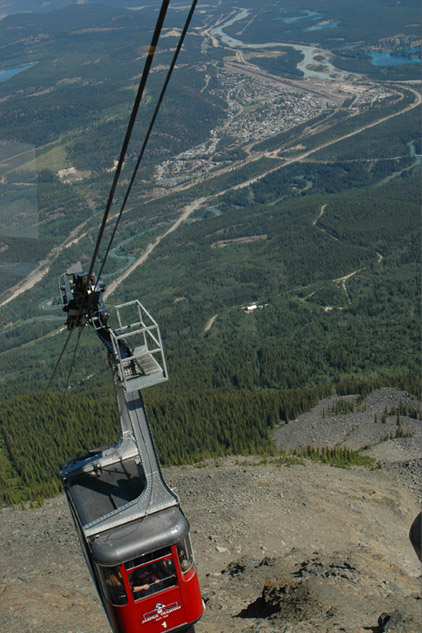
We had good views down on Jasper from the Jasper Tramway and the surrounding rivers and lakes from the lift and of course even better views from the top on this beautiful morning.The lower station is at 4280 ft and the upper at 7470 ft for a rise of almost 3200 ft (973 m is the official height). Jasper is a small town with about 5000 permanent residents, but we were told that it swelled to about 25000 in the peak of the tourist season. It's not hard to see why people would want to come here. It is nestled in a little corner formed by the rivers in this wide valley surrounded by beautiful mountains. The differences in the water colors strikes you immediately. To the northeast of town the light blue river is the Athabasca, a large rapidly-flowing river carrying lots of glacial silt to give it the color. To the south and west of town is the brighter green Miette River. It flows more slowly and some of the silt can settle out. Then there are the dramatic blue lakes scattered around Jasper that are stationary enough for much of the silt to settle out. They are clear and beautiful. The blue lakes to the right (northeast) of Jasper are Lake Edith, Lake Annette and Lake Beauvert. |
 |
 |
 |
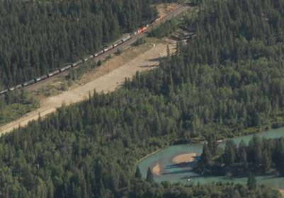
It was interesting to watch a long train snaking into Jasper as we were going up. We were amazed to see the amount of train traffic on this rail corridor through Jasper. It makes sense since there are probably just two rail corridors through the Canada Rockies. At right above you can see one of the bends in the Miette River - I loved its green color. The tight bends tell you that it is a slow-moving river, and can therefore settle out more of the glacial silt to give it the brighter color. The Athabasca is fast moving and more nearly straight, and it retains the milky white color of the silt-laden glacial river. Everything goes through this valley, the railroad on the left, the new pipeline as indicated by the bare dirt, the river and the highway. We saw a lot of the construction of this new major pipeline on our rail trip .
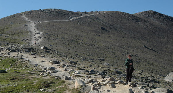 |
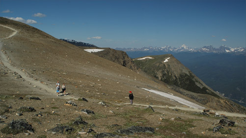
From the top of the lift there was a network of trails leading up to higher altitudes. You could certainly feel the altitude, but we started the climb up toward the Whistler summit. There were wonderful views on all sides and a surprisingly rich collection of wildflowers. We were at the top about 9:30am on about the third trip up, so there weren't many people on the trails with us. |
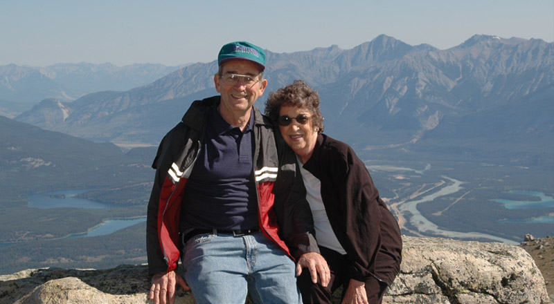
Brenda and Rod on the edge overlooking Jasper just above the top station of the Jasper Tramway. Rod had a water bottle, but the rest of his backpack was just camera gear. 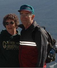 |
 |
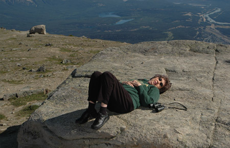 |
There were lots of flat rocks to rest on Brenda has a view of Jasper and of Lake Patricia and Pyramid Lake above Jasper. 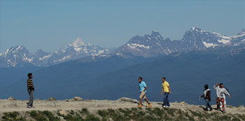 She also had views to the west of Mt. Robson (the sharp white peak) and Mt. Bridgland to its right. |
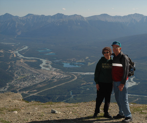
Rod and Brenda pretty well block the view of Jasper below, but on the left you can see Pyramid Lake and Lake Patricia. On the right are the Athabasca River and the horseshoe shape of Lake Edith.
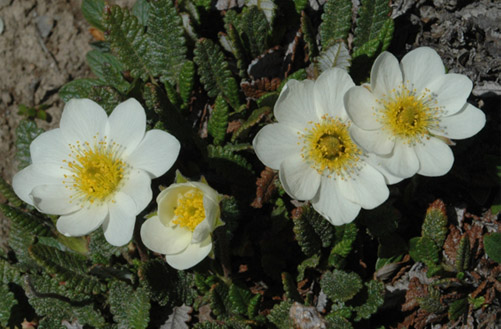 |
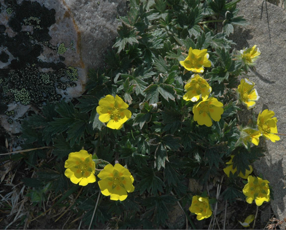
There were lots beautiful bouquets of wildflowers. An interesting low moss had blooms about 1/4 inch across. 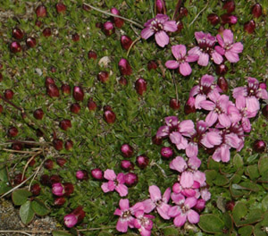 |
 |
As we climbed higher on the trail, we got different perspectives of Jasper and the valley. We are now well above the top lift station.  |
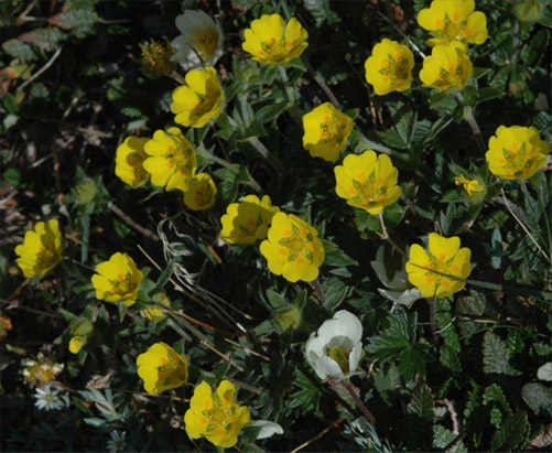 |
The flowers were surprisingly brilliant and healthy looking. 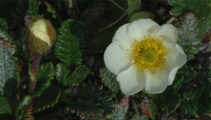  |
 | This was the last stretch of trail leading to the highest point we reached. What an incredible day with such clear air! Below is the continuation of the trail downward and the mountains to the east. 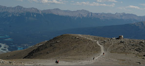 |
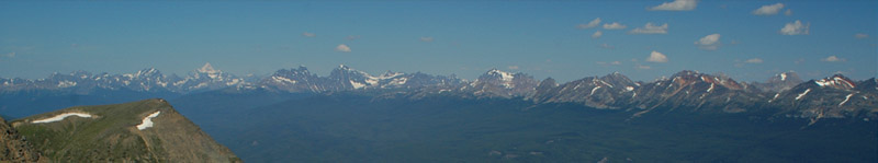
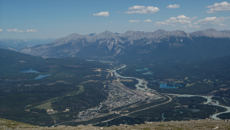
This is a view from the highest point we reached on Whistlers Mountan, looking westward and centered on sharp-pointed Mt. Robson. The mountain to the right of Mt. Robson with the three peaks is Mt. Bridgland. The area of Mt. Robson was to be the our destination on a rail trip on July 27, but it rained that day so this was the best view we got of the mountain. Below is the view back toward Jasper. | 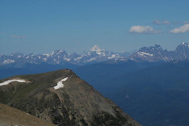 |
 | We walked to the southern edge of the summit region to see the mountains to the south and southwest. There were lots of nice wildflower settings in the rocks.  |
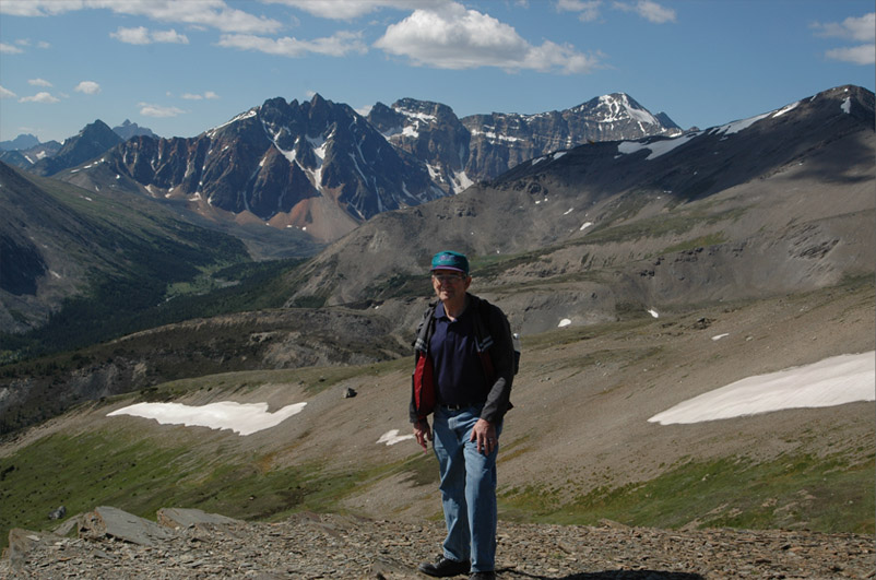
Rod with a background of the mountains to the west-southwest.
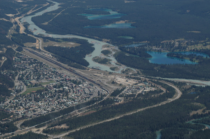
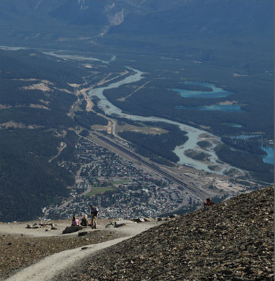
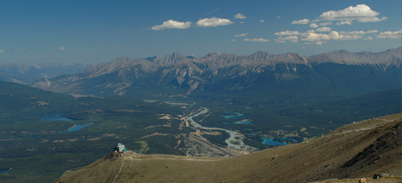
We started back down the trail toward the top lift station and for last views of Jasper from this height, we went as far out as we could on the northeast edge of the summit area. You can see the light bluegreen of the Athabasca River as it flows by the town and in contrast the vivid blue of the lakes to the east of town. There are five of them, the larger three from the top are Lake Edith, Lake Annette and Lake Beauvert. At the very bottom right you can see the greener color of the Miette River. There are three sections of trains on the Jasper sidings, and a long train is entering the town from the west, a very common sight here. At the extreme upper left of the picture, you can see a bridge crossing the Athabasca River. This is the Maligne Lake Road, and we followed it this afternoon on the way to Maligne Canyon and on to Maligne Lake. The main road along the Athabasca River is Hwy 16 and we had followed it as we came into Jasper two days ago, and we followed it back north on the way to Miette Hot Springs later.

A more detailed view of the color contrast between the glacial-silt-laden Athabasca River and the blue Lake Edith, Lake Annette and Lake Beauvert.

I was fascinated by the structure of the fast glacial rivers. As the Athabasca River approaches Jasper from the south, it divides into a number of watercourses. The darker green Miette River joins it and they flow out to the left, northward toward the Arctic Ocean. Jasper is just to the left of this picture.
One more wide view of the beauty of the Jasper area before we head down the lift. This view is wide enough to include Pyramid Lake and Lake Patricia on the left.
We explored most of the morning and came down the lift around noon to find the base station covered up with people. We were glad we started early because we stepped right on a cable car when we got there right at 9am.
| To drive on Maligne Lake Road |
2008