Capitol Reef National Park
November 2, 2016
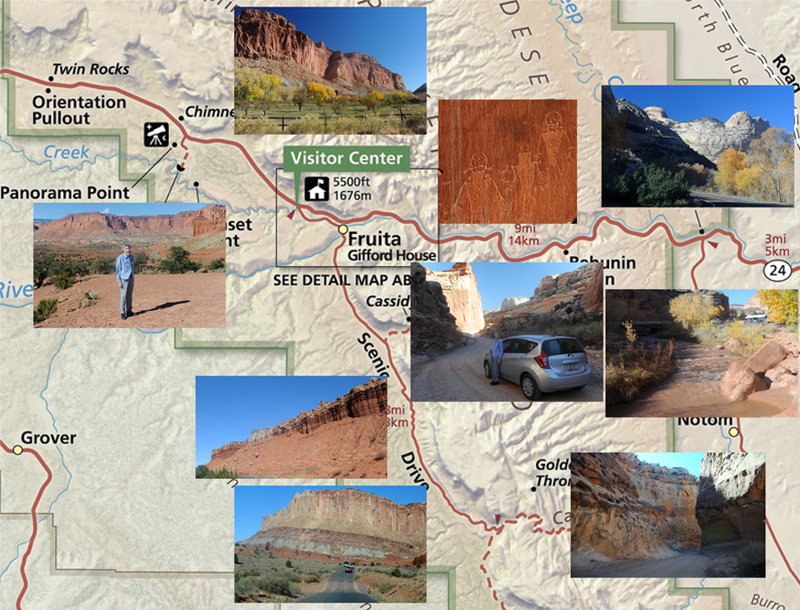
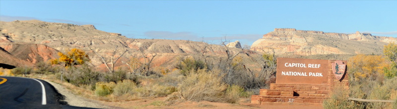
After having explored Canyonlands National Park until late in the afternoon, we left early on Wednesday, November 2 to drive to Capitol Reef National Park. We left Moab at 6:30 and drove to Green River, Utah and had breakfast at the very nice West Winds Restaurant. We then drove down Utah Hwy 24, reaching Capitol Reef National Park about noon.
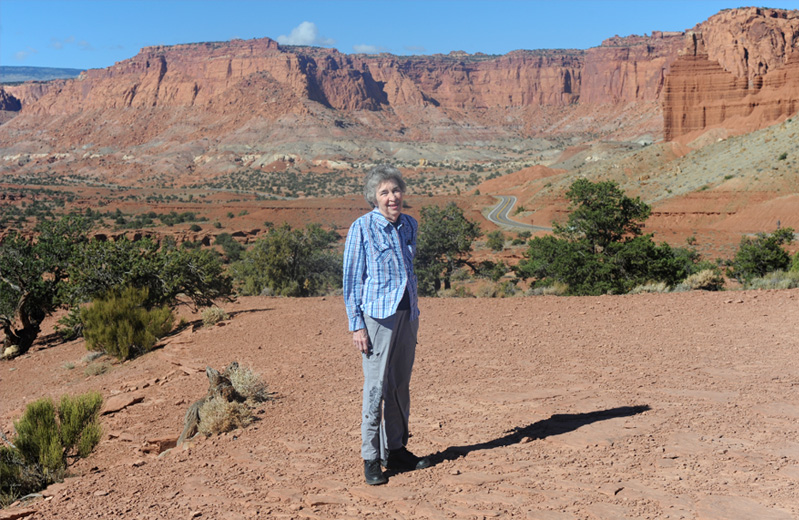
Brenda is at Panorama Point near the western edge of Capitol Reef National Park. Our earlier exploration of the park is detailed below, but this was my favorite picture of the afternoon. The vast open spaces and beautiful colors were exhilirating, and I was delighted to be there with Brenda.

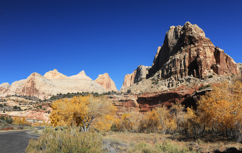
Having driven down Utah Hwy 24 from I-70, we now approached Capitol Reef from the east. It was nice to see the color of the formations accented by the fall color of the trees.
 |  |
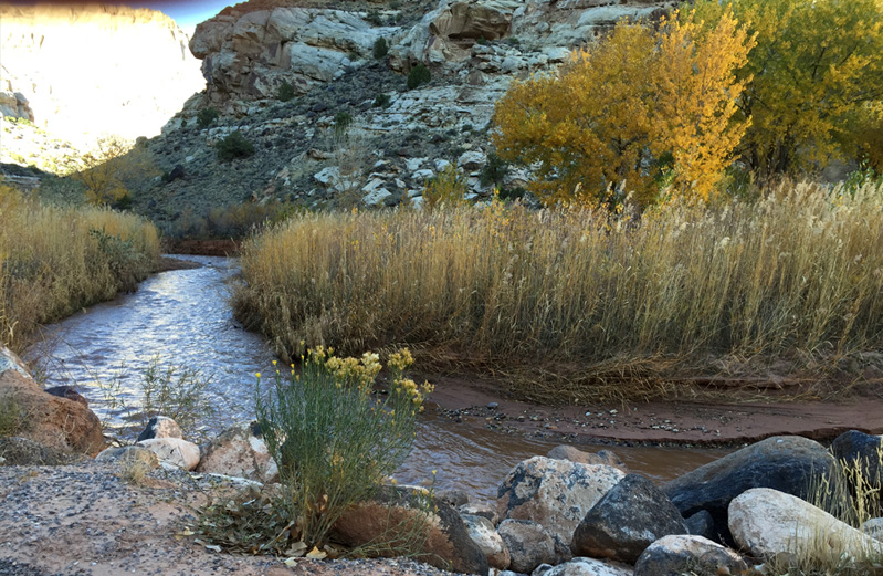
Definitely my favorite shot of the little Fremont River came from Brenda's phone.
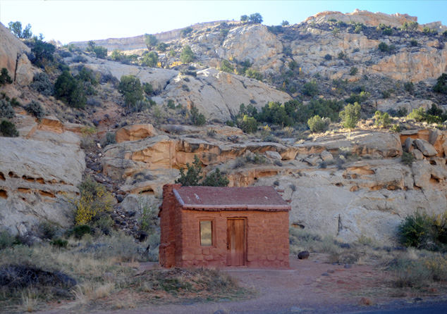 | We reached the park entrance about 12:15pm and reached the Behunian Cabin about five minutes later. The cabin was built to house Elijah Cutler Behunin's family in 1883-84. The Behunins lived there for only a year, leaving for Fruita after a flood threatened the house and its fields. In response to a question, a national park document says "The whole family (13 children) didn't sleep inside the house. The older children slept outside; the girls slept in a wagon box in the yard and the boys slept up in a rock alcove." |

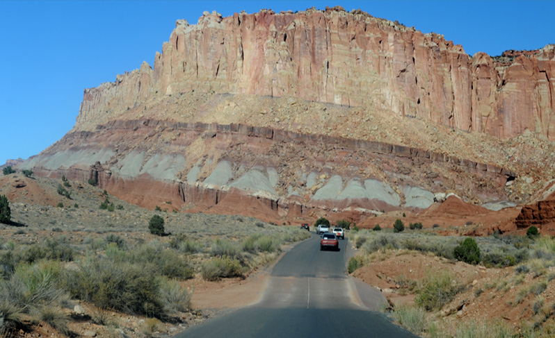
About 20 minutes into the park we started seeing these light colored rock domes which contribute part of the Capitol Reef name - they were thought to look like capitol domes. The "reef" part we saw later.
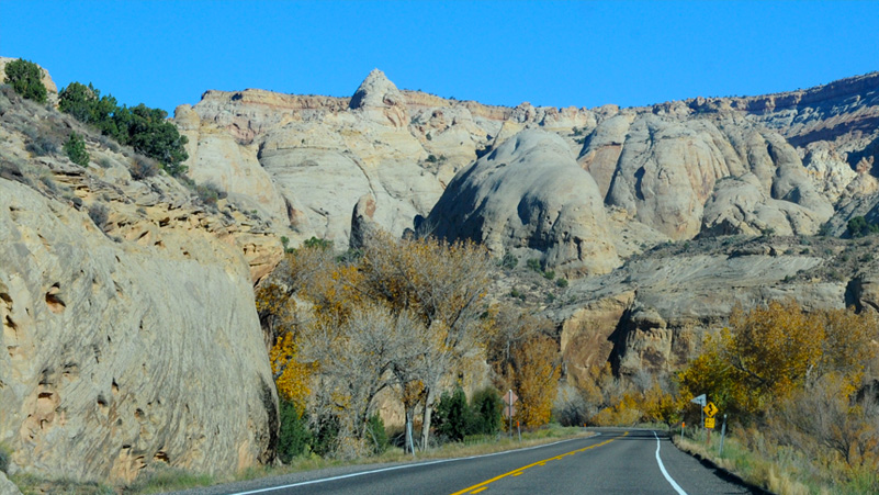
There was quite a variety in the dome structures. Some of them had small domes on top of large ones, which probably was taken as more like capitol domes. The material of the domes is called Navajo sandstone.
There were a lot of the domes here in the eastern part of the park on Hwy 24, but we didn't see them in the other parts of the park we visited.
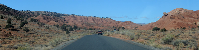
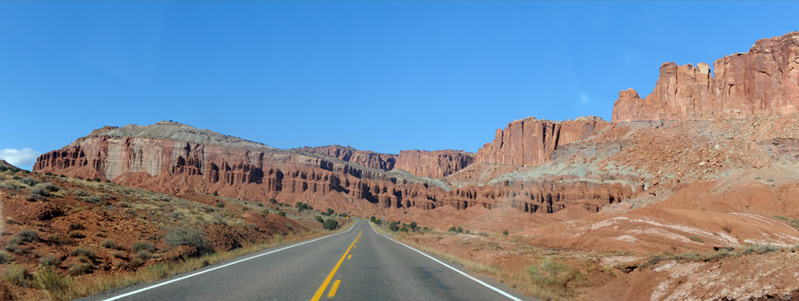
As we traveled westward on Hwy 24, the white domes gave way to high walls of red rock which is described as dark red Moenkopi siltstone and mudstone.
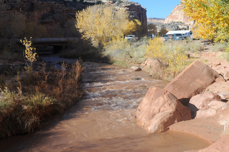
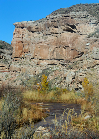
We stopped off at the trailhead to Hickman Bridge formation, but didn't have time to consider the hike. My main interest here was for a close view of the Fremont River. In Georgia we would call this a creek, but you have to remember that this is a desert with about 7 inches of precipitation a year, including snow. So here, it is a river.
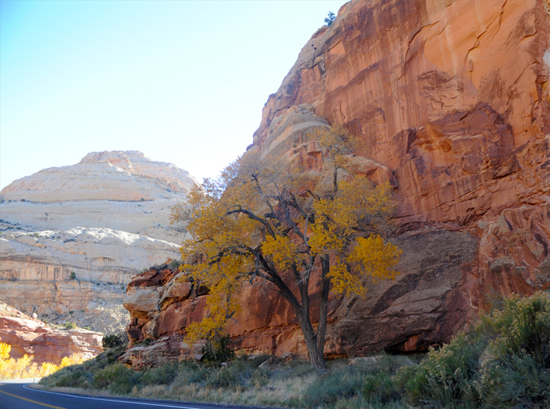
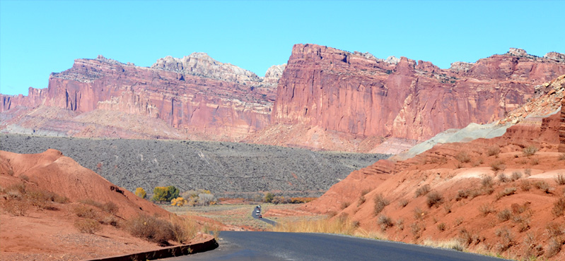
We proceeded alongside the red walls to Fruita, which is the center and headquarters of the park and the location of the original settlement in the 1880s.

We hadn't seen much in the way of fall colors so far on our trip, but these trees up beside the red stone wall made a colorful scene.
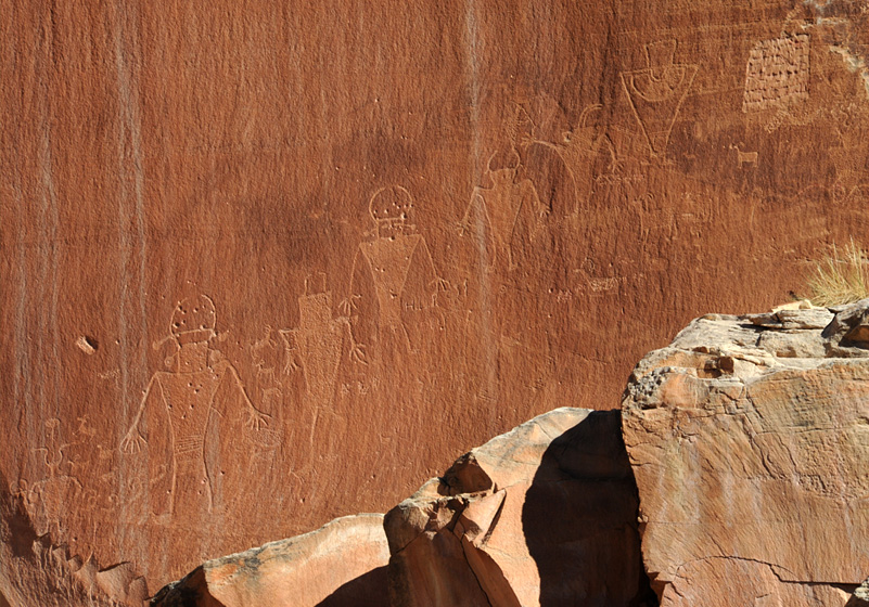
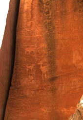
In the edge of Fruita we stopped at the walls where there were a number of petroglyphs. I was thinking, those are fairly straightforward carvings, but why the peck marks? And then I felt really dumb, because it is obvious that someone used them for target practice before they were protected. It is a strong argument for national parks to protect such artifacts.
 | A second group of petroglyphs was not so well defined, but then they didn't have as smooth a rock tablet. The park information says the figures were carved by the Fremont Culture Indians some 700 to 1000 years ago. "The Fremont were hunter-gatherers who supplemented their diet by growing corn and squash. They lived in pit houses dug into the ground and covered with a brush roof." |
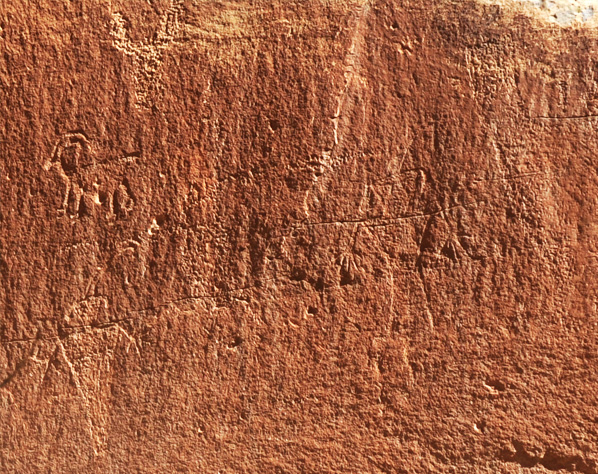
This third group has some indication of body or clothing decoration on the rightmost figure. |  |
 |  |

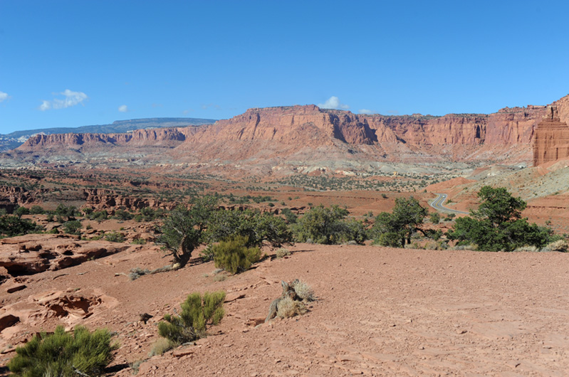
We had read a good bit about the orchards of Fruita, but we were surprised at the number and careful organization of them. We saw one on the way into Fruita from the east, and now saw this impressive example as were headed south on the scenic drive after stopping by the visitor center.
"Mormon pioneers planted the historic Fruita orchards beginning in the 1880s. The orchards are managed to preserve their historic character and are watered with an irrigation system essentially in original condition."
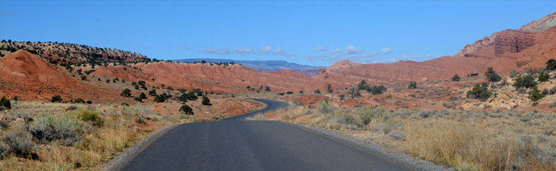
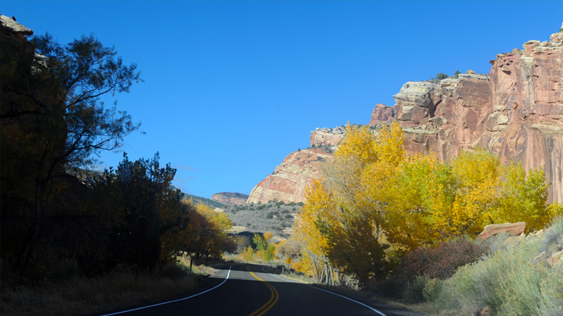
We had no idea what to expect as we turned south onto the internal scenic road in Capitol Reef. It was a beautiful wide open road through the red formations, and we had a fine day on which to explore it.

At places we could see the great ridge to the east of us which forms the "reef" of Capitol Reef.
Soon we came to the Grand Wash road, the first dirt exploration road to the east. It goes into a canyon in the big "reef".
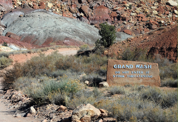 | We hadn't paid much attention to the name "Grand Wash" on the map for this side road, but when we encountered this sign we began to put some things together. It turns out that the whole area is subject to spectacular flash floods. So you don't go there if a storm is threatening. And it makes sense to leave the road dirt - when it washes away in flash flood, you just have to go in and regrade it. They left pronounced dips in the road where there were evident past waterways so that the water could flow without taking so much of the road with it. |
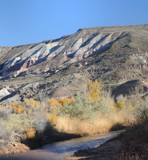
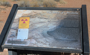 Another surprise was finding a display with a radiation warning on it! It turns out that this thin band of yellowish rock has uranium in it. Efforts to mine it had been made in 1904 when uranium was thought to have medicinal properties. And again in the 1950s efforts were made to mine uranium for nuclear weapons. Ultimately, little uranium was found, but dangerous mine shafts were left. You can see that these two are heavily barricades. | 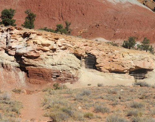 |
This is the larger context of the uranium mining effort. You can see the two barricaded openings near the bottom of the great wall. The thin yellowish band near the bottom is described as the Shinarump Member of the Chinle Formation, a layer of ancient, river deposited sandstone containing trace amounts of uranium. Note that despite the fact that camping or drinking water in the area is forbidden by the sign, the trail out to these barricaded shafts is well worn. It's hard to supress curiosity!

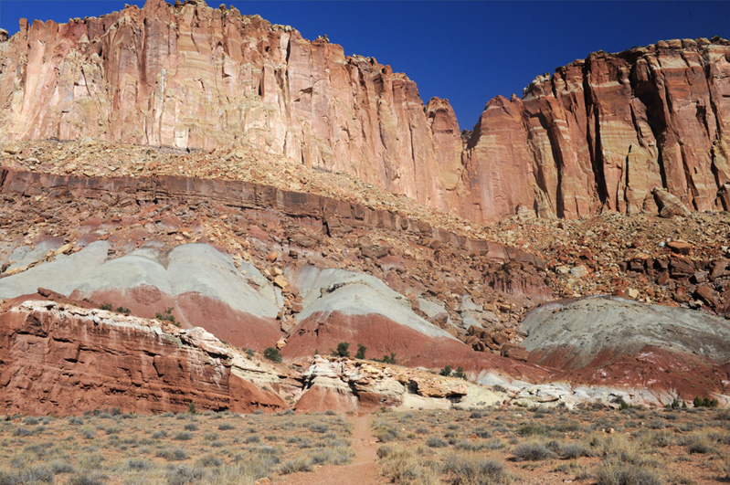
 |  One of the massive canyon walls along this side road. |
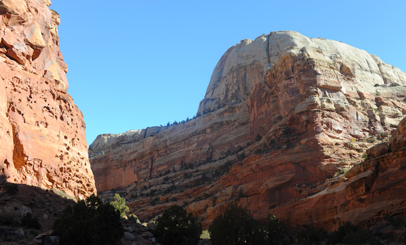
We reached the end of the dirt road where there was the trailhead for trails leading to the Narrows and to Cassidy Arch. There were several people there preparing to hike on the trails that extended past the end of the road. There was a dome here, the first dome we had seen since we left the eastern entrance road to the park.
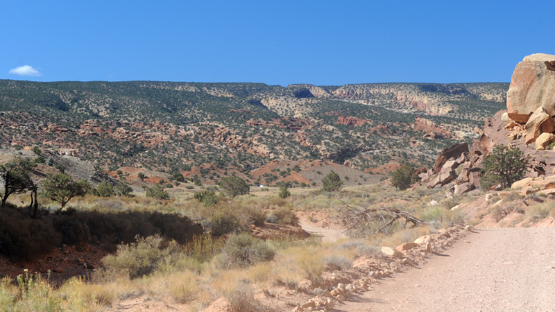
We are now headed back out the dirt road and the perspective is very different. Instead of looking into the canyon, we are looking outward to the open, tree-studded hills.
We now had a greater appreciation of the points where the road took a sharp dip like this where there was evidence of water flow from side to side. They could then just come back in and recontour it after the next "grand wash" from a thunderstorm. | 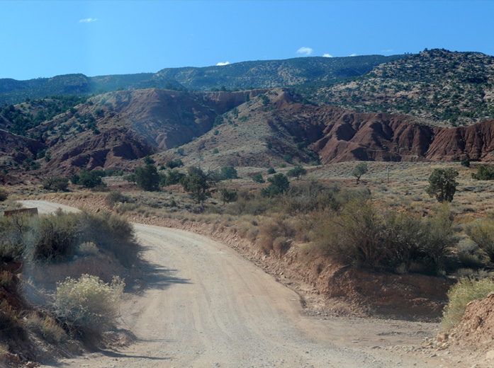 |

This was as close as I could get to finding a single shot to characterize the "reef" that forms a part of the Capitol Reef name. The land reef is a wrinkle in the Earth's surface called the Waterpocket Fold which extends a hundred miles north and south and forms a great barrier to land travel east to west. We traveled through it this morning on Hwy 24 on one of the few roads which penetrate the Waterpocket Fold. That penetration path was associated with the Fremont River.
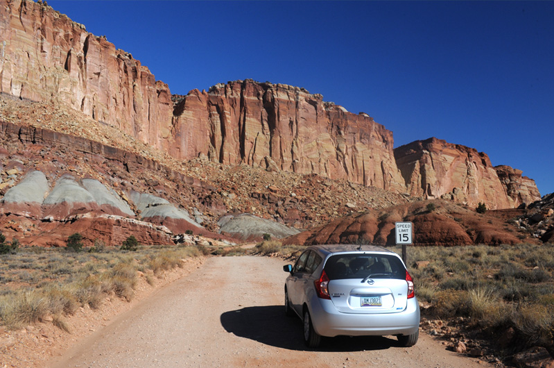
We proceeded to the end of the paved Scenic Drive and continued on the unpaved Capitol Gorge exploration road.
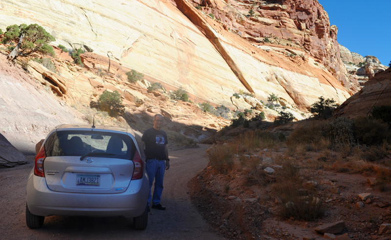
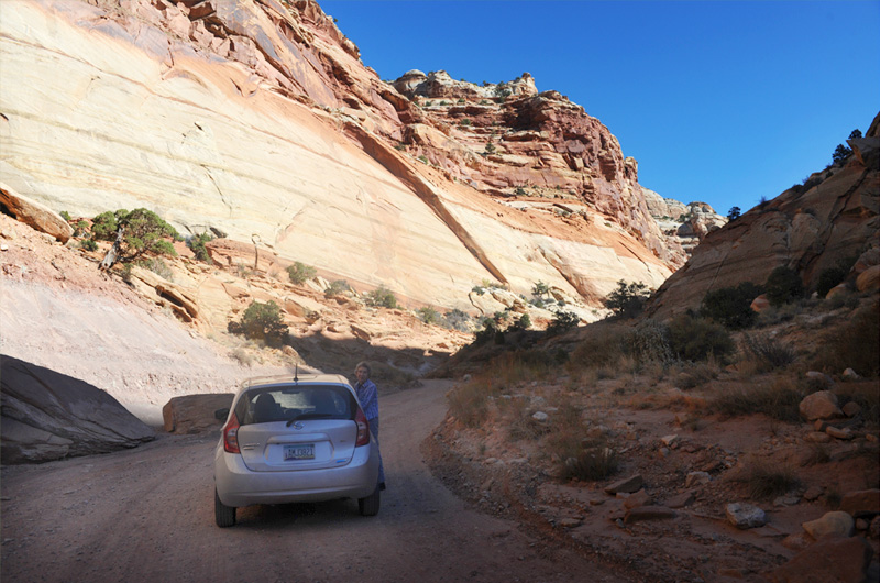
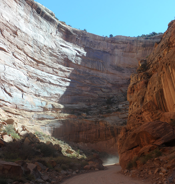 | This road promised to take us deeper into the canyon. A car had passed us when we were stopped, and now we were seeing his dust ahead in the tight bend around between two high rock walls. Things were closing in on us! |
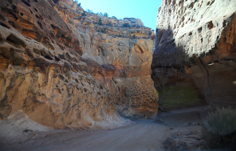
A neat road that took us into the strange world of the inner canyon. The rock looked like swiss cheese at points.
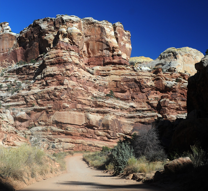
It really was a nice road to travel on deep into the canyon. But it then turned into a track for offroad vehicles and we turned back, very satisfied with our inner canyon drive. As we were driving back to the paved road, a whole column of four-wheel-drive vehicles were behind us. They had been further into the canyon and I guessed that they had camped there and were just coming out.
We are now back on the paved Scenic Road and ahead of us is one of the concreted depressions to handle the frequent flash floods that apparently wash violently across this terrain. Ahead also is the end of the column of four-wheel vehicles. I had pulled over to let them pass since they seemed to be in a hurry.
We enjoyed the beautiful weather and the open road on this trip back toward Fruita.
We headed back northward toward Fruita on the Scenic Road. Note the column of back-country vehicles way ahead of us.
I loved the austere beauty of the desert landscape beside us. I don't know what I expected when I looked at the road as a line on the Utah map, but I was continually surprised by its beauty.
The trees beside the road in the distance signaled the presence of the Fremont River and the fact that we were approaching Fruita. We had enjoyed the scenic drive in a national park which we barely knew existed until a few weeks ago.
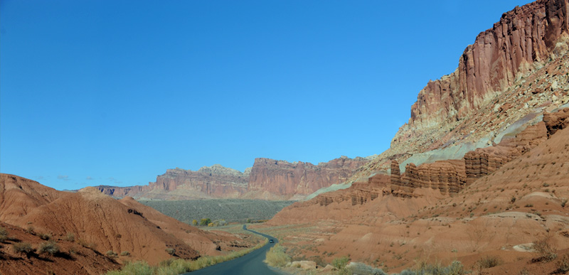
We turned left at Fruita to travel west on Utah 24.
 | Panorama Point near the western edge of Capitol Reef National Park was a truly inspiring open view in every direction. This is the view westward and the road we followed when we left there. |
| Down Utah Highway 12 to Cannonville |
| Kodachrome Basin State Park |
2016