Driving to Gibraltar
June 2, 2017
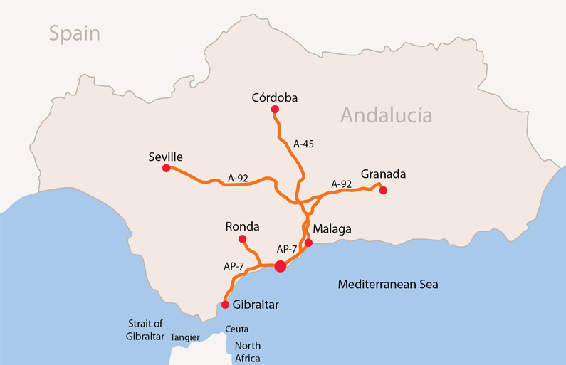
We ate breakfast at the Grangefield Oasis Club and checked out from there. We transferred remaining items to Club Marbella and prepared to drive to Gibraltar. We started out maybe 11:30 but turned to the AP-7 from the A-7 an exit too soon, which locked me into traveling the wrong way, toward Malaga. We had to loop about 20 km to get back traveling the right direction.
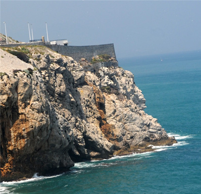
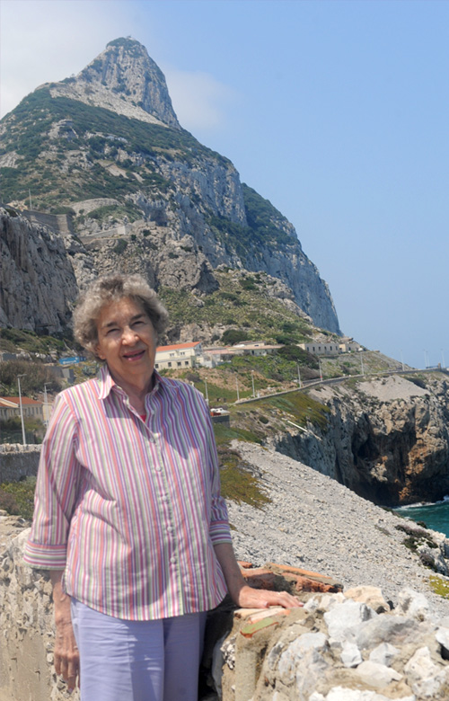 | Brenda on the coast of Gibraltar in view of the Rock. Chris's conversation with the native of Gibraltar at the restaurant described below had gotten us enough instructions to find this place to view the shipping that was anchored off the Rock.  From several miles out on the approach highway, we were getting misty views of the Rock of Gibraltar. 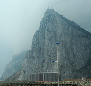 On our drive through La Linea, the Spanish town next to Gibraltar, we had gotten tantalizing glimpses of the Rock of Gibraltar in the mist. |
Using the A-7 as far as we could and then joining the AP-7, we made the drive to Gibraltar. First you come to the rather large city of La Linea, Spain. With Gibraltar in the GPS we more or less wandered through La Linea.
 | 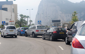 | Having driven through La Linea with some glimpses of the Rock, we thought we were doing well until we encountered the end of this long line of cars. Uh, oh! The line for customs! We could see the Rock, but we were stuck! |
With no way to estimate the time it would take to get through customs, we just had to sit. It took about an hour, and then there was just a cursory look at our passports and a wave to proceed. We would have to admit that we were dumb to just wander up to an international boundary on an afternoon driveabout. But Gibraltar is going to have a hard time building their tourist trade with that kind of slowness, lack of information, lack of helpfulness, and lack of guidance along the way. Hindsight would have sent us to Algeciras instead of Gibraltar. From Algecirus we could have booked a short boat tour without our passports, and could have even gotten across to the Spanish cities of Ceuta and Melilla on the North African coast next to Morocco without crossing an international boundary line. From a boat tour we could have seen the Rock as well as we saw it.
Without benefit of a map or any specific targets to use with the gps, I was more or less wandering blindly about. We had seen a sign pointing to the upper rock and turned that way, but there was no subsequent sign that I saw to further guide us, so I got off track somehow. We wandered a while, and then the road approached this narrow crude tunnel, which looked like a footpath from a distance. So I stopped and asked a guy walking whether you could drive through that tunnel. He spoke English, and said "Oh, yeah!" So we headed on through it and it wasn't as tight as it looked from a distance. There was a second similar one and then a third a bit wider which brought us out to a recreation area on the coast. | 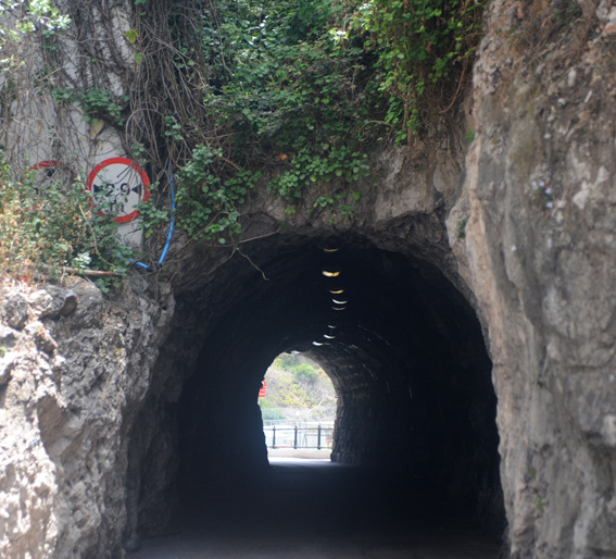 |
After we drove through the three tunnels, we found a beach and playground area where we could see across the Straits of Gibraltar to the north-African coast, where there is the Spanish city of Ceuta carved out on the coast next to Morocco. There were old structures on the cliffs that looked like fortresses of some kind. You can see the opening of the third tunnel that we had come through.
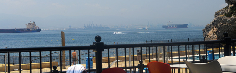
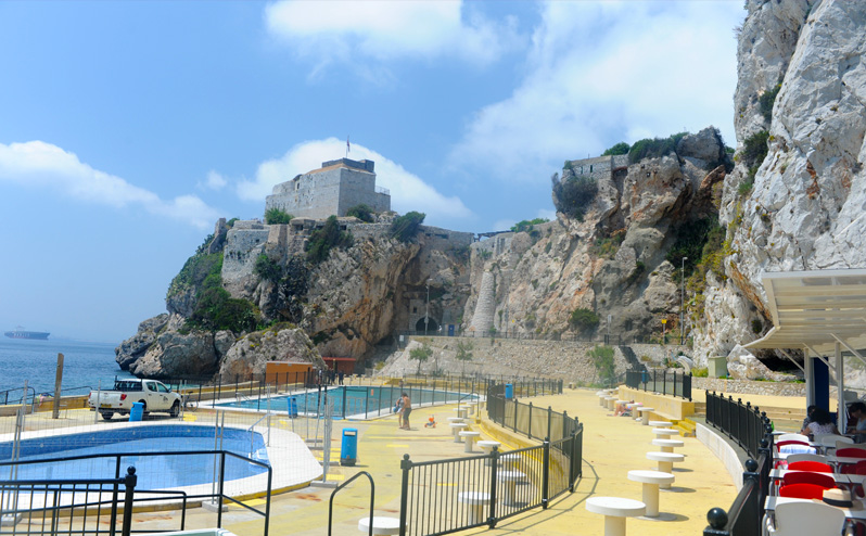
The Strait of Gibraltar was misty, but we could see several large ships moored off the Rock. We had lunch there, looking across the Strait of Gibraltar and watching the shipping.
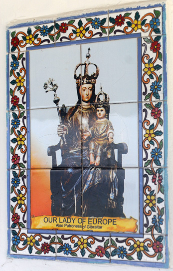 |  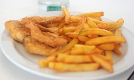 |
We sat beside a white tile wall which had this large portrait in tile, which I guessed to be Queen Victoria, given the British character of Gibraltar. Brenda and Chris had fish 'n chips, and I had a hamburger. The menu was in English with prices in pounds sterling, consistent with the practice of Gibraltar.
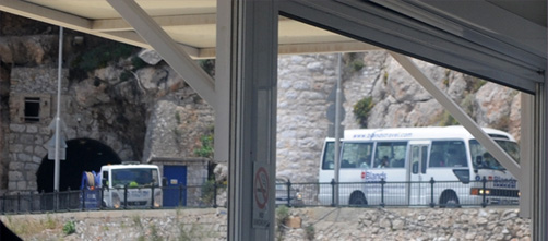 | We watched multiple small tour buses come out of the tunnel. This certainly impressed me since I knew that to come through that one, they had to have gone through the two much narrower ones before it. They couldn't have had more than inches of clearance at the top corners. |
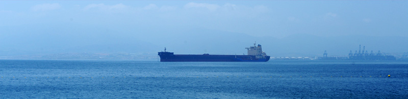
The shipping was not so extraordinary, but we were sitting there saying to each other "We are actually sitting on the shore of the Straits of Gibraltar, looking across to the coast of North Africa!" | 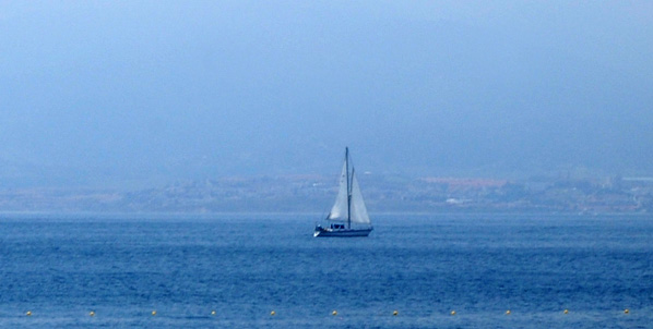 |
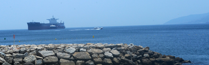
There were a large number of ships moored from every viewpoint from which we looked.
Chris went down and waded in the water so he could say he had touched the water off Gibraltar. He enjoyed talking with the waiters in Spanish. |  |

As we drove upward trying to follow the fellow's instructions, we found lots of evidence of the caves we had heard about, some having remains of Neanderthals. This wall we took as an example of the many kinds of fortifications that have been built on the Rock.

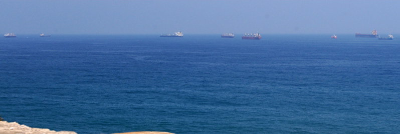
We came to an overlook with a wall which gave us a nice view of the variety of shipping that was moored near the Rock.
Chris with the Rock of Gibraltar in the background. 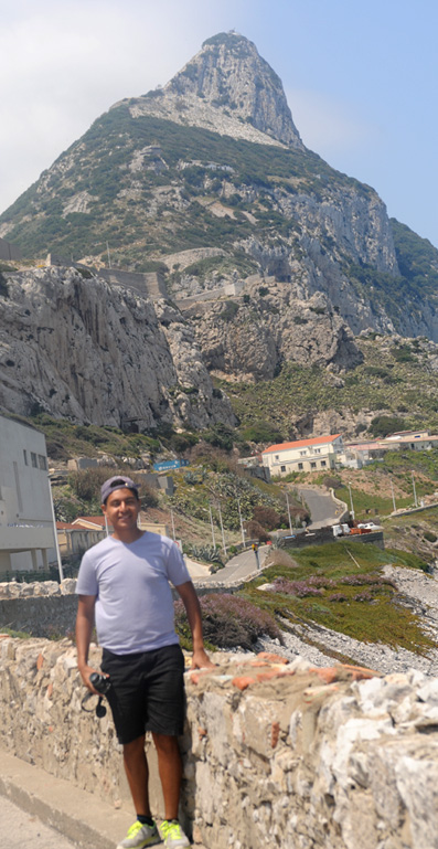 We had a good view of the Rock of Gibraltar above a nice blue sea. I found the color of the sea to be beautiful. |
  |
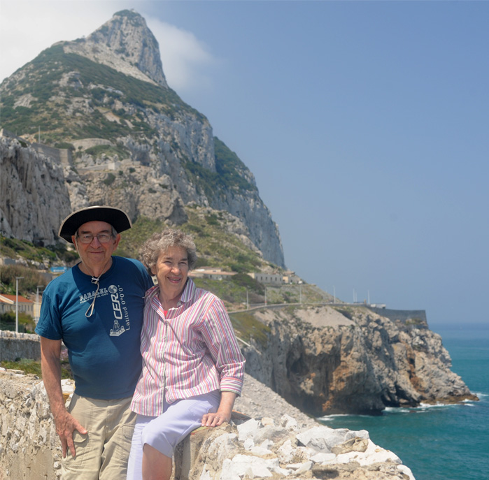 | Chris takes the photo of Rod and Brenda with the Rock of Gibraltar in the background and a beautiful blue sea surrounding us. So our afternoon of exploration did get us to the Rock, a place we had heard about and seen pictures of all our lives. |
We used the gps to get us back through La Linea and back on the road to the Club Marbella.
| The Sitio de Calahonda |
2017