Kauai
June 28, 2018
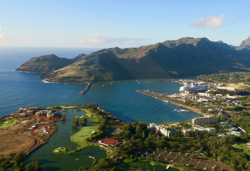
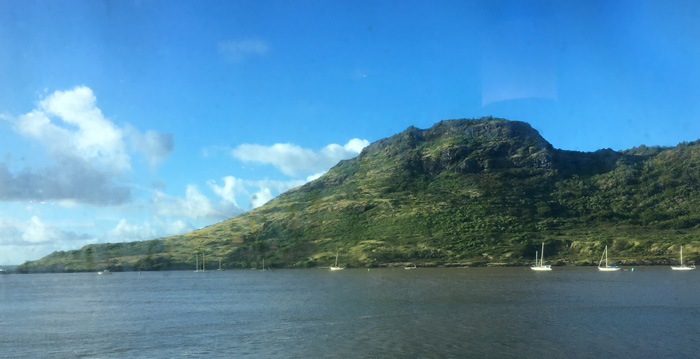 | We had made the sea journey from the Kona coast of Hawaii to Nawiliwili port near Lihue, Kauai. We were having breakfast at about 7am and had a pleasant view of the bay and a point of land. |
I was pleased to be able to watch these two tugs in action - I always like watching tugs work. Each of the two tugs was cabled to the freight barge. I gathered that this was to be able to swing the barge and place it sideways up against the dock they were approaching. | 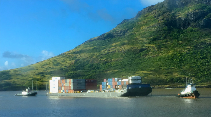 |
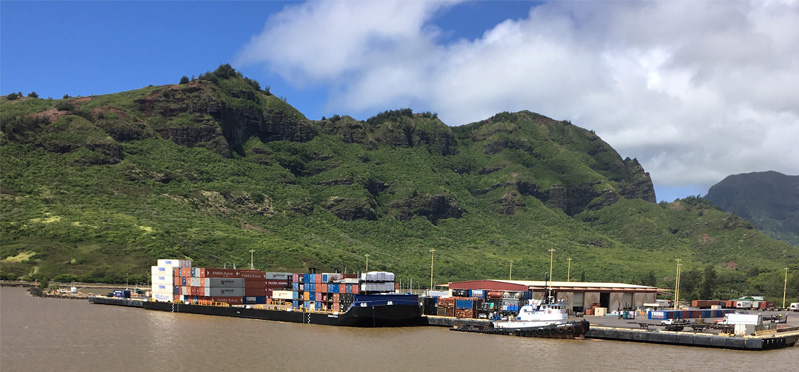
 | We were some of the earliest to breakfast, and really enjoyed our breakfasts at near water level to be able to watch what was going on outside. |
We picked up a rental car at a nearby Marriot at a resort and were on our way to Waimea Canyon by a bit after nine. Jeff drove us from Lihue to Waimea and up the new road Hwy 552 to Waimea Canyon. There has been major development of the Waimea Canyon area as a recreational site since our trip here in 1987, with a number of developed overlooks and established hiking trails.
Traveling up Hwy 552, then 550, we reached the Waimea Canyon Lookout. | 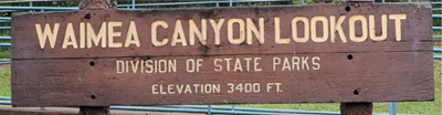 |
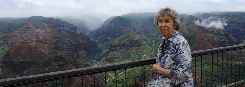
The Waimea Canyon Overlook is the first major viewpoint reached on Hwy 550. | 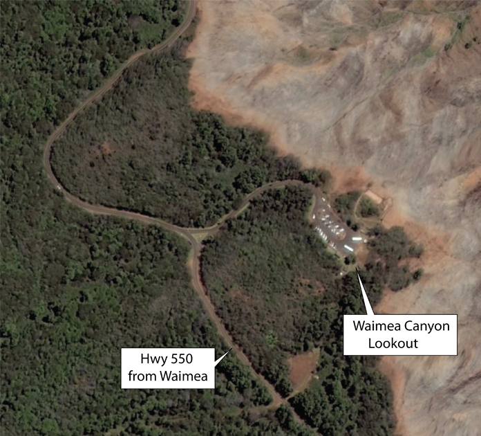 |
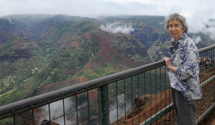 | Brenda by the sturdy fence on the Lookout. The last time we were here, in 1987, there were simple iron pipe railings. |
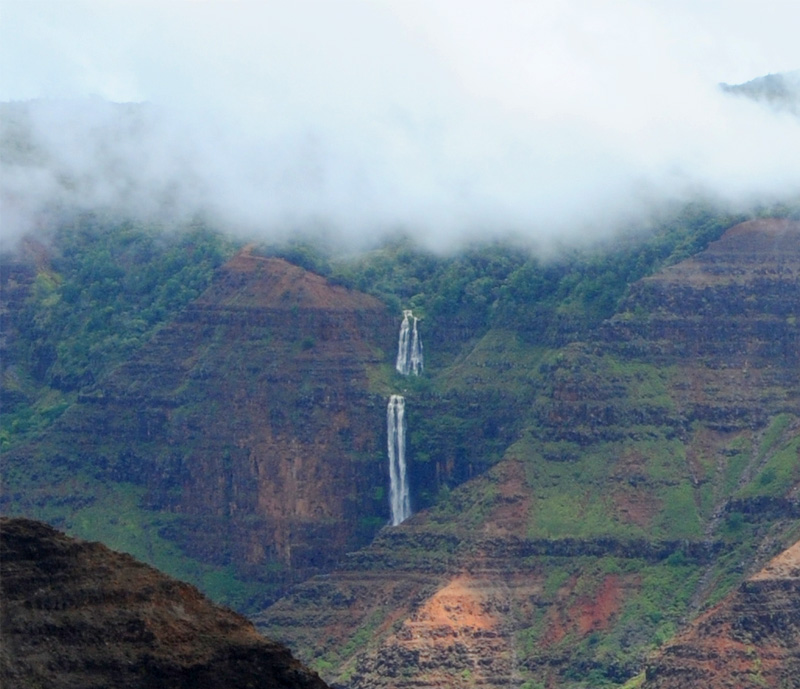
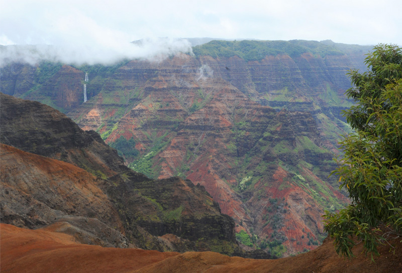
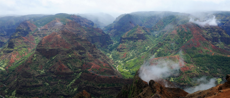
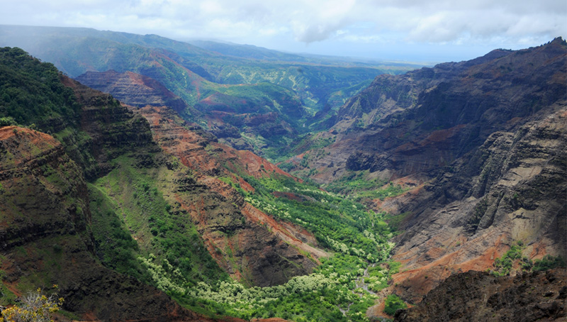
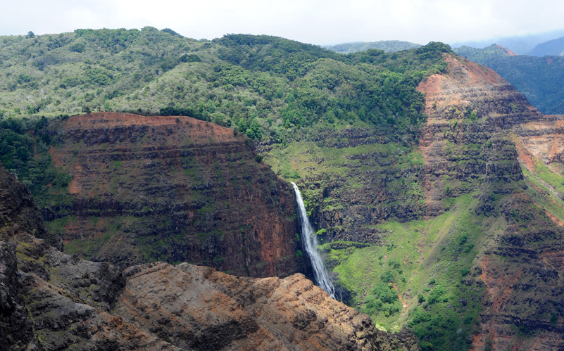
These beautiful falls and the clouds are both characteristic of the wet high elevations of Kauai. I believe these are the Waipo'o Falls.
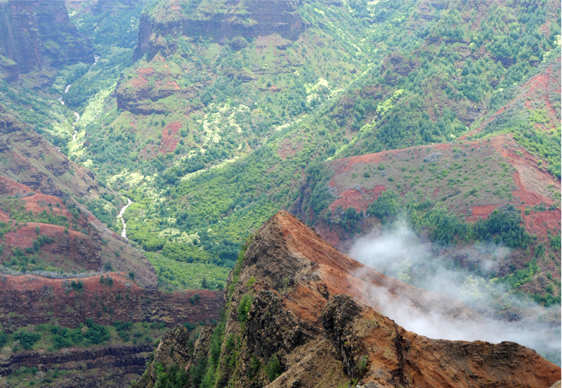
 | Looking in the direction downstream from the falls, we see the course of the river below the falls. I take this to be the Waimea River. |
Brenda with a wide view of the downstream canyon. It was intriguing to see the rapidly changing cloud patterns and light conditions.
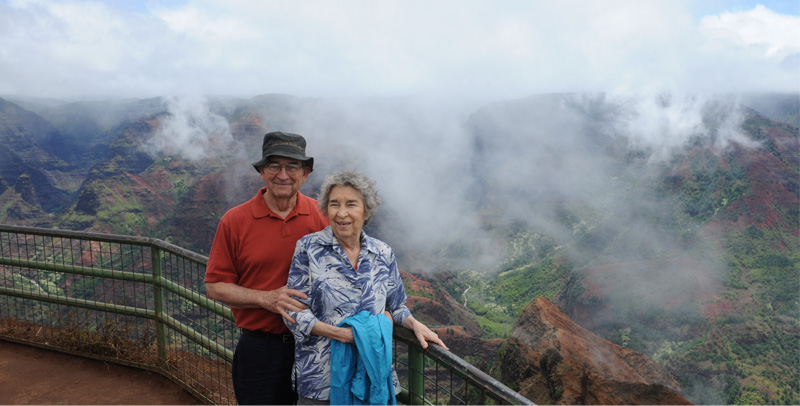
 | Jeff and Darla with the background of the Waimea Canyon. The above photos show the changing perspective with the rapidly moving clouds. |
I found these views of canyon, river, and wispy white clouds to be quite fascinating. | 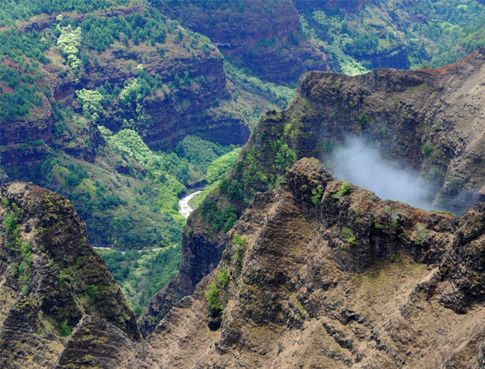 |
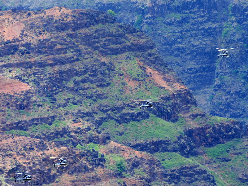
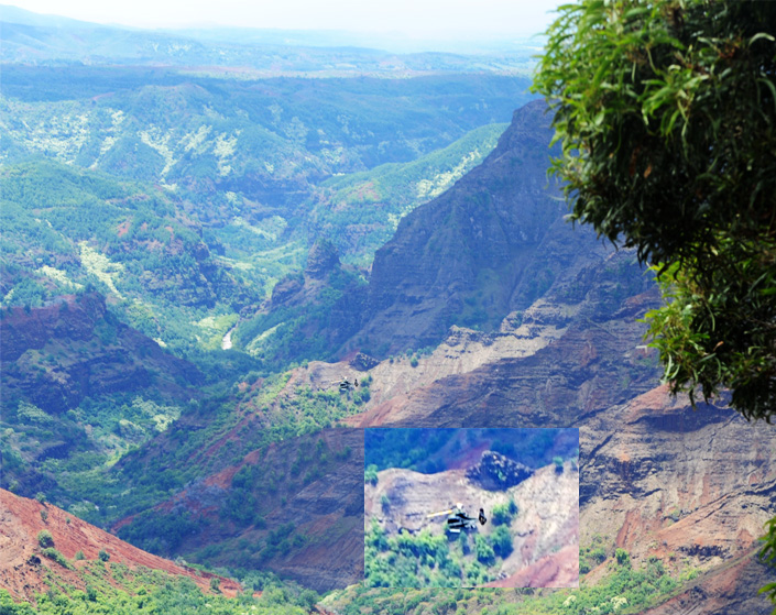 | Helicopter tours of Waimea Canyon and the Na Pali Coast have become very popular. We watched this helicopter buzz through while we were standing on the overlook. We saw several on our stay in the area. |
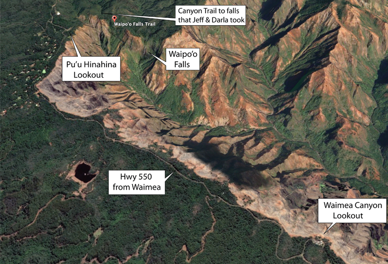
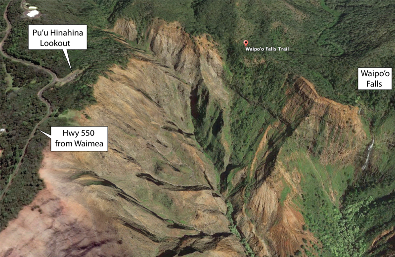
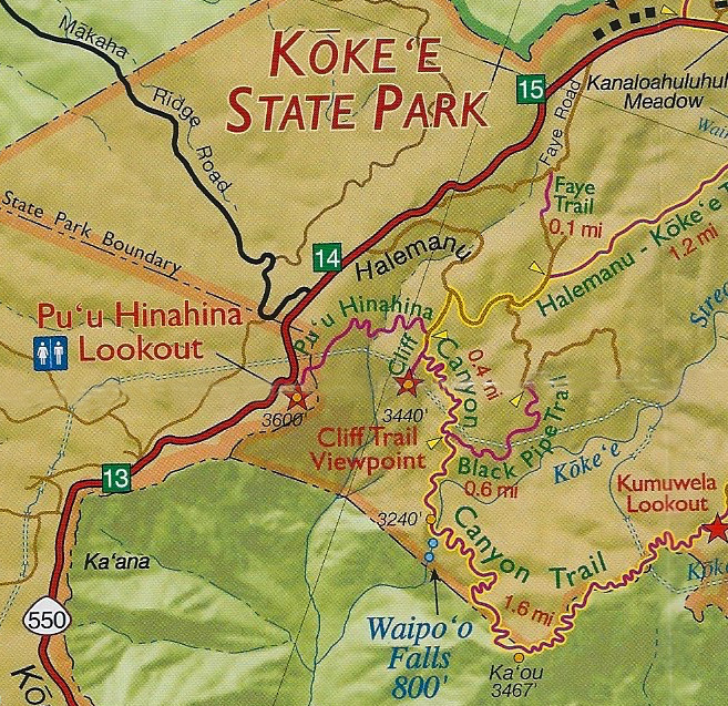
From the Waimea Canyon Lookout at 3400ft, we proceeded upward to the Pu'u Hinahina Lookout where the Cliff Trail and Canyon Trail started. Jeff and Darla planned to do the Canyon Trail. This lookout was just a few hundred feet higher, but enough to put the Canyon Trail near the altitude of the Waipo'o Falls.
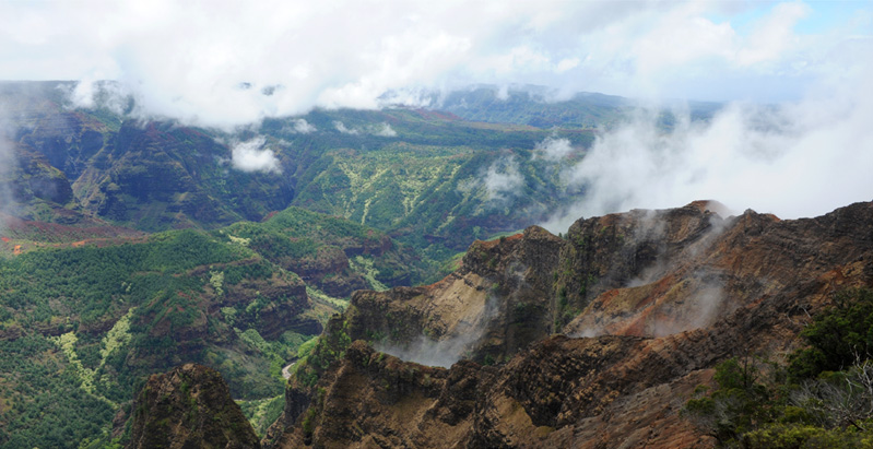
Brenda surveys the different perspective on the Waimea Canyon from this Lookout. | 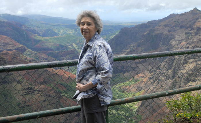 |
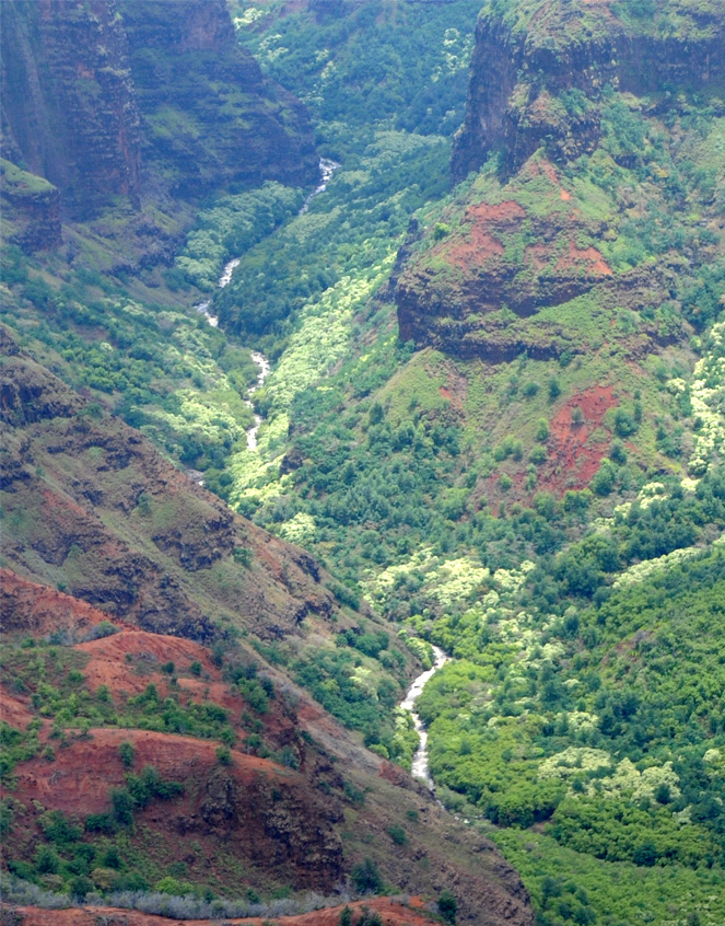
The view down into the canyon includes a lush stream environment. This stream joins the outflow from the Waipo'o Falls below the falls. The falls are around the wall to the left of this viewpoint. | 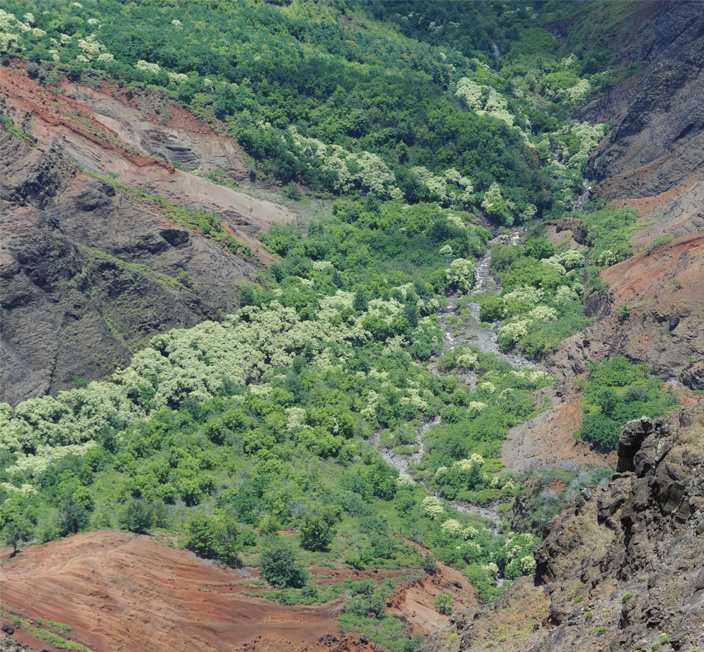 |
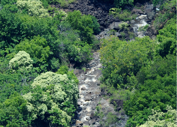 | This telephoto shot of the stream below shows it to be a rather small, rapid stream. But the wide swath of lush growth around it shown in the above photo shows that there are many water pathways through the valley to support this growth. |
The other surprise about this lookout was that after rising only 200-300 feet above the Waimea Canyon Lookout, we could now see over the ridge all the way to the shore near Waimea. | 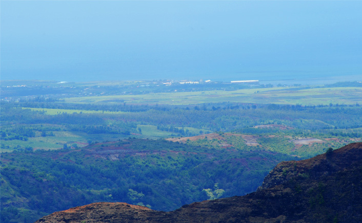 |
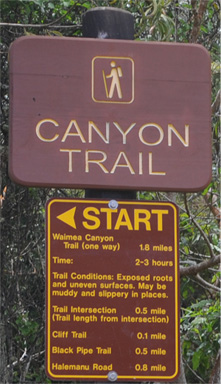 | 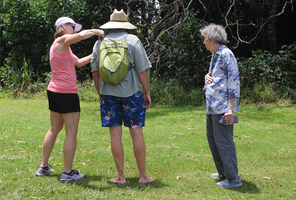 |
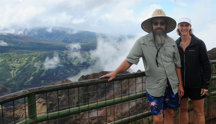
Darla and Jeff prepare to set out on the Canyon Trail which was listed as 1.8 miles in length and 2-3 hours. The Cliff Trail leads to it and is listed as 0.1 miles. Easy, for us, right?
 | Darla and Jeff prepare to set out on the Canyon Trail which was listed as 1.8 miles in length and 2-3 hours. The Cliff Trail leads to it and is listed as 0.1 miles. Easy, for us, right? |
Our plan was to just do the Cliff Trail which was labeled as 0.1 mile, and then go on to other exploration and meet Jeff and Darla on their return. Several people warned us that the trail was wet and slick, and we found that they were right! Sopping wet, with muddy holes you had to traverse, and very slippery. Brenda moved along it with great care for a few hundred yards, but when someone warned us that there was a downhill slippery part with no handholds, we decided to give it up and return. We kept comparing it to our hike in the Carara Wilderness in Costa Rica! | 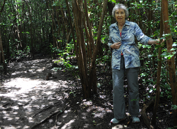 |
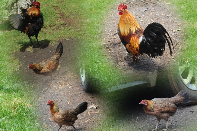 | On our way up the mountain to Waimea Canyon, we had learned that the most abundant type of wildlife on Kauai is the chicken! We had seen several on the roadside, and even a rooster and hen with several chicks. Here in this parking lot they were everywhere! If you sat down for a snack, you collected an expectant group of chickens. They all looked healthy and well-fed, so the feral lifestyle seems to be successful here. |
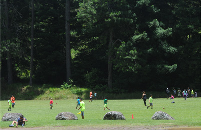 | 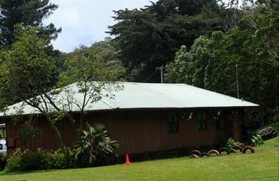 |
We drove on up to the location of the camp that I had worked with in the summer of 1959, the Kokee Camp. I remember this sports field area and the brown wooden buildings where we had our Bible study and mission programs. The buildings now house a restaurant and gift shop and the Kokee Museum. I drove some of the children from the Waimea Church up for the camp in an ancient Volkswagen bus which didn't have syncromesh to low gear. So on the steep slopes when I needed low gear, I had to come to a complete stop to shift. Fortunately, I had experience with that problem from an old truck that we had on the Arkansas farm, so it was no big problem.
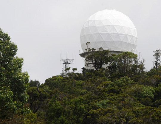 | Continuing on up the mountain, we encountered this geodesic dome antenna which we had not seen before. As I learned from Hawaii Insider, it is a radome radar device operated by the Hawaiian Air National Gaurd. It provides 24-hour air surveillance, and as Jeff suggested, is there to guarantee that there won't be another Pearl Harbor. At 4200 ft it is at about the highest point on the island of Kauai. It is operated by the 150th Air Control and Warning Flight unit of the 154th wing of the Hawaii Air National Gaurd. Having located this radome, it was a useful landmark for us in relation to the Kalalau Lookout, particularly when we were on the tour around the Na Pali Coast. |
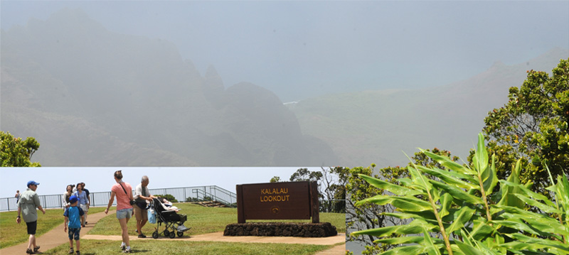
We drove on up to the Kalalau Lookout, which had mesmerized me when I visited it in 1959. I had brought Brenda here in 1987. Since 1987 there has been major development in this area including a parking lot, restrooms and a major viewing area with railings extending probably 50 yards. But when we walked up to the rail to view the valley, we could see probably 40 feet into the cloud that completely filled the valley. Hanging around for probably 20 minutes, we at least got this tantalizing glimpse of the valley and seashore far below.
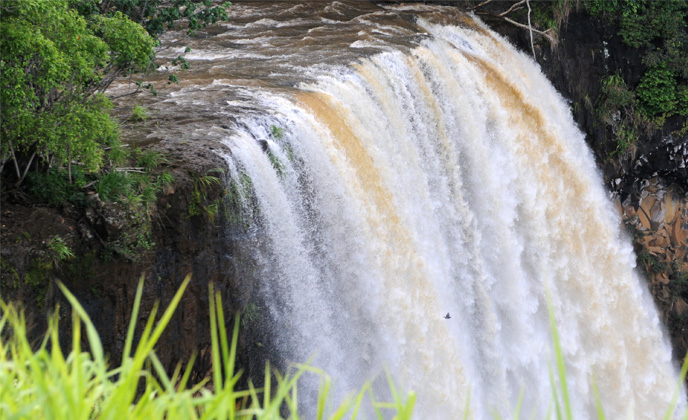
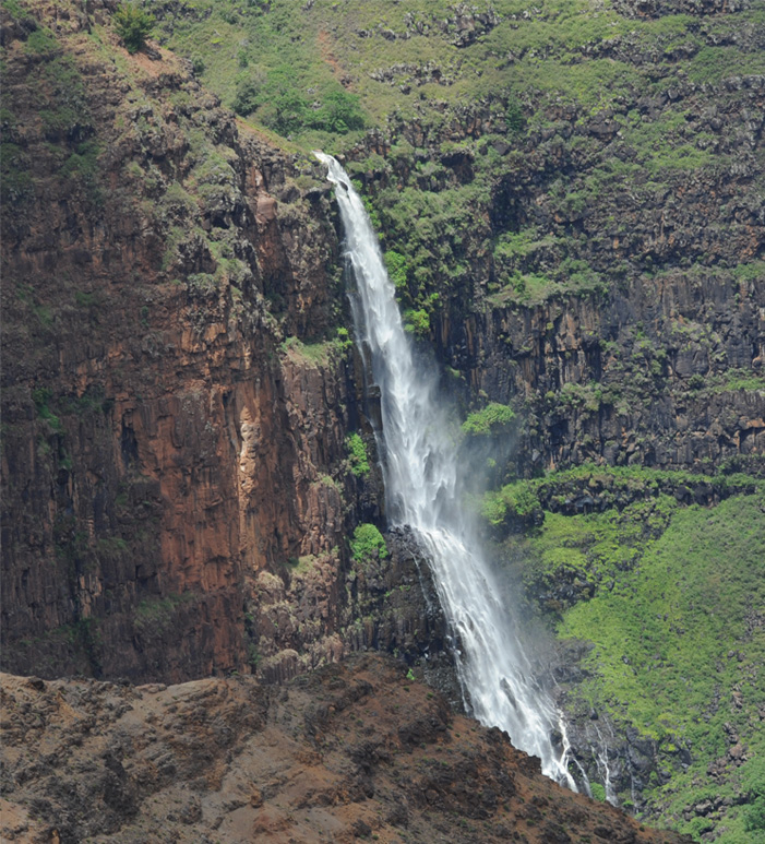 | It was time to return to the trailhead of the Canyon Trail to pick up Jeff and Darla. We stopped along the way at a roadside viewpoint to see this beautiful waterfall. It may have been the one that Jeff and Darla hiked to the top of. |
After the helicopter passed, I turned attention back to the falls. I loved the wild look of the bottom part of the falls. The combination of rugged rock, lush green growth and wild water was exquisite. I shot this at 1/1000 sec to get this sharp view of the falling water. 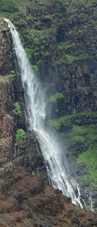 | 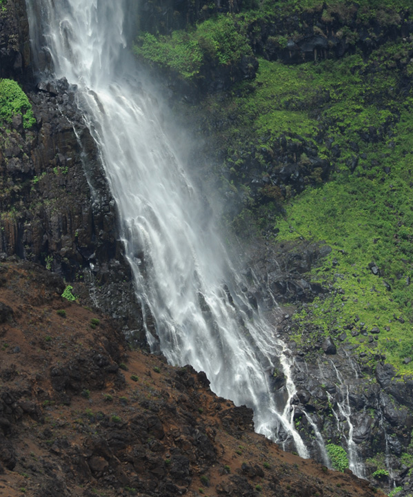 |
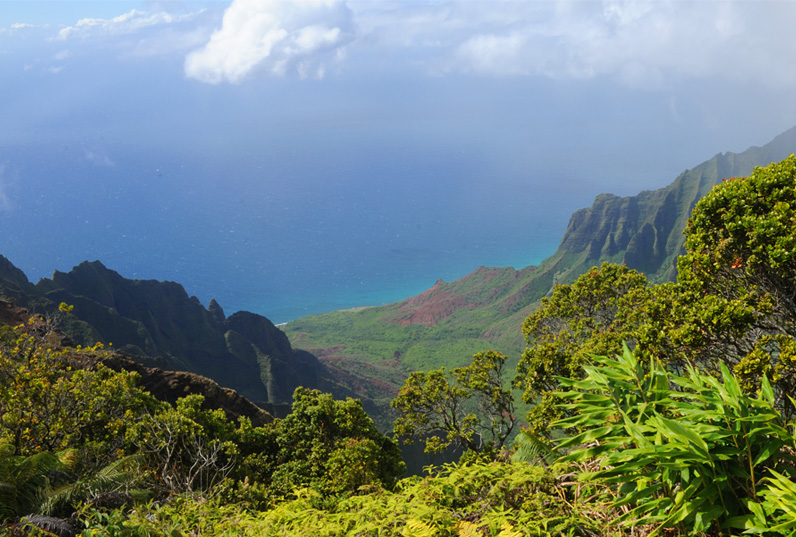
When we made it back up to the Kalalau Lookout with Jeff and Darla at about 3:45pm we got a good view of the beautiful Kalalau Valley from its altitude of about 4000 ft. Brenda and I had come up at about 2pm and we could see about 40ft, with the entire valley obscured by cloud. The Kalalau Lookout is a magical place for me since I saw it while a summer missionary on Kauai in the summer of 1959. When I walked up to the edge that summer after bringing a group of kids up to the Kokee Camp, I thought it was the most beautiful thing I had ever seen. One of my hopes on this trip was to show it to Jeff and Darla.
The next day we were privileged to see the Kalalau Valley from the ship on the Na Pali Coast tour.
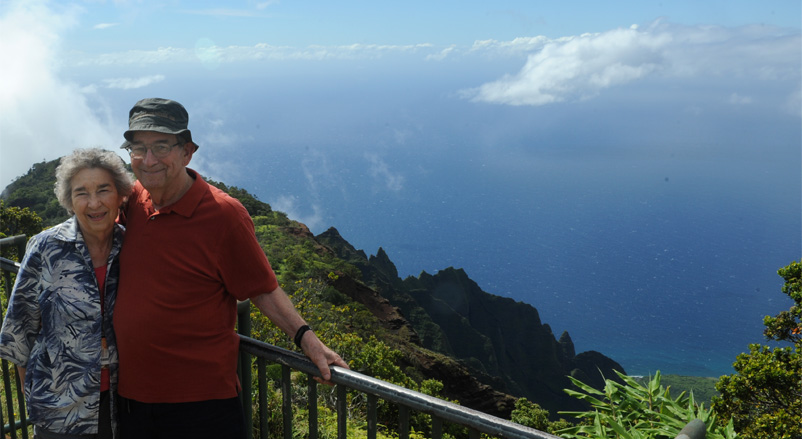
Of course it was most meaningful to bring the favorite person in my life to this magical place again. I had been able to bring Brenda here in 1987.
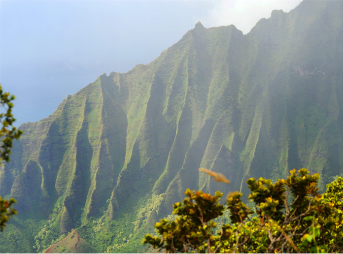 | On the right side as you looked to the sea was the characteristic ribbed mountain structure of the Na Pali coast. |
I was trying to get a picture of the three waterfalls on that mountain wall, but the cloud was again moving in rapidly. Below, Brenda was able to get a better view of the falls and green slopes with her phone. | 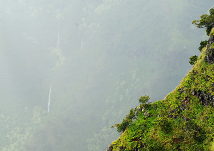 |

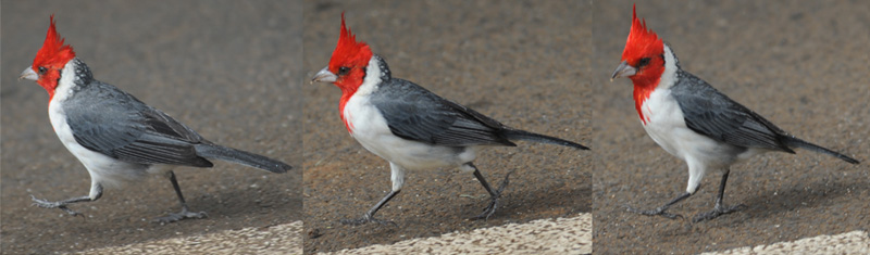
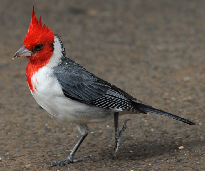 | We had been seeing this red-headed bird flitting about as we had driven into this area, and I finally got a good shot at him in the parking lot of the Kalalau Lookout. Jeff and Darla bought me a book to identify him and it is just called a Cardinal. Very different from Georgia cardinals. The "Hawaii's Birds" book p117 says this bird was introduced from South America around 1930. It is also known as the Brazilian Cardinal. |
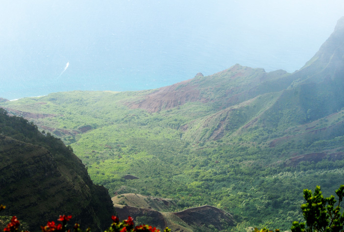 | A new road and a new lookout has been constructed beyond Kalalau, which was the end of the road when we came in 1987. It is called the Pu'u o Kila overlook, and a wilderness road and trail extend beyond it now. We drove up and had a brief look, but the clouds were moving in. It looks at the same valley. |
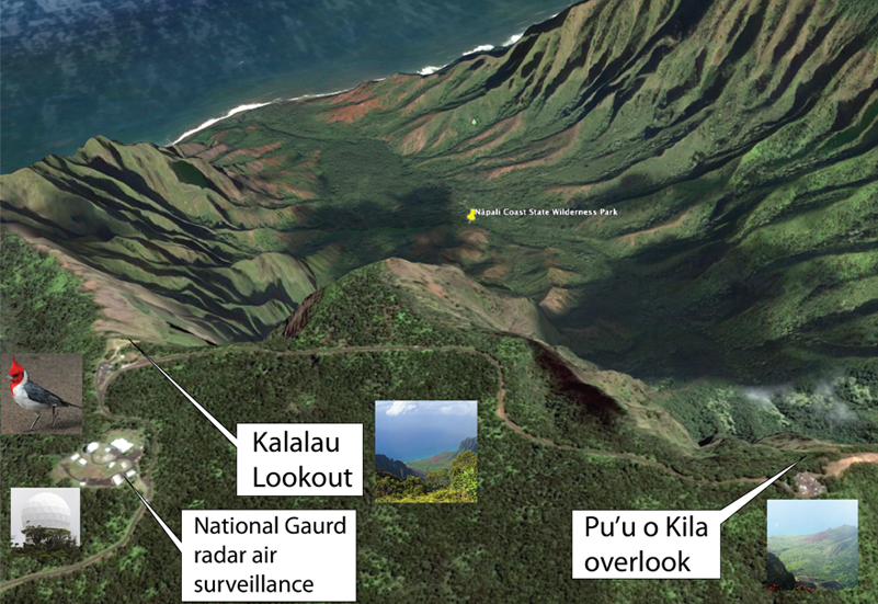
This satellite view was very useful in locating the radome in relation to the Kalalau Lookout, and it helped later on the Na Pali tour to locate this valley from the ship.
You can see that the road extends past this upper lookout as a dirt wilderness road. There is also a 11 mile wilderness trail that leads down into the Kalalau Vallley. The Kalalau Valley is the largest valley on the island and reaches 2 miles in width. This valley is famous as a movie background, having been used in King Kong (original), Mighty Joe Young, Jurassic Park and Six Days Seven Nights. The valley was inhabited until 1919.
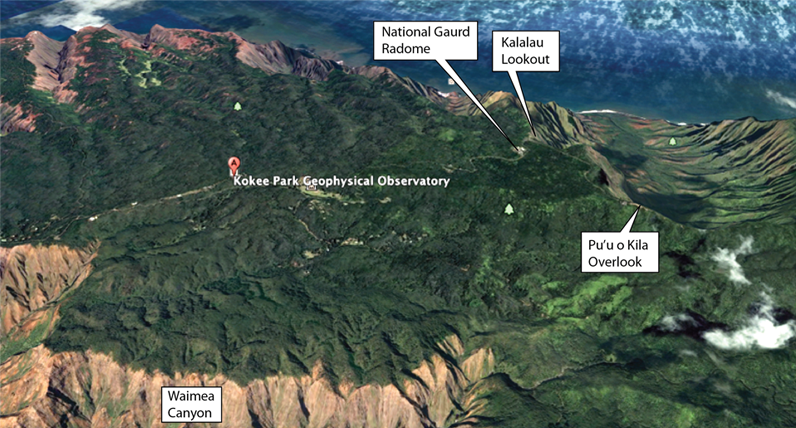
Another research and observation facility that we passed on the way to Kalalau Lookout was the Kokee Park Geophysical Observatory. It is a NASA facility that was established in 1961 as a part of the Manned Spaceflight Program. I actually thought it was new since our visit in 1987 when we saw it.
We headed downward from the vicinity of 4000ft about 4:45pm. This time we took the old road route 550 all the way down. | 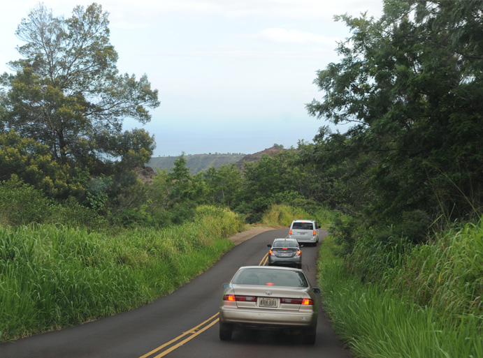 |
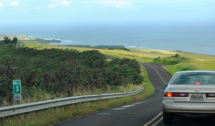 | It was a winding road, but well constructed, and soon we were in view of the coastline near Waimea. |
Hwy 550 brought us right down to Waimea right beside the Waimea Baptist Church. | 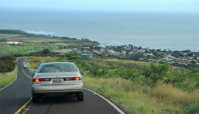 |
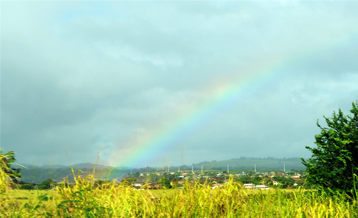 | We reached Waimea and turned toward Lihue on Hwy 50. We were treated to at least a partial rainbow. Kauai is one of the most famous places in the world for rainbows, so I was glad we got to see at least one. |
 |  |
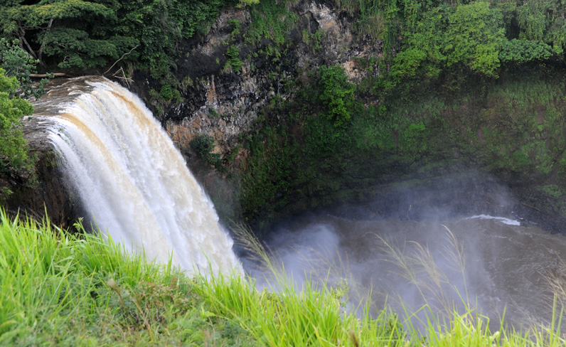
 | The waterfall was indeed a powerful one that roared into a carved out cavity. It produced a cloud over it in the hollow. Jeff was a bit disappointed because he had read that you could go to the bottom of it. |
On the way back to the ship, we passed the Lihue Baptist Church where I worked in Vacation Bible School during the summer of 1959. Brenda and I visited there in 1987. Jeff dropped Brenda and I off to take the shuttle to the ship while he and Darla returned the rental car and explored a bit more. | 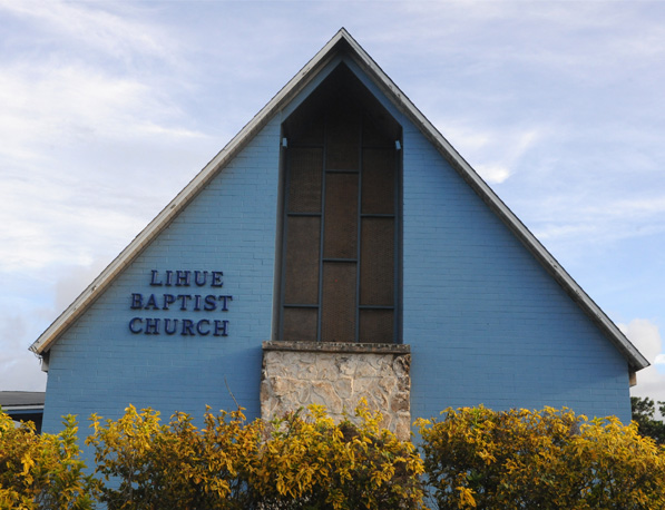 |
June 29, 2018
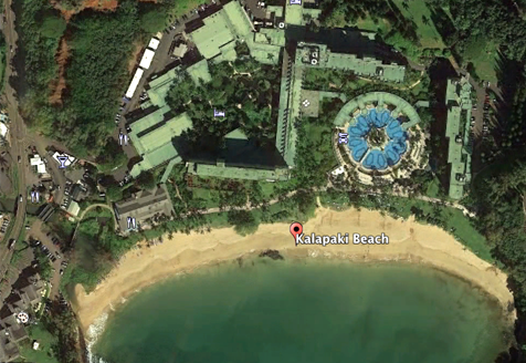
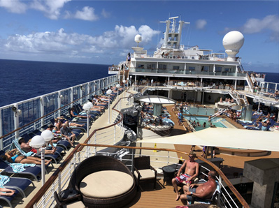
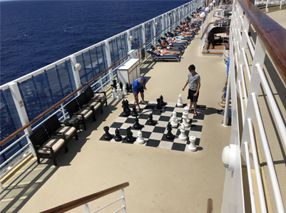
Brenda and I had our usual luxurious breakfast in the Skyline Dining Room and had decided to just take it easy on the ship today. Jeff and Darla headed out to the Kalapaki Beach which was within walking distance, right next to the resort with the Marriott where we picked up the rental car yesterday. |
 |
 |  |
 |  |
The ship headed out early in the afternoon for a swing around the Na Pali Coast before heading to Honolulu. My afternoon agenda was to watch the coastline of Kauai as we explored.
| Na Pali Coast |
2018