Waterton National Park
August 12-13, 1995
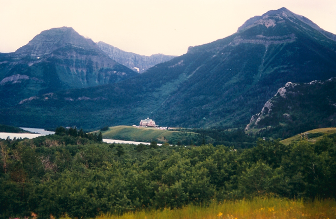
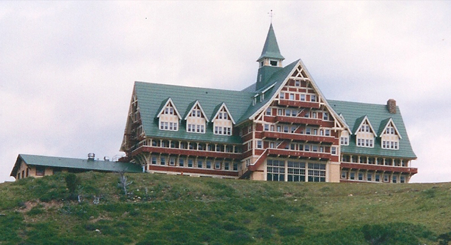
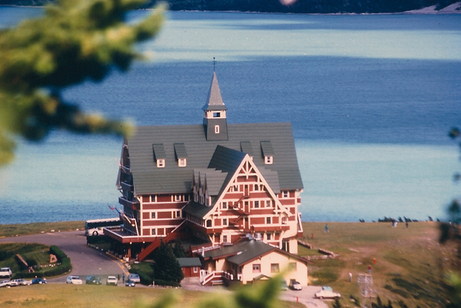
 | After a long days drive including Glacier Park, we reached Waterton Village, heralded by the Prince of Wales Hotel on the hill north of town. |
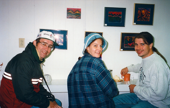
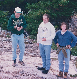
Driving into Waterton Village, we found Jeff and Darla in the room next to ours in the El Cortez and enjoyed the evening together. This little cafe was in walking distance from our rooms so we went there for dessert.
August 13
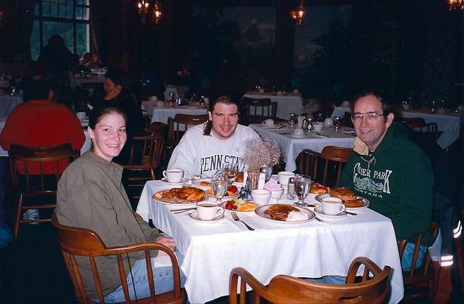
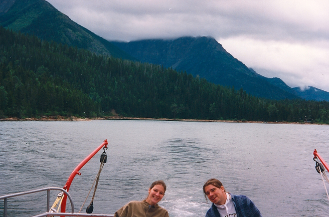
Darla, Jeff and Rod at the buffet breakfast at the Prince of Wales Hotel, Waterton Park, Canada. Rod has never been known to turn down a buffet breakfast, and this one had fantastic scenery to boot.
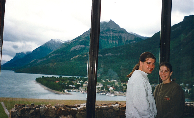
Darla and Jeff with the great view you get from the Hotel dining room. You look over Waterton Village and the Upper Waterton Lake, all the way down to the pillars on top of Citadel Peak at the far end of the lake.

The hill by the Prince of Wales is a popular picture-taking place. Although the visibility is good at lake level, it was cold and the wind was blowing very strongly.
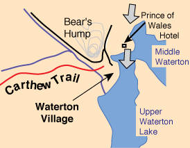
We had gotten up early this morning with the hope of tackling the Carthew Trail, but with the high wind and the heavy cloud cover we could see up on the tops of the mountains, we decided to put off the ascent until tomorrow.
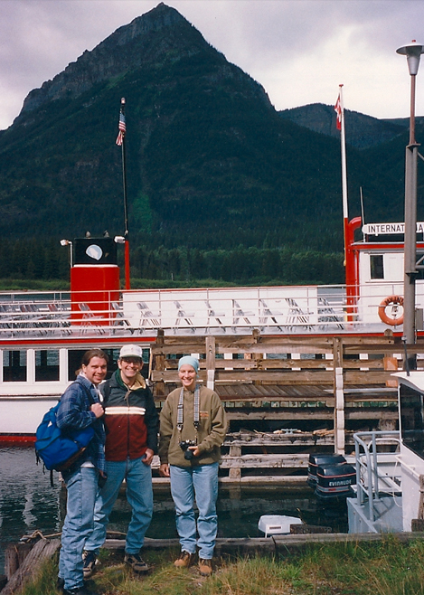 |  |
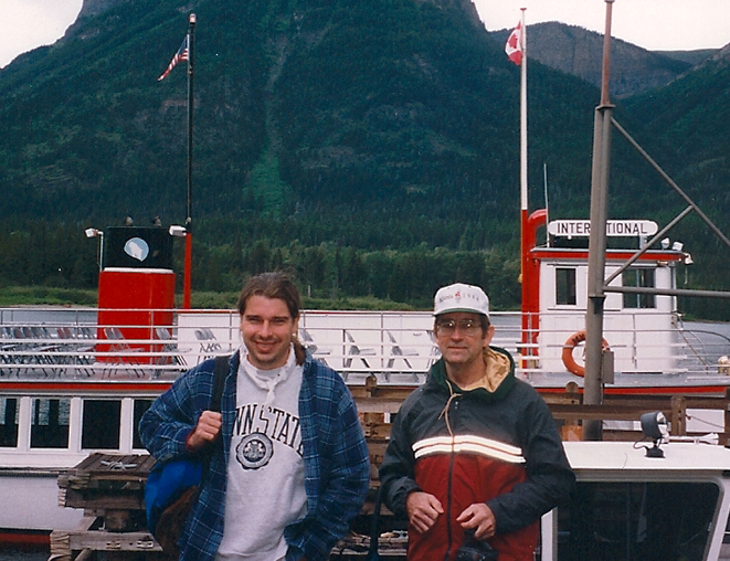
We decided to board the 73 ft ship International for the trip down to Goat Haunt at the south end of the lake. That involved crossing the U.S. border on the way down. Goat Haunt is a part of the U.S. Glacier National Park.
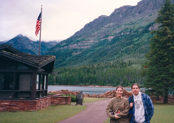
The cruise down the Upper Waterton Lake to the tiny outpost and dock at Goat Haunt was a relaxing one. The guide told us about the geology of the area and about the damage from the severe floods of spring 95. Darla and Jeff are standing by the information center which is a short walk around the end of the lake from the dock.
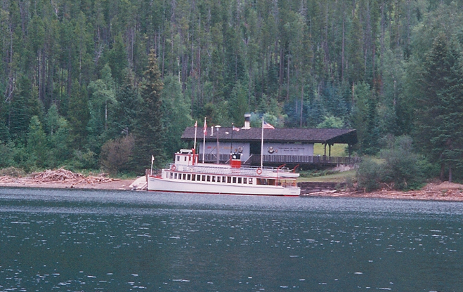
This is the view of the tiny outpost of Goat Haunt and our ship docked by it. It is taken from the information center shown above.
 | On the return trip, the guide pointed out Hell Roaring Canyon, which Jeff and Darla went by on their hike to Crypt Lake a couple of days ago. |
There were a lot of interesting curves and folds in the rock strata, and we got more geology information from the knowledgable guide. She told us that the red and green argillite minerals both got their color from iron, which made red minerals when oxygen was present and green when it was not.
We got good views of the lush forest as we traveled up the lake, but the peaks were totally socked in with heavy cloud. It was a better day to be low than high.
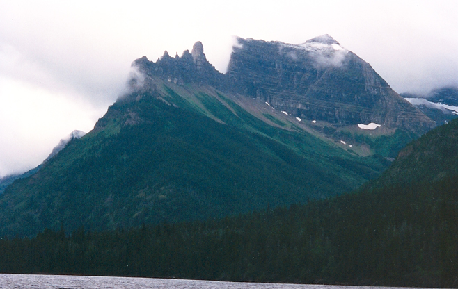
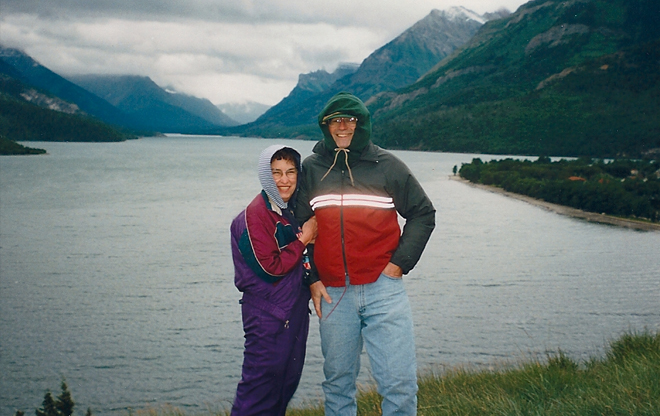
The view above is one of the more famous mountains at the south end of Upper Waterton Lake called Citadel Peak. We were told that the strange pattern on the left was a glacial arrete, a sharp thin ridge carved by glacial action. We had hiked over an arrete structure called Crib Goch on a hike to the peak of Snowdon in north Wales. The view at right shows the position of the Prince of Wales as seen from out on the lake. On the return trip it had warmed up enough for us to be comfortable out on the open upper deck. Even with spending 30 minutes at Goat Haunt, we still got back to Waterton before noon. | 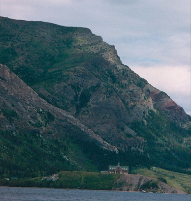 |
 | We came back into dock in view of the Prince of Wales Hotel after our trip to Goat Haunt. We took off north to Pincher Creek. Jeff and Darla had driven up there for shopping yesterday and were interested in showing us the vertical axis wind generators just north of there off Hwy 3. It was a pleasant drive through hay and cattle country. As we had approached Pincher in the middle of open fields, we noted a sign promising a fine to truckers for using their "prony brakes" on the downslope into town. We thought, "These folks really value their peace and quiet!" But we reflected later that it might have to do with producing the low smog in cold weather that such locations in the north are subject to. |
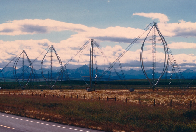
These four vertica-axis wind generators were just sitting out on the plain, with the ridges of the Canadian Rockies in the distance in the background. Next to them was a collection of solar photovoltaic arrays as a part of a renewable energy test station. | 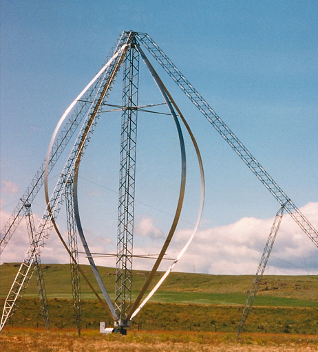 |
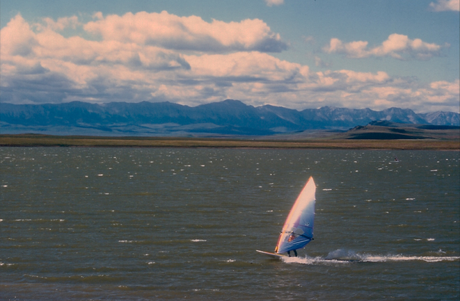
Just past the wind generators was a reservoir where the wind was so strong that they had built two-sided wooden wind shelters with all the picnic tables! We ate lunch there and watched the hardy sailboarders with wetsuits out on the reservoir. By the time we left, we were certainly convinced that they had picked a good spot for wind turbines!
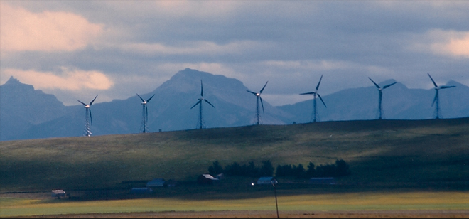
After lunch by the reservoir, we noticed another set of conventional propeller-type wind generators off in the distance toward the west, toward the mountains. We decided to go and investigate and were able to get a pretty good view of them.
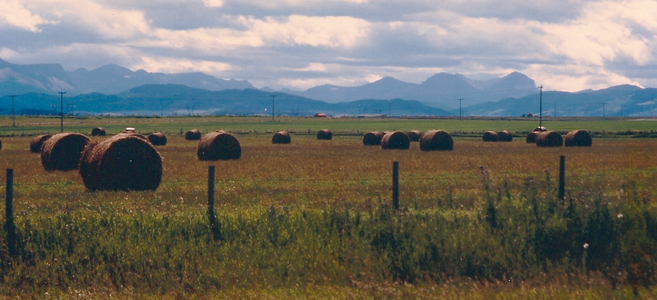
In stark contrast to the steep mountains of the Waterton Park area, this country about 30 miles north was like the great plains, gently rolling with hay fields, cattle and wheat.
 |
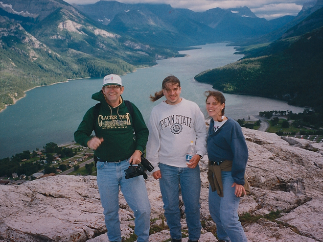
The weather cleared somewhat in the afternoon, so we decided to take the mile of switchbacks to the top of Bear's Hump, which gave nice views of most of the length of Upper Waterton Lake. We climbed 656ft on this short trail, but the view was worth it. The above view of the Prince of Wales was from along the switchbacks. |
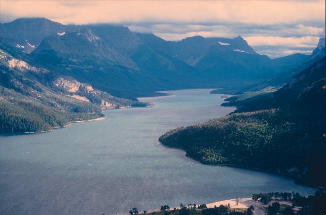
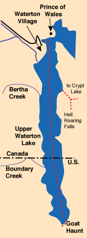
A view down Upper Waterton Lake all the way to Goat Haunt on the south end.
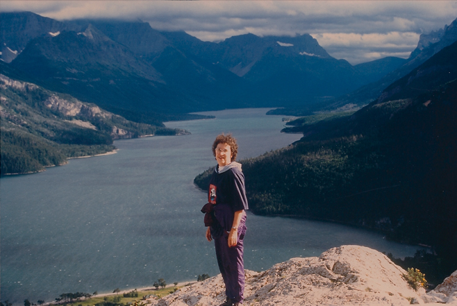
The last time Brenda and I stood here, two years ago, I could barely see her for the dense fog, much less the valley below! This time we got great views of Upper Waterton and the ring of mountains. Last time you couldn't have convinced us there was a village right below us. |
 |
| Akamina Parkway |
1995