Into the Desert and to Marble Canyon
May 27, 2011
Leaving Desert View on our east rim drive, we are on Hwy 64 heading into the desert for the long loop around to the North Rim of the Grand Canyon. The guidebooks are fond of saying that the average width of the Grand Canyon is 10 miles, but that the drive from the South Rim to the North Rim is 215 miles. 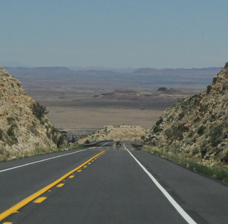 | 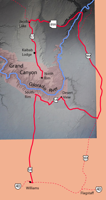 |
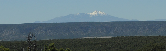 | We left Desert View in green forest and with a view of the distant San Francisco Peaks. |
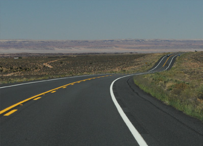
With wide open roads the forest grew drier and more sparse, and then we were suddenly into full desert. | 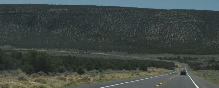 |
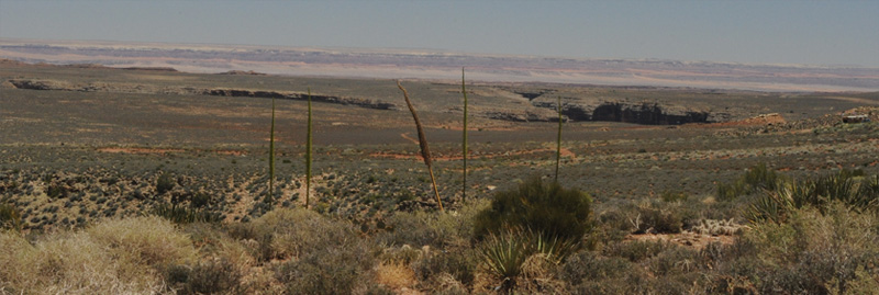
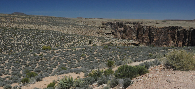
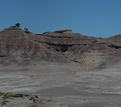
A short time later we got views of this strange-looking canyon to our left in the desert. There was a two-track dirt road and a couple of trailers of Indians selling jewelry, so we pulled off to investigate. The canyon was within walking distance at this point. | 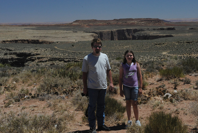 |
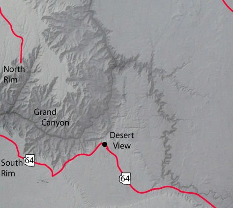 | At the time we had no idea about the nature of this canyon, and it was only after we came home and pieced things together that this picture emerged. A key part of the information came when we visited the Yavapai Geology Museum on the South Rim and found and outstanding satellite image of the Grand Canyon complex. Then when I pieced together the road map scaled to that satellite image, it became apparent that Hwy 64 runs very close to a strange side canyon that runs off the main canyon to the east and then southward. At the time we pulled off Hwy 64 to this side road, we had none of this information, but it was still an intriguing enough canyon to stop and have a look at. |

So this intrepid group of explorers set off in the Arizona desert to explore an unknown canyon. To me, the desert is surprisingly beautiful. And the wide open blue sky is exhilirating.
This is what we saw as we approached the canyon. Just a crack in the earth where it dropped away several hundred feet to the bottom.
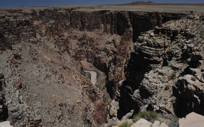 | When we (carefully) approached the edge of this canyon, what we found was not particularly beautiful, but it certainly was impressively deep! A sizable sandy riverbed looks tiny in the distance. |
I did find the desert quite beautiful though, and that surprised me. There were actually several types of flowering plants, but just the sagebrush and other vegetation were quite attractive. 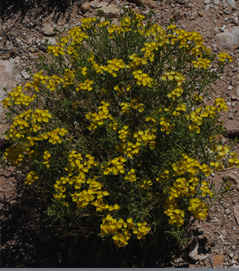 | 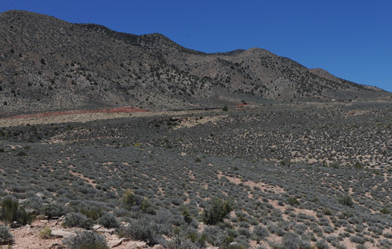 |
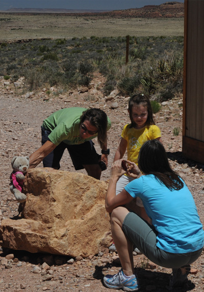 |   |
Before we left the mysterious canyon in the desert, Elyse wanted to stage a picture of her bear with a desert backdrop, so Mom and Dad were obliging her. We then traveled to the end of Hwy 64 and started north on Hwy 89 on long stretches of open road through the desert. I was amazed to again find a point where we could see the San Francisco Peaks of the Flagstaff area, at least 50 miles away.
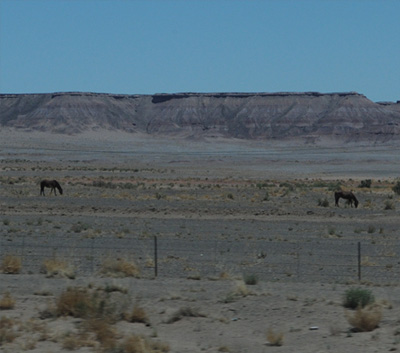 |  |
We proceeded north on Hwy 89 through some real desert regions. There were a few horses behind barbed-wire fences, but it didn't look like they had much to eat. For a short stretch there were Painted Desert type formations.
 | The really dry desert gave way to sagebrush and scrub, and the red cliffs began to rise beside us as we drove northward. |
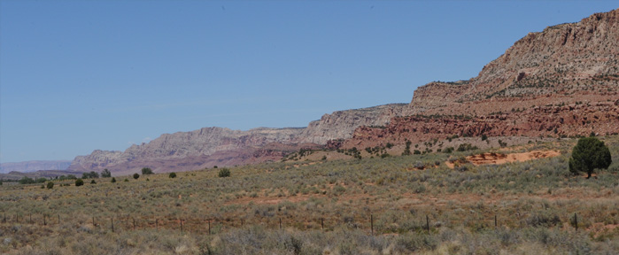
We turned off to Hwy 89A at Bitter Springs and headed toward the Vermillion Cliffs ahead of us. | 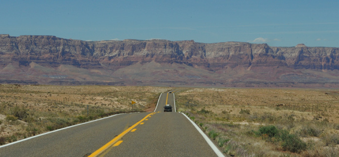 |
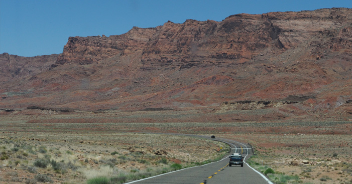 | This long sweeping bend carried us around to a westward heading toward Marble Canyon. These big red cliffs are called the Echo Cliffs. |
Marble Canyon and Navajo Bridge
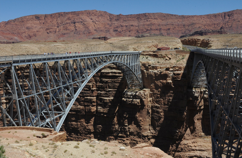
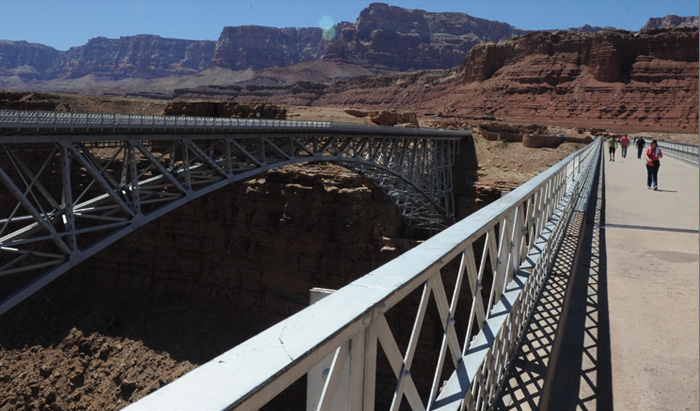
We reached the Marble Canyon and the historic Navajo Bridge across the canyon. The Navajo Bridge is the one on the left, constructed in 1927 as the only road crossing of the Colorado River canyon within 600 miles. When we reached Glen Canyon Dam later, we were told that in 1957 when the dam project was started, the only connection between the two sides of the canyon was a 200 mile dirt road. That road had to cross the Navajo Bridge. That Glen Canyon Dam is only about 15 miles up the Marble Canyon.
The Navajo Bridge had been placed on the National Historic Register in 1981, a year before our last visit here in 1982. The new bridge on the right was constructed in 1995, since our last visit. The old bridge is personally historic for me since I crossed it in 1960 with Sam, Jerry and John on our westward trip.
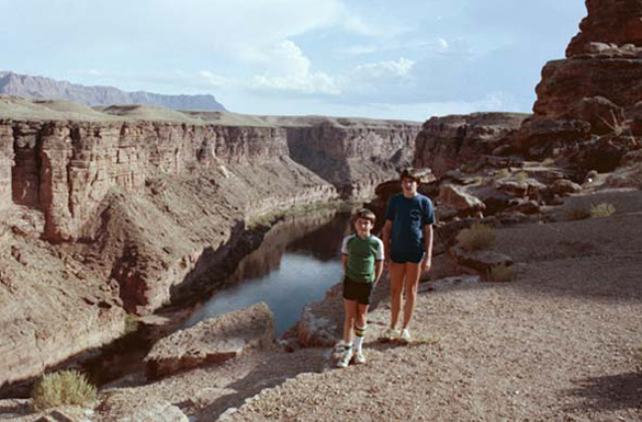 | This is Jeff and Mark on the edge of Marble Canyon in 1982. They are just about at the location where the new bridge was built in 1995. |
This picture is taken at about the same location as the one above, but now the new 1995 bridge is in place. | 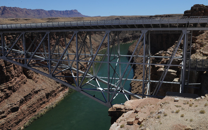 |
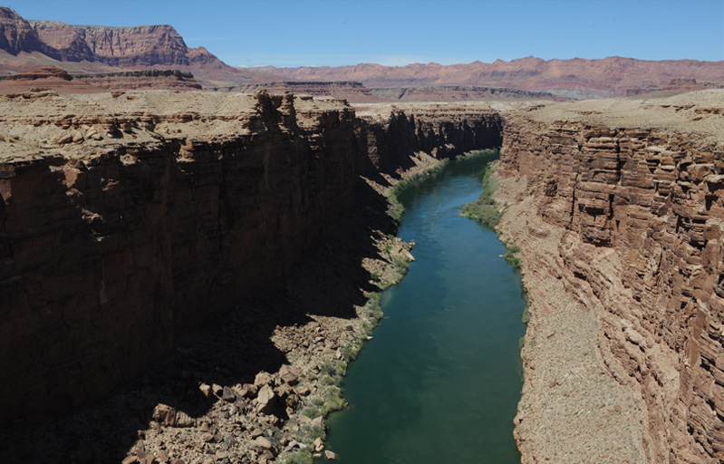
This is the northward view of Marble Canyon from the Navajo Bridge. The Vermillion Cliffs are on the left and the Echo Cliffs on the right. About 15 miles upstream in this direction is the Glen Canyon Dam.
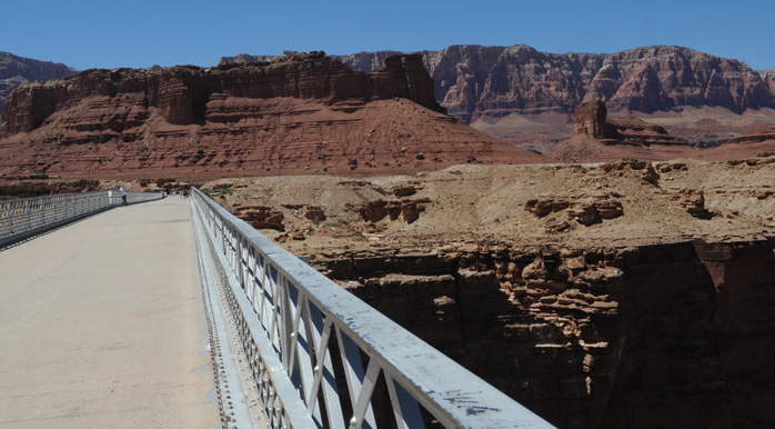 | This is a view toward the Vermillion Cliffs from out on the span of the Navajo Bridge. It is a pedestrian and equestrian bridge now with an interpretive museum on the side opposite the visitor center. |
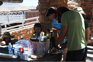 | 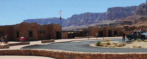 |
We had lunch at a covered picnic area. There was a very nice and extensive visitor center. Everything here brought back a lot of memories for me. When we crossed this bridge in 1960, there was absolutely nothing here except the bridge. We hadn't seen anyone on the road for an hour, and we spent probably 45 minutes on the bridge and not a single car passed. Now its on the historic register with lots of folks around.
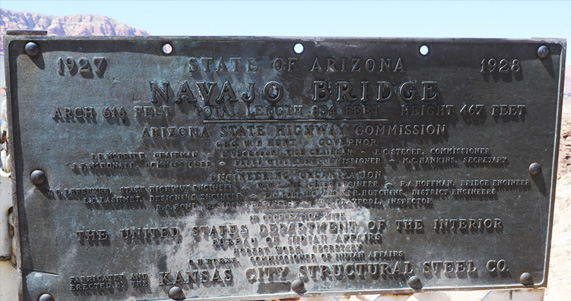 | This is the original Plaque on the bridge, stating that its height above the water is 467 feet. From that height in free fall, it would take a dropped rock 5.4 seconds to hit the water. The speed of impact would be 173 ft/s or about 118 miles/hr. And with a sound speed of 1100 ft/s it would take almost half a second for the sound to reach your ears after the impact is seen. |
They are taking very seriously the throwing of rocks off the bridge, and so they should since regular rafting trips come down the river now, and probably other boats as well. When we came in 1982, this was the only bridge, and they had high chainlink fences on the sides to discourage rock throwing. Now, as a historical site, they have restored it to its original form. | 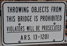 | 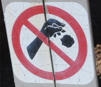 |
All this detail is given to retell the story of our original encounter with the Marble Canyon bridge in 1960. We were heading away from the North Rim with a destination of Santa Fe, NM. We roared across this isolated bridge at high speed, having not seen another car for a long time. As we crossed it, someone commented "Hey! There was nothing under that bridge!" We screeched to a halt to return and investigate and were struck by its incredible height. There wasn't as much water as now, and it looked like a small stream. So what would you do in that situation? We dropped a rock off the bridge to see it fall, and the first time we missed the river! We saw a crater appear in the sand beside the stream, silently, and then after a time lag heard a sharp crack, like a high powered rifle. We did successfully hit the river, and would see a silent splash followed by a satisfying loud crack a short time later.
After doing that for a while, one of us wondered "How high is this bridge?" And all being engineering or math students, we decided to try to get an estimate. We timed the interval from the dropping of a rock until we heard the sound, and got about six seconds. From that we could estimate that it might be 500 feet, so when we finally tired of this process and were walking off the bridge, we found the plaque that told us it was 467 feet. Having a precise number was in fact a little deflating, because now we couldn't exaggerate it as we probably otherwise would have.
The further history is that when I started teaching introductory physics and needed to teach Newton's laws and the motion equations, I used this as a standard tale for the application of the motion equations. Giving the 6 seconds between drop and sound requires the use of the linear equation for sound travel and the quadratic equation for the accelerated fall. Both of those are something the students must learn but tend to find deadly boring, and this story was a way to spice them up in a legitimate calculation. And of course I did embellish the tale a bit.
 | 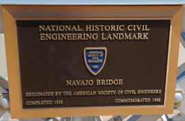 | From an isolated and from all appearances forgotten bridge in 1960, this bridge has gotten a lot of recognition. It was placed on the National Register of Historic Places in 1981, the year before our last visit. And it was commemorated as a National Historic Civil Engineering Landmark in 1998, three years after the new bridge was completed. |
| So I was pleased for the girls to get to see this historic bridge and this canyon. This is the same river that carved out the Grand Canyon, so it is neat to see it earlier on its course. |  |
 | This is a westward view of the new bridge from the old bridge. It was built with an almost identical structure, just wider and stronger. |
Darla and Ashleigh with a last view of the Navajo Bridge before we head off westward across the desert. | 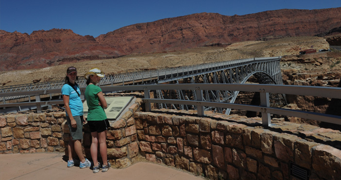 |
| From the Vermillion Cliffs to North Rim, Grand Canyon |
2011